

ORH_wxman
-
Posts
93,094 -
Joined
-
Last visited
Content Type
Profiles
Blogs
Forums
American Weather
Media Demo
Store
Gallery
Everything posted by ORH_wxman
-
December 2024 - Best look to an early December pattern in many a year!
ORH_wxman replied to FXWX's topic in New England
It helps that they have like 20+ hours of darkness though. -
The threat on Jan 1-2 has subtly cooled today on guidance. I am skeptical for SNE on a lot of wintry precip for that one. But it could trend enough for CNE and NNE. But yeah, the time range still makes something more interesting down here at least plausible. I really like the look after that system but it would be a great bonus to score anything from Jan 1-2.
-
Region Wide Christmas Eve Clipper Potential
ORH_wxman replied to WxWatcher007's topic in New England
A little bit grinchy on the Cape with temps near 40F. They did already have several inches OTG though. Might get some OES later tomorrow too. -
Region Wide Christmas Eve Clipper Potential
ORH_wxman replied to WxWatcher007's topic in New England
Prob not gonna get more than a half inch but it’s nice to refresh the snow from the other day after my boys trampled all over it -
Region Wide Christmas Eve Clipper Potential
ORH_wxman replied to WxWatcher007's topic in New England
Snowing good now in this second band. Baking powder borderline moderate. Everything covered ina fresh coating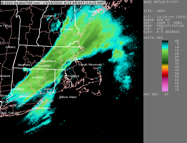
-
He’s not gonna answer until he wakes up and shakes off the hangover at noontime. He does this every 1-2 weeks during winter when the libations are flowing generously.
-
Region Wide Christmas Eve Clipper Potential
ORH_wxman replied to WxWatcher007's topic in New England
First band disintegrated as it got here. Not really surprising. Steady light snow but prob like 1-2 mile vis. We’ll se if band #2 does better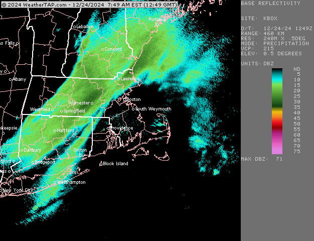
-
Region Wide Christmas Eve Clipper Potential
ORH_wxman replied to WxWatcher007's topic in New England
Hoping this band holds together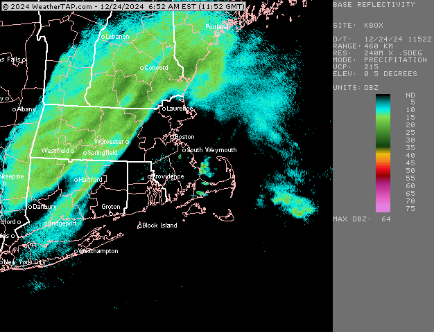
-
Region Wide Christmas Eve Clipper Potential
ORH_wxman replied to WxWatcher007's topic in New England
The sound of crappy snow growth. I feel like every storm in ‘07-08 during those SWFEs sounded like that. Like 9 to 1 baking powder falling from the sky. It’s great for building pack though since it’s kind of dense even though it’s dry/powdery. -
Yeah I think some people got sucked into the idea of a marginal threat prior to 1/3 or so….that’s prob where some of the whining is coming from. The ensembles look gangbusters still beyond that so don’t see anything that screams red flags for January.
-
Region Wide Christmas Eve Clipper Potential
ORH_wxman replied to WxWatcher007's topic in New England
Def fighting dry air in SNE but some decent bands N of pike at the moment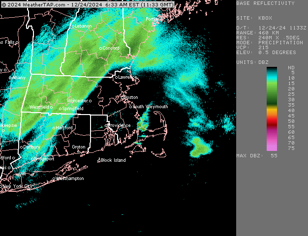
-
December 2024 - Best look to an early December pattern in many a year!
ORH_wxman replied to FXWX's topic in New England
Woodstove has eaten a lot of wood over the past couple days. When it’s colder out, you really gotta keep that internal stove temp up and when it’s that hot inside the stove, the wood almost vaporizes as you put it in, lol. -
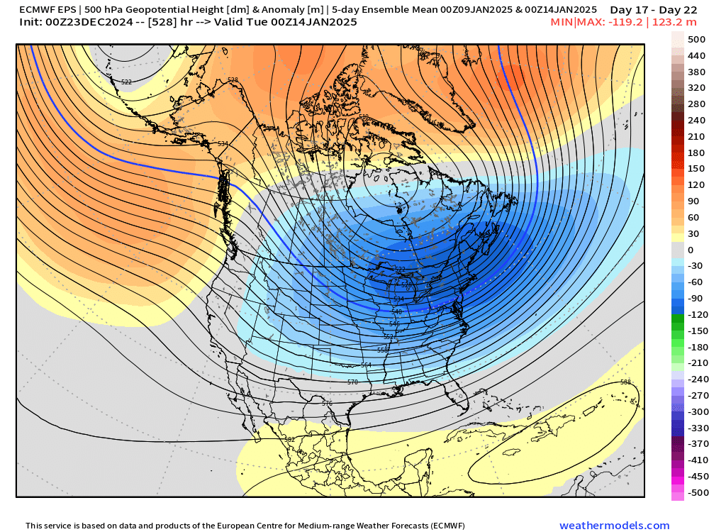
2nd week of January is quite the cold signal on the weeklies today…keep in mind this is a 5-day mean
-
Could be a random storm signal, agreed. But it’s strange how different it is. Pretty good agreement on MJO going into phase 8 after new years so I think you would no longer have destructive interference so the pattern reverting back to something favorable would make sense.
-
GEFS vs EPS for January 3rd
-
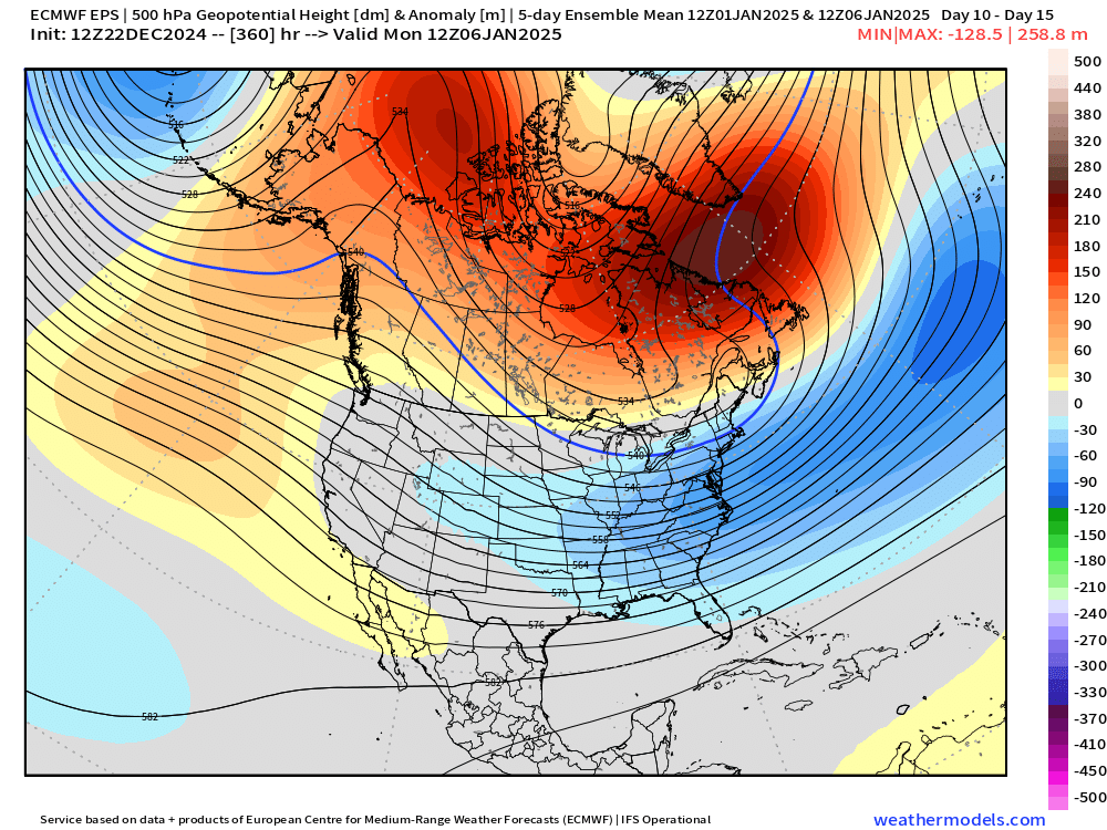
Western trough has been underestimated many times in the last few years. So far this year though it’s been fairly tame so we’ll see. 12z OP Euro still not buying it. Has a huge ridge out there in early January. We’ll see what ensembles say.
-
December 2024 - Best look to an early December pattern in many a year!
ORH_wxman replied to FXWX's topic in New England
Almost a 2F step change in July after what looks like a very slow drift down before that (which may or may not just be an artifact of local mesonets coming online…but usually a prolonged drift is not from new mesonets.) -
There’s a bit of a model battle. GEFS have diverged decently for the first week of January (really the first 4-5 days) It’s hitting the deeper troughing out west which will keep us much milder and prob at least one cutter. Maybe a couple. EPS not buying that idea. Keeps the warmer look to mostly pre-New Years.
-
December 2024 - Best look to an early December pattern in many a year!
ORH_wxman replied to FXWX's topic in New England
How long has it been that bad? Even the very very lenient “within 2F” margin they use on calibration would fail miserably. Cant imagine why it hasn’t been axed and replaced yet. -
December 2024 - Best look to an early December pattern in many a year!
ORH_wxman replied to FXWX's topic in New England
That was a good storm with a solid 6-10” front ender…really nasty cold tuck with ice all the way into BOS and SE MA the next morning. Eventually we all warm sectored though in SNE except maybe the deep valleys near Hippy/Your old neck of the woods and N ORH county. -
December 2024 - Best look to an early December pattern in many a year!
ORH_wxman replied to FXWX's topic in New England
Sunset looked nice tonight behind the ridge line with the snow and lights. Grabbed this pic around 4:30.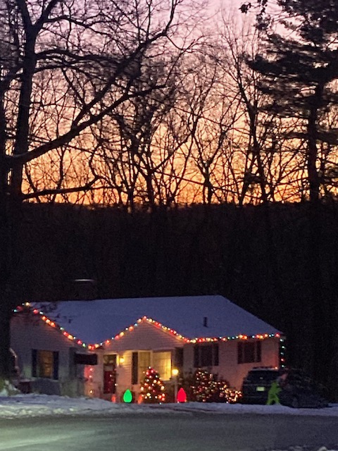
-
Yeah it’s been kicked down into South America. That period between Jan 3-6 looks really ripe at least.
-
Very little cold air for that new years threat so it will be marginal and likely favor NNE and/or interior.
-
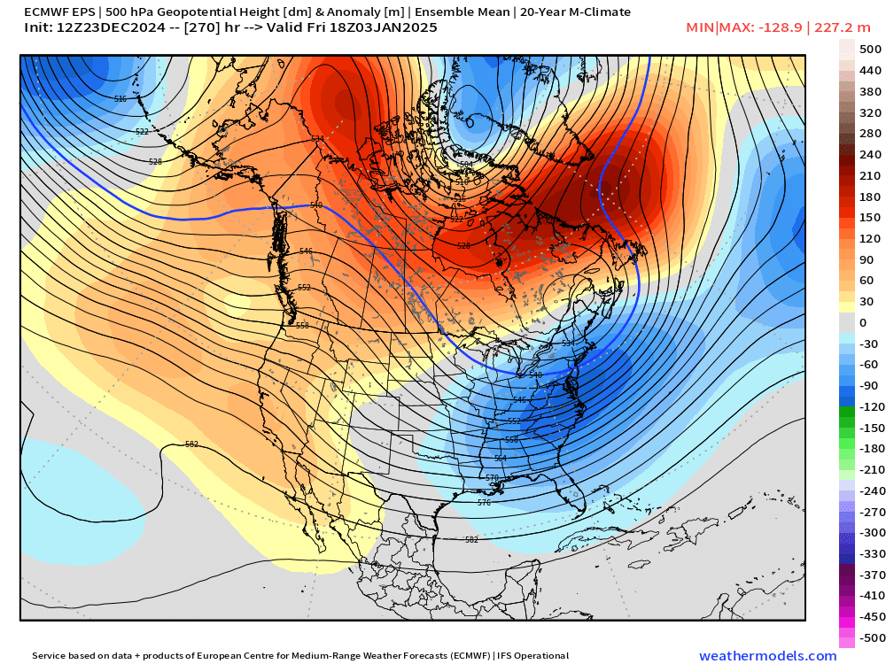
EPS 11-15 day composite. That’s pretty classic…even with a little STJ involvement for once as others have pointed out. Potential and verification are two different things though. Hopefully it produces.
-
December 2024 - Best look to an early December pattern in many a year!
ORH_wxman replied to FXWX's topic in New England
Was in Boston last night and even though I already knew they did well in the storm, it still surprised me somewhat to see how much snow they had. I guess 2-3 years of them getting skunked has started to numb me…I always expect the snow to disappear once inside 128 but it got meatier and meatier. Looked and felt like deep winter there. Great to see during the lead up to Xmas.


