

ORH_wxman
-
Posts
90,892 -
Joined
-
Last visited
Content Type
Profiles
Blogs
Forums
American Weather
Media Demo
Store
Gallery
Everything posted by ORH_wxman
-
The next 2 weeks looks really solid for an early start…sans the mildish few days later this week…but that torch really shrank in both magnitude and duration as we got closer…once that cold front comes through on Saturday, I think it’s pretty cold through months-end barring any major changes (or the clown range OP GGEM scoring a coup over the rest of guidance). Should be a lot of snow making and plenty of upslope opportunities from that early-season lake effect on full blast. Hopefully we can get a good synoptic event in there too so that some sense QPF is put down in the base.
-
That was close to major violence the day before Tday on 18z GFS. Either way though, like I mentioned earlier, there’s quickly a forming consensus on guidance for a cold Thanksgiving. Don’t think we’ll break all time monthly records like 2018, but some of those runs are damned cold.
-
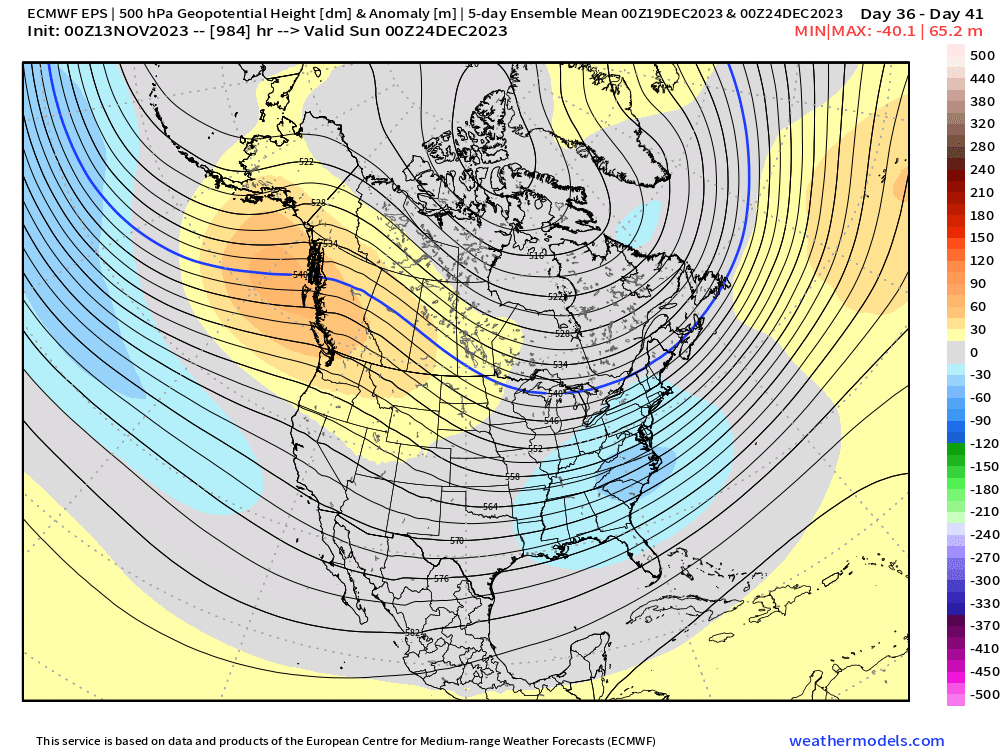
LOL...didn't see Scott's post....but yeah, pretty torchy for a chunk of early December, but it does improve late....here's how it looks for the 5 day mean leading into Xmas Eve
-
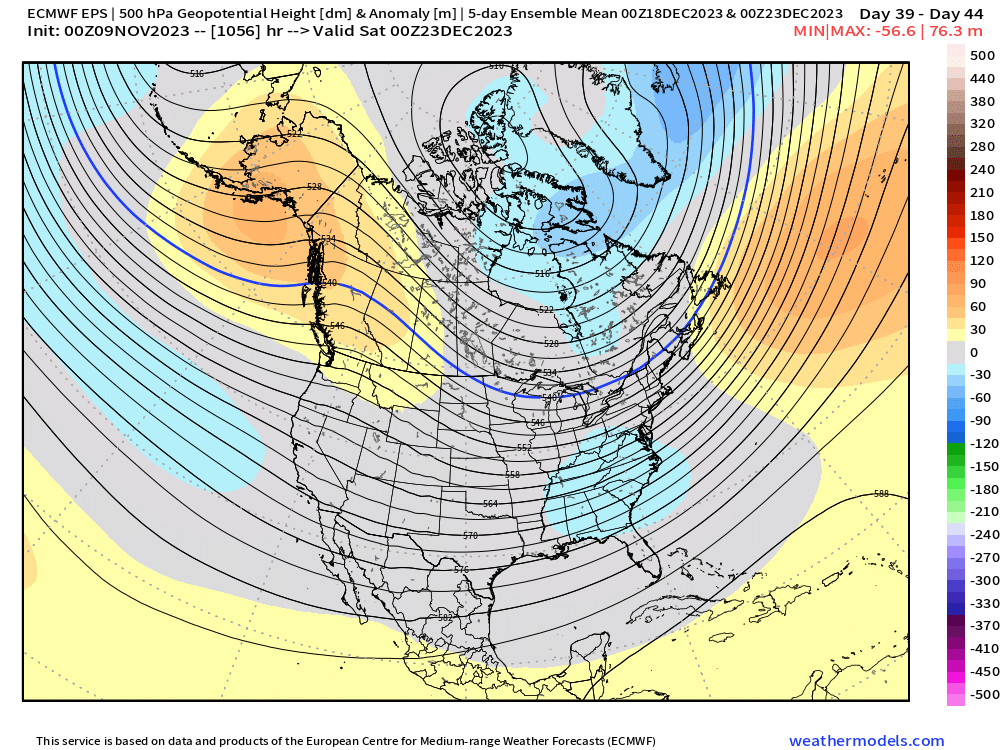
Weeklies are kind of up and down...maybe a bit colder to open December but then it quickly goes torchy for about 10-12 days until it drastically improves heading into the week before Xmas. Also worth noting that the EPS are significantly colder than the weeklies for late November.
-
Decent chance of some snow showers and flurries coming through this evening....so maybe those who haven't seen first flakes yet will see a few.
-
Tday itself is starting to look pretty damned cold on all guidance now...still a bit of uncertainty, but a lot less than there was even a day or two ago. Could see another system later that weekend too.
-
Time to fire up the Hugh Millen/Tommy Hodson era at QB again....the winters are matching.
-
Yeah it was toast inside of 495 by Tday....we had prob like 75-80% cover here, but it was completely full in ORH...but like 5 miles east of here was almost completely bare.
-
At this point, we might want to root for the Super Nino to verify so we can actually have a Nino North Pacific….lol. Don’t think that’s happening though.
-
GFS trying to go 2018 for Tday
-
October was like for a long time. Between like 1930-2010, ORH had like no temp trend in October. But then the 2010s went furnace lol.
-
ACK actually historically has an earlier first freeze date by 4 days than BOS. I was always surprised by that.
-
Yeah let’s get that pattern for first week of Dec. That would likely give some chances.
-
Yeah end of the month is def trending colder on most ensemble guidance...i'll be interested to see if EPS go that direction too in a little bit here.
-
Yeah the pattern flipped the final week of the month. Late Nov 1985 and Dec 1985 were very cold....we prob left some potential on the table in Dec 1985. It was like a -5 month, but not all that snowy.
-
We were at my grandparents in Holden, MA (just outside of ORH at 1000 feet) and we lost power mid-afternoon with a nasty mixed of pellets and ZR (had about 1.5" of snow before the changeover)....luckily, most of the dinner was already cooked, but some of the sides had to be finished on top of the wood stove. There was already snow OTG too when that storm started because there had been a 2-3" snow event two days earlier. It was like a currier and ives week you'd expect near Xmas and not Tday. That was probably the best stretch of winter that season....lol.
-
There was a good snow to ice storm in the interior on Tday 1985 too....and of course the warning snow event in Nov 1980.....seems like the '80s were decent for November and spring snows, but were pathetic for actual winter snow.....lol.
-
It was the gold standard for early season snowstorms for a long time until Oct 2011 (interior, not coast)
-
Still a lot of uncertainty Tday week on guidance....it's all over the place. Until then, seems pretty boring....cold and dry this weekend and early next week (sans upslope snow showers....maybe a few flurries down here monday night) and then mild and dry late next week.....but a lot of guidance last night went with a mini-cold shot next weekend which wasn't really there before. That might affect the pattern Tday week just beyond that.
-
Lol we’ve had meltdowns in here before because a D10 storm in mid-November fell apart when it got to day 7….it’s comical more than anything. I knew the weeklies would get a rise out of some so I posted all the pics. The funny part is many of the chronic complainers have still had a blockbuster storm or two in the past few years even if the winters weren’t great. There have been multiple periods in the past when you could go years and years or even over a decade without a big storm (say, 15”+) in large chunks of southern New England. The thing is…the 2000s and 2010s has gotten us to think we’re CNE snow climo now when in reality, that was likely just a couple of awesome decades that were due to regress.
-
‘09 and ‘02 weren’t. But yeah it wouldn’t be surprising. They do start to look good closer to Xmas week but obviously anything beyond about 3 weeks is like throwing darts
-
Euro weeklies today:


-
First Thanksgiving was mild....you gotta wonder if the Pilgrams were throwing their crates and wagons against the rocks in anger.
-
It was also T-day week that started this discussion. The warmup around 11/15-16 has been pretty well-advertised for over a week now. What happens after about 11/20 is the bigger question.
-
Been a model war of sorts of Tday week....GEFS have been colder the last few runs while EPS are slightly above normal.


