ORH_wxman
-
Posts
93,092 -
Joined
-
Last visited
Content Type
Profiles
Blogs
Forums
American Weather
Media Demo
Store
Gallery
Everything posted by ORH_wxman
-
Yeah wouldn’t surprise me if the northern fronto band produces some weenie totals even if QPF stays under an inch. Like a foot on 0.75 or something.
-
Tracking February 6. Light to moderate event potential
ORH_wxman replied to Typhoon Tip's topic in New England
Looks like it tries to flip to snow in the heaviest stuff in NNJ…we’ll see if it gets some resistance as it tries to push east and northeast into the deeper arctic air.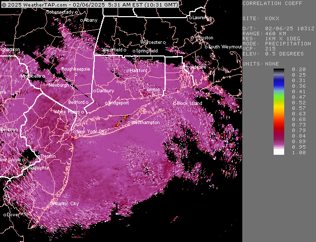
-
Solid arctic airmass. You could tell with how dry it felt. Not nearly as cold as up there but you could still tell this airmass has some bite to it when I was outside. It’s not even that weird of an airmass but it feels a little alien after the last two winters of mimicking Vancouver’s climate.
-
Tracking February 6. Light to moderate event potential
ORH_wxman replied to Typhoon Tip's topic in New England
At least if you don’t get much in this one, you weren’t missing much anyway with bigger things in the pipeline for the weekend. -
Gary Gray’s site was millennium weather (separate from any primitive forums back then). He was always a must-read before big storms. He used to post on here for a while actually. We always laughed when at the beginning of every update of his on millenniumwx, he’d start it by saying “I don’t have a lot of time right now so I’ll make this update brief…” and then he’d proceed to write a novel dissecting every single model solution.
-
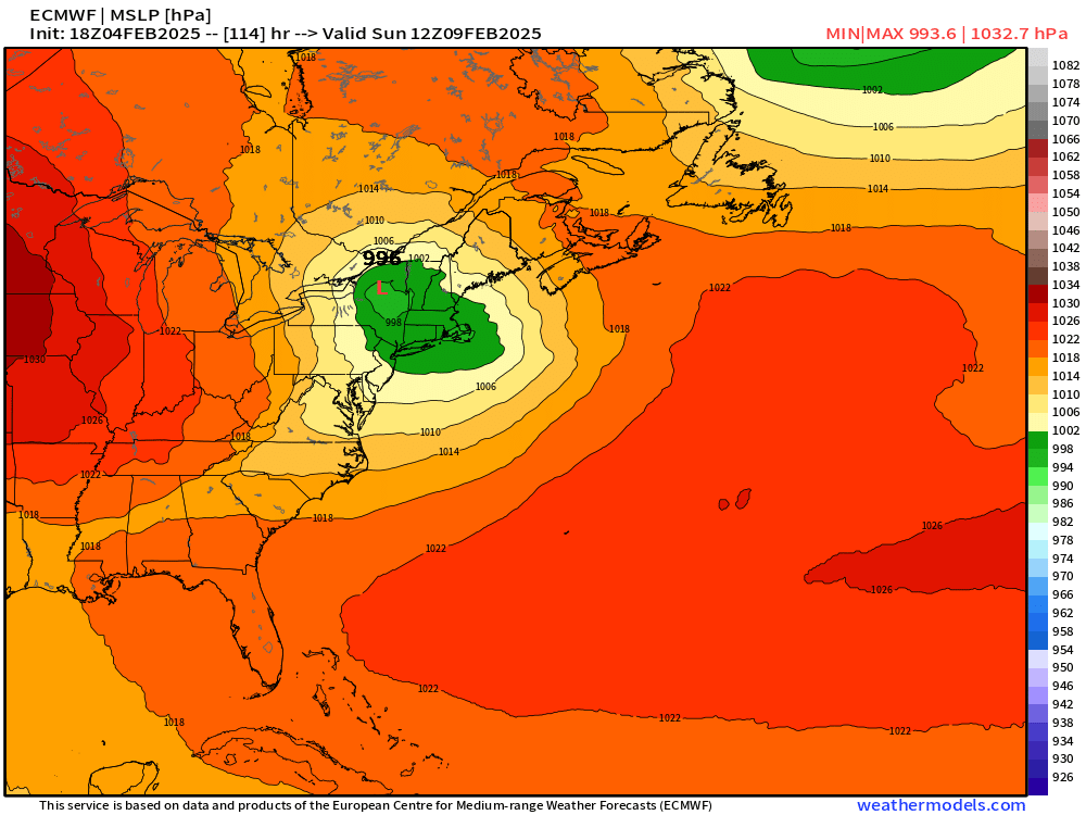
18z euro is a solid hit again. Low end warning criteria for much of SNE and into CNE.
-
Yep I remember you all the way back then. Jspin too. Dendrite obviously. Then of course there were a whole bunch down in the mid-Atlantic too.
-
I think you started posting when you were still at PSU! Lol. I was just out of college. Crazy. Hopefully this stretch coming up can be another good one for the memory bank. We def got lucky during those first 10-15 years on the forums with some epic winters and epic storms.
-
Btw…..Happy 20 years of posting…I think you and I starting posting on Wright weather bulletin board (WWBB) around the same time…that epic 2004-05 winter. I had lurked previously but didn’t post until that winter. I remember seeing you show up and I started interacting with your posts. Jesus…20 fooking years…and some of the same peeps are still here from that era…Jerry, Ginxy, Kevin (CT Blizzard back then), Ryan, Bob, Tamarack, and several others I’m sure I missed. Fun times.
-
Yep, I’ll translate for those who don’t know 1= 0.1”-2.0” 2= 2-4” 4= 4-6” 6= 6-8” 8= 8”+ 8 is the highest it goes so if the model was predicting 20” of snow in that 12 hour period, it would still spit out an 8 on MOS
-
The crazy part is the pattern is still very weenie-ish at the end of the ensemble run too so you’d probably have more in the pipeline. Still gotta actually get these events to deliver but confidence is rising quickly.
-
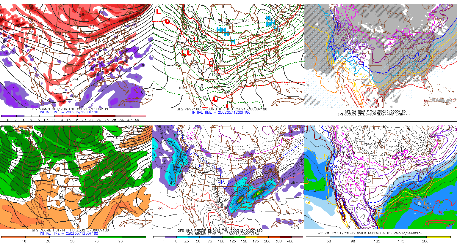
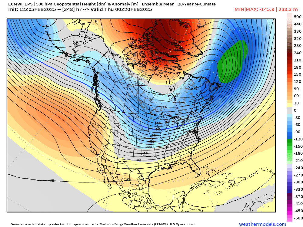
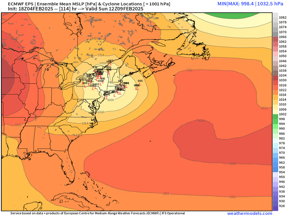
This is what it looks like at the end of the run…there’s still a lot of bullets in the chamber on that look..esp if we try and sneak some ridging out west
-
How long has it been since we saw this type of Scooter high with a juicy system coming out of the south? It’s starting to get that “look” where something larger could happen…just need to get this a bit closer but the cross-guidance support is really strong for being a week out
-
Almost reminds me of this event http://www.meteo.psu.edu/ewall/NARR/1994/us0107.php#picture
-
Tracking February 6. Light to moderate event potential
ORH_wxman replied to Typhoon Tip's topic in New England
Commutes might not be that bad for most. Much of this falls after morning commute and ends before evening commute. Exceptions might be SW CT where it could affect the morning commute and then further northeast into Maine where it could still be steady precip during evening commute. -
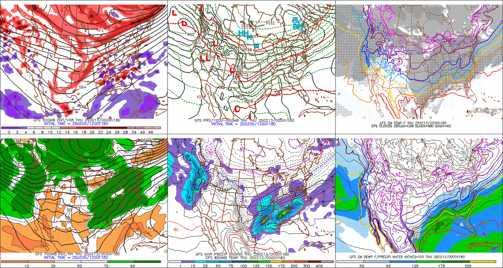
Little bit of CCB getting going.
-
Tracking February 6. Light to moderate event potential
ORH_wxman replied to Typhoon Tip's topic in New England
Just not a whole lot of exciting dynamics with this thing. The hope is that the vort attenuates a little less than model guidance shows which would strengthen the thump. But otherwise I think 1-3” for many. Maybe some 4” lollis north of pike into CNE. All guidance keeps the secondary sfc reflection SE of the region now so I don’t see any liquid precip over the interior. -
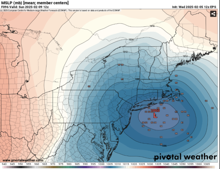
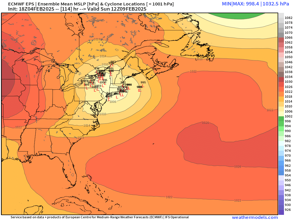
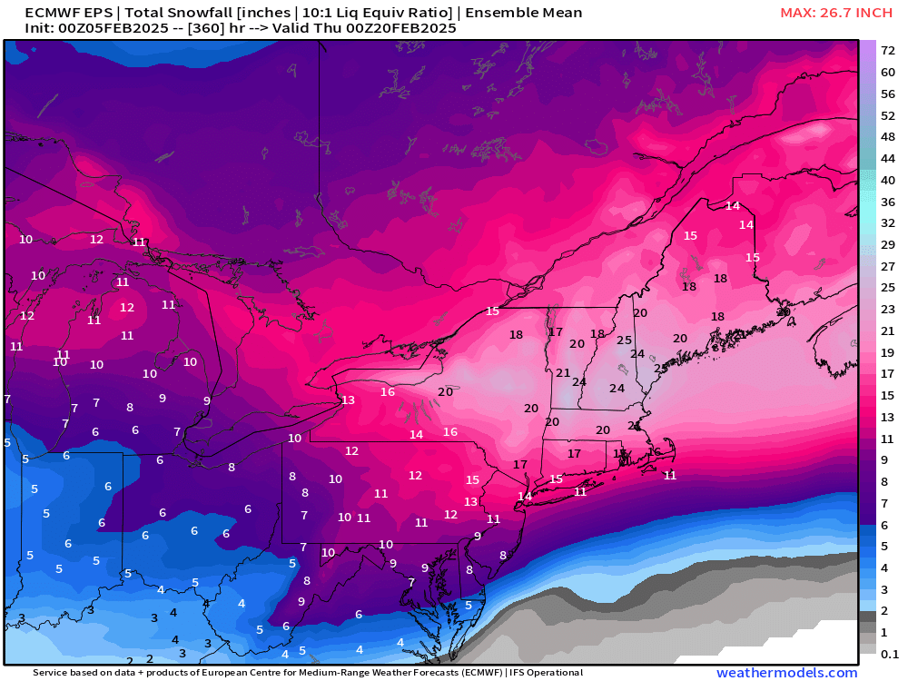
How can you say that without it posting a clown map for Moonshine? I will say the most impressive part of the EPS run is the 6” mean for BOS-ORH (and you can extend that basically down to HVN) for next week’s event (the event after Sunday which could be a prolonged overrunning situation)…impressive mean for that far out.
-
06z EPS tickled a little colder and a little weaker with primary into NY state…slight faster transfer. N of pike to central NH looks excellent on the mean…but still nice thump for even S of pike folks.
-
06z euro pretty nice thump for BOS-ORH. 6-7” or so.
-
Euro suite still a bit more amped than other guidance for this threat. Still a nice front end but def more mixing/ptype issues further north.
-
18z op vs 18z EPS…pretty decent match actually as 18z EPS amped up a little bit from 12z …OP still on the stronger side but not by a ridiculous amount…this one def has more dynamics than Thursday.
-
18z OP euro is still pretty amped. It’s a good thump before mixing but def more amped than the ensembles.
-
Tracking February 6. Light to moderate event potential
ORH_wxman replied to Typhoon Tip's topic in New England
Yeah the tick colder on 18z euro makes the difference between all guidance pretty small now save for the very paltry 3k NAM but hard to take that seriously yet. Maybe inside of 36h start giving it any weight at all.