baltosquid
-
Posts
597 -
Joined
-
Last visited
Content Type
Profiles
Blogs
Forums
American Weather
Media Demo
Store
Gallery
Everything posted by baltosquid
-

Jan Medium/Long Range Disco 2: Total Obliteration is Coming
baltosquid replied to Jebman's topic in Mid Atlantic
The hamsters doing the math on that run should be sacked. -
Jan Medium/Long Range Disco 2: Total Obliteration is Coming
baltosquid replied to Jebman's topic in Mid Atlantic
How cold for how long to get some legit icing on the bay? -
Jan Medium/Long Range Disco 2: Total Obliteration is Coming
baltosquid replied to Jebman's topic in Mid Atlantic
Absolutely massive glut of cross polar air -
Jan Medium/Long Range Disco 2: Total Obliteration is Coming
baltosquid replied to Jebman's topic in Mid Atlantic
20th is intriguing but that cold press is so insane I'm not sure if there's any room for the GoM energy to do what we need -
Jan Medium/Long Range Disco 2: Total Obliteration is Coming
baltosquid replied to Jebman's topic in Mid Atlantic
I don't want to touch grass until March -
Jan Medium/Long Range Disco 2: Total Obliteration is Coming
baltosquid replied to Jebman's topic in Mid Atlantic
In total agreement, but if we can maximize here then holding snow cover through to the potential cold look reload in February is on the table... keep the ground white! -
Jan Medium/Long Range Disco 2: Total Obliteration is Coming
baltosquid replied to Jebman's topic in Mid Atlantic
Low really lurches towards the coast at 120-123 on pivotal... is this a potential tuck situation? I don't trust the backend with the low far away. Never seems to work - but in this case we'd get hit nicely with warning level snow beforehand, so not relying fully on the back. But if it can tuck and chill for just a sec... -
Jan Medium/Long Range Disco 2: Total Obliteration is Coming
baltosquid replied to Jebman's topic in Mid Atlantic
If we continue to trend like this in the Mississipi river valley, we can definitely score quite well. -
Jan Medium/Long Range Disco 2: Total Obliteration is Coming
baltosquid replied to Jebman's topic in Mid Atlantic
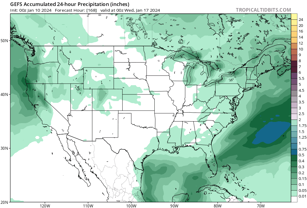
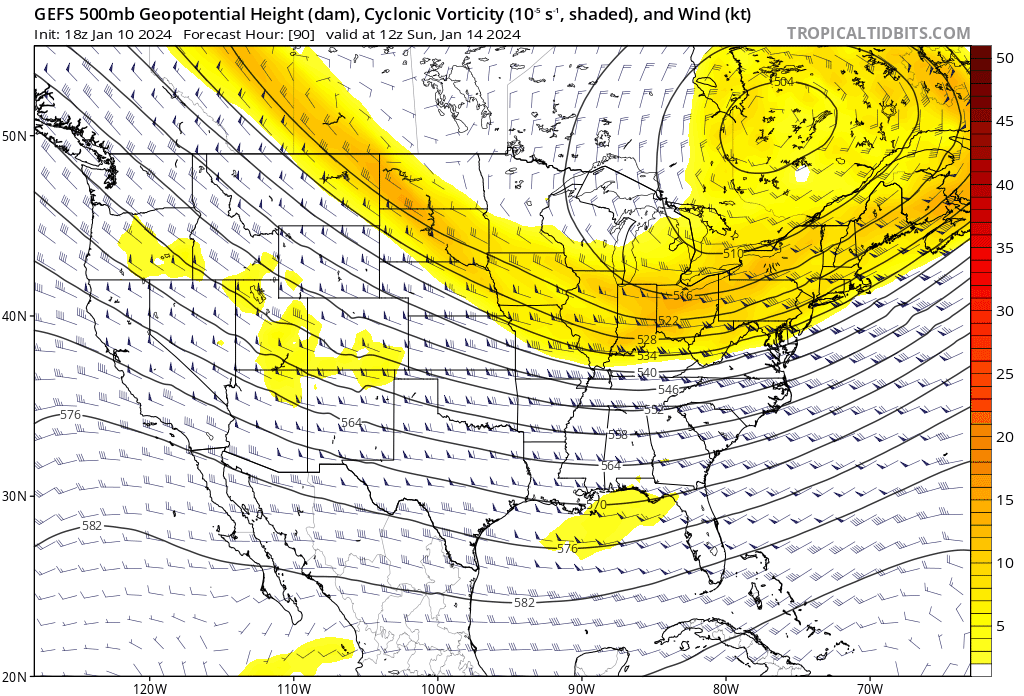
GFS notably colder at the surface for us at hour 90. Just have to hope it's not an indicator of suppressive forces -
Jan Medium/Long Range Disco 2: Total Obliteration is Coming
baltosquid replied to Jebman's topic in Mid Atlantic
I do fear the dwindling hours. Not that it's an insurmountable adjustment (in fact it's extremely within reason to adjust to a win), but it does feel like one or two bad days of runs would leave us statistically unlikely to see the kind of changes necessary to get a nice event. -
Jan Medium/Long Range Disco 2: Total Obliteration is Coming
baltosquid replied to Jebman's topic in Mid Atlantic
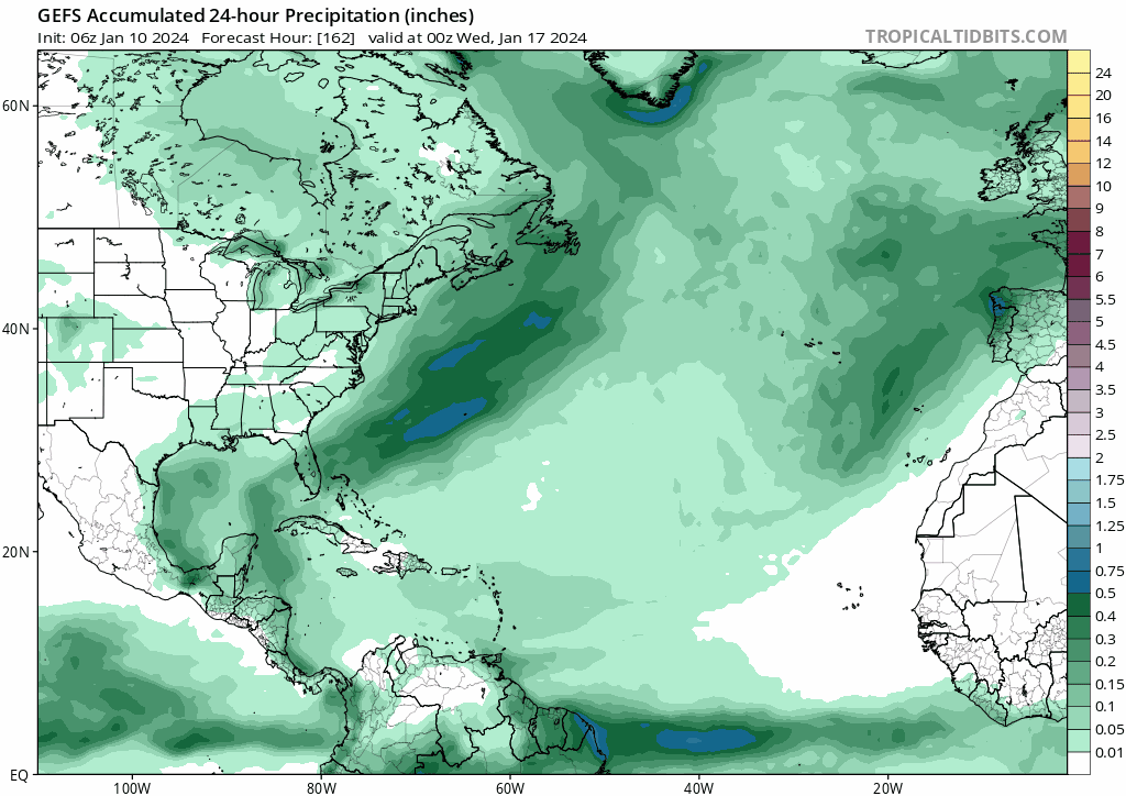
A day's worth of GEFS trends. 00z still an improvement and appears to have done away with lots of ultra suppressed members given the clearer precip and MSLP presentation, but the bulk of the tracks still have some work to do.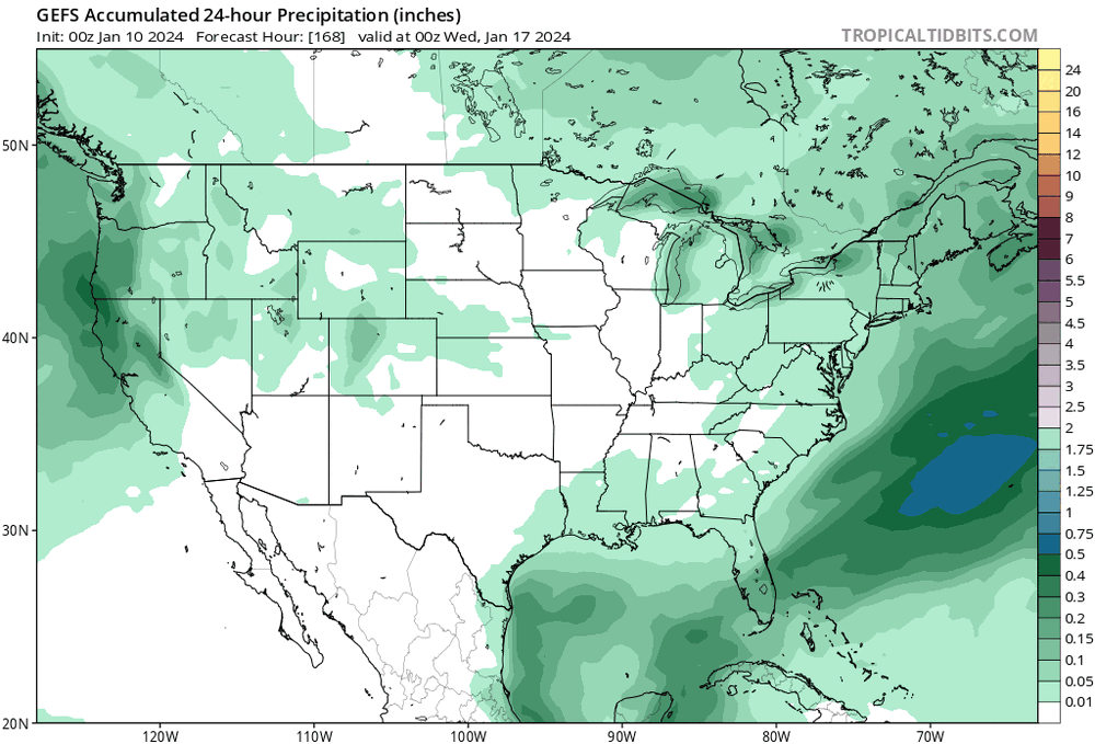
-
Jan Medium/Long Range Disco 2: Total Obliteration is Coming
baltosquid replied to Jebman's topic in Mid Atlantic
Low came out much clearer in mslp anomaly on this GEFS run. -
Jan Medium/Long Range Disco 2: Total Obliteration is Coming
baltosquid replied to Jebman's topic in Mid Atlantic
Early in the GEFS run you can see some more trailing s/w action, hopefully portends another step towards the Euro.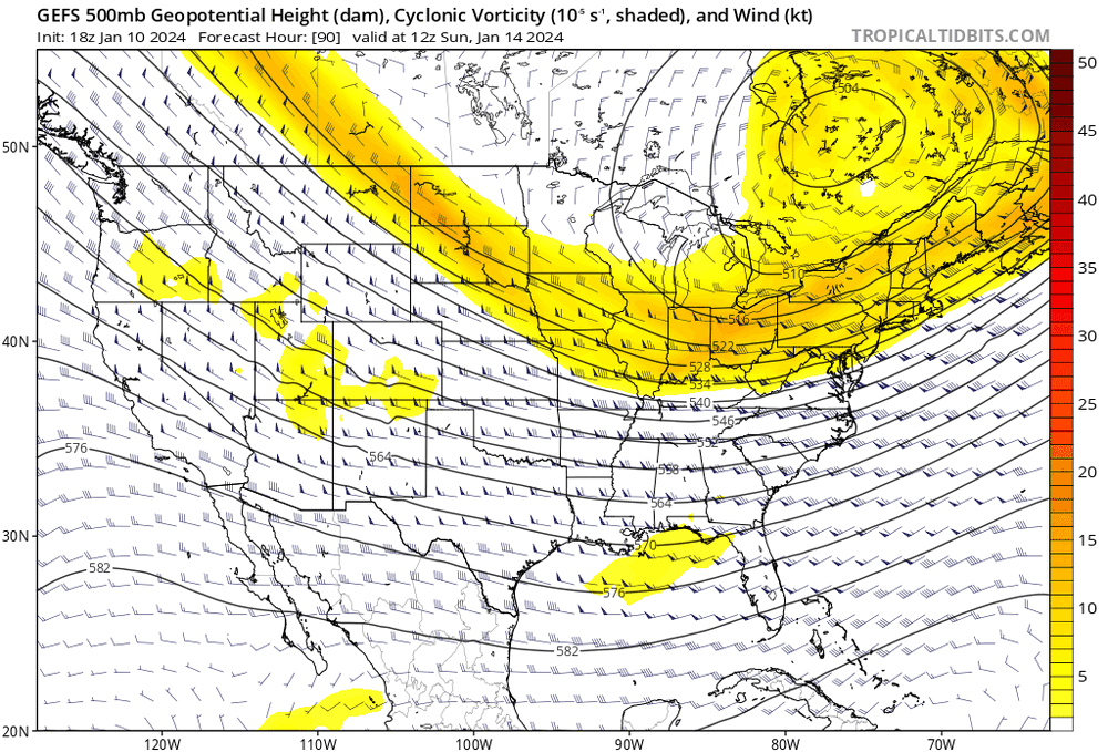
-
Jan Medium/Long Range Disco 2: Total Obliteration is Coming
baltosquid replied to Jebman's topic in Mid Atlantic
Definitely moving in the right direction but the GFS is stubbornly holding on to a later organization. -
Jan Medium/Long Range Disco 2: Total Obliteration is Coming
baltosquid replied to Jebman's topic in Mid Atlantic
It feels like that s/w needs to get a bit more interplay with the vort, still too slow to consolidate something for us. But at least the piece is there; one more element brought in from the euro's take on it. -
Jan Medium/Long Range Disco 2: Total Obliteration is Coming
baltosquid replied to Jebman's topic in Mid Atlantic
Does seem further SE though. But pretty similar. -
Jan Medium/Long Range Disco 2: Total Obliteration is Coming
baltosquid replied to Jebman's topic in Mid Atlantic
good old fashioned model war over this one, hopefully GFS op bleeding to Euro progression signals a coming surrender though. -
Jan Medium/Long Range Disco 2: Total Obliteration is Coming
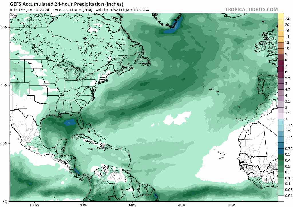
baltosquid replied to Jebman's topic in Mid Atlantic
Also for the 20th, precip on GEFS indicates the GoM is going to spin something up. Obviously as depicted it's OTS but given the beautiful bigger picture, hard to complain at this range... good to know there's potentially energy around, then got to get it in our neighborhood.
-
Jan Medium/Long Range Disco 2: Total Obliteration is Coming
baltosquid replied to Jebman's topic in Mid Atlantic
Baby steps. Still reeling in the precip field from the sea..thumb.gif.16b27837712e29d72d95968180a179af.gif)
-
Jan Medium/Long Range Disco 2: Total Obliteration is Coming
baltosquid replied to Jebman's topic in Mid Atlantic
Intrigued to see how GEFS will pick up on the euro idea. If the OP is starting to cave, should hopefully see some nice members at least. -
Jan Medium/Long Range Disco 2: Total Obliteration is Coming
baltosquid replied to Jebman's topic in Mid Atlantic
Trend is friend! Trend is friend! Trend is friend! -
Jan Medium/Long Range Disco 2: Total Obliteration is Coming
baltosquid replied to Jebman's topic in Mid Atlantic
Would love to see the members on that, to get a spread that good on depth maps in particular is encouraging. -
Jan Medium/Long Range Disco 2: Total Obliteration is Coming
baltosquid replied to Jebman's topic in Mid Atlantic
IF Tuesday is going to be something, the bar for me is simple - drop enough snow to survive the relative warmth Friday (a bit Thursday too) and keep the grass covered! Then we can get into "the look" period with even deeper cold and lock that snow cover in for a bit... not accounting for any added snow! -
Jan Medium/Long Range Disco 2: Total Obliteration is Coming
baltosquid replied to Jebman's topic in Mid Atlantic
Didn't realize it initially but GEPS has some real cross polar flow in the picture for the 20th, ridiculous cold. -
Jan Medium/Long Range Disco 2: Total Obliteration is Coming
baltosquid replied to Jebman's topic in Mid Atlantic
You can see the trending signature on the precip map of the storm amping up off New England. But definitely more juiced overall even before that, hopefully that trend contributes to it coming in a bit more NW over time.


.gif.9fc4a34b2b211685a153ccc033eede95.gif)