.gif.a8150e126cebc480193fad2934fe975c.gif)
Torch Tiger
-
Posts
16,399 -
Joined
-
Last visited
Content Type
Profiles
Blogs
Forums
American Weather
Media Demo
Store
Gallery
Everything posted by Torch Tiger
-
.thumb.gif.f92b16c631a1d15d405ed77b33f0710d.gif) 1944 hmmm
1944 hmmm -
wow just noticed that. Cape Cod Bay buoy up to 77.2 and ACK 75. impressive though it's shallow
-
it's hot but victims, nah, no one forced them to go. I do feel for those who don't choose to be out though
-
quite the Steined heatwave. theyre becoming more frequent it seems
-
he here
-
It's histrionic clickbait, agree 100%. I just liked the "tHiS sToRm is going to EXPLODE" headline and the heat dome thing that is what makes money. we adapt
-
pop-up south shore zygote, too
-
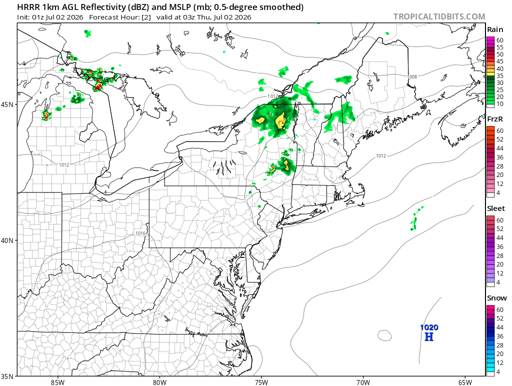
those NNE storms sent out a distinct outflow boundary visible on radar- through here to nearing pike - seems to be interacting with W MA storm(s) now.
-
low dew though..68
-
7:42
-
Is there a * with that, if back to back? Folks were saying BOS is running warm
-
starts the video with "massive heat dome"
-
für Vortex
-
barely a breeze. 99F
-
100 on car therm in N. Billerica! This is so great!!
-
nothing really compares to that since, tbh. 26 years it was no different than a plains event
-
8/9-10 2000 blows this meager crap convection out of the water
-
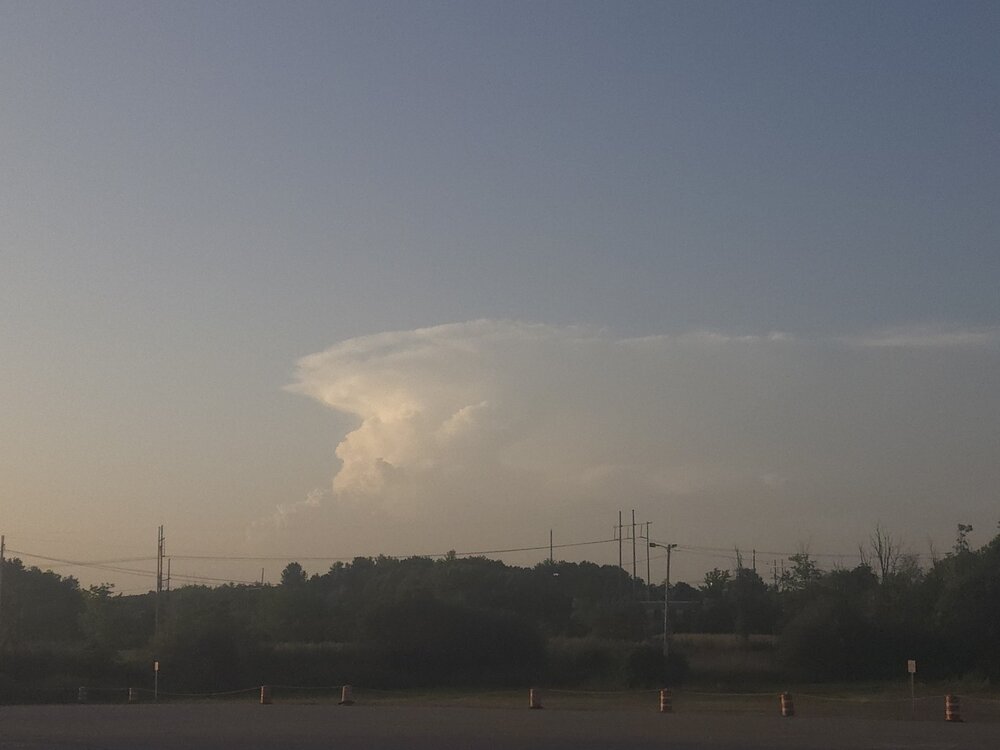
Weakening now. Lightning dropping quickly
-
Temp still low 80' so I assuming there is a bit of sbcape to play with along with mlcape
-
Lightning!!!!
-
Love it! 'Grats!
-
Looking forward to tomorrows bump up to record-shatting #'s!
-
what a wimp