tiger_deF
-
Posts
543 -
Joined
-
Last visited
Content Type
Profiles
Blogs
Forums
American Weather
Media Demo
Store
Gallery
Everything posted by tiger_deF
-
2024 Atlantic Hurricane Season
tiger_deF replied to Stormchaserchuck1's topic in Tropical Headquarters
GFS has been showing development in the western Caribbean for three runs in a row, now in only 6-7 days. Will be the next place to watch. Hoping that nothing develops or that it is more of a gulf threat, since the west coast of Florida will be uniquely vulnerable -
2024 Atlantic Hurricane Season
tiger_deF replied to Stormchaserchuck1's topic in Tropical Headquarters
Leslie has been feeling shy, so of course once model intensities have plummeted and all eyes are off her she has decided to put on a show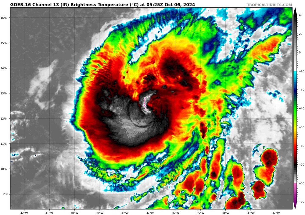
-
2024 Atlantic Hurricane Season
tiger_deF replied to Stormchaserchuck1's topic in Tropical Headquarters
00z GFS sends an even stronger major hurricane into the same area in 12 days, and sends it up the eastern seaboard. Almost certainly not verifying but would be absolutely catastrophic if it did.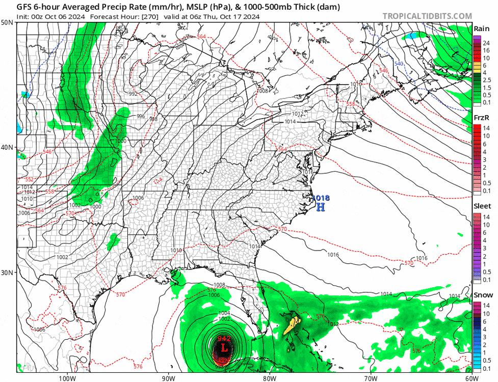
-
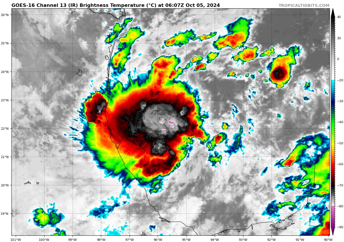
This is quite a rare case of EPAC-ATL crossover, but in the opposite direction! Typically Atlantic systems cross over to the EPAC, but this late season the crossover AOI from the EPAC to the Gulf of Mexico has worked in tandem with CAG-induced instability and vorticity in the region and produced a bonafide low pressure region with intense and persistent confection. I’d still doubt major hurricane status given the northerly shear, but the setup is quite conductive for west to east GOM systems - a rarity even in the past 100 years. Will be interesting to see the evolution of this system, and how it interacts with the punishing high pressure, the trough to the North, and potentially even Leslie if it scoots across the peninsula fast enough.

-
2024 Atlantic Hurricane Season
tiger_deF replied to Stormchaserchuck1's topic in Tropical Headquarters
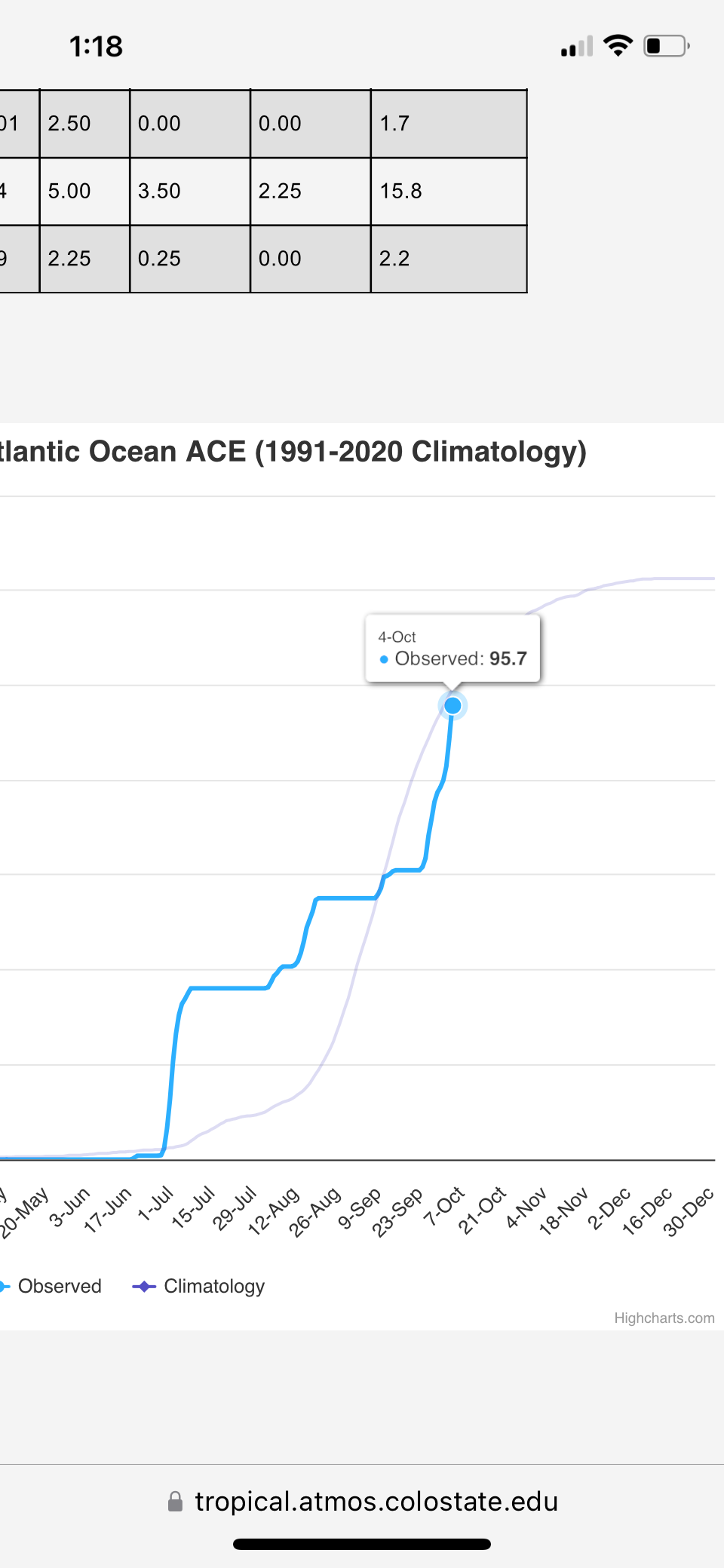
Crazy season to track. From a cat 5 early July major, to a total shutdown of the basin in peak season, to multiple powerful major hurricanes causing the greatest damage since Katrina during late season. 2024 will be talked about for many decades in the future, not just due to the incredible amount of hurricane landfalls on the gulf coast, but due to the truly anomalous pattern of tropical cyclonegenesis and intensification. Is this another artifact of AGW or just a season with many conflicting signals which have constructively and destructively interfered with each other, or both? Only time will tell.
-
2024 Atlantic Hurricane Season
tiger_deF replied to Stormchaserchuck1's topic in Tropical Headquarters
Keeping my eye on the wave behind soon-to-be Kirk. It would be unprecedented to have a storm form in the East MDR and make it to the islands in October, but the ICON and EC-AI have been showing that as a possible scenario. The future storm is kept locked under a potent ridge that builds just slightly ahead of the disturbance as Kirk moves North. Hard not to buy the early recurve solution but this has been a season of odd behavior. -
The story of this hurricane is going to be the horrifying inland flooding. Entire towns in TN and NC wiped off the map, houses destroyed and the landscape reshaped. Probably dozens of people if not more dead that are unaccounted for. The most impactful hurricane since Ian.
-
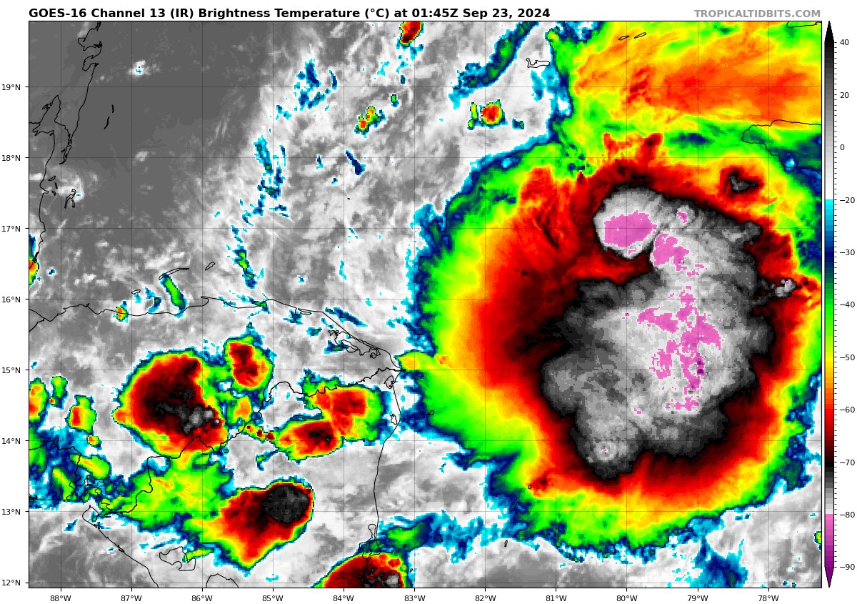
The MLC has been starting to rotate pretty quickly in the past few frames. Now that the low and mid level centers are more or less aligned, think we are finally seeing the start of eyeball building, though there is a long way to go
-
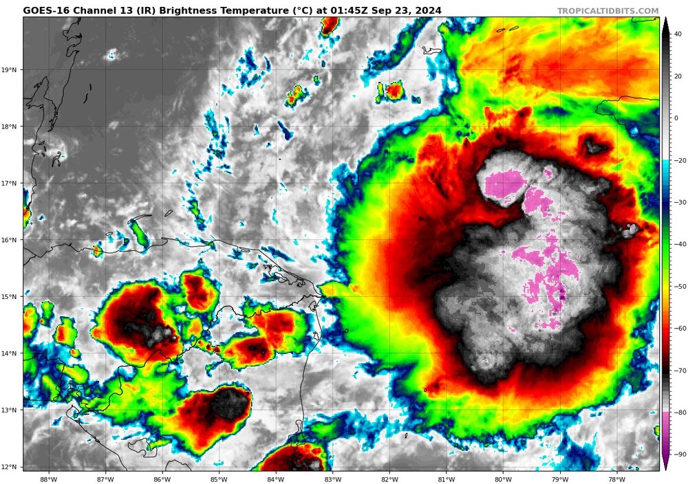
Really impressive convection, shear is quite low over the blob as there is a potent anticyclone. The lower level circulation is likely still right off the NI/HD border but it could drift right, especially if it cannot fire off its own convection and alignment occurs to the East.
-
It’s tough in a way since I recognize in “said poster” a little bit of what I saw in myself when I first started tracking weather; boundless enthusiasm, heat-of-the-moment that nowadays I look on as barely better than spam, and inexperience. Unfortunately the inability to read the room and understand that clogging up thread after thread with the same sort of post is a disruption that brings down the quality of discussion and information isn’t acceptable, especially during peak season. Early in the first years I was into weather, there was a poster on a forum I frequented with the username Tasmanian (Taz). His posts were somewhat similar in manner but far less spammy and engaged critical conversation and insight. He was a legend of the forum, and it’s not too late for “said poster” to learn a lesson. Anyhow, going to be an active few days, and if the 18z GFS is correct potentially an active few weeks. 97L appears to be setting up as a Michael redux (potentially weaker and larger), but these systems are always full of surprises.
-
Still watching this one. Steering pattern looks to be such that if this ends up east of the forecasts it could be shunted up the Atlantic, potentially close or on NE, like that GFS run a few days ago. Quite unlikely but it’s something, and we’ve had storms arrive in that manner from the West before
-
2024 Atlantic Hurricane Season
tiger_deF replied to Stormchaserchuck1's topic in Tropical Headquarters
18z GFS is all over the place, but one thing it does have is signal. This may be the largest percentage of developing members we’ve seen for the AOI yet. We might not get much from this system but it sure isn’t being dropped -
2024 Atlantic Hurricane Season
tiger_deF replied to Stormchaserchuck1's topic in Tropical Headquarters
Ironic that right as everyone is becoming bearish there’s finally something to actually look at. This seems a step beyond what many models had in terms of convective activity for today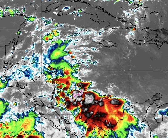
-
Benchmark for serious interest on my end is any sort of impact within 168 hours (7 days) on the models. We’ve had ~3 semi persistent modelcanes this season, and the signal vanished at that time or before for each one. If NE is getting even getting scattered hits after that then we could be on to something.
-
2024 Atlantic Hurricane Season
tiger_deF replied to Stormchaserchuck1's topic in Tropical Headquarters
While no model shows any development and there isn’t much vorticity, I’m a little suspicious of this feature crossing the Lesser Antilles. Will likely die in the Caribbean graveyard, but the convection is robust and increasing, and shear does not appear to be destroying the cloud tops at this time. I think this bears watching.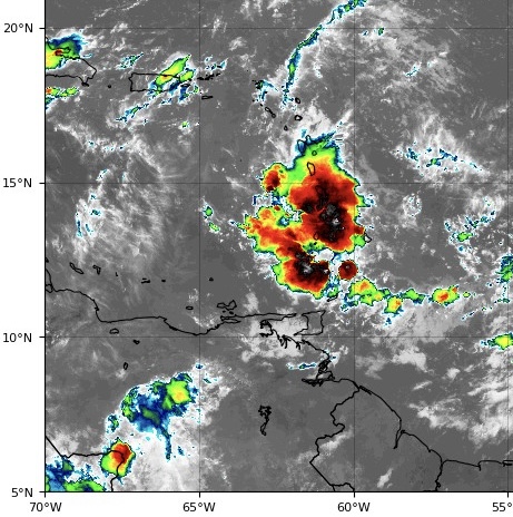
-
2024 Atlantic Hurricane Season
tiger_deF replied to Stormchaserchuck1's topic in Tropical Headquarters
Our AOI 5 hours ago vs our AOI now Convection is still popcorning and somewhat sparse, but the convective pattern is much more consolidated. Remains to see if that will improve short-term development.

-
2024 Atlantic Hurricane Season
tiger_deF replied to Stormchaserchuck1's topic in Tropical Headquarters
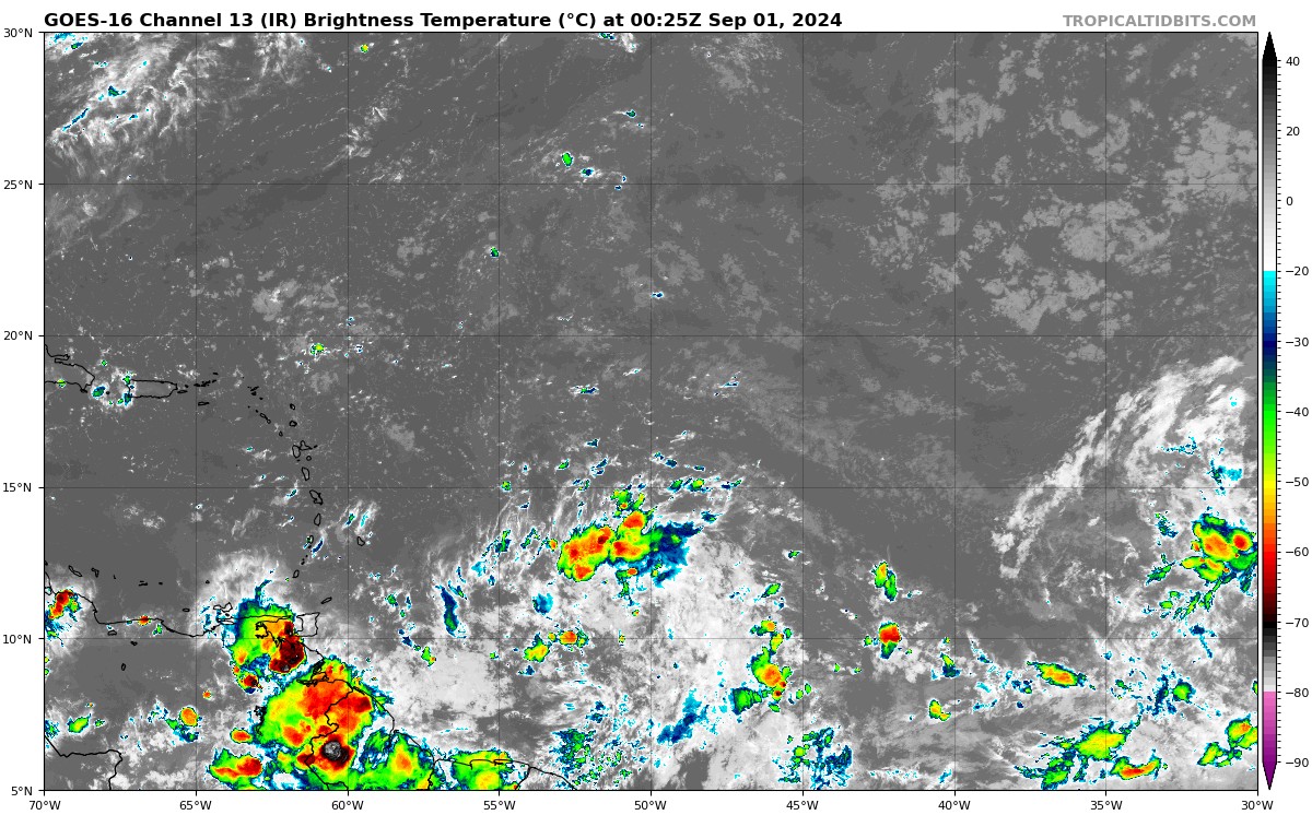
The SAL profile looks pretty dry for this time of year, but important to remember that SAL tends to hurt larger, sprawling waves more drastically than smaller waves, stringing them out and delaying or preventing discrete consolidation. While our current batch of AOIs are certainly not consolidated systems, the convective patterns are more promising for development than a week ago, where diffuse, persistent convection filled the eastern Atlantic.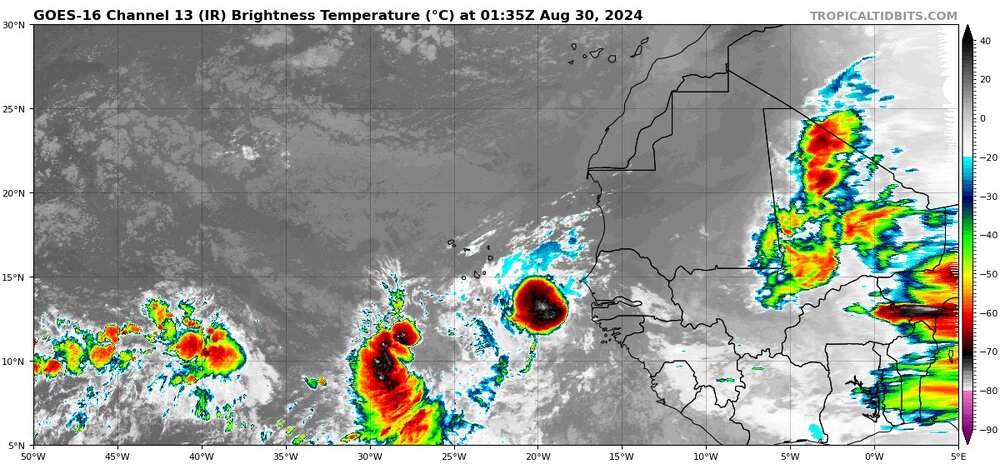
-
The shameless of youth… almost enviable, on most places but a forum for weather discussion To make sure this post isn’t deleted I’ll throw in something relevant. Worth watching the current central Atlantic wave, the one behind it will almost certainly recurve. Hopefully we get a big beautiful storm out of that one
-
2024 Atlantic Hurricane Season
tiger_deF replied to Stormchaserchuck1's topic in Tropical Headquarters
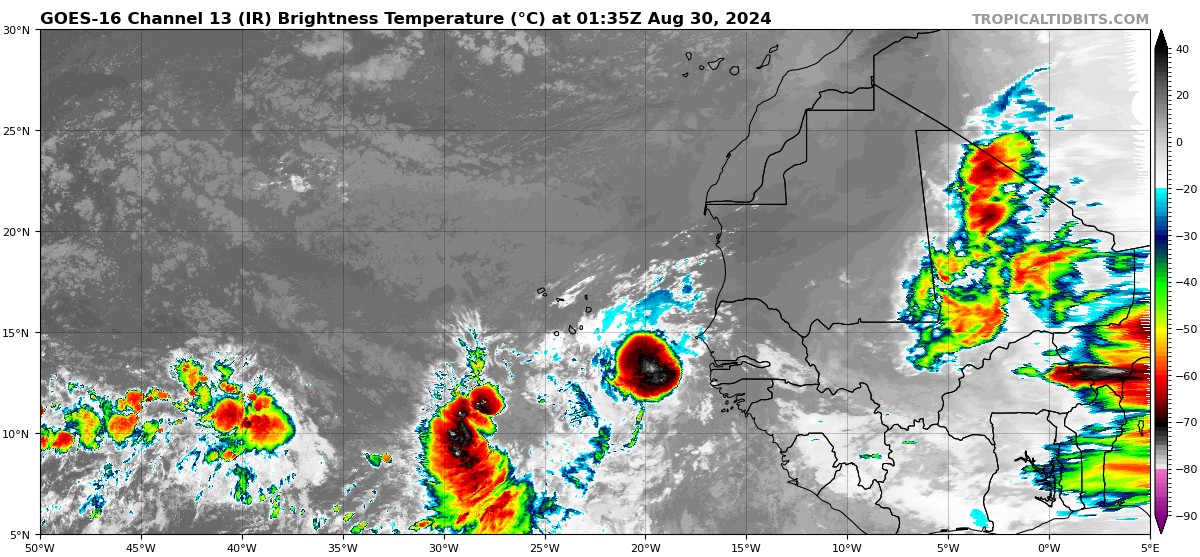
It’s hard to believe that during peak season, with a look like this in the Eastern Atlantic, that nothing will form from these two areas… Interesting that the monsoonal look has been lessening a little, looks like two discrete disturbance areas rather than the mess of convection we’ve had recently.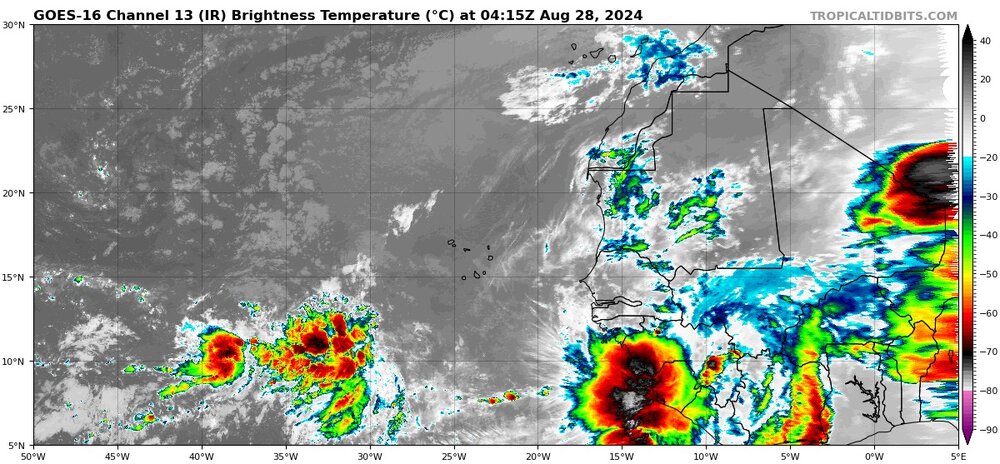
-
2024 Atlantic Hurricane Season
tiger_deF replied to Stormchaserchuck1's topic in Tropical Headquarters
Frankly I’m more concerned with making it to 15 NS if that, GFS shows nothing right through the peak of the season September 10th… Effectively the first entire half of the true peak (Mid August-Sept 10) will be 1/1/0. Something out there is deeply unfavorable, maybe the combination of SAL and the ICTZ being North has been the culprit. Either way the climo model runs have been busting hilariously over the past few weeks. -
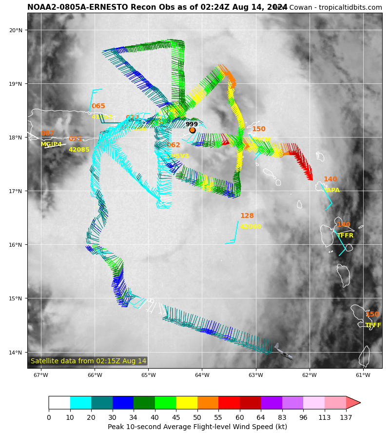
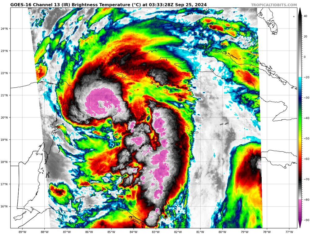
Interesting recon profile here. I wouldn’t go so far as to say there are two separate low level centers, but there is definitely a broad area of low pressure and low wind to the SW of the smaller northern low, with the typical increase in winds happening farther from the center than the northern portion of the storm. Will be a fascinating evolution to watch over the next 24 hours.

-
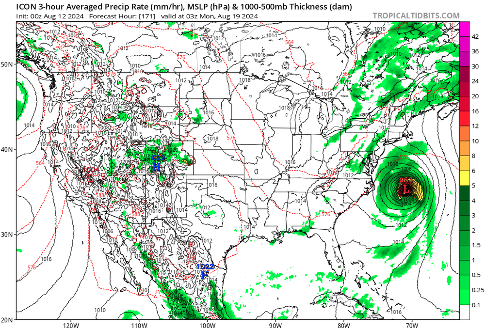
Huge West shifts for the GFS and ICON 00z operational. Wow thought we had completely lost this one…

-
I still think there’s less than a 5% chance of this getting up here. Time and time again, every season we see waves like this slip right through our fingers (or completely disappoint, looking at you Henri…), even when modeling shows something substantial. That being said I’m embracing the delusion. Subtropical waters are warm enough that a hurricane moving at a decent clip could actually maintain major intensity at this latitude for a short time. Plus, gambler’s fallacy- we are so overdue, we have to hit soon, right?
-
Now that Debby is approaching her stall era, even 10 miles of difference east could change her eventual fate. If the center can fully park itself offshore than I think it can regain hurricane strength, maybe become even stronger than before FL landfall. Otherwise, I expect we will continue to see Debby spin down.