Weather Will
-
Posts
7,608 -
Joined
-
Last visited
Content Type
Profiles
Blogs
Forums
American Weather
Media Demo
Store
Gallery
Everything posted by Weather Will
-
We are overdue for something to trend in the right direction...
-
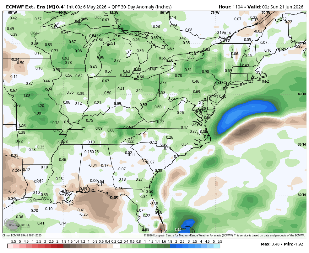
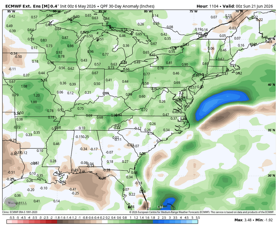
WB latest Euro weeklies: May 20-June 20 hopefully some precip. chances with near normal temps.
-
WB 18Z EURO...sigh...latest runs take Saturday's moisture mostly north and Monday's shortwave south.

-
Glad I cut the lawn last night. Nice little rain. Will take every drop....
-
WB 18Z EPS. Rain still possible on Monday.
-
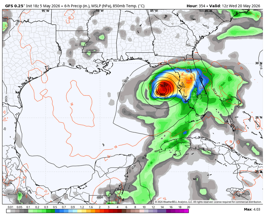
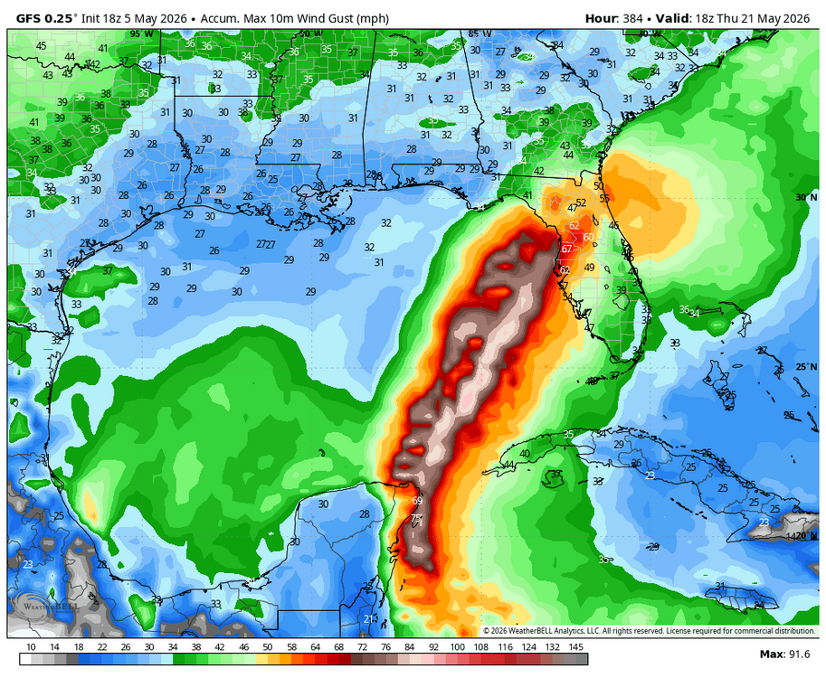
WB 18Z GFS at range. GOOFUS is off to an early start in the tropics.
-
Talked to a nursery about the lack of leaves on the top half of my Crepe Myrtle. The frost/freeze in late April killed a lot of new buds. May bloom late or not at all until next year. Have to keep it watered and fertilized like a new plant to keep it alive.
-
If I get another .10 to .25 I will take it. Beggars can't be choosy....
-
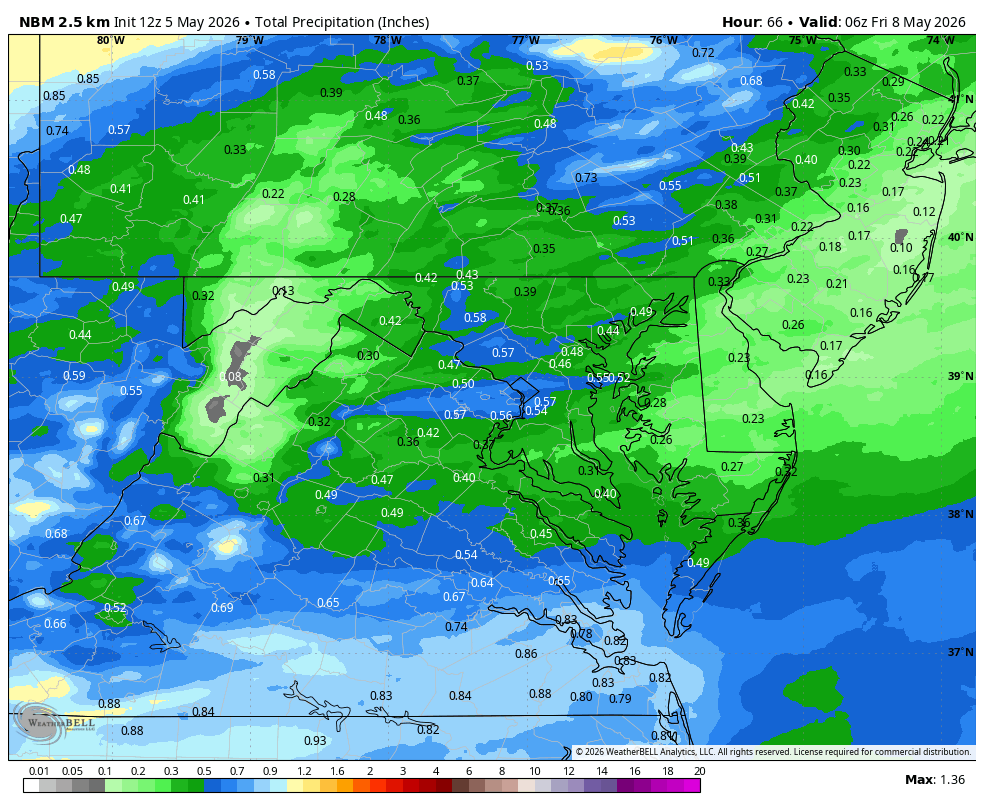
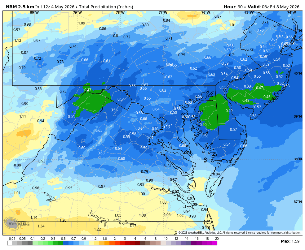
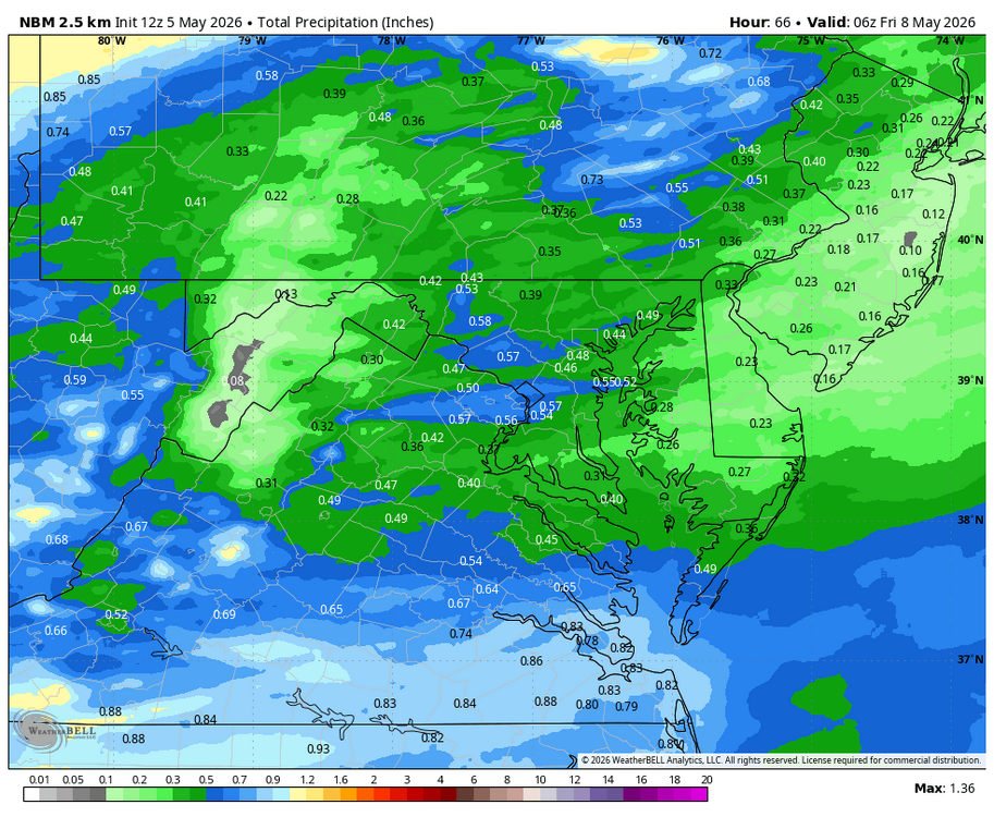
WB 12Z NBM thru Th.
-
Next chance is early next week. WB 0Z EPS and 12Z GFS.


-
WB 15Z NBM for midweek.
-
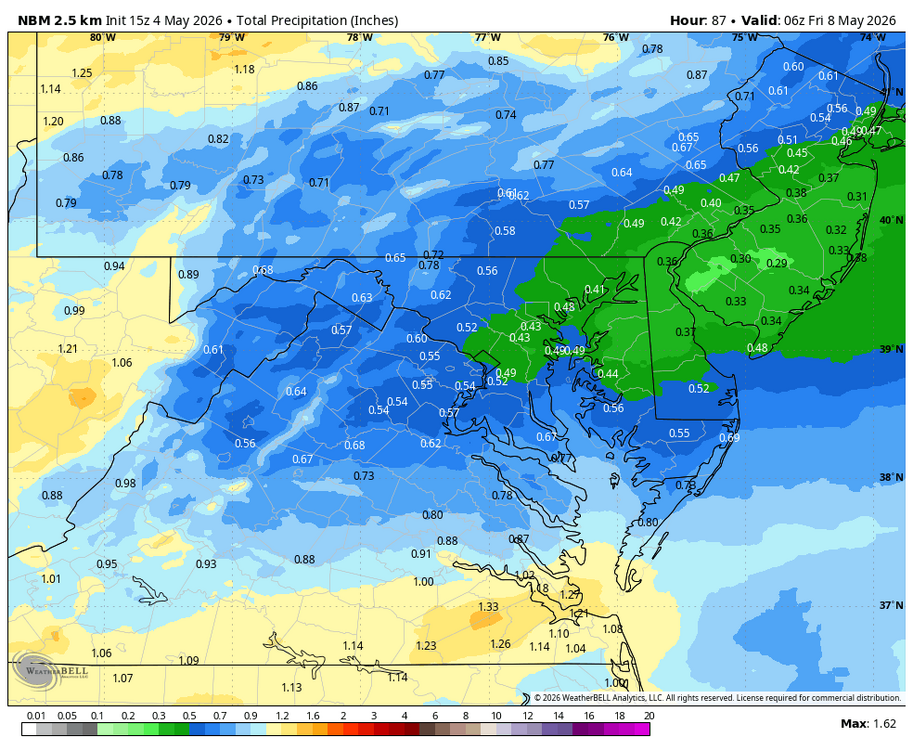
WB 12Z NBM for midweek..

-
43. No frost. Flowers survive another day!
-
WB 18Z EURO Wed./Th. As duly noted in NWS discussion, big shift south with low pressure compared to yesterday.
-
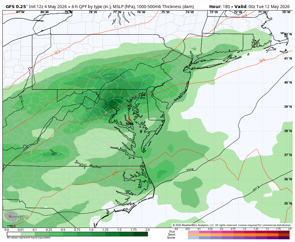
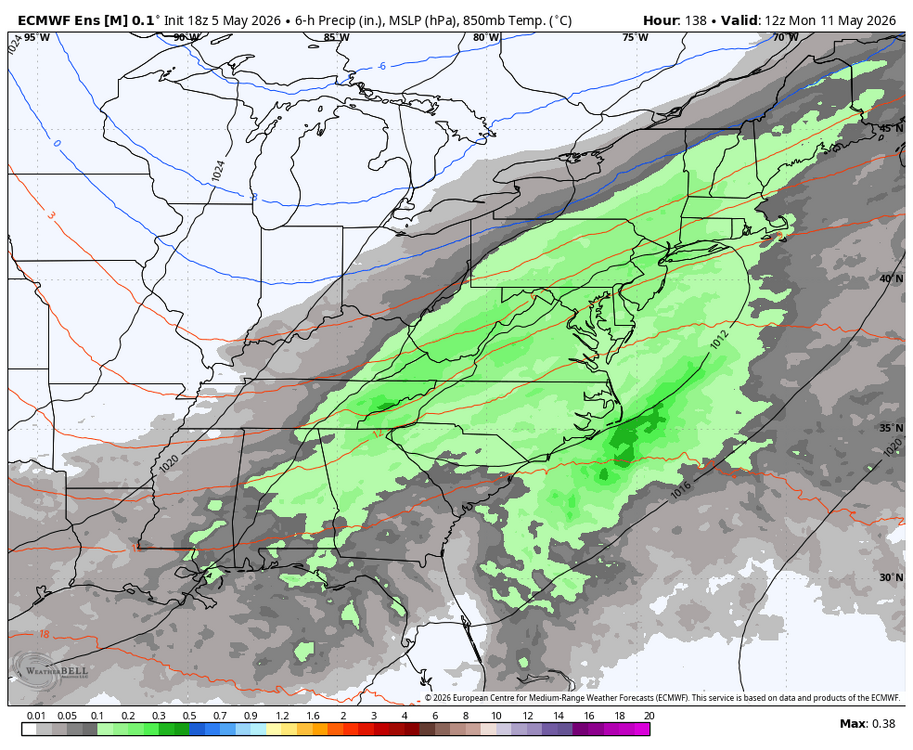
WB 21Z NBM for upcoming late week rain chances. Most of this rain falls next Wed.-Th. Period.
-
WB 5/1 Canadian Jan-March. Looks wet with cold air around.
-
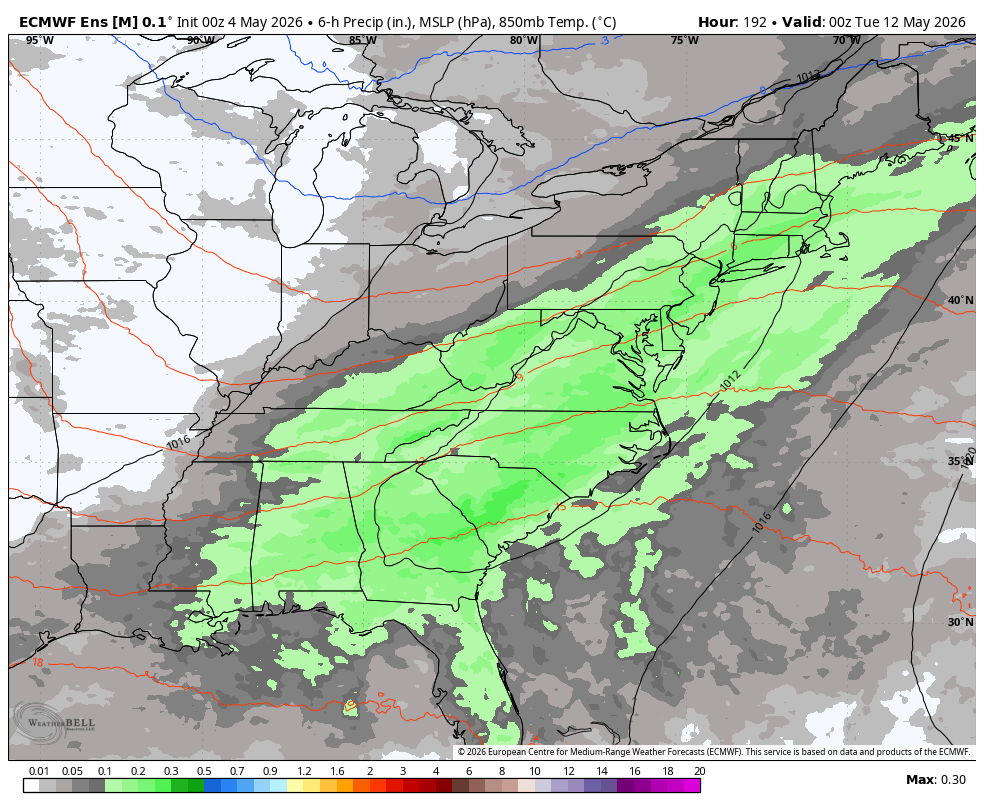
WB 12Z EPS total precip. mean for Wed. night through early Saturday.
-
WB 12Z EURO: snow only 8 days away...
-
WB 12Z NBM. Wet Saturday at the beaches.
-
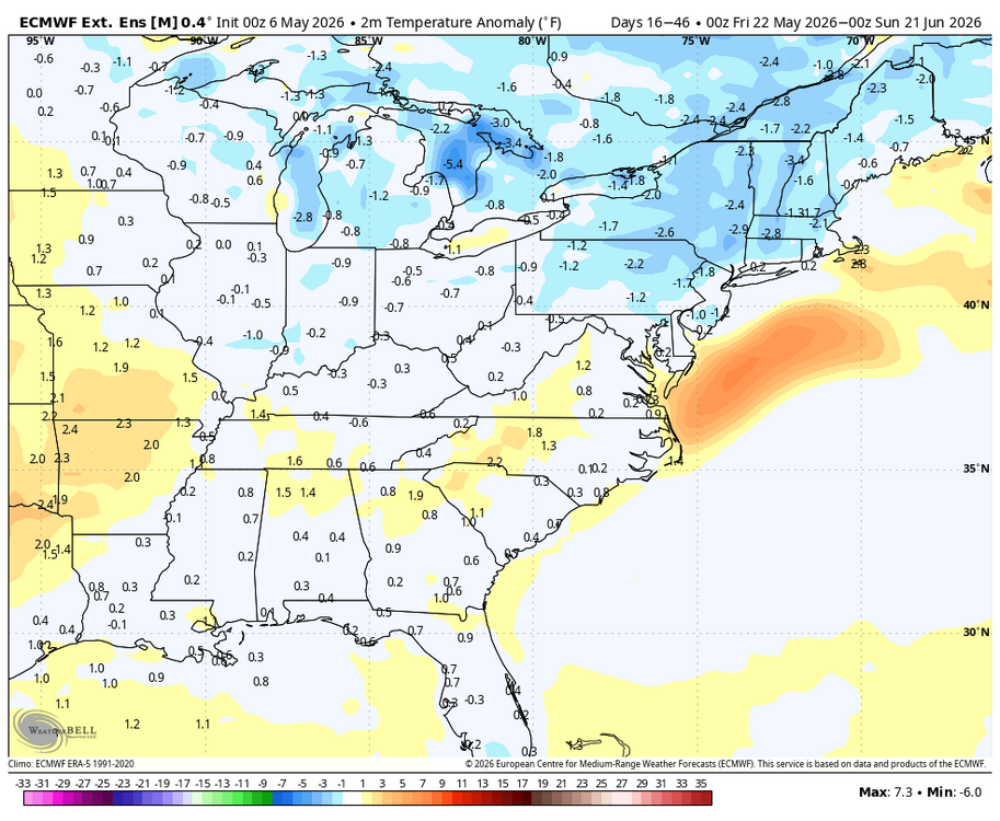
WB latest EPS weeklies for May. Cool, no big heat waves...average rainfall.
-
WB 12Z EPS. Next "significant" rain chance next Th.
-
One good shower about an hour ago. Well under the .50 to an inch forecasted by some models but I will take .15. Maybe one more line will add a little more....edit. Total .35.
-
WB 12Z HRRR
-
WB 6Z HRRR and NBM
-
WB OZ NBM