
jaydreb
-
Posts
2,086 -
Joined
-
Last visited
Content Type
Profiles
Blogs
Forums
American Weather
Media Demo
Store
Gallery
Everything posted by jaydreb
-
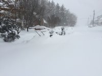
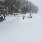
1” here in N. Arlington.
-
We’ll be fine. Storm is barely an hour old.
-
Light snow in N. Arlington. Really enjoyed the chase with everyone!
-
Hope everyone enjoys! We’ve waited 3 years for this.
-
Best EURO run yet! Still snowing in DC at 6z Monday.
-
It’s fine if they show more snow!
-
-
GFS is the driest model and still shows 6” IMBY. LWX has bumped up totals for DC to 4-7.
-
It’s a little bit better for just about everyone than 6z.
-
RGEM
-
After seeing the NAM, that’s kinda meh. Lol.
-
True. Even if you cut the precip in half thats 6-10”.
-
12k NAM has 12-18” for most of the DC metro area.
-
-
Something something NAM’s wheelhouse.
-
32/13 in North Arlington.
-
Best Mid-Atlantic winter storm of the last 40 years
jaydreb replied to PrinceFrederickWx's topic in Mid Atlantic
In January 1996 I was 20 years old and and home from college for winter break at my house in Central NJ (Monmouth County). The Blizzard of 1996 was the most snow I have ever seen from a single storm. We got about 30" from that storm. I moved to the DC area the next year. The most snow I received from a single storm since I've been in this area was in 2016 when I got about 26". The most snow I ever had on the ground at one time, however, was after the 2/10/10 storm. We had gotten about 24" from the 2/6 storm and then another 12" on 2/10 (along with wind and blowing snow). I voted for '96 simply because it was the most snow I had ever seen from a single storm. If the February 2010 storms were combined into a single entry I would have voted for that. -
I am about 1 mile north of 66. Nothing yet.
-
We toss. SREFs better at this range.
-
18z GFS shifts the precip field north by a hair.
-
I’ll set my bar at seeing flakes falling from the sky. Will take a burst of flurries at this point.
-
18z RGEM actually gets precip pretty far north. Flurry watch in DC.
-
Euro pretty much nailed this thing. GFS wasn’t bad either but had a few off runs here or there. CMC and FV3 were the last to catch on.
-
-
GFS doesn’t budge. Not even a tick north. We had a good 30 mins enjoying the NAM extrapolation and JMA though.


