jaydreb
-
Posts
2,086 -
Joined
-
Last visited
Content Type
Profiles
Blogs
Forums
American Weather
Media Demo
Store
Gallery
Everything posted by jaydreb
-
I thought the trough looked more positively tilted but I could be wrong. It’s a moot point anyway.
-
The Xmas storm looking more progressive on the GFS through 114 FWIW (probably nothing). EDIT: Downpours on xmas eve followed by some windblown flakes on xmas.
-
The week or two after Xmas look primed for a big East Coast storm.
-
GFS trending the wrong way for xmas snow. Also gives us a nice rainy coastal a few days later.
-
I can’t remember the modeling leading up to it, but the January 2019 storm that ended up bullseyeing DC metro area could be another example of a positive bust for that area (and maybe a negative bust for other areas).
-
GEFS nearly unanimous that we will see at least mood flakes on Sunday.
-
That’s one heck of a cold front on xmas eve on the GFS.
-
A fair number of the 12z GEFS members show decent snowfall on xmas eve/xmas morning. Hard to capture it all in a single panel because of timing differences, but you can sort of see it here.
-
Ha. I did the same thing but want a house. Looking at Wisp or Snowshoe? Wisp is easier to get to. Snowshoe has arguably better skiing.
-
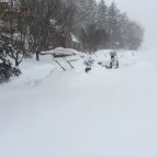
Ripping snow in N. Arlington near McLean border. Roads caved.
-
For now it’s dumping snow pretty good in North Arlington.
-
Might as well embrace the fail!
-
North Arlington - 40/20 30.35.
-
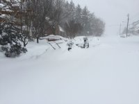
Looks even better now!
-
Ok, I was using WB.
-
Does GFS ever even turn us to plain rain on the western side of the beltway? Haven’t looked at the soundings but from precip type maps looks like mostly frozen (sleet)?
-
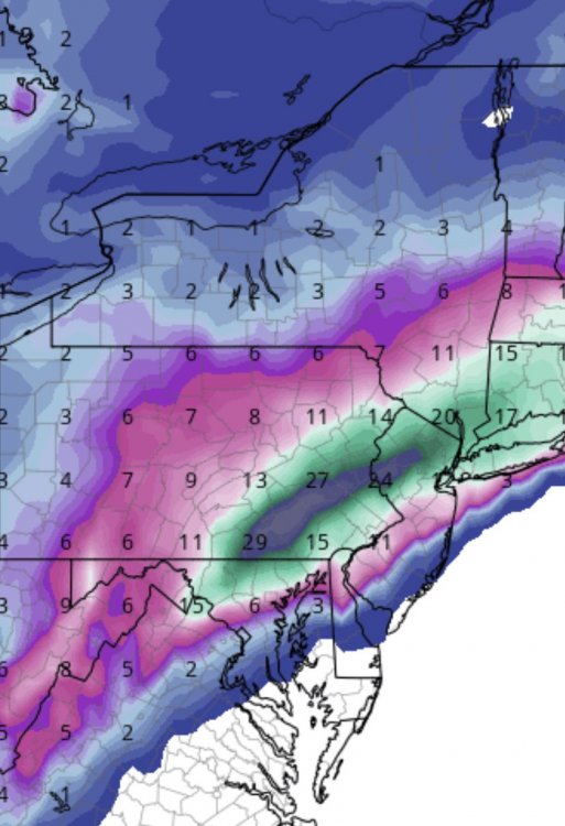
How can that map possibly give DC 9”?
-
Yes, that’s the latest LWX forecast depending on where exactly you are within the beltway.
-
GEFS cut back somewhat.
-
Lol, GFS gives Boston 2” and CMC gives them 12”.
-
Yeah, the 0z runs have definitely tempered my expectations.
-
Wow, congrats PSU.
-
12z was over Delmarva at 84. Sounds like a slight tick east?
-
Wow, the storm hits a wall between 78-84 and scoots east.
-
HP pressing down a little more at 51 on 18z Euro.