jaydreb
-
Posts
2,086 -
Joined
-
Last visited
Content Type
Profiles
Blogs
Forums
American Weather
Media Demo
Store
Gallery
Everything posted by jaydreb
-
-NAO but not too negative cold but not too cold PNA ridge precisely located over a two block radius of Boise, ID
-
The Mongolian Ji must be lamenting the loss.
-
I don’t know. One model gives us no snow and one model gives us an MECS. We’ll see which one ends up correct.
-
Looks like a texbook pattern that checks all the boxes.
-
I think it’s fairly supported at this range but there’s still a lot of spread because we are a week out. It does seem to be on the extreme edge of the solutions though.
-
About 35 are whiffs for early next week. The other 15 are acceptable.
-
The good news is this is beyond the range of 18z Euro so we have a full 12 hours to enjoy it.
-
Whoa there Euro!
-
Sorry, for Friday. GEFS has a few decent hits for next week but generally favors suppressed/OTS.
-
GEFS looking like 2018. Nice hit for VA/NC border.
-
GFS setting up a big storm in the super long range. Plenty of blue over us. PSU fringed.
-
GEFS is pretty much a whiff for Friday.
-
12z GFS looked like 0z Euro (except for the snow part).
-
LOL, the GFS hates us. Where’s @Ji?
-
Snowing in Alabama at 162 on GFS.
-
Euro is a very nice storm for us on 1/12.
-
Euro has snow into Houston and Western LA at 168.
-
Euro is a nice event for S VA before going OTS.
-
Snowing in NC and SW VA at 120 on 12z Euro.
-
So ICON targets DC metro, GFS targets south and central VA, and UKIE targets N and W?
-
TT map shows rain in DC. Not that it matters at this point.
-
12z GEFS looks better than 6z for next weekend’s “event”. ETA: The 500mb pattern at the end of the run is gorgeous.
-
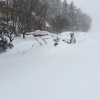
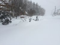
Light snow at our Wisp rental. Nearing .5”.
-
What a weird map. Why are the snow colors so similar to the sleet colors?
-
When is our last good jan 1-15 event? I think 13-14 had a 9 inch mecs followed by near zero temps. That was amazing The beltway got around a foot in 2019.