

ChiTownSnow
-
Posts
746 -
Joined
-
Last visited
Content Type
Profiles
Blogs
Forums
American Weather
Media Demo
Store
Gallery
Everything posted by ChiTownSnow
-
Cold air wraps in quicker.. more snow on the cold side. Hopefully that continues
-
Yeah GRAF.. anyway, rain snow was well south, similar to 00Z GFS . crushed Milwaukee
-
Skilling showed an IBM GRAF model....wtf is that?
-
That same scenario didn't really pan out with the last one tho
-
Adjustments early out west are real tho..
-
Precip shield looks so odd. Like it's too far N with the front end and disconnected
-
Was the city/south end of the winter storm watch debated heavily internally? Or was there good agreement?
-
Timing of both is just not coming together perfectly. PV needs to speed up or system slow down.. but then impact works be a miss. Hard to get it all together
-
Hopefully it's still underestimating a bit on how quickly the cold air wraps in..
-
Not sure I can handle another battle of the WAA
-
I'm at the UC and all rain here
-
Was just thinking that..if the flakes weren't so big, would it look this impressive? And are the larger flakes contributing to the reflective nature on the radar? I guess looking out the window I don't really care...keep ripping
-
Can land those planes with em
-
+SN and ripping right now
-
+SN now. Feeling lucky as everybody immediately around me is reporting rain.
-
Take it and run
-
I'm riding that line here. Snow rain, snow rain.. moderate snow atm
-
Pretty good flakes now.. 10 miles south of ORD edit... Aaaannnd rain now
-
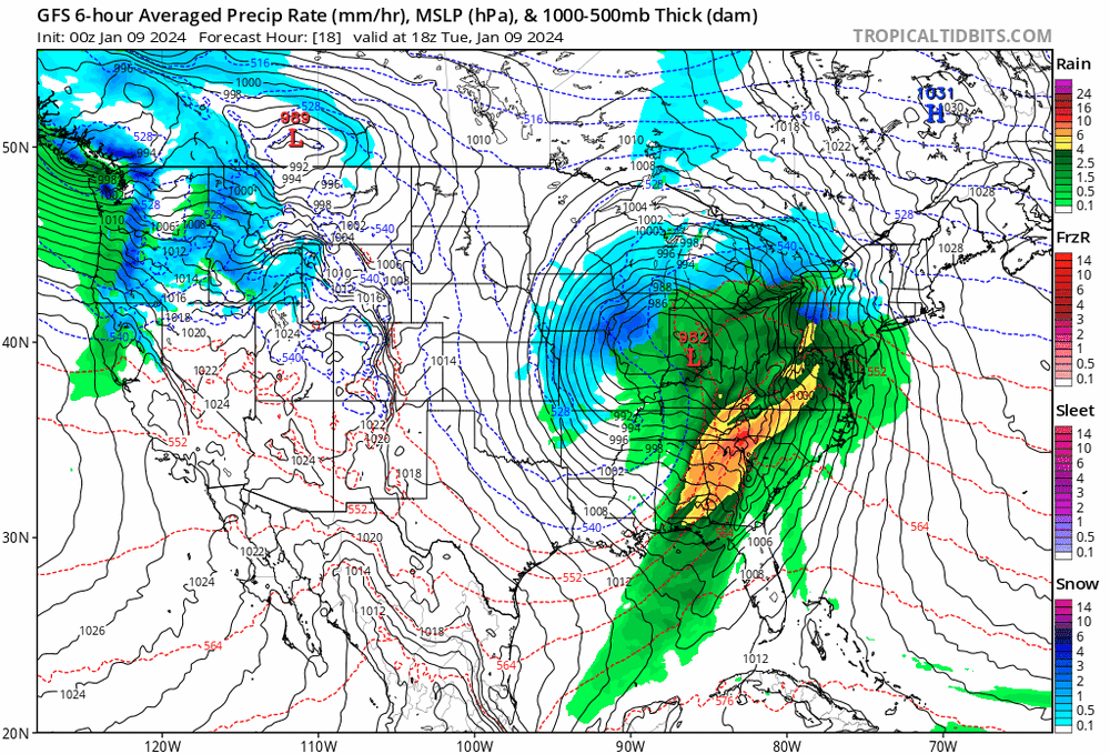
Another incredible run for the 00Z GFS
-
Need someone smarter than me to tell me why this won't happen
-
Fwiw...Some pretty big changes on Gfs 00z . Looks more NAMish than even the NAM did
-
Someone said it earlier.. Gonna be a nowcast scenario due to the potential
-
That deform is cranking..
-
Who the hell brought the heater!?
-
Nervous a bit here as well. Sitting at 35 right now


