LeesburgWx
-
Posts
1,501 -
Joined
-
Last visited
Content Type
Profiles
Blogs
Forums
American Weather
Media Demo
Store
Gallery
Everything posted by LeesburgWx
-
-
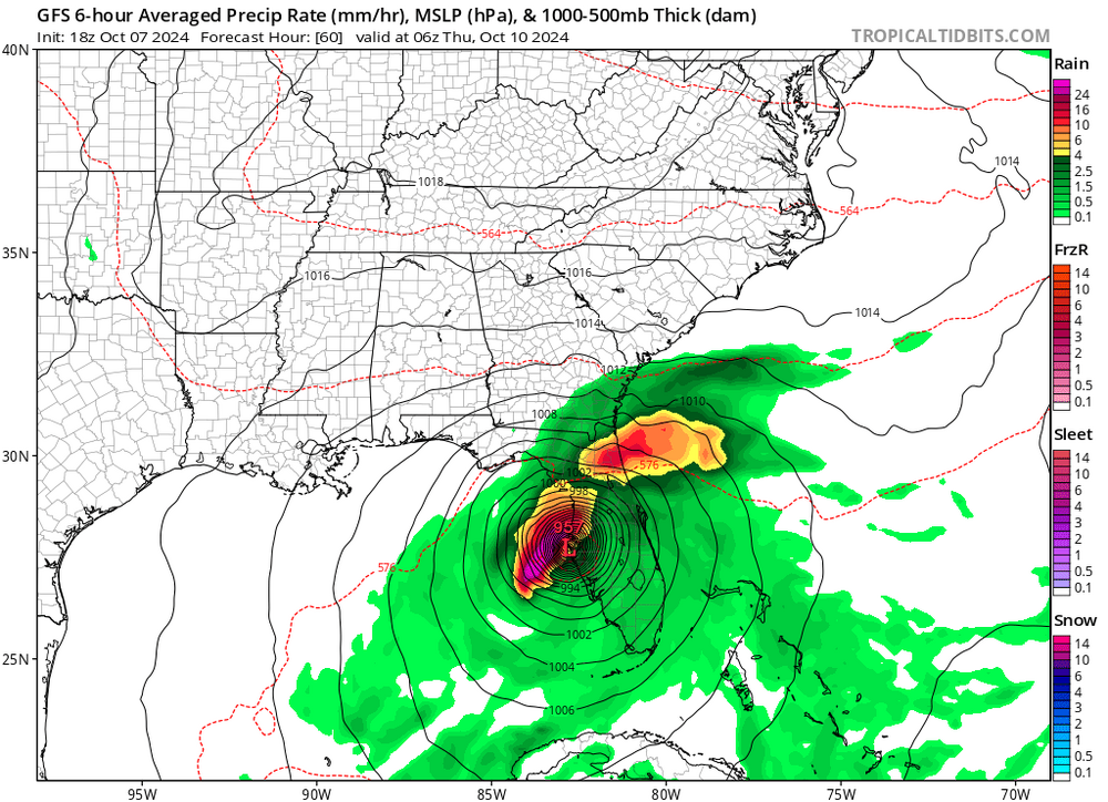
Yeah, we are going sub 900mb. This is a run for the money over the next few hours
-
I am in awe of what we are witnessing right now. This may be the storm that changes Tampa Bay. Up to 15 foot storm surge being forecasted now. Wow
-
Just stunning. I am just amazed this is moving west to east vs our typical east to west movement. The norms are being thrown out the window so often now, it seems.
-
Hurricane Milton has definitely started more ENE now
-
This could very well now be a Cat 3 landfall with cat 5 storm surge. And it's moving east to west... Wow - Speechless.
-
And it's not just the landfall location, but the NE heading to that landfall. The worst possible outcome
-
Location aside, how often do we see a straight up west to east moving Category 5 hurricane?
-
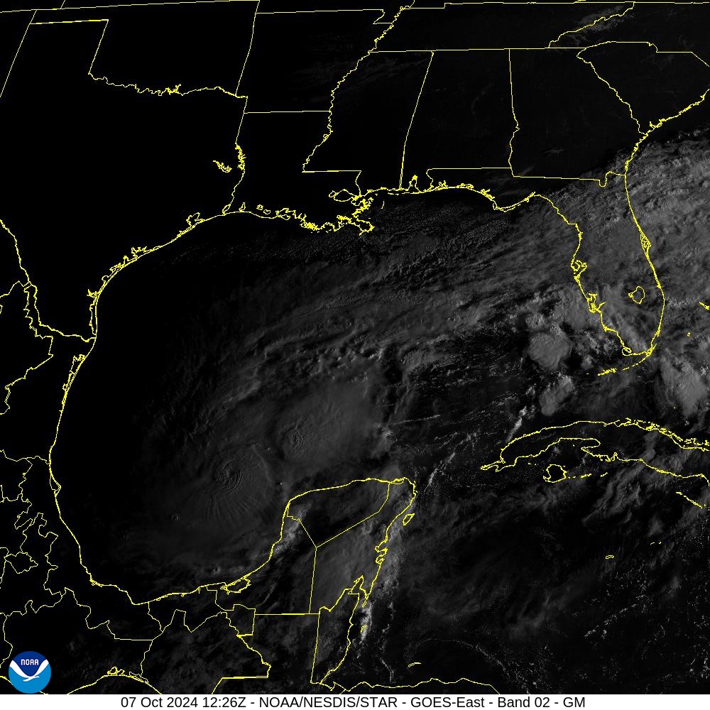
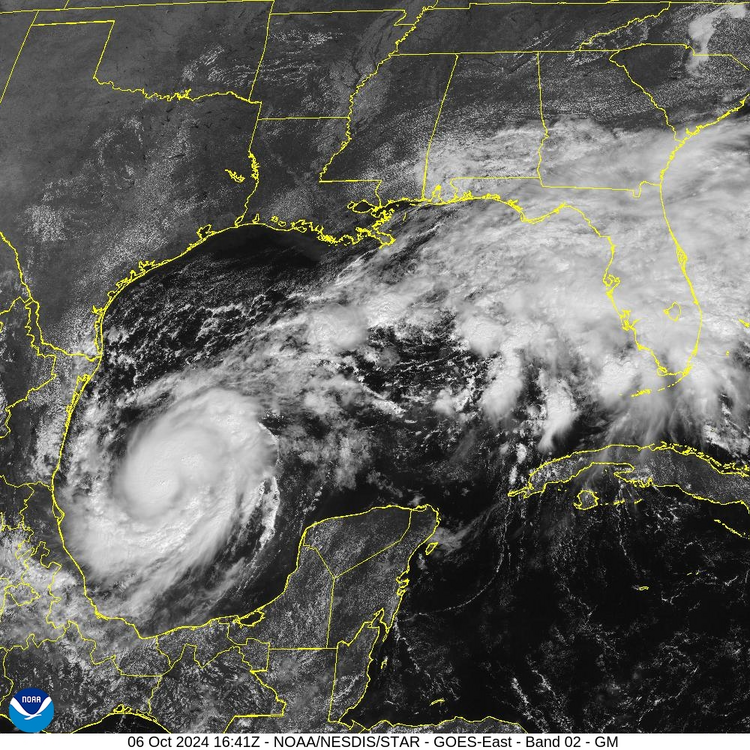
First morning visible is out
-
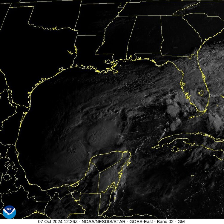
For the northern Yucatan coast, this is such a rare occurrence for intensity and direction. The new NHC track has the core scraping the coastline. Wow
-
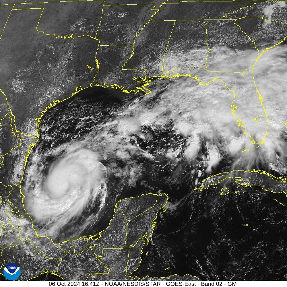
Wow, he is taking off now - Looking great and stacked on stacked
-
If Milton hits Cat 4+, the damage will already be done in regard to surge, even with any weakening upon landfall. This needs to be the primary focal point for public messaging.
-
But it goes down to 901 before that
-
He is starting to get the "look"
-
12z GFS is north of Tampa and a brutal track for storm surge
-
It's already at 991mb and this is showing 48 hours out...
-
I would assume that most people are just finding out that there is even a storm to look at. By tomorrow night, I suspect many more will begin go take notice.
-
I was thinking of Hurricane Charley and how that hurricane veered NE before reaching Tampa. Everyone was very worried for Tampa Bay but I have to imagine, the trajectory for Milton vs Charley is much worse, if Milton comes ashore at or just north of Tampa Bay.
-
Tampa has, for the most part, avoided the worst case scenario and worst impacts of storms for years. This one is looking ominous and the track is pretty unique too.
-
Late Feb/March Medium/Long Range Discussion
LeesburgWx replied to WinterWxLuvr's topic in Mid Atlantic
March 7th, grass is green, weeds growing, shorts weather outside, and I’m legit being pulled back in by a 384 GFS plot… -
Late Feb/March Medium/Long Range Discussion
LeesburgWx replied to WinterWxLuvr's topic in Mid Atlantic
Here we go, pulled back in again… Even a dog learns by repeti… -
Late Feb/March Medium/Long Range Discussion
LeesburgWx replied to WinterWxLuvr's topic in Mid Atlantic
Agreed. I am ready for spring. All they hype for perfect upper air setups which fell apart overnight, along with last nights disappointment, I am all but resigned for any winter weather now, unless a HECS shows up. -
The Weekend Rule? Saturday 2/17 - The Icon Storm
LeesburgWx replied to DDweatherman's topic in Mid Atlantic
Damn it. Just woke up and radar shows it’s over. Have like 2 inches -
The Weekend Rule? Saturday 2/17 - The Icon Storm
LeesburgWx replied to DDweatherman's topic in Mid Atlantic
If this fails, future posting of the HRRR should lead to automatic bans from the Board -
The Weekend Rule? Saturday 2/17 - The Icon Storm
LeesburgWx replied to DDweatherman's topic in Mid Atlantic
More beer in here than models right now. Not sure if that’s good or bad