

Sundog
-
Posts
10,535 -
Joined
Content Type
Profiles
Blogs
Forums
American Weather
Media Demo
Store
Gallery
Everything posted by Sundog
-
Weird that they would reference the HRRR when the model runs every hour and talking about what was close to the end of its run when this discussion was posted. The latest HRRR run is the fastest yet with the BDCF and has LGA in the low 50s by 7PM.
-
6z 3K NAM very strong with the cold push: VID-20250329-WA0000.mp4
-
In 2007 I went to Islip to buy a car from one of those big dealerships and when I left there it was in the mid 40s but when I got home to Queens it was in the mid 70s. Granted it's a bigger distance and a smaller temp gradient but it felt like a completely different time of year from when I left the dealership to when I got home.
-
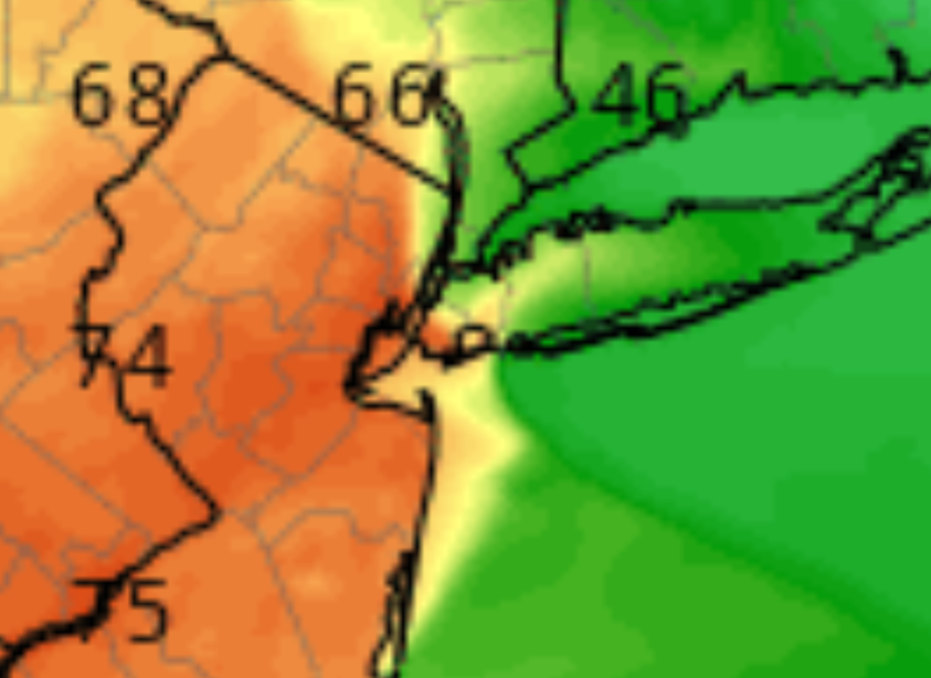
40 degree spread between Robert Moses State Park and southern Nassau County on the GEMLAM at 6PM, mid 80s to mid 40s. We're talking about a distance of 6 or 7 miles

-
60+ degrees spread in this area is very rare. Maybe in the West where they deal with downsloping winds it's more common.
-
12z GEMLAM has mid 80s all the way to central Suffolk
-
The Euro AI never bit on the warm Sunday night and always had a cooldown between 8 and 10PM, it looks like it had the right idea all along.
-
12z GFS has a much stronger BDCF push compared to 6z, it's now more in line with the other models.
-
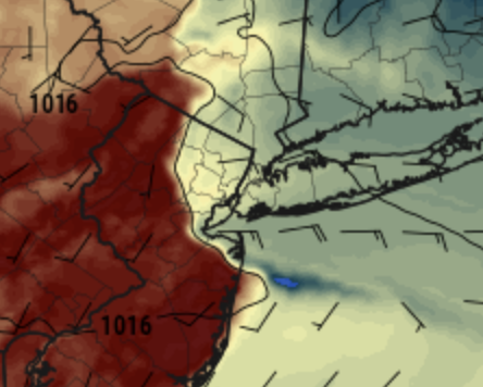
The NAM has a NE wind coming in with the backdoor cold front over Long Island Sound and so at 8PM it has temps in the mid 40s in northern Queens while it's still in the low 60s in southern Queens.
-
3K NAM has some spots going from near 80 to low 40s in under 3 hours
-
3K NAM tomorrow at 9PM: That's a hell of a gradient.
-
BDCF back on on the models GFS is slowest and therefore produces the warmest nighttime lows. Most other models have a good cool push around 8PM
-
You're going to torch in Huntington, at least for a few hours.
-
I only gave this a like because I like the graphics lol not because of the content of the image
-
I'm not looking forward to Saturday at all. Me second floor already gets toasty on a sunny day this time of year, provided that it's not 50s or cooler of course. Low to mid 80s is July temps, no thanks.
-
There is almost a 50 degree spread between the Mid Hudson Valley by the Mass border to southern New Hamphshire on Saturday on the ICON. From near 80 degrees to 30 degrees.
-
Saturday looks like a westerly wind, I can see widespread low 80s, maybe even a few 84s or 85s
-
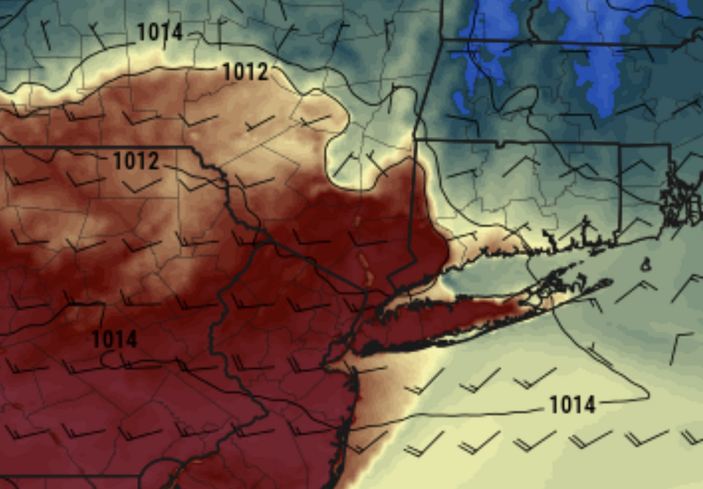
Look how the 1012 MB line follows the heat push on the 3K NAM on Saturday 18z:
-
BDCF looks weaker on models, it might be the warmest night since last fall coming up
-
It's not that, I still have like 25MB of space left, it's that individual file sizes cannot exceed 1.95MB.
-
18z RGEM has a strong BDCF but the gif is too big to post despite being only 15 hours of the run
-
Is there a way to increase the upload file size limit? 1.95MB is so low
-
Wtf Are you crazy?
-
I hate having to turn the air on.
-
I didn't say we have to have 30s and 40s and cloudy, I just want +10 departure, not +30 lol Normal high is only 53, and that's with the fake new normals. I just want 60 degres.


