fluoronium
-
Posts
219 -
Joined
-
Last visited
Content Type
Profiles
Blogs
Forums
American Weather
Media Demo
Store
Gallery
Everything posted by fluoronium
-
The 0z HRRR is an all time weenie run for my area. It has a supercell in a tornadic environment tracking over my house and then has accumulating snow falling 9 hours later. The dream!
-
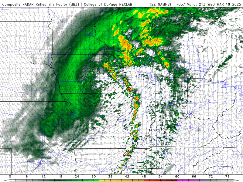
2025 Short Range Severe Weather Discussion
fluoronium replied to Chicago Storm's topic in Lakes/Ohio Valley
I'm definitely interested in the cold core potential Wednesday. Dew points look marginal but mid level temps are frigid leading to steep low level lapse rates. It seems like a good opportunity for low topped supercells at least and maybe even a tornado threat. It's local for me so there's a good chance I'll be out chasing if this doesn't down trend.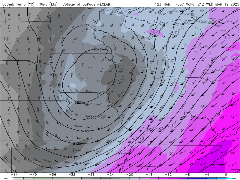
-
March 14-15 Severe Weather Outbreak
fluoronium replied to HillsdaleMIWeather's topic in Lakes/Ohio Valley
I think I'll head down to just east of STL and let the storms chase me up i70. It should be a fun time. The next couple days have a good shot at setting records for number of severe reports. -
March 14-15 Severe Weather Outbreak
fluoronium replied to HillsdaleMIWeather's topic in Lakes/Ohio Valley
It's too bad a low of this strength has such meager moisture to work with. It'll probably still manage to spam QLCS tornadoes though. I'll be chasing regardless because I am so storm deprived. -
The WAA hit was more impressive than I expected it to be here. It's not often I get solid snow rates with ripping SE winds. It's too bad it didn't last very long though.
-
These past 3 winters have been brutal for snow in the Peoria area. This winter sure takes the cake though. It's crazy how many times all models have agreed on a big dog a few days out or less, only to fall apart last second. The snow falling now is dense pixie dust. I'll be lucky to get over an inch where I live. The winter storm warning headlines add insult to injury lol
-
I shouldn't have stayed up for the 06Z HRRR
-
Not liking these drier trends, although I really shouldn't be surprised considering how this winter has gone here. If I get 3" out of this, it'll double what I've had all season.
-
That's about how it has been in my area as well. This has been the worst winter I've ever witnessed.
-
Fall/Winter '24 Banter and Complaints Go Here
fluoronium replied to IWXwx's topic in Lakes/Ohio Valley
Looks like I'm going to make it halfway through met winter without having a snowfall >1" IMBY. Extended appears grim as well. Nothing worse than cold and dry. -
No accumulation here, and a report of 3.5" 10 miles to my SE. Ouch.
-
It's hard to get anything done when there are new models to view lol. Today's runs have given some hope for us in the Peoria area, but man what a devastating cutoff on the north side.
-
Nail biter for me in the peoria area, especially if the northern cuttoff ends up as sharp as the euro is showing. NAM being in south camp has me worried as well as it has sniffed out local snow busts pretty well in recent years.
-
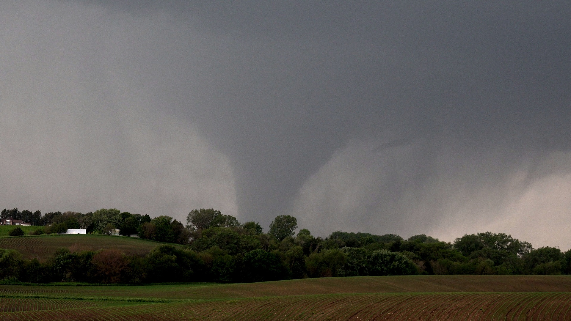
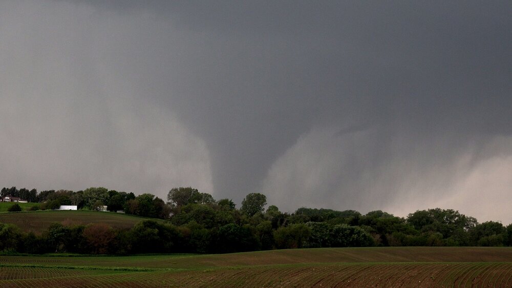
Not long after I pulled over to watch the Carbon tornado, I saw Greenfield form, and since I was in the path of that one, I had to bail south. I still managed to get some decent views of it as I took my escape route. Greenfield/Carbon was my third set of twin tornadoes in less than a month!
-
Incredibly early start to spring here. Flowers are blooming weeks ahead of normal and the grass greened up within the first week of the month. I'm actually thankful for the current cool spell that has set in as it should slow things down a bit. Fruit crops will take big losses in a seasonable April freeze if growth gets much further ahead.
-
2024 Short/Medium Range Severe Weather Discussion
fluoronium replied to Chicago Storm's topic in Lakes/Ohio Valley
Yeah it's the 84hr NAM, but GFS is onboard too. It's something to watch at least.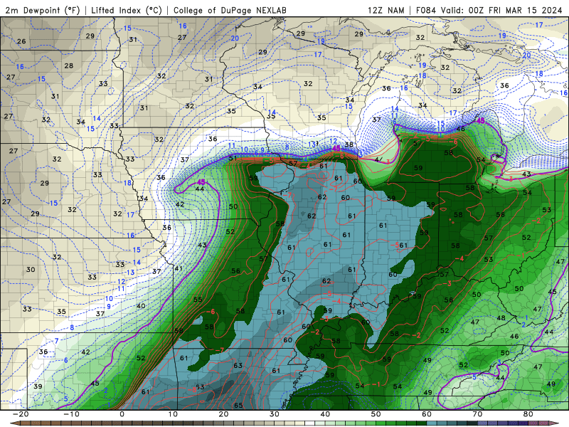
-
PIA set the all time February and winter record high AGAIN yesterday, with the temp plummeting 61F over the 14 hours. Insanity. I chased yesterday and busted on the dryline, but was able to get a distant view of one of the tornadoes in the suburbs.
-
Peoria, IL got to 77F today, smashing the all time high temperature for both February and met winter overall. Chase mode activated for tomorrow. As they say, you don't get that kind of warmth in winter without somebody paying for it!
-
Scored a nice surprise 3" of snow with the system that came through yesterday. Plus, I saw the IL tornado on the 8th, so I'm pretty happy with how this month has gone so far.
-
Can't forget January 3rd in IL and January 16th in IA just last year either. Models certainly have grabbed my interest for Thursday, although dews look pretty marginal. It's too bad about the gulf getting swept right before this.
-
It's been a pleasant stretch of wintry weather recently. Nothing crazy, but the glacier on the ground is nice, and it's been refreshed frequently with light snows or at least snow that gets blown around. It sure beats some recent winters.
-
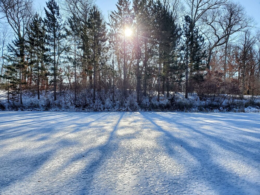
interesting scaly ice crystals forming on my pond in the cold snap
-
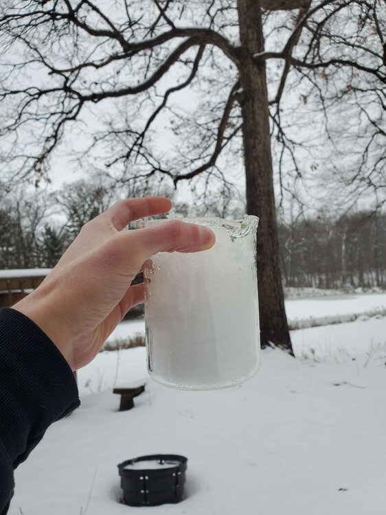
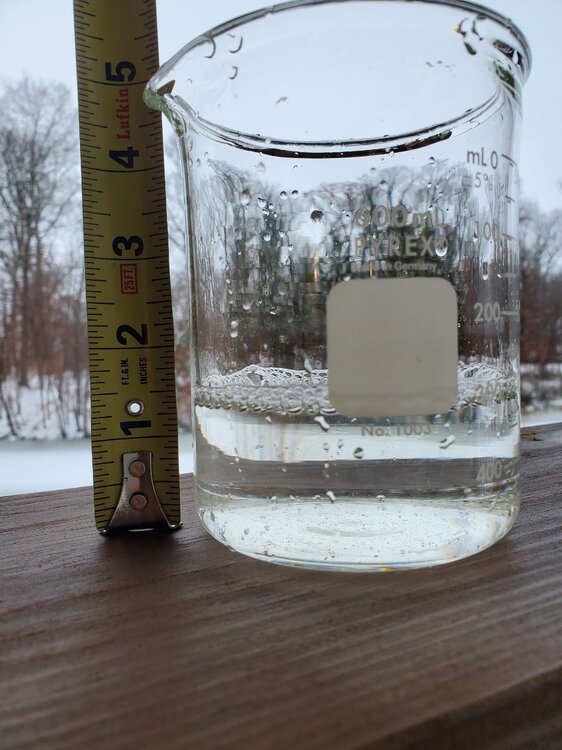
I just took a core of my 5" of snowpack. 1.4" liquid equivalent! Snow to liquid ratio of 3.6. This is some of the densest snow I've ever seen.
-
I got at least 3" out of the morning band. A pleasant surprise
-
HRRR is our only hope left lol