*IndyMeso*
-
Posts
332 -
Joined
-
Last visited
Content Type
Profiles
Blogs
Forums
American Weather
Media Demo
Store
Gallery
Everything posted by *IndyMeso*
-

4/2-4/3 Potential Major Severe WX Outbreak
*IndyMeso* replied to Geoboy645's topic in Lakes/Ohio Valley
Went right over me. Super intense and nerves are shot but so far hearing of no major damage. -
4/2-4/3 Potential Major Severe WX Outbreak
*IndyMeso* replied to Geoboy645's topic in Lakes/Ohio Valley
The motion on that Lake City tornado is insane. Brandon Copic has a beautiful view -
4/2-4/3 Potential Major Severe WX Outbreak
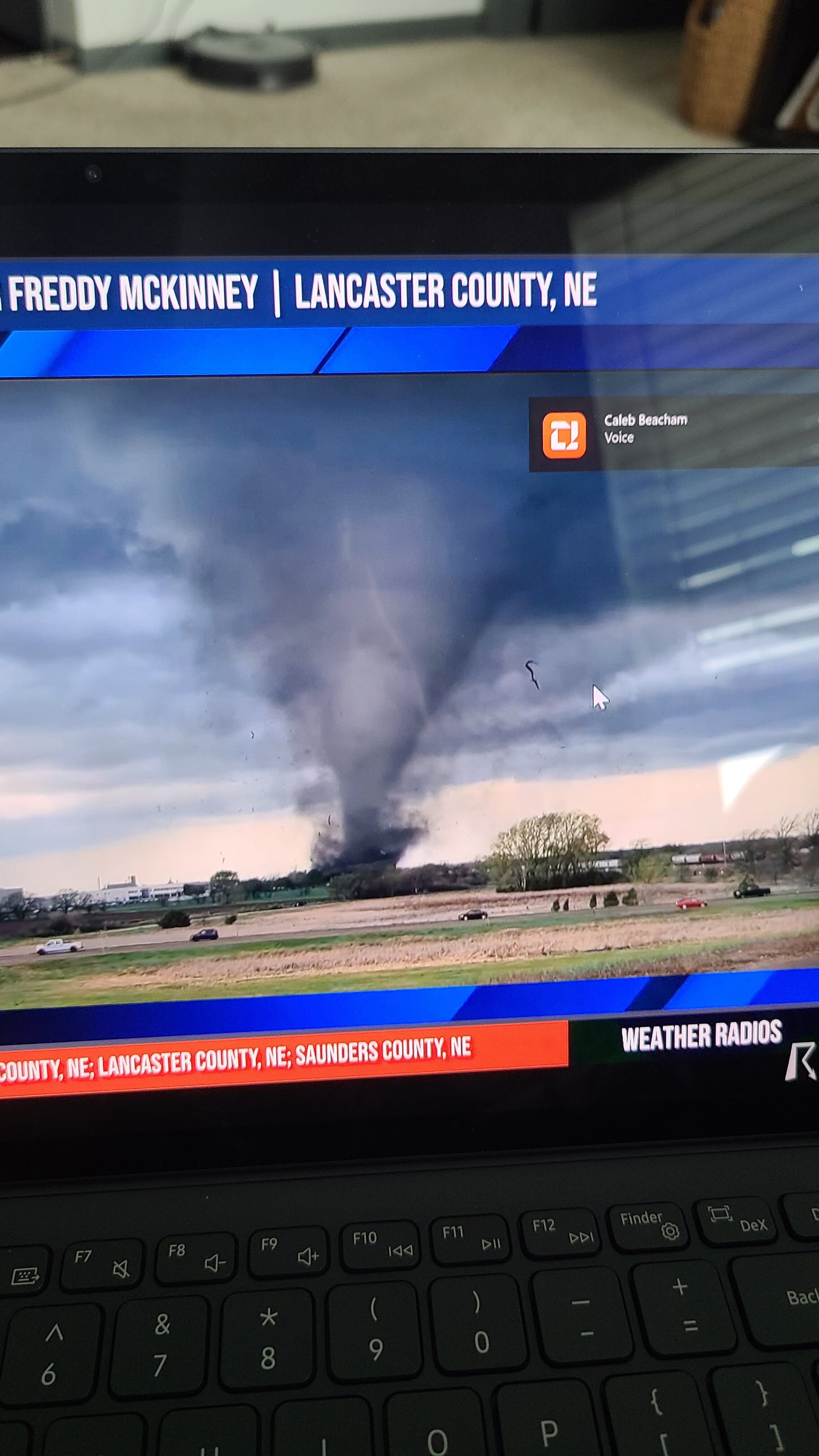
*IndyMeso* replied to Geoboy645's topic in Lakes/Ohio Valley
Nothing really on the other Regional boards so I will say it here but holy s**t Arkansas. Radar images for the books -
Well deserved Tornado Emergency on that one. That debris ball is massive.
-
March 14-15 Severe Weather Outbreak
*IndyMeso* replied to HillsdaleMIWeather's topic in Lakes/Ohio Valley
That hook near Arnold... -
Please stop. Your posts aren't helpful and on a day like today your trolling isn't needed. The SPC has already mentioned several times that a delay in initiation doesn't mean bust. Please read forecasts before commenting.
-
Severe Weather 4-25 through 4-28-24
*IndyMeso* replied to cheese007's topic in Central/Western States
Screen shot. What a stunner.
-
4/1-4/2 severe threat (southern portion of subforum)
*IndyMeso* replied to largetornado's topic in Lakes/Ohio Valley
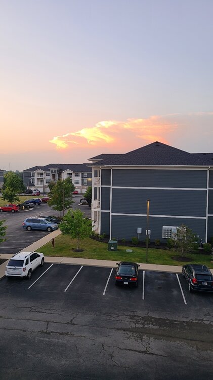
Definitely clearing out now. My weather station just jumped two degrees in 30 minutes. -
My view of the storms in Northern Indiana.
-
This will do it.
-
Saw the wall cloud in northern Hamilton County from my porch but crapped out pretty quickly. What sucks even more is I'm between two storms so I'm not even getting any rain. Painful.
-
Sounds like a huge wedge heading towards the east side of Lockett.
-
There are so many chasers on this thing. Many of which are way too close.
-
Yeah just heard he lost his back window. Not surprised as that developed rapidly next to him. Large tornado now
-
Vince Waelti is literally in front of the tornado near Crowell. Update: he was in it for a bit.
-
Damn Seminole managed to escape a tornado Monday. Gut wrenching for sure. That mesocyclone is rotating like crazy.
-
This was posted earlier when Fort Worth asked for verification. https://twitter.com/pgbrown92/status/1514026414940561418?t=K-0vJR9mOMjgIRteVBi0rw&s=19
-
This guy is lucky to be alive. I can't believe he just stood there filming this as the roof was ripped off. https://twitter.com/myahcowart/status/1511477729266479104?t=TkHXGQXCMtDPGSOL3ITXrQ&s=19
-
Sleet central in Noblesville. Certainly for a longer time period than I thought. Snow line is close though
-
Not sure if this was posted yet but this is a really great graphic of the evolution of the long supercell.
-
Kentucky Governor now expecting upwards of 70 - 100 deaths according to his press conference just now. Absolutely horrific
-
Looks like this guy is trying to get into Mayfield. May take awhile though.
-
Jesus... I hope people could take shelter underground if possible. Just an unreal debris ball.
-
Yesterday I noted several commercial airlines flowing relatively "low" past my house before heading west. It actually shocked me as they never come this far north to start their flight after taking off IND. I suspect they had to travel a significant distance to get out of the smoke. Crazy to think about really.
-
Looks like Bloomington, IN is dealing with extreme rainfall amounts. Seeing some reports of nearly 2" in 20 minutes. Water rescues ongoing now.