AU74
-
Posts
170 -
Joined
-
Last visited
Content Type
Profiles
Blogs
Forums
American Weather
Media Demo
Store
Gallery
Everything posted by AU74
-
I'll be watching the 4 Nations Face-Off final on TV. It's at TD Garden in Boston at 8 pm, just about when the storm is expected to hit that area.
-
3" in Cloverly, MD.
-
31 and light freezing rain in Colesville, MD. Ice on the deck, haven't gone outside to check anything else.
-
About a half inch of sleet followed by maybe a half inch of snow so far here in Colesville/Cloverly, MD. Looks like the back edge is just about here.
-
Short Pump has all the fun: A magnitude 2.8 earthquake rattled the Short Pump area northwest of Richmond on Tuesday evening, with people as far away as Fairfax County reporting they felt it, too, according to the U.S. Geological Survey. The quake occurred at 5:28 p.m. in Henrico County’s Wyndham/Short Pump area. https://wtop.com/virginia/2025/01/small-earthquake-rattles-richmond-area-felt-as-far-north-as-fairfax-county/
-
Same here in Colesville.
-
Guess I should go look out the window!
-
Ellicott City under a flash flood warning.
-
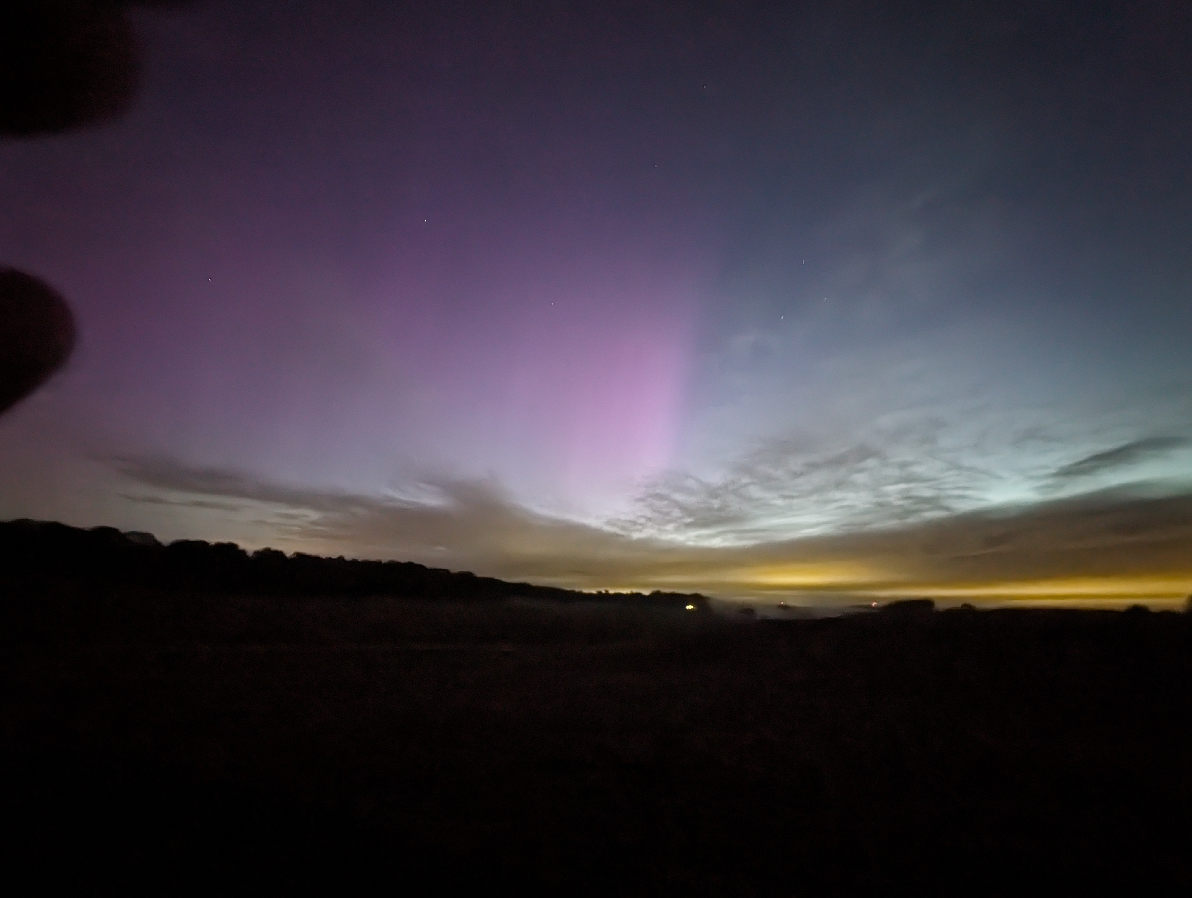
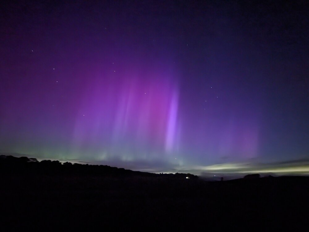
I'm up on Skyline Drive and all we saw was a faint bit of purple in photos. We are back at our hotel now warming up and may go back out if it ramps up again.
-
98% clouds here. Going back to sleep.
-
Sure. If it fails, I'll owe you a refund on all the money you paid me.
-
Here in Colesville right now, the rain is ending, the sun is shining and there's blue sky in sight to the west.
-
I saw the they are predicting midday tomorrow UTC, which is 7am tomorrow morning. So 3 am - 5 am might be a good time to look.
-
Is there a good site to see modeled future cloud cover so we can head to the areas likely to clear later tonight.
-
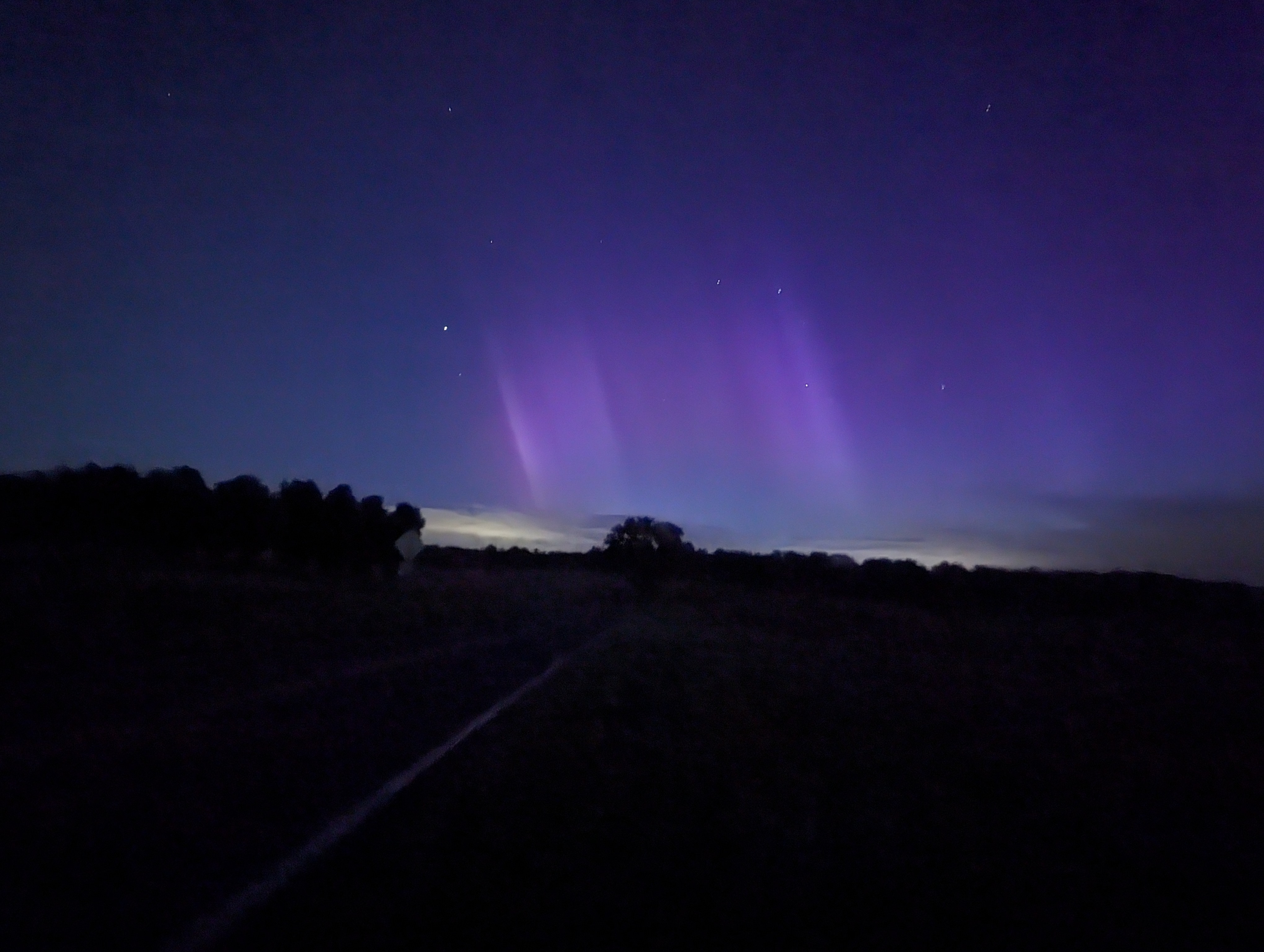
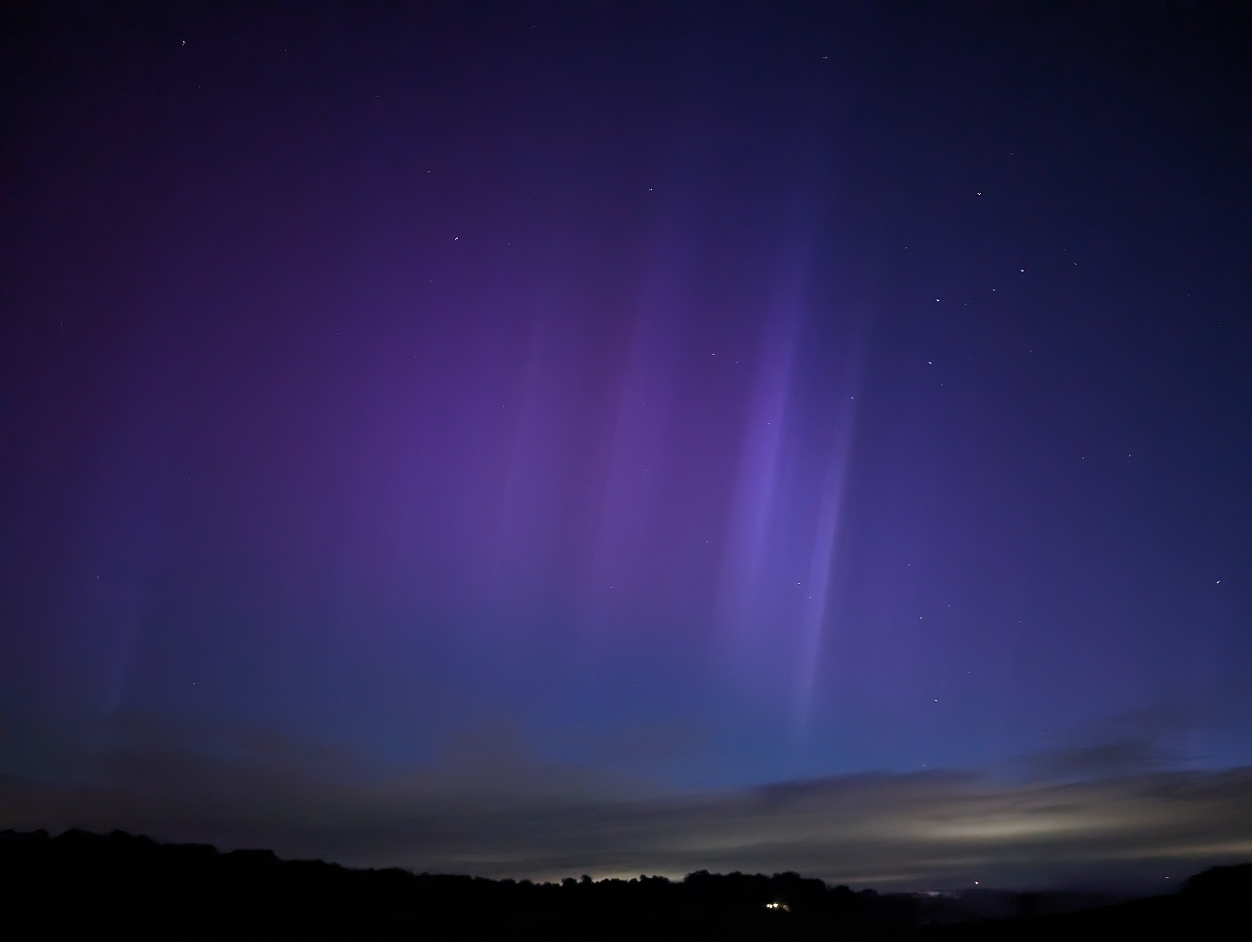
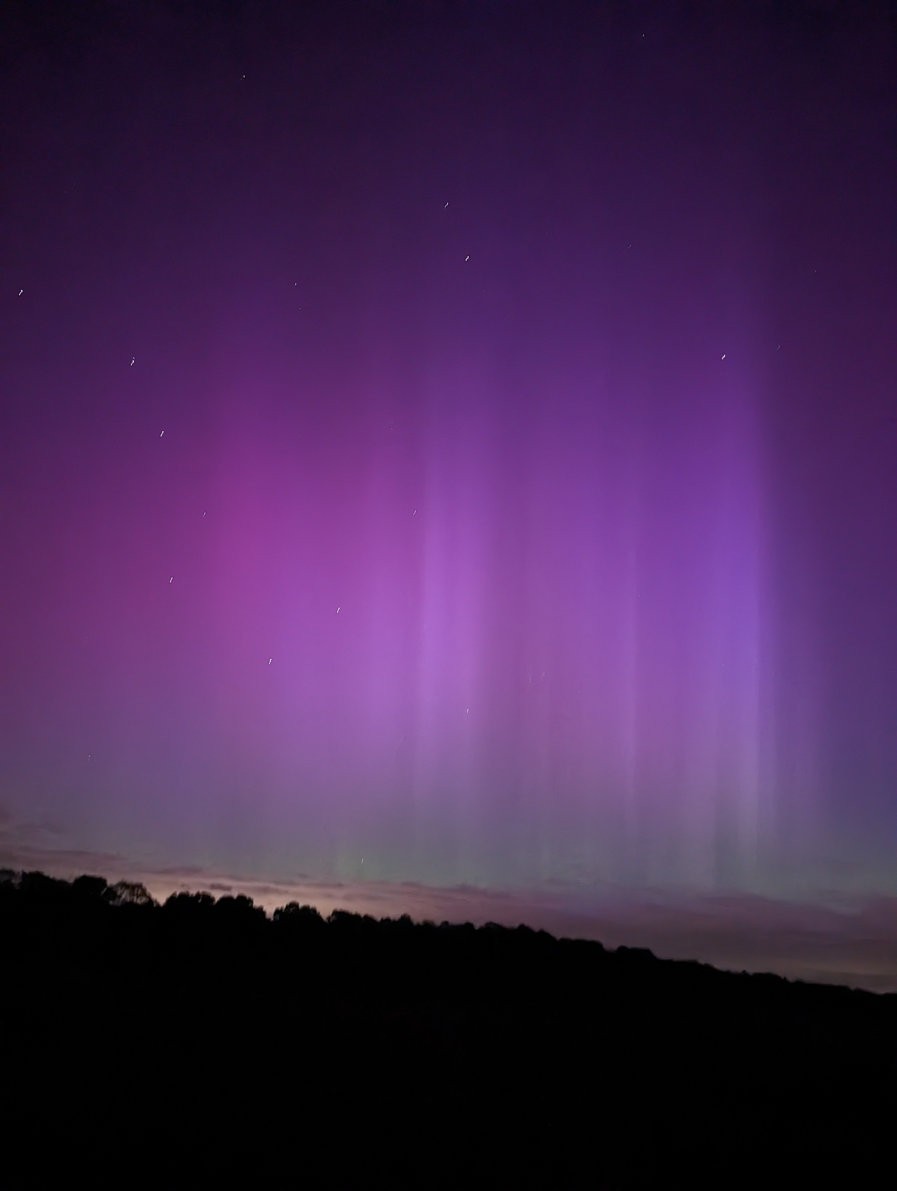
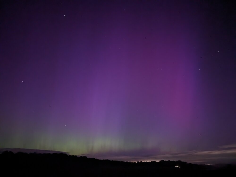
More photos from Howard County 4:15-5:00 am
-
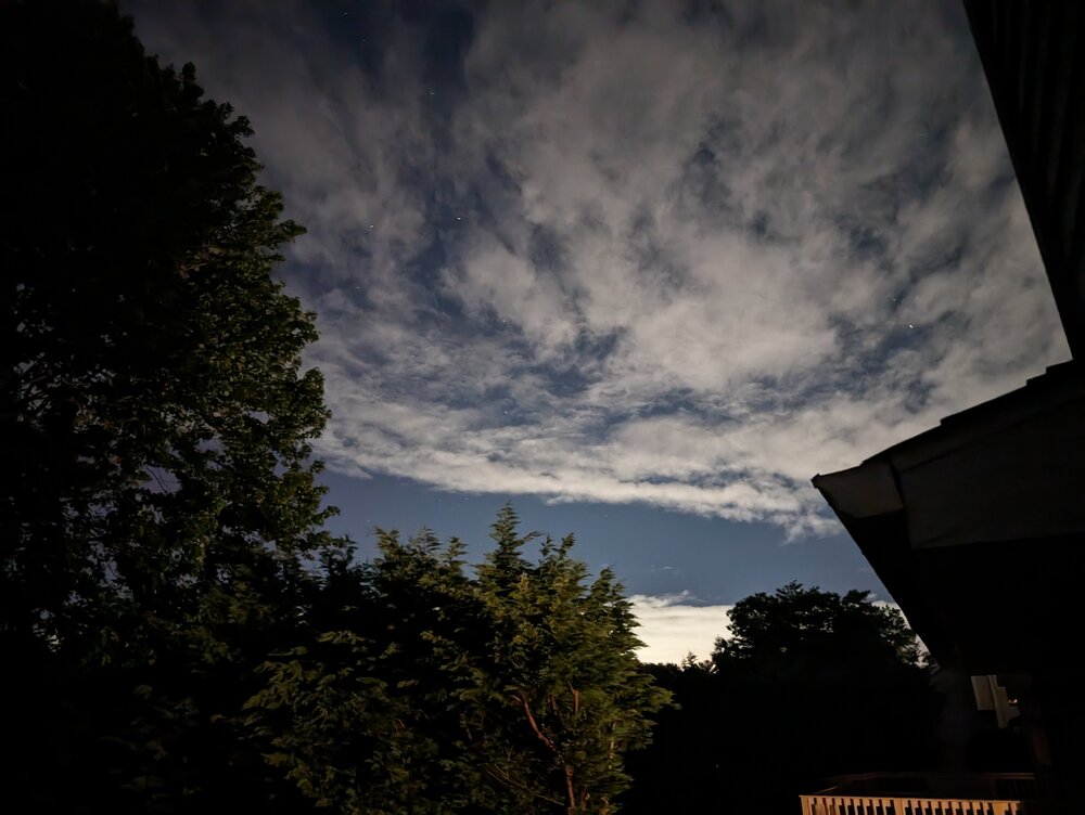
This is from my driveway in northern Silver Spring, looking back towards my backyard at 3:40 am. I didn't notice the pillars in the photo, but it did look purplish, which I thought might just be my phone camera being weird, but it was enough to hop in the car and head for my favorite dark spot in Howard County.
-
From Howard County, Jennings Chapel Road just now!
-
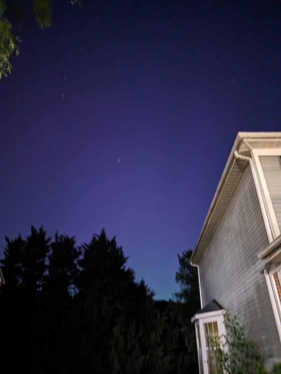
Cloud cover is breaking up nicely in northern Silver Spring now. May need to take a drive in search of a better view of the horizon.
-
From the Washington Post: Forecast group predicts busiest hurricane season on record with 33 storms University of Pennsylvania climate scientist Michael Mann cites record ocean warmth as key factor in unprecedented Atlantic forecast A research team led by University of Pennsylvania climate scientist Michael Mann is predicting the upcoming Atlantic hurricane season will produce the most named storms on record, fueled by exceptionally warm ocean waters and an expected shift from El Niño to La Niña. The new forecast, issued Wednesday, calls for a range of 27 to 39 named storms, with a best guess of 33. The most on record was 30 named storms in 2020. Gift link: https://wapo.st/3JBWmIZ
-
April 8th Eclipse- Last Easy One To See In My Lifetime
AU74 replied to Interstate's topic in Mid Atlantic
I'm in Canton, TX and the NWS forecast discussion has injected some hope for seeing totality (~1:41-1:45 CDT): Eclipse Details: Despite being just ~12 hours from eclipse time, the cloud picture is really no more/less clear than it has been for the pasts everal days. One can find a model solution even in the very near term that supports any sky cover forecast desired, ranging from completely clear to overcast. However, the following currently seems to be the most likely scenario based on close scrutiny of model cloud cover and their typical performance/biases. An intrusion of low stratus will spread northward into Central Texas by mid-morning, perhaps accompanied by patchy fog. Conditions will likely be at their worst between roughly 9 AM and noon, and the picture may look rather bleak for many during this time period as the low deck impinges on the DFW Metroplex and points to the north and northeast. However, most guidance is becoming increasingly bullish on fairly rapid scattering of this low cloud layer between 11 AM and 2 PM, and this would allow for decent viewing for many areas. That being said, some unlucky spots likely will remain socked in with low cloud cover, particularly across Central Texas, where any very low stratus and/or fog mixesi nto a broken or overcast layer by early afternoon. Guidance is slightly more optimistic in North Texas, with much guidance depicting scattering and even localized dissipation of the low deck prior to eclipse time. While some last vestiges of low stratus may be present, at least some partial viewability does seem likely for many areas of North Texas based on this trend. Also by early afternoon, a plume of cirrus ahead of the previously discussed upper trough will be spreading in from the west, and these clouds are already present across far West Texas as of 1 AM. However, most guidance indicates that the main swath of the most dense cirrus will remain displaced mainly north of the CWA, with perhaps thinner and more scant cirrus across North Texas. As long as this cirrus does remain on the thinner side, many eclipse features would still be viewable through the veil. The low cloud evolution will be the main factor to watch over the next 12 hours, as a slower erosion of the low deck could still result in substantially worse viewing conditions due to its opaque nature. -Stalley