Joshb32689
-
Posts
29 -
Joined
-
Last visited
Content Type
Profiles
Blogs
Forums
American Weather
Media Demo
Store
Gallery
Everything posted by Joshb32689
-
E PA/NJ/DE Spring 2025 Obs/Discussion
Joshb32689 replied to PhiEaglesfan712's topic in Philadelphia Region
Good morning 2 hours early to all. Holy lightning in the Coatesville area -
Moments likes this remind me that non-weather people really don’t like the word sleet. My husband has stopped calling it hail… he’s now just calling it ice.
-
Sounds like a decent mix between freezing rain and sleet, primarily freezing rain at the moment? Between Coatesville and Glenmoore. Very slippery
-
Hate to be in Poconal for this one. Have to imagine this puts them back to zero for the season.
-
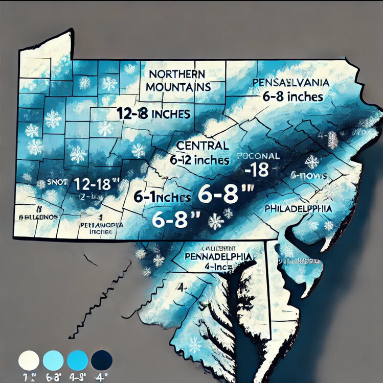
I sent ChatGPT these 2 images… I asked it to make me a forecast snow accumulation map. Here’s what we’re looking at on the ChatGPT model. This is also my official forecast.
-
Are we approaching the skull phase of the storm?
-
Pre-Christmas (Dec 21-23rd) Winter Storm
Joshb32689 replied to Chicago Storm's topic in Lakes/Ohio Valley
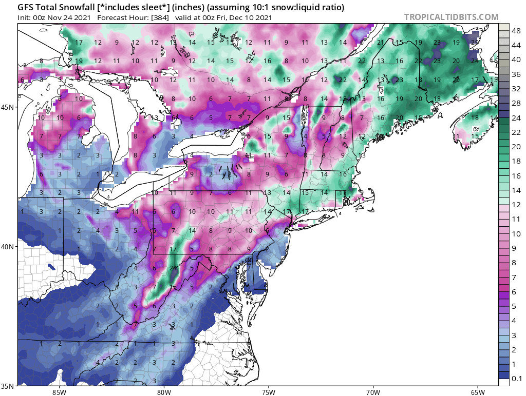
East Cost snob here, long time Philly lurker, traveling to ORD morning of 22nd and staying in Evanston visiting family through the 27th. Was feeling disappointed we would be missing out on the snowstorm on the east coast as previously modeled but feeling encouraged now that things are looking juicy out here for when we’ll be in town. Not too familiar with Chicagoland weather patterns and snowstorm evolution. First and foremost, curious if we should consider moving our flights to the evening of the 21st to avoid potential travel impacts or if we’d be safe chancing a 10am arrival on the 22nd. Also curious to know what thoughts are on this system as depicted by the recent model runs with those Kuchera maps spitting out 1-2 feet. Are we getting close to any reality yet and is this a typical setup for a classic storm out this way? Everything on the east coast is a thread the needle event and 99 times out of 100, we forget the needle altogether. How tempered should my expectations be at this point or can I start getting excited? Thanks! -Philly Weenie -
January 28th/29th Event Obs - From KU to FU?
Joshb32689 replied to JTA66's topic in Philadelphia Region
Holy hell. -
January 28-29, 2022 Miller abcdefu Storm Threat
Joshb32689 replied to WxUSAF's topic in Mid Atlantic
That sliver west of DC runs the gamut…. It’s just perpetually starting to snow for 15 hours. -
Is…is it…self aware?
-
If you looked at the radar right now, and then listened to the after-snow sounds out there …in Drexel Hill/Havertown, you would think you could lookout and see a couple inches of snow on the ground. Nothin but a long time ago evaporated trace.
-
Implications of any sort?
-
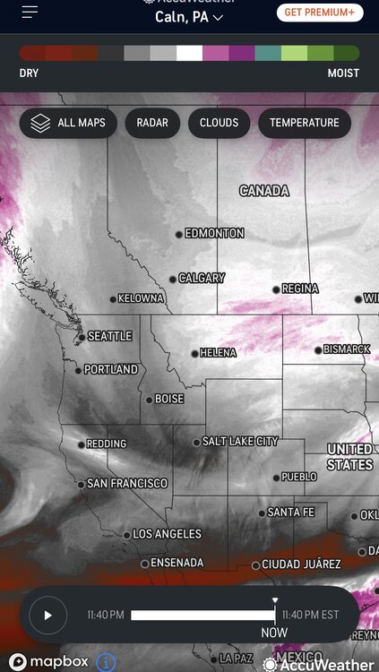
Okay, many models pointing to a decent+ event, yet not even a WWA. Is a little chaos on the horizon? Is NWS all-in on the NAM/ICON solution?
-
November 28th, shortly after midnight
-
Where have I seen this before? #delcosnowholestrikesagain Are we just living the new normal for the foreseeable future?

-
Originally was thinking how can this turn into another Delco screw job. But just looking up at the skies, and all the different directions the cloud cover is coming from. On top of the fact that tornadoes and flooding are happening elsewhere, I’m content if things don’t materialize down here in Drexel Hill. And obviously there is way too much yet to unfold to deem us safe from anything destructive. hope everyone comes out on the other side of this safe and sound. god speed everyone.
-
Just had a beautiful rainbow over here in Havertown. Wish I could attach the picture, says it’s too big. Posted on the Phillywx obs. thread. bring on the rain!
-
Crawling at 10 MPH
-
Another tornado on the ground near KOP
-
West Chester must have just been/is being smacked right now? No one has anything to report?
-
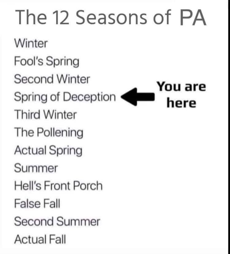
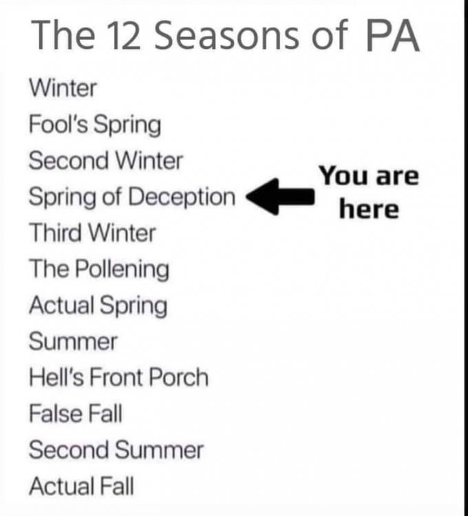
Apologies if this has been posted already, but found this floating around on the socials... feels pretty accurate. Haven’t been following long range recently, is 3rd winter coming?
-
50/50 snow sleet mix here in Havertown continues. Eyeballing, 2” snow/crust. Congrats to everyone on the surprise high totals as we again fail here in Delco. ETA: Back to all sleet.
-
Surprisingly not surprised. Heavier returns on radar are starting to translate, but no different to what fell earlier this morning. Maybe my coating here in Havertown will double and we’ll approach an inch when all is said and done.
-
Intermittent medium flakes mixed in with the small ones here in Havertown, Delaware County, not enough to accumulate beyond a fighting coating. Low end potential was always a concern with this surface setup, was hoping to beat it with rates, but hopes are quickly being dashed.