-
Posts
43,737 -
Joined
-
Last visited
Content Type
Profiles
Blogs
Forums
American Weather
Media Demo
Store
Gallery
Everything posted by Ian
-
Did a pattern update post today with some thoughts from Wes and Judah Cohen plus Jason making my text make sense. https://wapo.st/3W2EU4j
-
yeah dca area bullseye is gonna happen in a marginal pattern with a marginal storm
-
well - figured I should say something more than it needs to be cold to snow lol. I dunno. I think it showing up early and strong is probably a sign it will try to 1) linger and/or 2) return. but not sure it's quite the be all it might be in some nino winters etc. we've had a recent tendency for -nao and east coast ridging in last few winters. not saying that's going to be the case long term here but the shifts in the nearer term on that front might be worth considering. a lot of it imo is Dec is tough now.. warming is a pain.
-
Keep it simple right? Feels like it's hard to get that ideal modeled pattern in a Nina around here. Still looks okay at some distance but verbatim it's mostly warm until mid-Dec on Euro ensembles for instance. Not great. We don't do cold December anymore.
-
part of it is we don't have much prolonged cold. unfortunately it needs to be cold to snow.
-
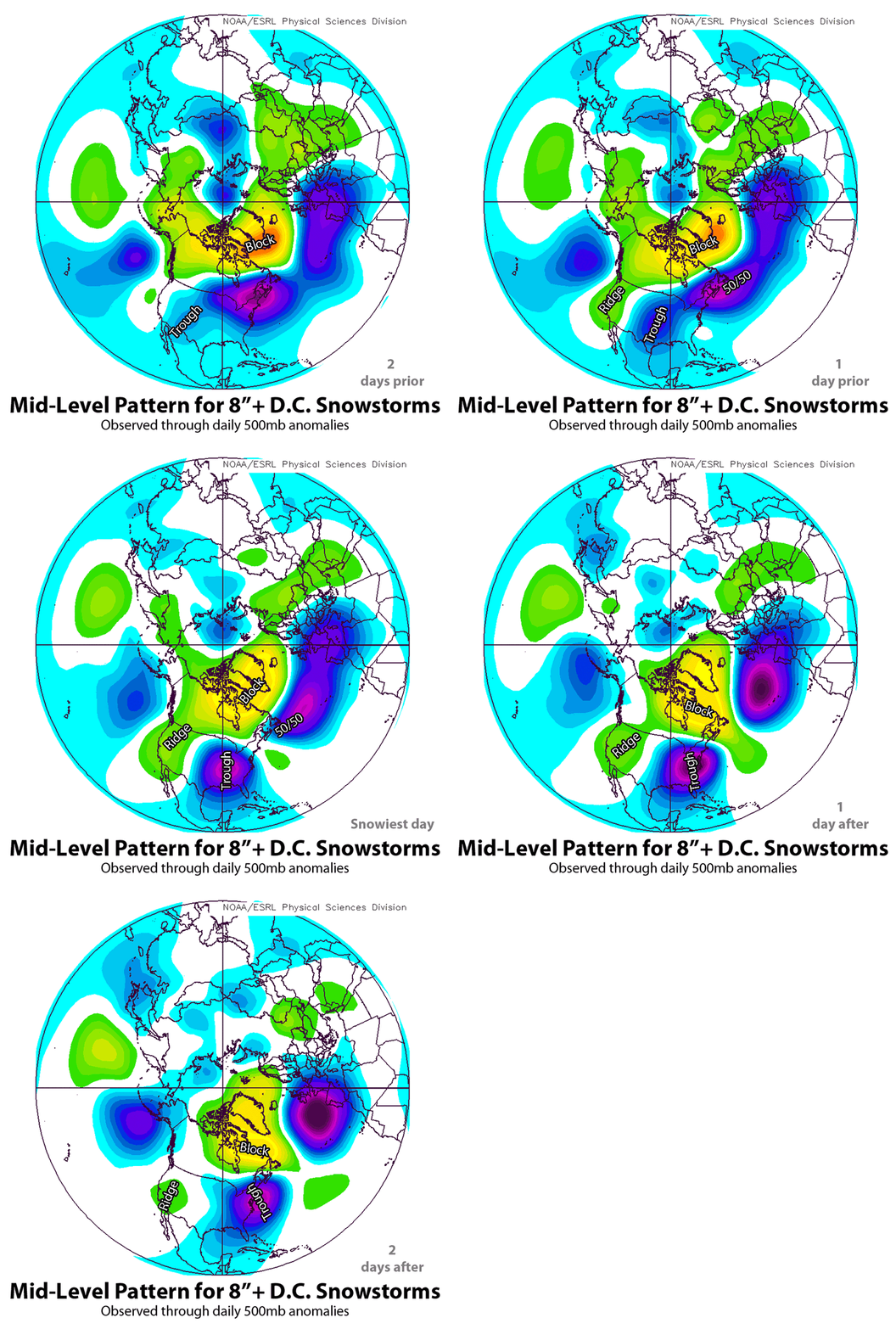
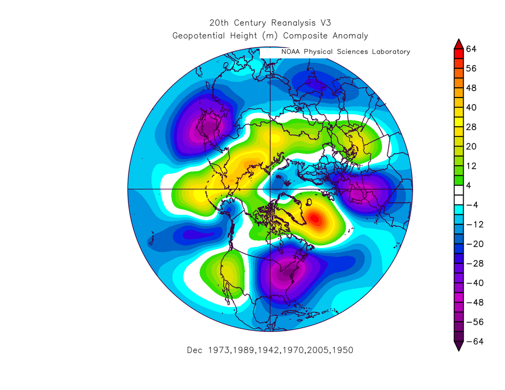
I dunno if this is behind paywall or not but we did a look at the classic look for a DC snowstorm before Jan 2016. That block location and movement is v sexy. The key characteristics of Washington’s biggest snowstorms - The Washington Post
-
when dt woofs no worries where the 50-50 is. yes
-
-
Calling for a KU 15+ days out to be the first... good ole Twitter.
-
rainstorm in the Trump era must be somethin'
-
Thanks! Think I'm quitting Twitter so maybe I'll remember to come here lol. Prob more a game of details like how/if suppression, how long it lasts etc. Background state shouldn't support it for a long time but they do roll once you get strong -NAO/-AO. Boxing Day has been #1 for a while so prepare for DC flurries. This is a great pattern advertised tho. I mean can't ask for a ton more at this range except maybe for a Nino instead of a nina.
-
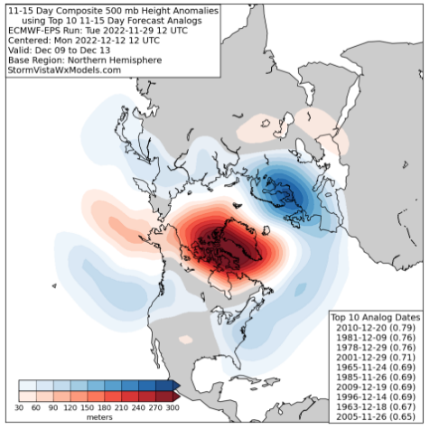
plus the mechanisms that kick it off are already getting underway in the Scandi/Kara Sea region. would be a pretty ugly bust on ensembles for -NAO not to materialize. more about details etc. from earlier today with some quotes from Wes: https://wapo.st/3io8anP
-
I hear it's gonna be a yuge winter
-
nam is pretty good esp in the short range. the fact that it and the euro have generally turned the backside into very little is a flag for sure. not sure I'm too worried about tomorrow tho... see what the gfs says I suppose.
-
I am here for the panic
-
Prepare the Jebwalk
-
-
Just came to check lol. Dulles screws me a bit.
-
BWI: Nov 15 IAD: Nov 15 DCA: Dec. 15 RIC Nov 15 TB: 87
-
I'd guess upscale growth will be relatively rapid but it has some decent ingredients. As usual -- esp around here -- need to see how the morning plays out. Today actually looks relatively interesting so far. Maybe mapgirl will catch a tube.
-
I think social science has led to the ref on numbers. They have been in many of their graphics for a while. We tend to always mention numbers ourselves ... a level one of five, etc. Figures I'm in Cape Cod. Enjoy the wedges.
-
tropical season is the worst
-
Hit squarely with two solid cells today in NW DC. Gotta be an inch from both... ground can't really hold anything more it's becoming a lake. Solid shelfie too.


