purduewx80
-
Posts
1,705 -
Joined
Content Type
Profiles
Blogs
Forums
American Weather
Media Demo
Store
Gallery
Everything posted by purduewx80
-
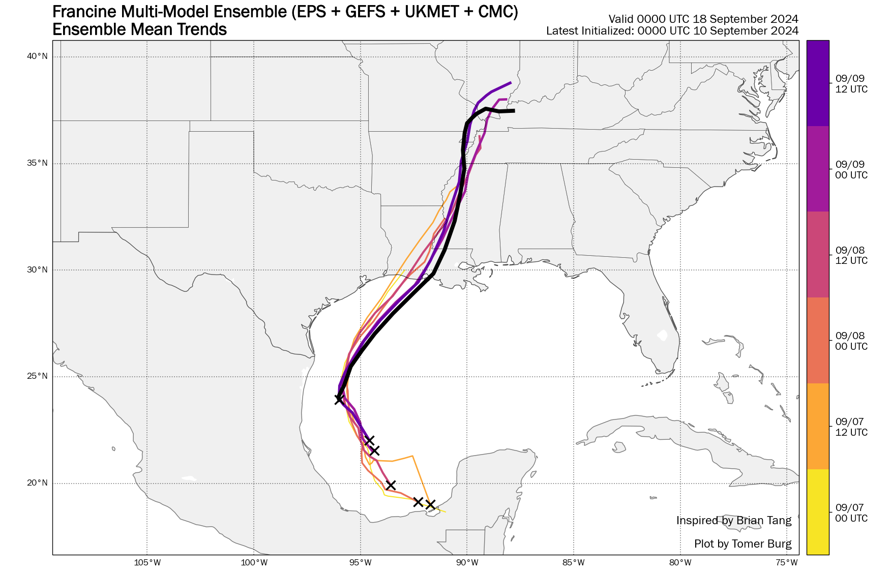
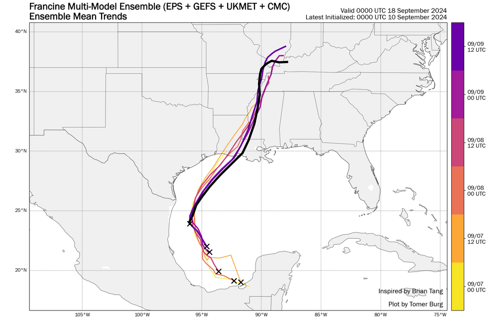
Models have continually shown the best window for intensification tonight, that still looks legit as that mid-level circulation in the northern Gulf dissipates and convergence refocuses over the water/Francine during the overnight hours. The eastward trends some of you noted are also quite obvious (below), and I think New Orleans should be added to the hurricane warnings on the next update. The shear map you posted applies to this morning, not tomorrow's shear near landfall. Yes, it will increase as Francine approaches land tomorrow, but there is really good diffluence and jet dynamics involved, which may negate some of the modeled shear. Peak intensity at cat 2 seems reasonable, but I'm not sold on trends right before landfall, which will be impactful in terms of how much wind makes it to the surface. The more eastern solutions would have a track more aligned with the shear, and a bit more time over warm water could help it maintain intensity. The biggest inhibitor now to intensification in my opinion is dry air. Anyway, like we saw with Beryl, an intensifying storm at landfall will be much more efficient at bringing down the strong winds aloft, while a weakening one would underperform on winds but still produce a substantial surge.
-
You claimed NHC has landfall as a cat 1 on the 10CT advisory, yet the discussion was posted just before yours explicitly stating landfall would likely be 85KT in between forecast points, which is a Cat 2. You can't look at an inland forecast point and claim that's the landfall intensity.
-
Truly perplexed as to what y’all weenies were expecting. The globals have consistently shown modest strengthening until late tomorrow when it starts to accelerate to the northeast. There is no reason to expect RI tonight.
-
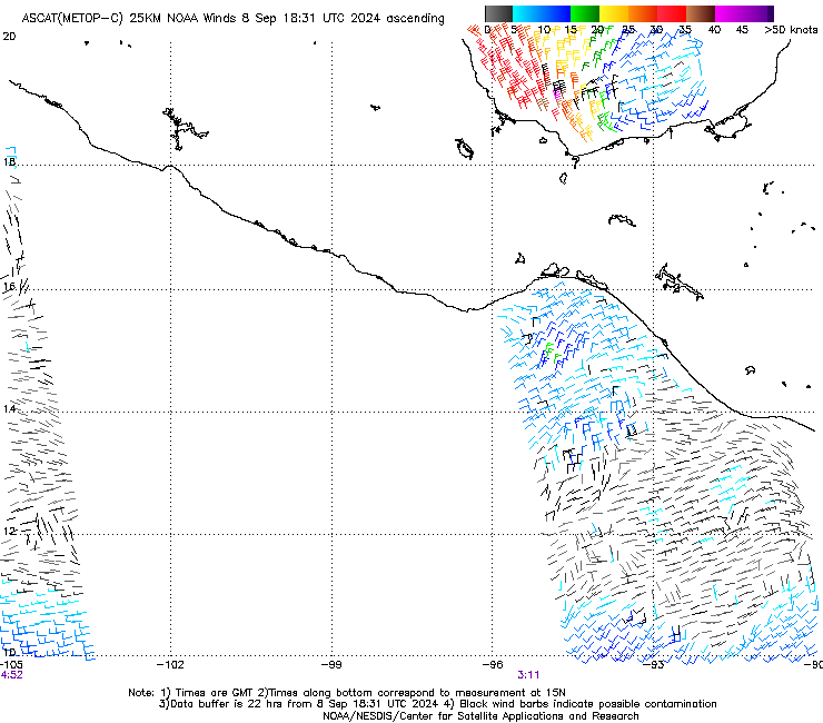
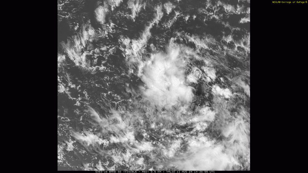
I think most of 90L has already rotated into the southeast Gulf and is evident just northwest of the Yucatán on GOES vis and ASCAT. If you look at some of the 850 vort progs, this had been shown for several days.
-
Advisories on PTC6 will start up at 5E/4C.
-
GOES and ASCAT (below) both suggest 90L's remnant is tighter. Hopefully recon is able to sample both circulations.

-
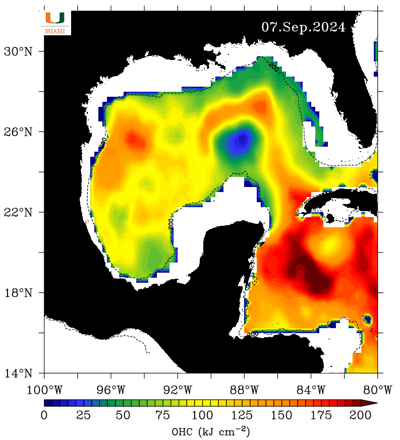
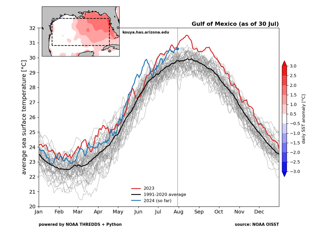
Despite SSTs cooling in the Gulf recently, ocean heat content is at record highs. 91L may be able to take advantage of that loop current eddy in the western Gulf if it gets its act together in time.

-
18Z GFS and ICON ensembles both show an uptick in members with hurricanes, especially with a farther offshore track. There are good jet exit region dynamics for ventilation but with increasing shear prior to landfall, and dry air still looks to be an issue into early next week. It will be an interesting system to watch meteorologically due to the likely merger of the frontal-origin and AEW-origin surface waves. HAFS and other hurricane models are probably not to be trusted until this process is sorted out.
-
2024 Atlantic Hurricane Season
purduewx80 replied to Stormchaserchuck1's topic in Tropical Headquarters
90L is an interesting one and could fujiwhara or even merge with the western Caribbean wave. Icon and its ensembles have been showing this for several days. Whatever evolves in the western Gulf may struggle due to the competing waves initially, an east Pac storm, intrusions of dry air aloft from the east and at lower levels from the northwest, with substantial shear likely an issue as it drifts north next week. Looks like the ensembles are showing less support for a hurricane than a few days ago, but there’s still a lot to iron out.
-
2024 Atlantic Hurricane Season
purduewx80 replied to Stormchaserchuck1's topic in Tropical Headquarters
Probably seeing the last major burst of that now. There is good model support for the deserts moistening up, thanks to the MJO and other shenanigans.
-
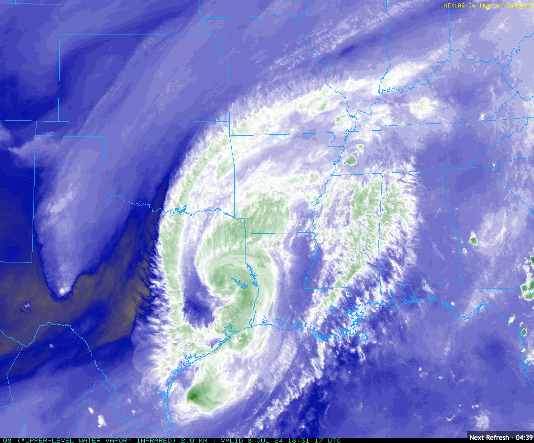
There's a GOES-East floater on it, and as Boston Bulldog said, we don't yet have a defined surface low. You're not going to get one until we get persistent convection to help mix out the dry SAL air encompassing western and northern parts of the broader circulation. NHC would be wise to go with PTC advisories by this evening given impacts begin in <48 hours.
-
Getting Fiona vibes from this one. Hope it develops more quickly and misses the islands to the north.
-
It's probably going to be hard for Debby to get rid of this dry air once it moves back offshore, but the 18Z icon shows how it might be doable. Will depend partially on how long and how far offshore it sits over the Gulf Stream.

-
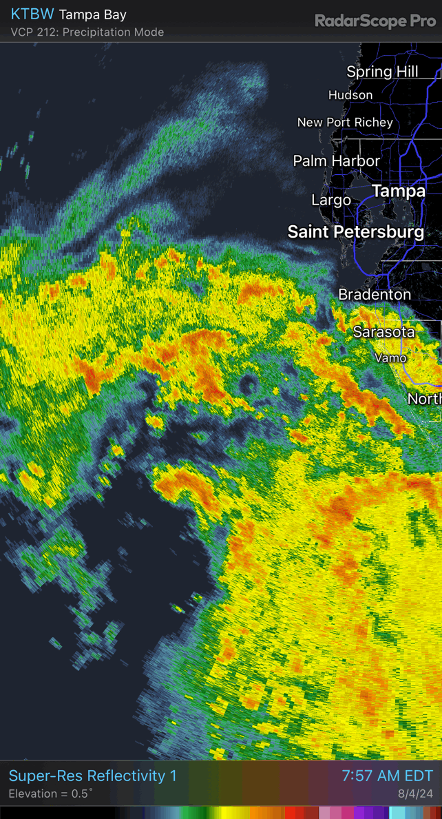
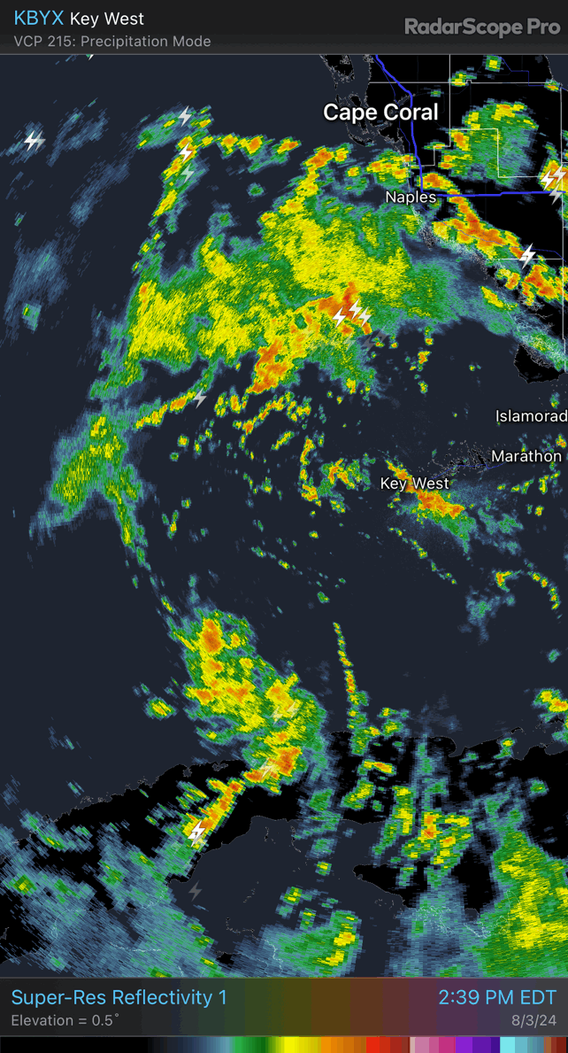
You can see the implied impacts of downsloping off Cuba’s mountains, with dry air being maintained into northern parts of the circulation. Once that convection on the southern end builds around, we should see it intensify at a pretty good clip. 18Z SHIPS upped the prob of 25KT/24hours to 33% and 65 KT prior to landfall at 25%.

-
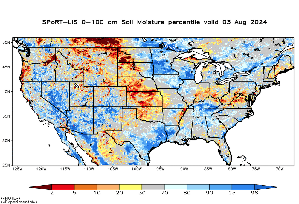
Truly a nightmare scenario for coastal areas from Savannah to Wilmington because of the long duration onshore flow, saturated soils (below), training convection ahead of and with the outer bands and potential surge. Hope people aren't downplaying concurrent sea/freshwater flood risks in these areas that have seen some of the greatest rises in sea level due to CC and sinking land.
-
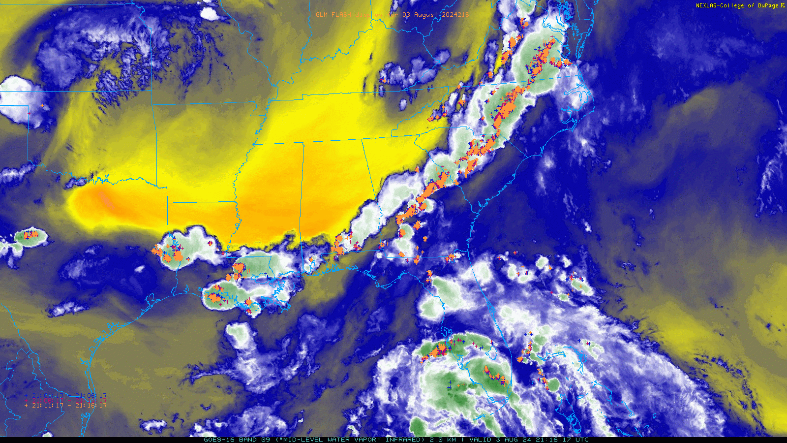
Another consequence of the record warm SSTs on the east side of the Gulf could just as easily be the potential for catastrophic flooding in the vicinity, should this wave get trapped under the ridge. The Gulf on average is just behind last year. There’s plenty of uncertainty here until we get a persistent consolidation of convection, and I wonder if we see that occur just along the north coast of Hispaniola and/or Cuba given the frictional convergence that would be favored there.
-
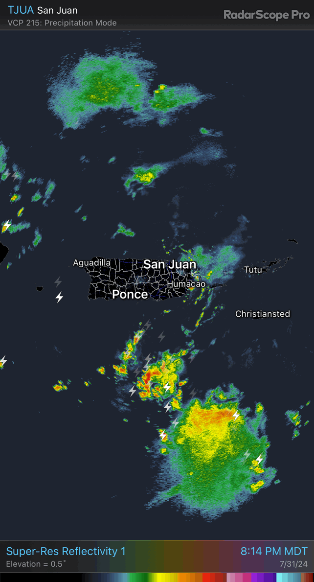
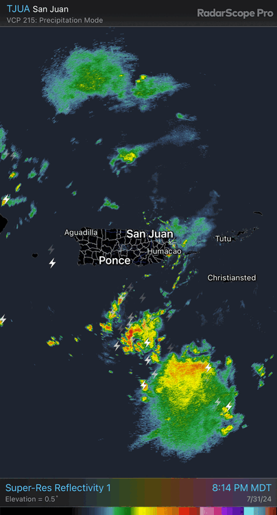
Pretty clear circulation well south of PR this evening, but there are other vort maxes near and north of the island too.
-
2024 Atlantic Hurricane Season
purduewx80 replied to Stormchaserchuck1's topic in Tropical Headquarters
You’d have to look at the upper pattern it expects to be dominant, but the precip pattern implies recurving storms that are FL/East Coast hits, or storms get trapped under ridges and head west into Mexico. It isn’t unreasonable to think something like that might occur, but one storm could easily soak any of those areas, too. The latest CFSv2 monthlies are also showing inland areas from the Gulf being drier than normal. -
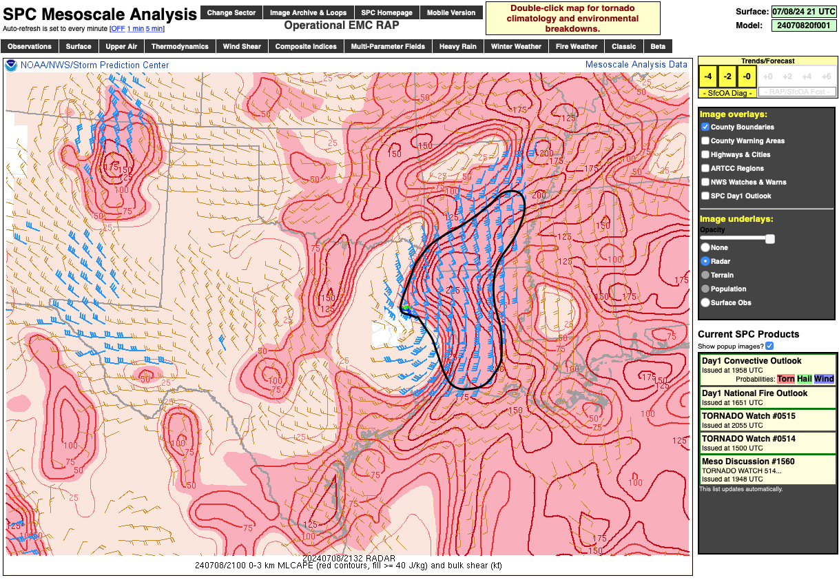
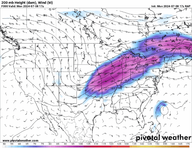
The 250 mb layer affects the background synoptic conditions, but inland tropical convection is usually relatively shallow. The cloud-free air just east of the strongest winds and flow off the abnormally warm Gulf both are aiding in anomalous low-level instability that is overlapping strong low-level shear (denoted by my approx. drawing in black). 0-3km shear vectors are the depicted wind barbs, while 0-3km instability is contoured.

-
Suspect the developing outflow channel and RRQ dynamics with this intensifying jet streak is at play in the maintenance of the low-level wind field.

-
The RI near landfall depicted in the 18z hi-res hurricane models is concerning and is hopefully not the start of a trend. They don’t necessarily show better organization until tomorrow sometime, so I’m real curious to see what recon finds this evening.
-

-
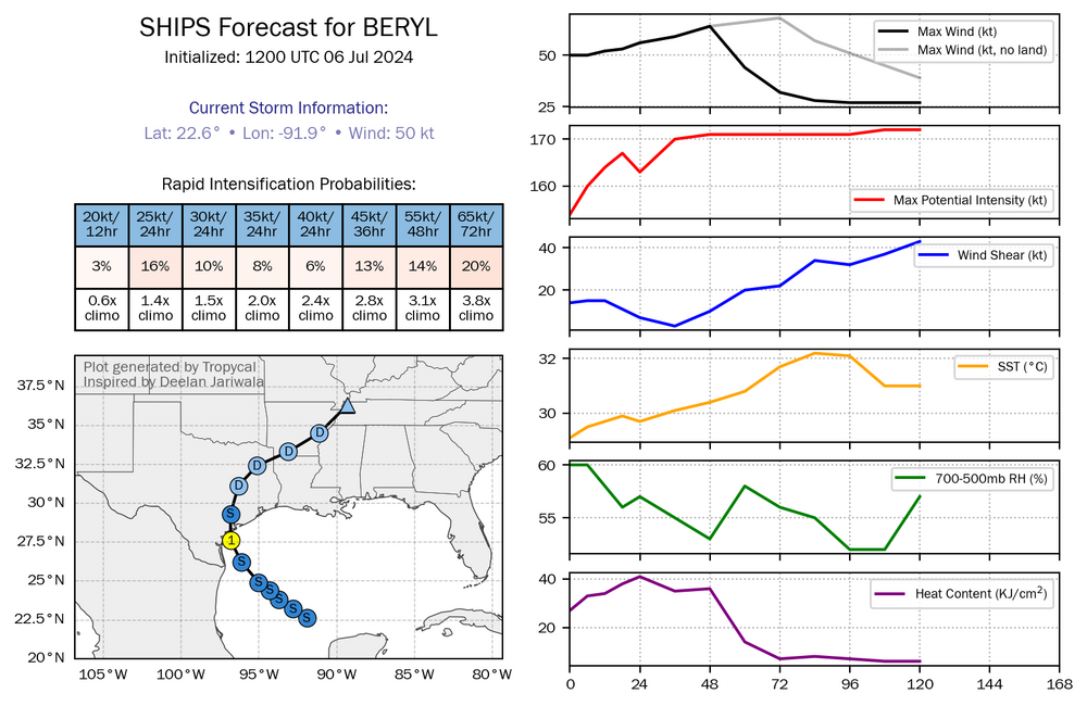
12Z SHIPS guidance shows that dry air will be the main inhibitor to intensification, though it does indicate a rapid increase in 700-500mb RH just prior to landfall. It's notable that the probs for RI have been increasing, as well.
-
2024 Atlantic Hurricane Season
purduewx80 replied to Stormchaserchuck1's topic in Tropical Headquarters
Been thinking about this a lot, mostly in terms of whether it leads to subsidence and stability issues in the MDR.