purduewx80
-
Posts
1,705 -
Joined
Content Type
Profiles
Blogs
Forums
American Weather
Media Demo
Store
Gallery
Everything posted by purduewx80
-
Yeah, HAFS-B is wild. Historic Cat 5 microcane followed by an ERC, all before it even gets to the loop current.
-
-
One long-term impact the government has also been preparing for is the complexities Helene adds to fighting wildfires in the Appalachians. There will likely be a lot of debris burning in the coming weeks/months, and if these areas don't get any rain through leaf drop, things will dry out enough to cause some problems this fall. Lack of wildland firefighter access to many areas with washed out roads/trails may also require heavy aviation assets.
-
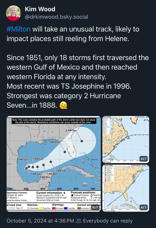
Way too early to make claims like this. The consensus track is south of Tampa Bay for now and would ease the concern of another major surge.
-
Everyone chipping in to help is amazing, but don't get it twisted. The federal government has a massive and still growing response that began a week before Helene made landfall.
-
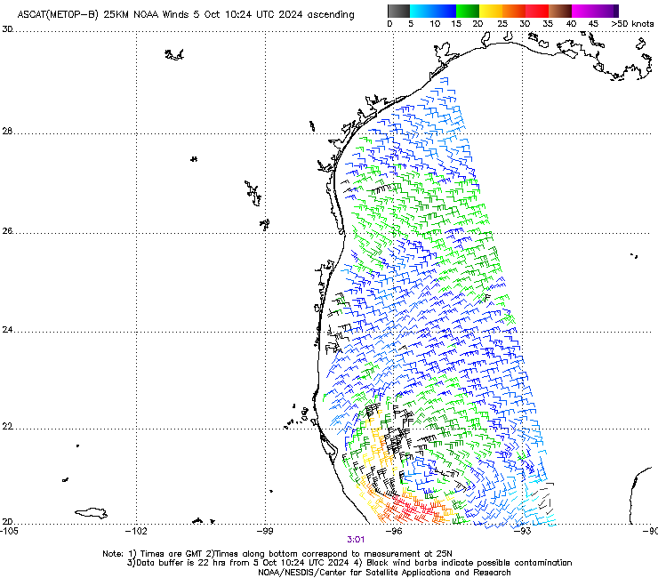
Looks good enough to initiate advisories at 1100ET to me.
-
A hurricane traveling across the entire Gulf and then making landfall at nearly a right angle is relatively rare for the peninsula. This would definitely enhance the surge south of wherever it comes inland, even if it weakens near the coast. The Atlantic side surge would also be significant and could be co-located with some of the heaviest rain.
-
Still looks somewhat elongated, but I would think advisories start up today. It seems like the earlier intensification helps fight off some of the shear and sends 92L farther north. Most of the strongest members are on the north side of the ensemble suite. The outflow channel modeled on the 00/06Z GFS is a thing of beauty.
-
2024 Atlantic Hurricane Season
purduewx80 replied to Stormchaserchuck1's topic in Tropical Headquarters
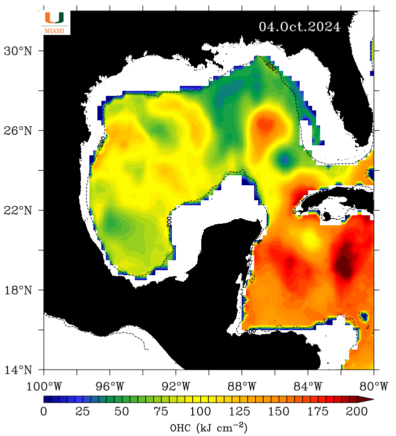
Hopefully less hot shelf waters behind Helene counteract whatever happens over the loop current.
-
2024 Atlantic Hurricane Season
purduewx80 replied to Stormchaserchuck1's topic in Tropical Headquarters
10/50 Gulf and 0/20 AEW.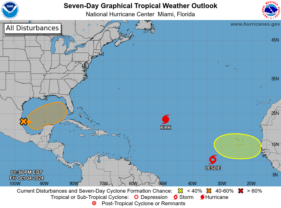
-
2024 Atlantic Hurricane Season
purduewx80 replied to Stormchaserchuck1's topic in Tropical Headquarters
There have been some ensembles showing solutions down into the 950s like that most of the week. Sort of a decrease in them yesterday and uptick on the 12Z EPS/GEFS today. Favorable entrance region dynamics are certainly there a lot of next week to support either some semblance of a PRE and/or a strengthening tropical cyclone. The Gulf is still warm as hell, too.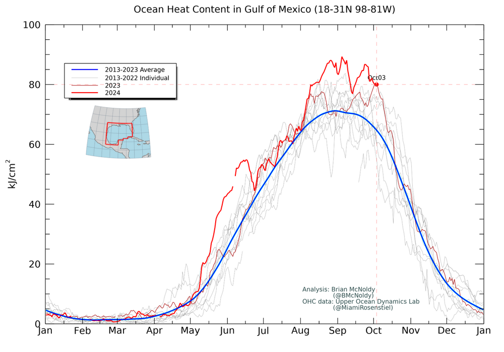
-
2024 Atlantic Hurricane Season
purduewx80 replied to Stormchaserchuck1's topic in Tropical Headquarters
Agreed, this is not what you want to see with the signal in the ensembles next week. A lot of the water hasn't made it to South FL yet.
-
2024 Atlantic Hurricane Season
purduewx80 replied to Stormchaserchuck1's topic in Tropical Headquarters
TD12 is gonna be a big ACE maker. The one behind 12 is farther south, which could allow it to track closer to the Caribbean islands. We’ll see.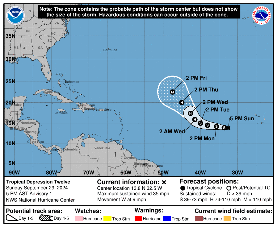
-
2024 Atlantic Hurricane Season
purduewx80 replied to Stormchaserchuck1's topic in Tropical Headquarters
The predecessor rain event showing up in the 12Z GFS does show up on some other guidance, but with different placement, timing and intensity. It could be a classic setup for it with the blocked pattern, reinforced front and lower confidence potential in upper jet support. -
2024 Atlantic Hurricane Season
purduewx80 replied to Stormchaserchuck1's topic in Tropical Headquarters
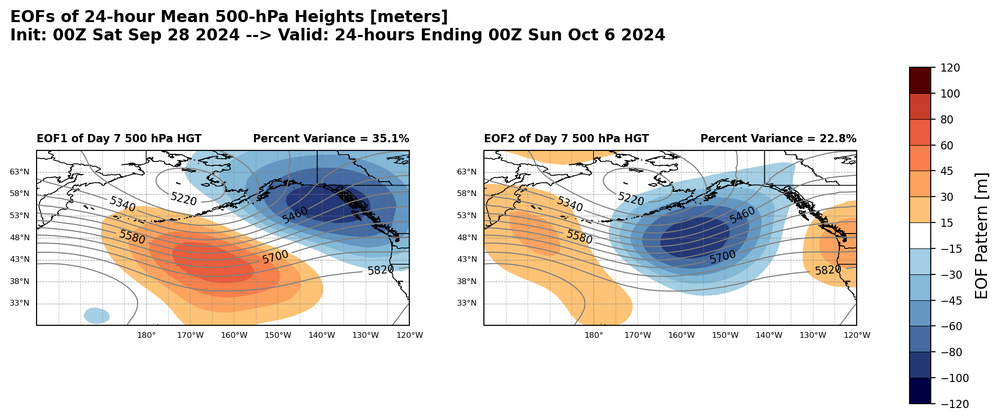
Too many competing areas of convergence (CAG, tail end of a front and the central Caribbean wave), so not only do we have questions about where cyclogenesis occurs, but the pattern over North America is totally out of phase between many of the ensemble clusters. One area of important consistency is the -NAO/Greenland Block, which of course impacted the pattern leading up the Helene. That would place the onus on the more uncertain Pacific. Saturday below, with the first image showing the four clusters, their anomaly from the ensemble mean and the multi-model ensemble; the second showing where the uncertainty is with ridging in the Pacific: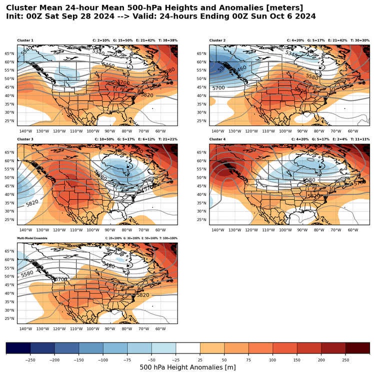
-
-
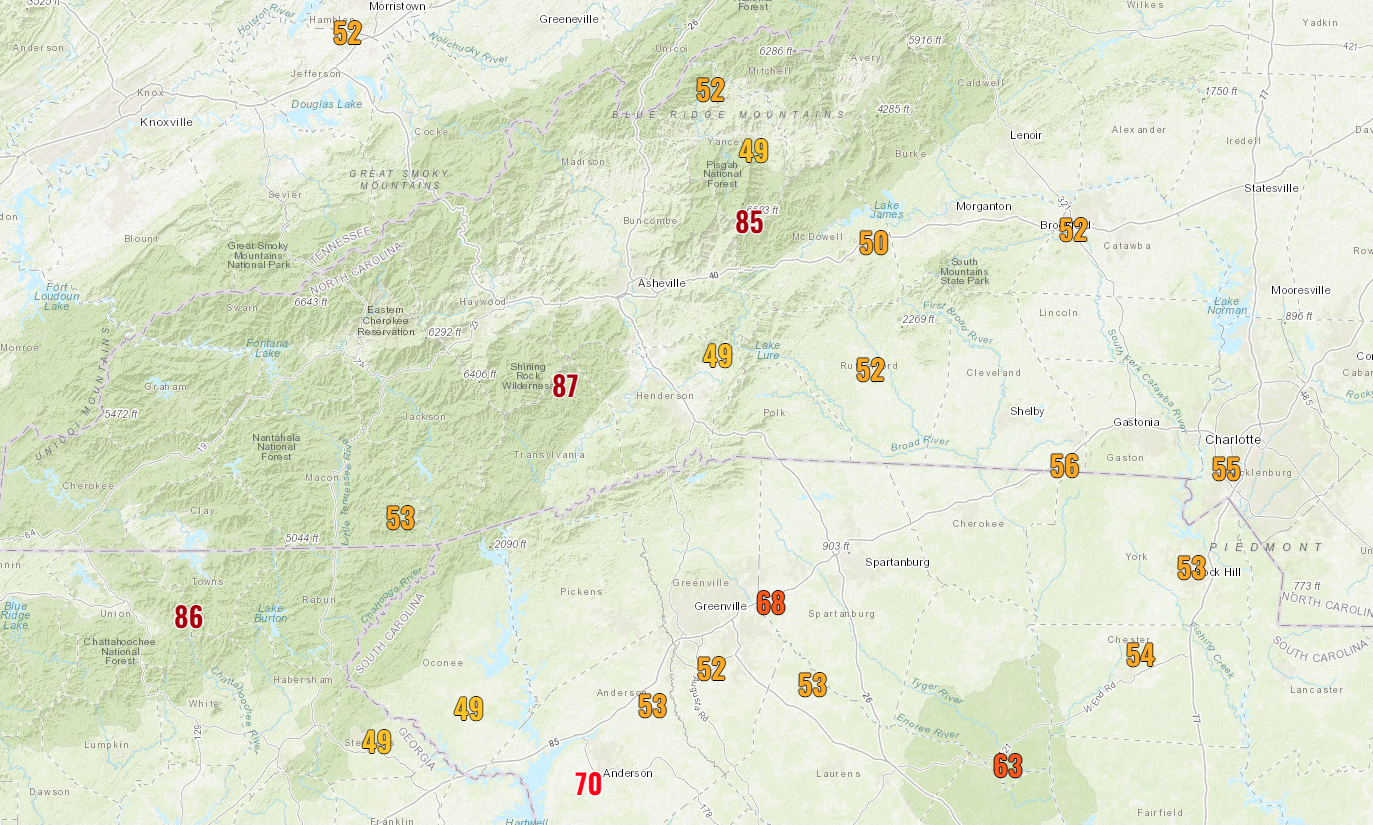
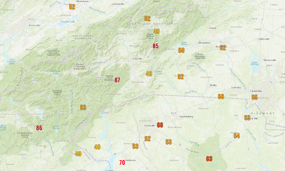
Some of the peak gusts in the mountains. This is filtered for anything at or above 49 mph.
-
on the mesovortices observed in radar:
-
you weenies broke tropicaltidbits
-
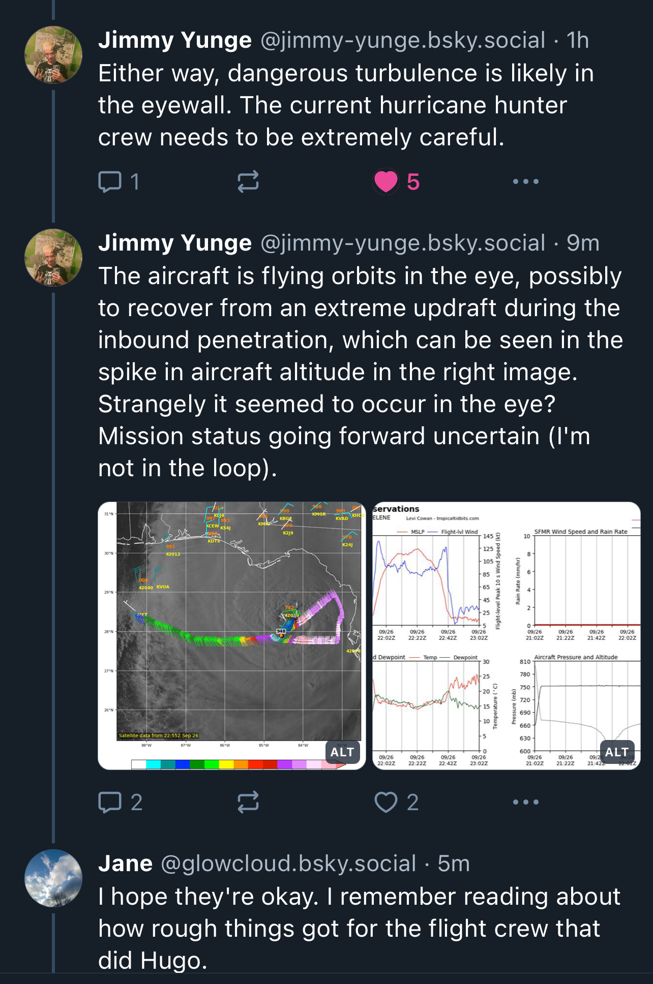
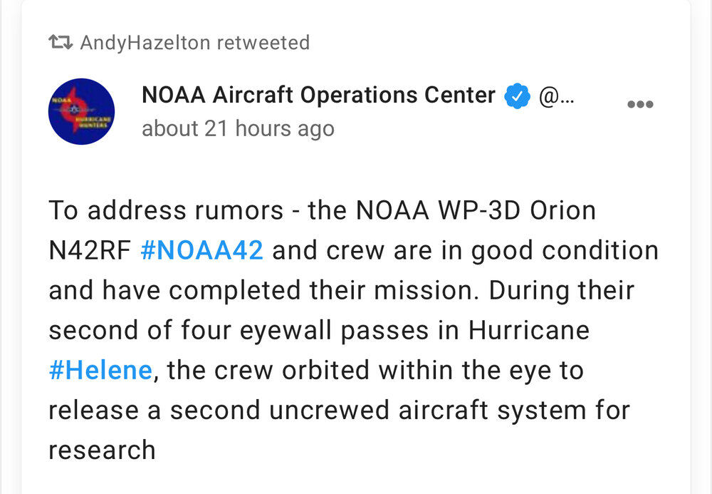
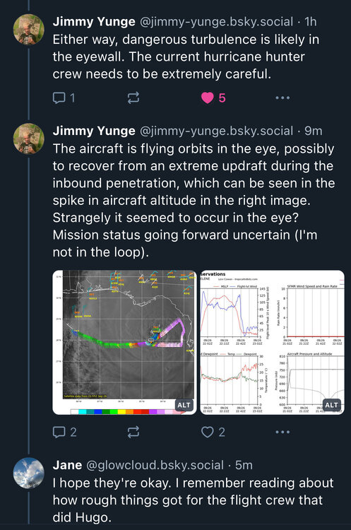
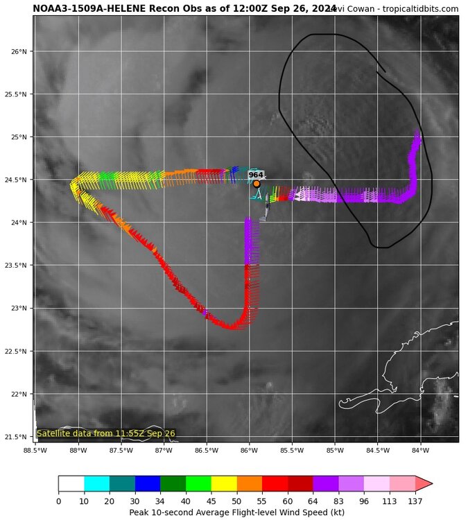
This is a NOAA plane, so unless there's mechanical issues, I would guess they're collecting important RI data.
-
2024 Atlantic Hurricane Season
purduewx80 replied to Stormchaserchuck1's topic in Tropical Headquarters
That will be counteracted by its huge wind field. The Bay of Campeche will stay much warmer, and if the latest models and ensembles are right, it could meander for a bit, allowing the Gulf to heat back up. -
2024 Atlantic Hurricane Season
purduewx80 replied to Stormchaserchuck1's topic in Tropical Headquarters
This tropical wave in the eastern Caribbean is likely the seed, or will at least merge into the CAG and enhance cyclogenesis by early next week.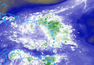
-
One of the main reasons ATL should be calmer is due to the cold air damming and stabilization at the surface. Need that southerly component to maximize gust potential. That matters less in the expose ridges farther north.
-
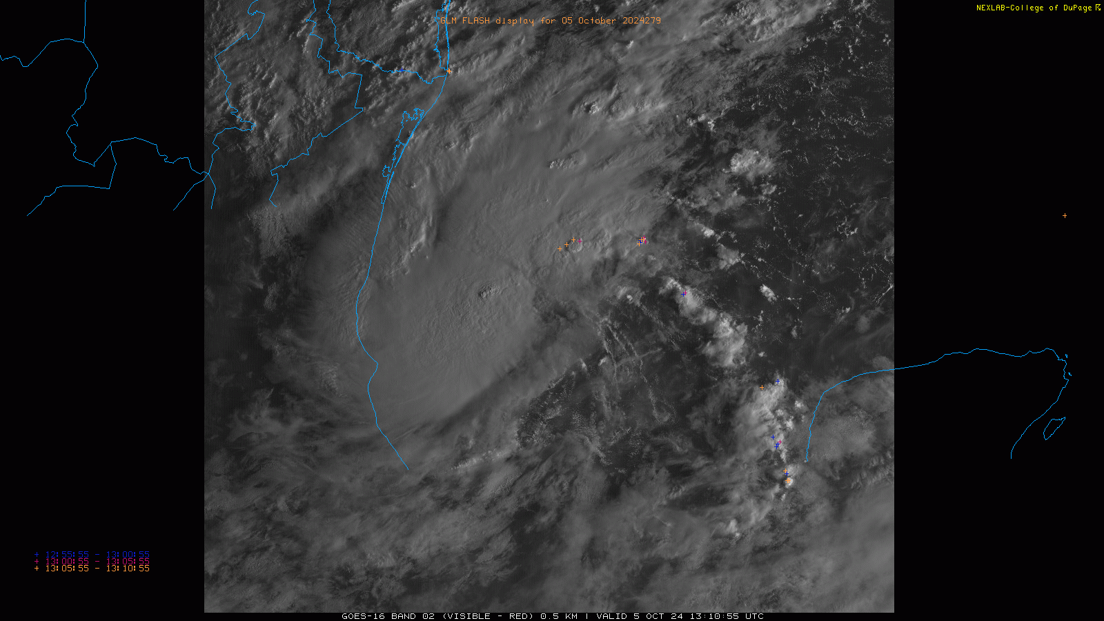
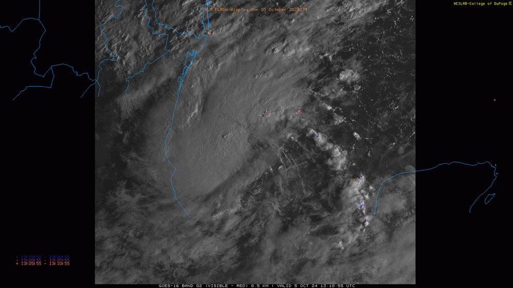
All the gravity waves radiating out on first vis are indicative of intensification picking up now too.
-
Yeah, there is not a lot of model support for a track west of here like NHC has. Really hoping it tracks east since I have a full canopy of 150’ trees overhead.