purduewx80
-
Posts
1,705 -
Joined
Content Type
Profiles
Blogs
Forums
American Weather
Media Demo
Store
Gallery
Everything posted by purduewx80
-
At the least, it's going to need to maintain that convection near the center today into tomorrow to become a depression. The strongest winds are well north of the small but well-formed surface circulation.
-
What do you mean by this? There was a temporary stand down caused by terroristic white supremacist threats. The White House outlines in this document exactly the amount of federal help that is occurring there in western NC, and they specifically mention FEMA continues to increase support in the region.
-
2024 Atlantic Hurricane Season
purduewx80 replied to Stormchaserchuck1's topic in Tropical Headquarters
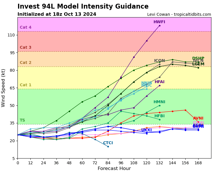
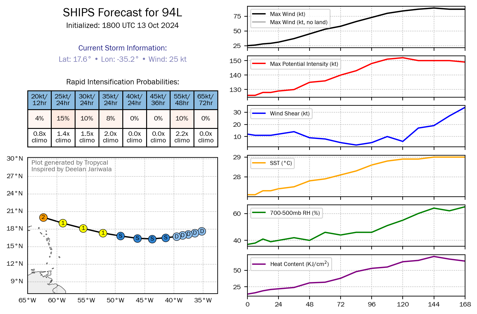
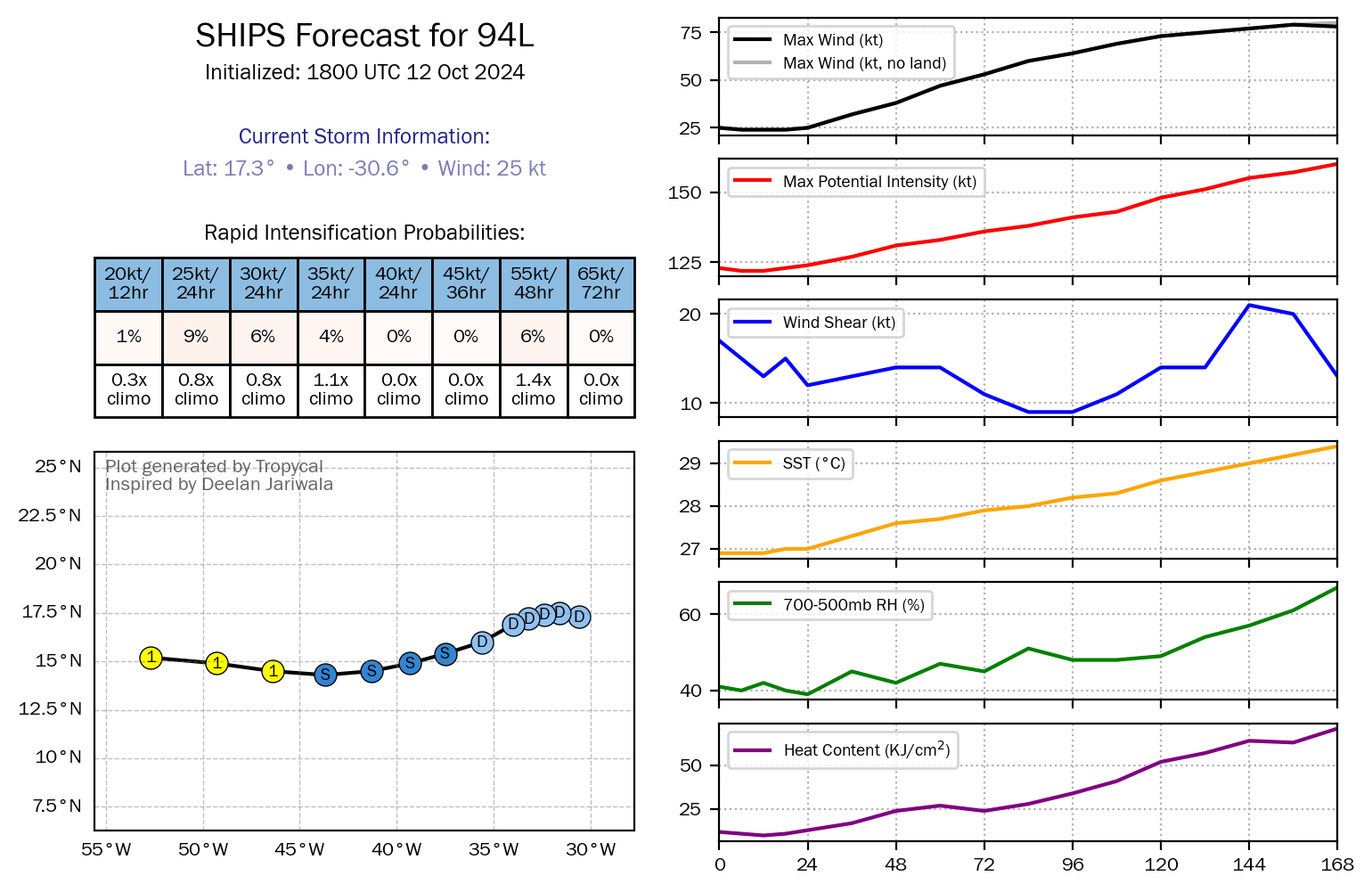
You can sort of see the environment it’s eventually getting into on SHIPS guidance: increasing mid-level moisture with westward extent counterbalanced by shear until the end of its forecast, plus increasing OHC/SSTs. May not take off until it tracks west of the surface high centered off the East Coast unless the islands interfere.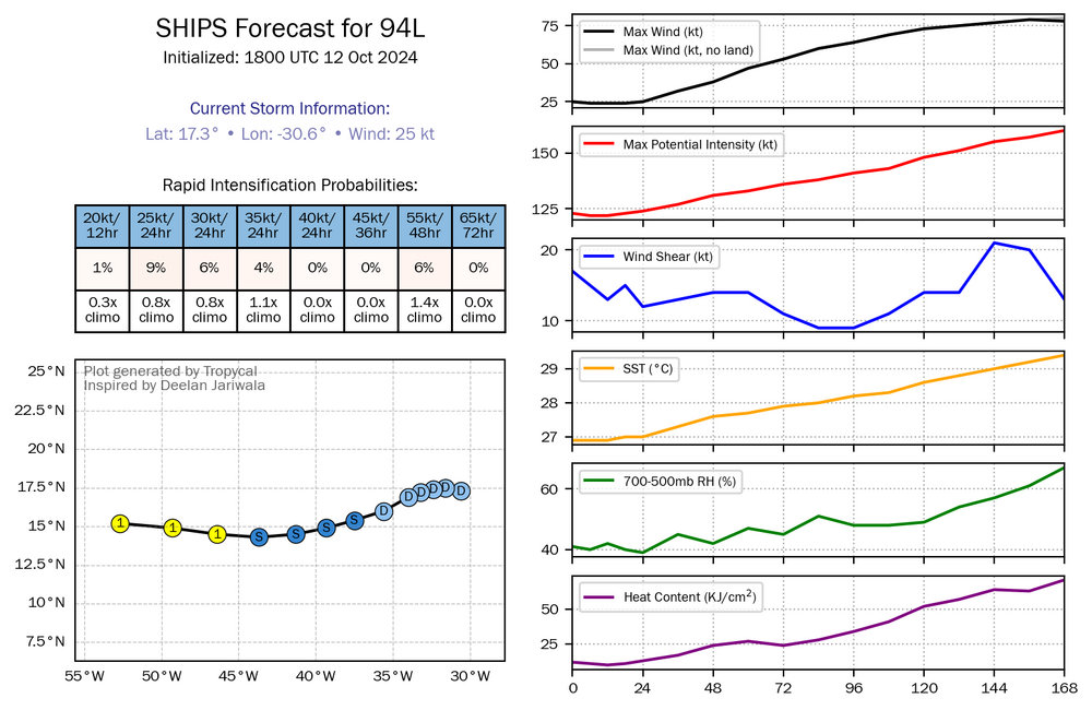
-
2024 Atlantic Hurricane Season
purduewx80 replied to Stormchaserchuck1's topic in Tropical Headquarters
For sure. The pattern change taking place pretty much has mid-level ridging rebuilding to its north the entire way across. Should be easy to track and seems more likely to develop closer to the Caribbean where better moisture is pooled south of our stalling fronts. -
It was a blast living in Madison back then. I grew up not seeing accumulating snow every winter and had some wild storms while in WI from '05-'13. A lot of '07-'08 was frequent nickel and dimes in an Arctic air mass that covered the giant piles as soon as they started to look dirty. December '08 was also epic. Now I'll most certainly be subjected to my third snowless winter in a row with the beefed-up SER. Would think that we start seeing tornado outbreaks heading into winter and spring somewhere in the Mississippi Valley and/or Gulf states.
-
2024 Atlantic Hurricane Season
purduewx80 replied to Stormchaserchuck1's topic in Tropical Headquarters
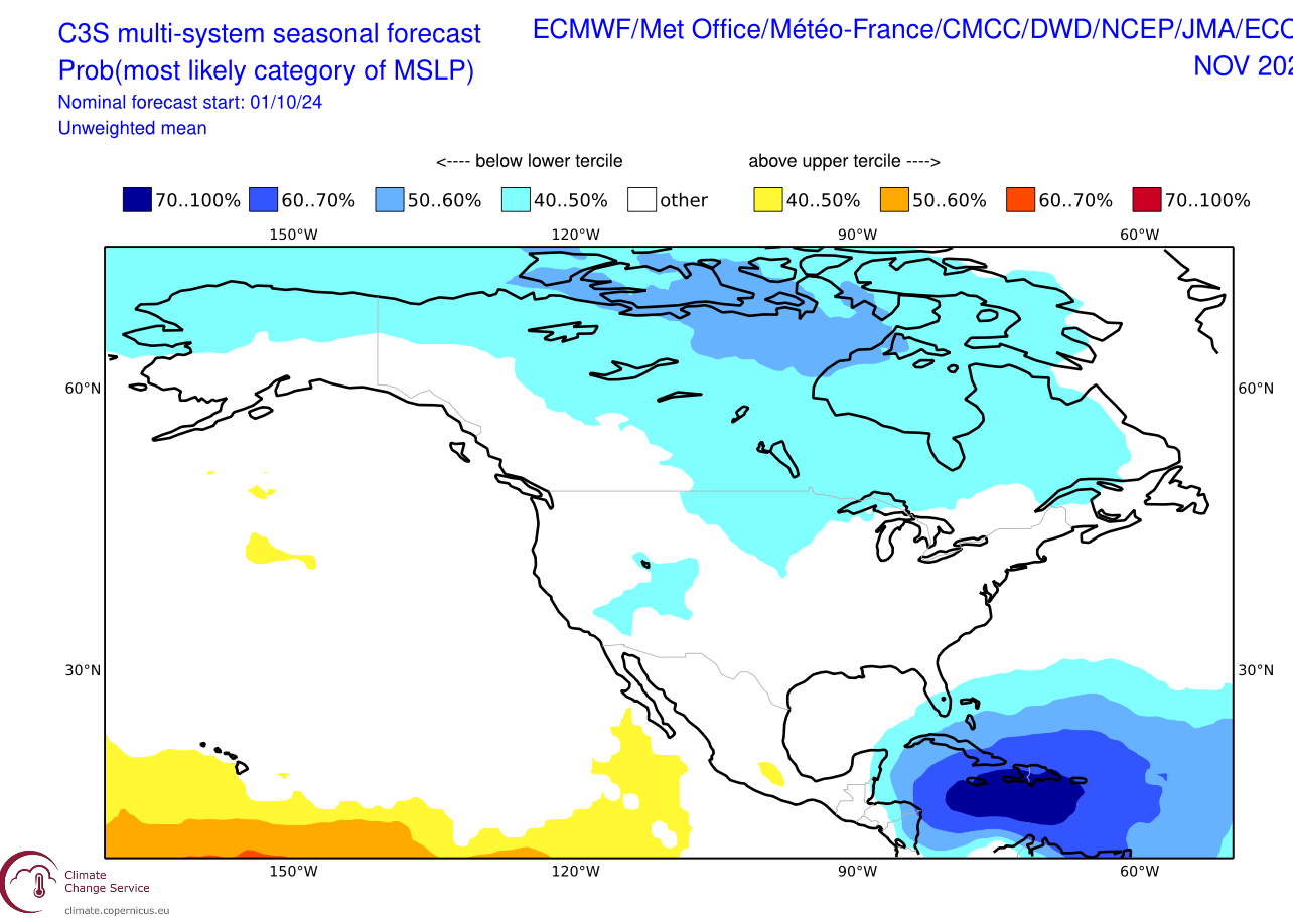
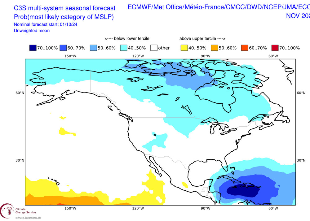
The Copernicus blend is a big yikes in the Caribbean during November. Even if we don’t get a string of majors down there, I think the record SSTs and OHC will mean disastrous flooding for some of the vulnerable populations down there.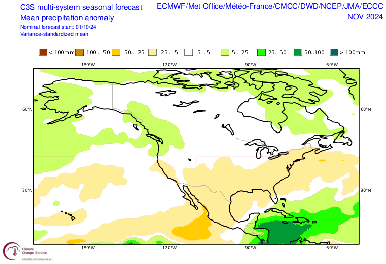
-
https://www.nature.com/articles/s41598-023-33305-w

-
Between all the guns and chaotic damage, it's truly apocalyptic.
-
I suspect it will gain more of a northerly component the next 6-8 hours as the base of the shortwave trough in the western gulf has reached Milton’s latitude.
-
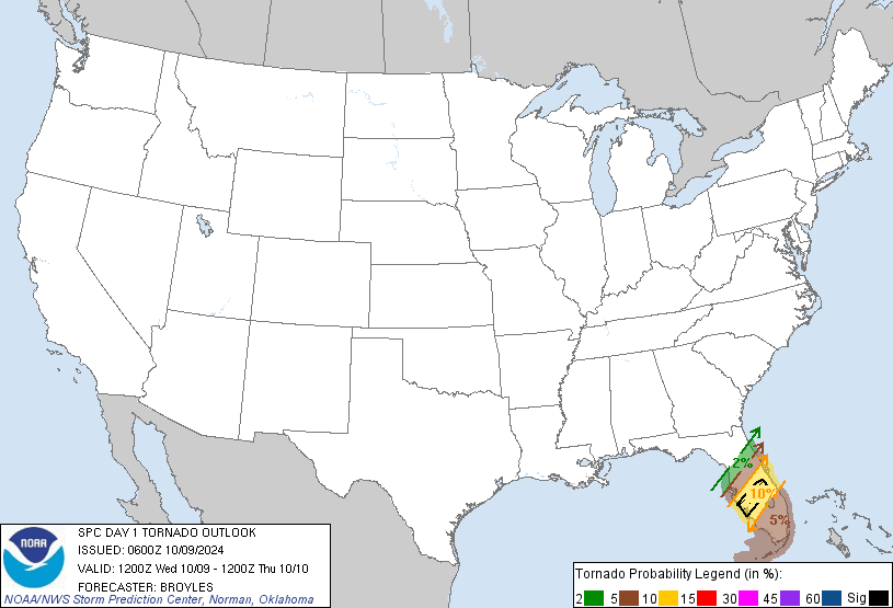
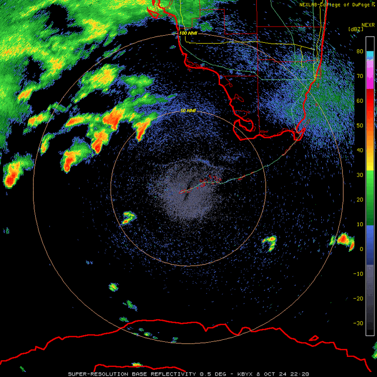
Enhanced SPC outlook with a 10% hatched tornado area west and north of Lake O.
-
Water would slosh right back into the Bay with the HWRF/HMON tracks on the back side, coincident with high tide.
-
The old front lifting north already has a bunch of supes lined up offshore. Thinking tomorrow could be a prolific producer in the NE quad.
-
Shelf waters are too shallow to derive OHC, at least by their methodology.
-
2024 Atlantic Hurricane Season
purduewx80 replied to Stormchaserchuck1's topic in Tropical Headquarters
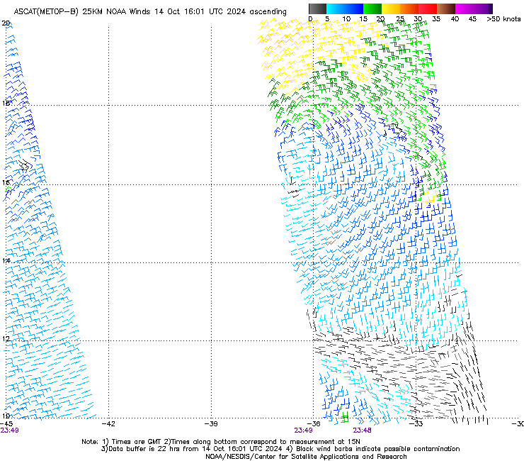
It still looks pretty frontal on vis but it’s hard to tell for sure. Unfortunately ASCAT hasn’t been updating since early this morning. It was still elongated around 8-9AM. -
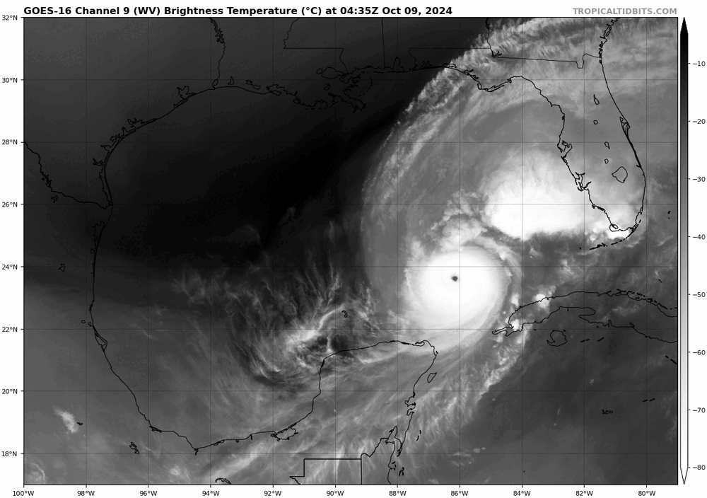
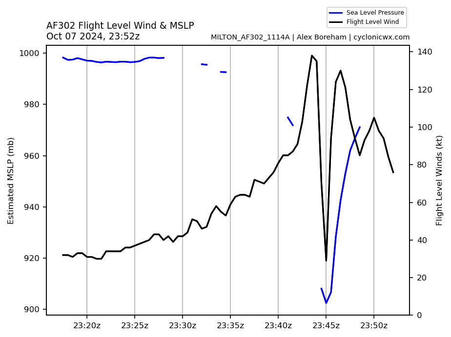
Both planes in the storm now indicate it’s a cat 5 again.
-
Yeah, double wind max evident on the east side now too. Bummer they weren’t in there when it likely peaked.
-
2024 Atlantic Hurricane Season
purduewx80 replied to Stormchaserchuck1's topic in Tropical Headquarters
It’s getting going east of WPB now.
-
fyp
-
The GFS likely restrengthens Milton because it's passing over the Loop Current tomorrow night at the same time it gets a synoptic boost from the upper jet. This is entirely reasonable but ignores the uncertainties with timing of eyewall replacement cycles. The 00/06Z hurricane models trended towards less dry air getting into the circulation near landfall, but weakening is certainly possible given the large reservoir of continental air to the north and west. Too soon to say for sure.

-
This is what I alluded to this morning in regards to flooding in the urban areas of coastal southeast FL tonight and tomorrow. The low will start to reform and detach from the front as part of this process. This happens regularly in that area, with winds often overperforming as convection is enhanced by coastal convergence and the Gulf Stream. It may be having some influence on Milton today, though I’m not sure how you can definitively attribute its ESE motion solely to that. Could spin up into a brief TS but it’s hard to say.
-
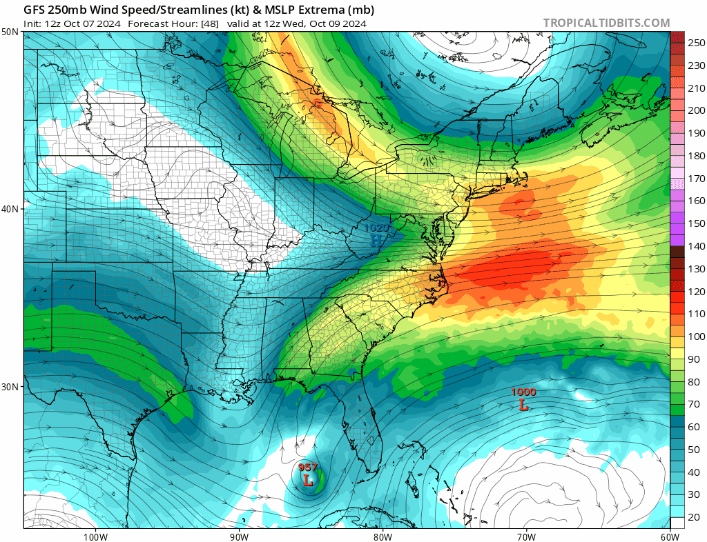
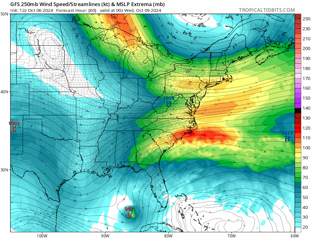
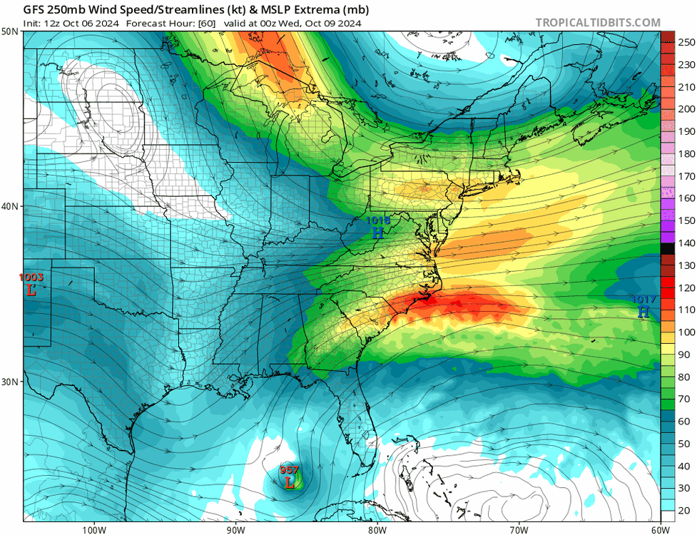
The synoptic situation as it shifts across the Loop Current and towards the coast is textbook. It’s essentially a partial capture, with extreme divergence aloft and ventilation from the 160KT+ jet developing off the Eastern Seaboard. Eyewall dynamics and dry air intrusion will probably have the main impacts on landfall intensity, but that jet configuration will play a big role in expanding the footprint of impacts.
-

-
If Milton bucks the trend of landfalling intensification this year, as is just about unanimous on model guidance, winds will not reach their full potential on the southeast/east side of the storm. Milton also looks to go through at least one ERC based on the hurricane regional models, maybe two, which would both lead to a much larger radius of winds than we’ll see today and tomorrow. It shouldn’t become as large as Helene, but its intensity over the Gulf and larger size with time will both enhance the surge potential.
-
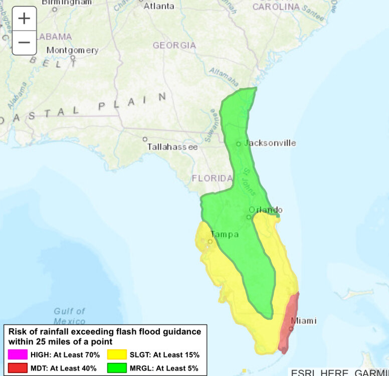
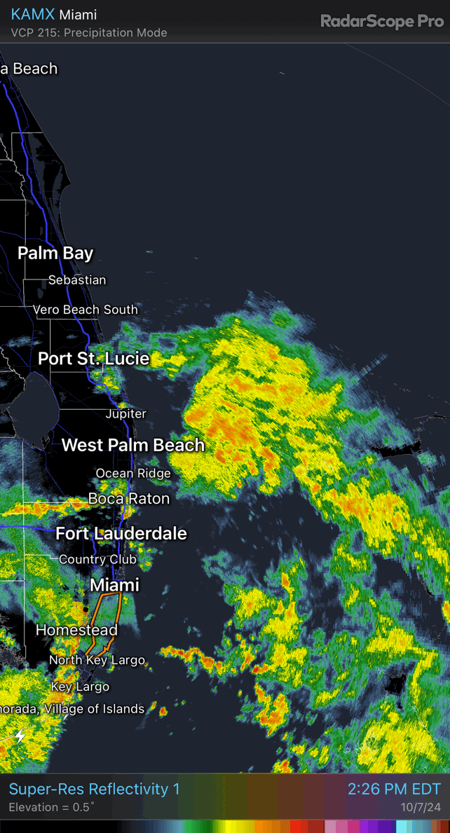
Looks to be some model support for localized rainfall of 10-20” with the PRE/lead wave affecting South FL later today into tomorrow, unfortunately centered on the urban corridor near and north of Miami. Low-level flow will be enhanced into the coast there tonight and tomorrow, likely resulting in stationary thunderstorm clusters. Sometimes the diabatic heating and coastal convergence can enhance the winds there as a mesolow develops, too. WPC has a moderate risk out for excessive rain, and I wouldn’t be surprised to see a high risk as confidence increases.