purduewx80
-
Posts
1,705 -
Joined
Content Type
Profiles
Blogs
Forums
American Weather
Media Demo
Store
Gallery
Everything posted by purduewx80
-
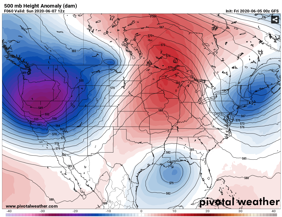
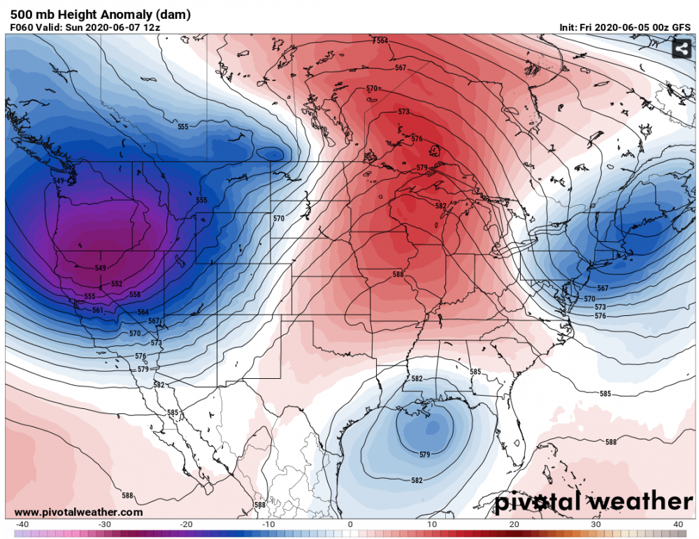
Could be some of that, but the pattern is so amped up - adding tropical heat into a favorable synoptic pattern could definitely lead to rapid deepening. The trough coming into the West has near record low 500 mb heights for June in the PacNW:
-
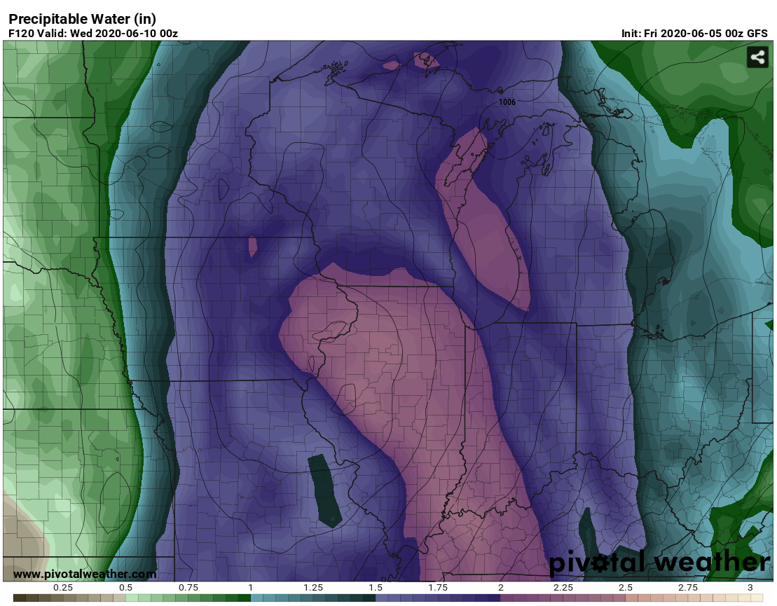
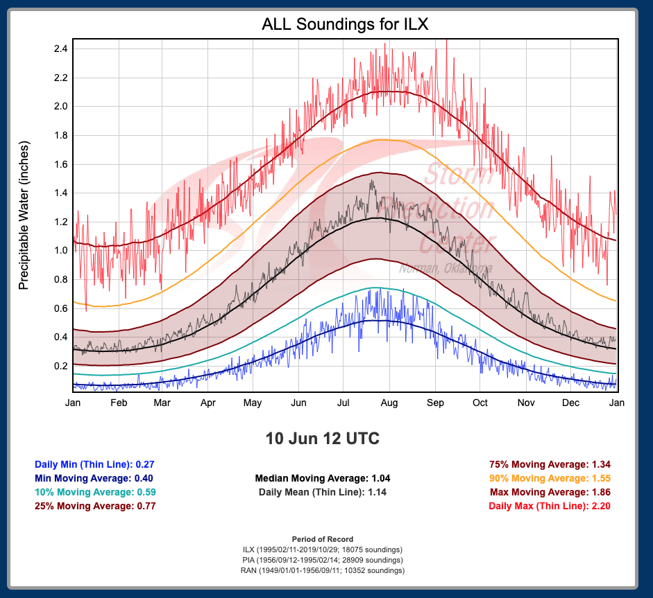
00Z GFS farther west a bit. PWATs are near or above record territory for June.


-
2nd lake breeze pop up of the year here - weird seeing this so early given ~August is climo. There are some decent/new puddles in the neighborhood.
-
http://arctic.som.ou.edu/tburg/products/covid19/

-
Spring/Summer 2020 Medium & Long Range Discussion
purduewx80 replied to Geoboy645's topic in Lakes/Ohio Valley
Ensembles certainly support the heavy rain threat. That Euro verbatim would also be a higher end tornado threat Tuesday evening ahead of the stronger SSW winds early Wed. -
Yeah, tomorrow certainly has more potential. Looks like the lake breeze shifted inland a little too quickly today.
-
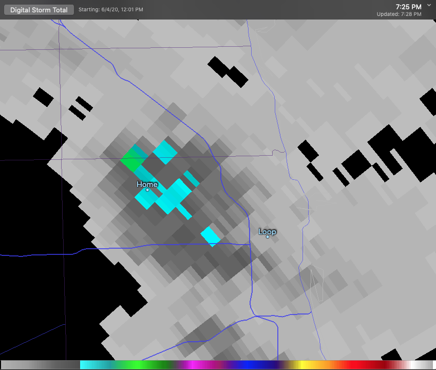
ORD up to 9.27" for May now. Should be fairly easy to surpass 10" given 2 more days of potentially tropical downpours. Today looks like a near carbon copy of yesterday.
-
quality here in humboldt. blew up right on top of us.
-
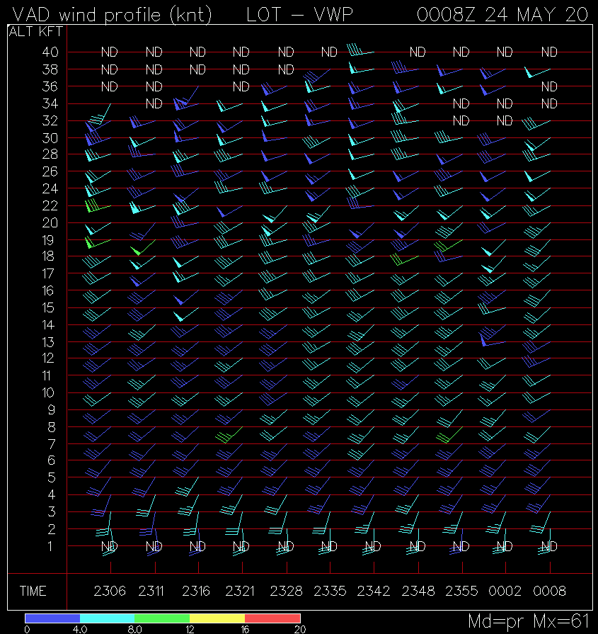
Looks like that's verifying. Can see 5000' (~850) winds increase by ~10KT over the last hour on the KLOT VAD:

-
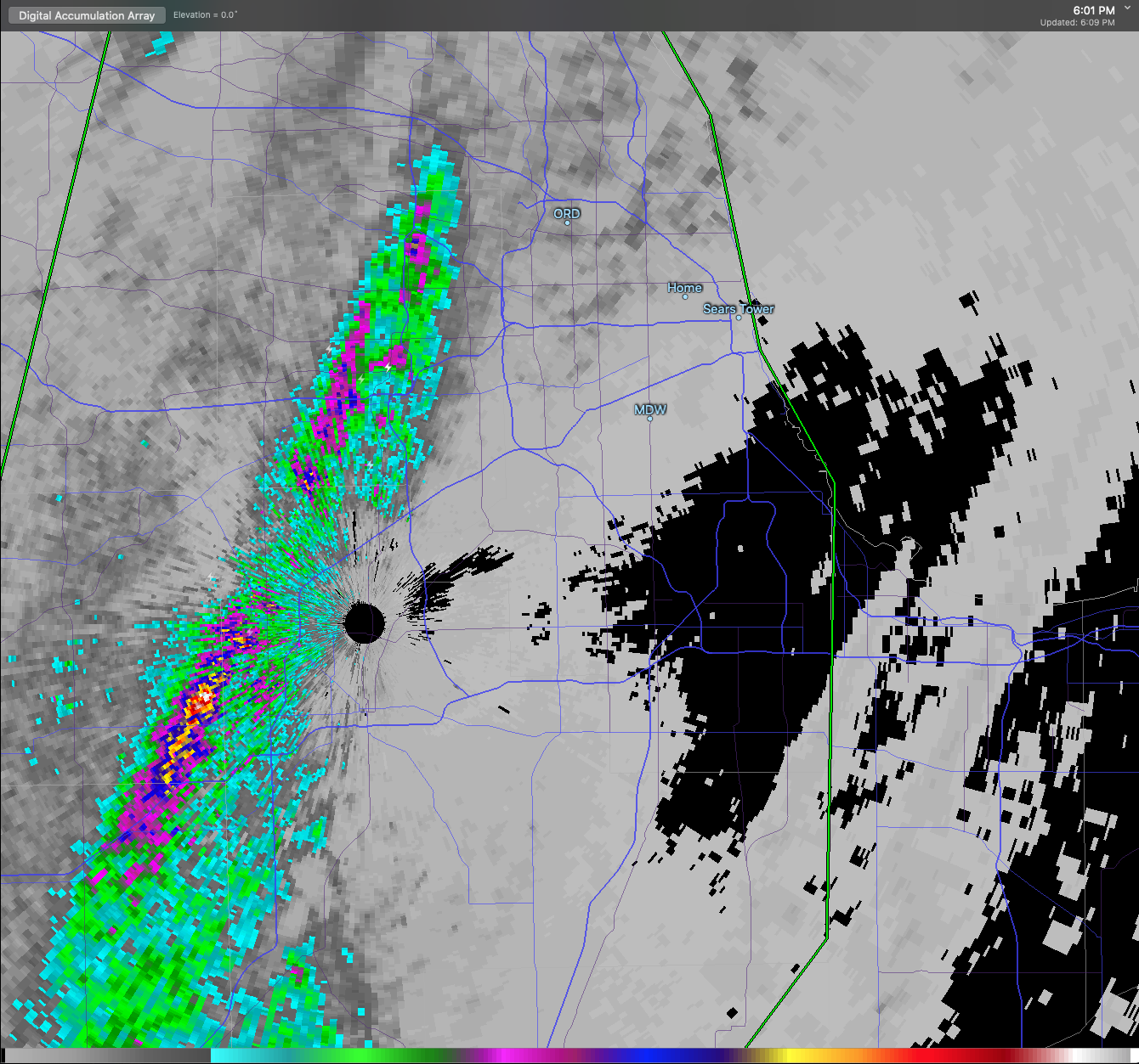
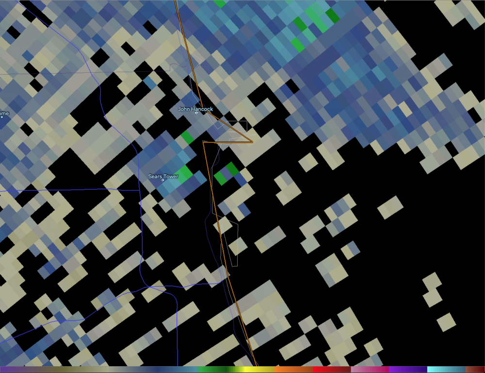
Got to love the anvil lightning strikes hitting both the Sears Tower and John Hancock buildings. Lots of cloud-to-cloud lightning occurring here now.
-
Agreed. Will have to watch for localized flash flooding again too. Flow lines up w the front for a few hours this evening. Some 3”+ radar estimates are showing up with the ongoing activity.
-
Yeah, the warm frontal passage is more an increase in dew points and shift in winds to SSE. The triple point will essentially pass right over the metro unless upscale growth of the current cells modifies things.
-
The best combo of low level shear and low cloud bases should be near the warm front as the cells move in. In Chicagoland this should end up being roughly along and south of the I-90 corridor. The lake will modify the warm front a bit. Not guaranteed to see anything but you shouldn’t have to go too far.
-
Agree a slight risk upgrade would've been reasonable given an enhanced risk ceiling across a small corridor. I like the overlay of shear and instability across northern and possibly central IL. Chicago is likely in play too given early AM fog will clear quickly.
-
May 13-19 Severe/Heavy Rain threats
purduewx80 replied to Tim from Springfield (IL)'s topic in Lakes/Ohio Valley
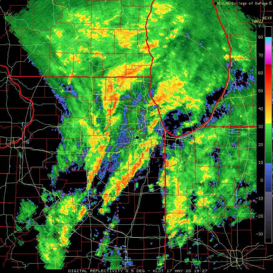
KLOT is estimating 1-2"/hour rainfall rates in this line, with local 3"/hour embedded within.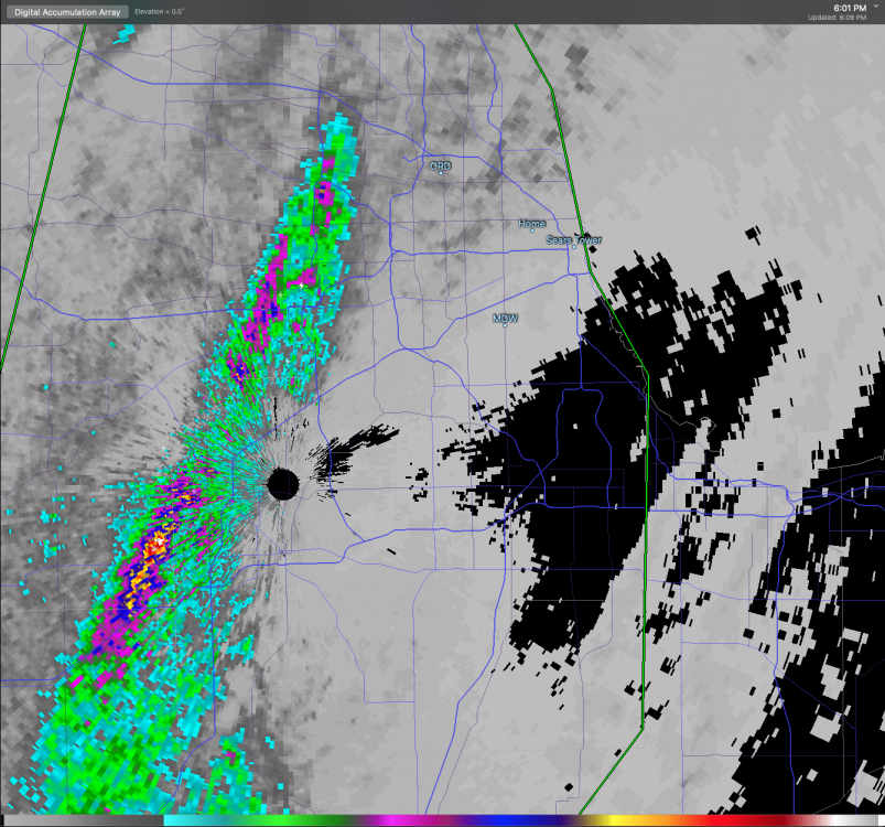
-
May 13-19 Severe/Heavy Rain threats
purduewx80 replied to Tim from Springfield (IL)'s topic in Lakes/Ohio Valley
no doubt. pretty easy to envision the pivot/training happening over the city. -
May 13-19 Severe/Heavy Rain threats
purduewx80 replied to Tim from Springfield (IL)'s topic in Lakes/Ohio Valley
Could be close, but it looks like the extreme amounts will be in the more densely populated and urban areas closer to the lake (and MDW). Thunderstorms are closing in quick on the south side.
-
Crowded bars immediately after the ruling - only in WI. That partisan state Supreme Court has always been a hot mess. https://wkow.com/2020/05/14/crowded-bars-seen-across-wisconsin-after-safer-at-home-extension-struck-down/
-
Anxious to see updates for the past week. Many of the areas relaxing the rules now, I imagine, are in for a rude awakening. https://www.brookings.edu/blog/the-avenue/2020/04/29/covid-19-is-expanding-further-into-trump-country/
-
Because it started in the larger cities where people were traveling globally more often. It's fairly obvious the spread was efficient in areas with public transportation. Cut the N vs S bs. The civil war ended ages ago, and I think we all know who won.
-
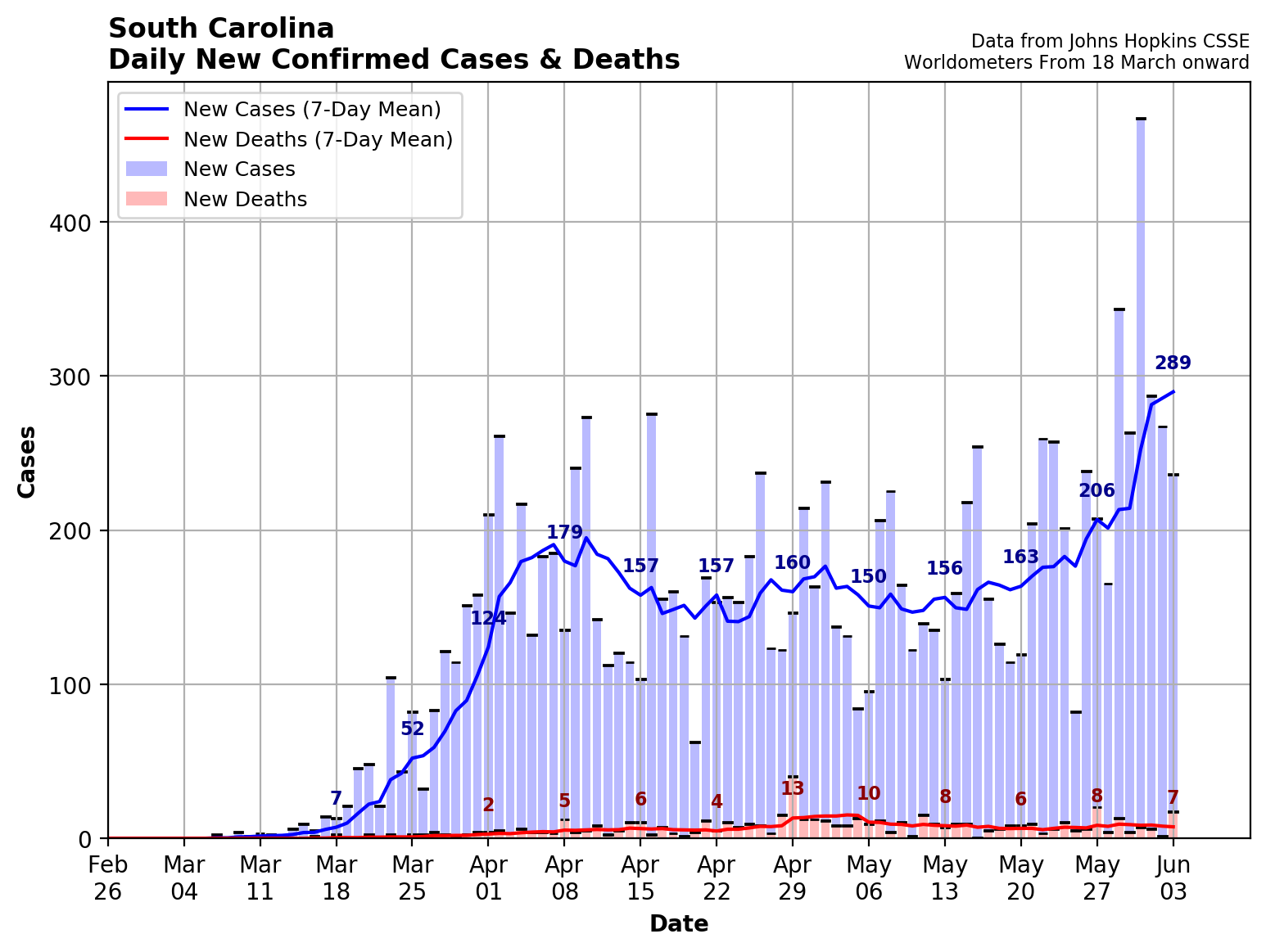
WI and SC are neck and neck in terms of cases per 100,000 people. https://www.statista.com/statistics/1109004/coronavirus-covid19-cases-rate-us-americans-by-state/
-
Definitely close to 50mph in this shower here now.
-
This one was a good example of why not to forecast snow using QPF alone. 800-600mb 00Z NAM average frontogenesis (where the DGZ was located) and composite radar valid at 11Z below. Note the greens/blues are a proxy for downward motion and the orange/red upwards. Lower level winds then carry the snowflakes S/SW (in the case of low-level NE winds) of where the best fronto/lift is occurring.
-
https://www.spc.noaa.gov/products/md/md0392.html
-
looking like a pretty solid call to me. best 700mb fronto/dgz combo should be ~4-9AM.