purduewx80
-
Posts
1,705 -
Joined
Content Type
Profiles
Blogs
Forums
American Weather
Media Demo
Store
Gallery
Everything posted by purduewx80
-
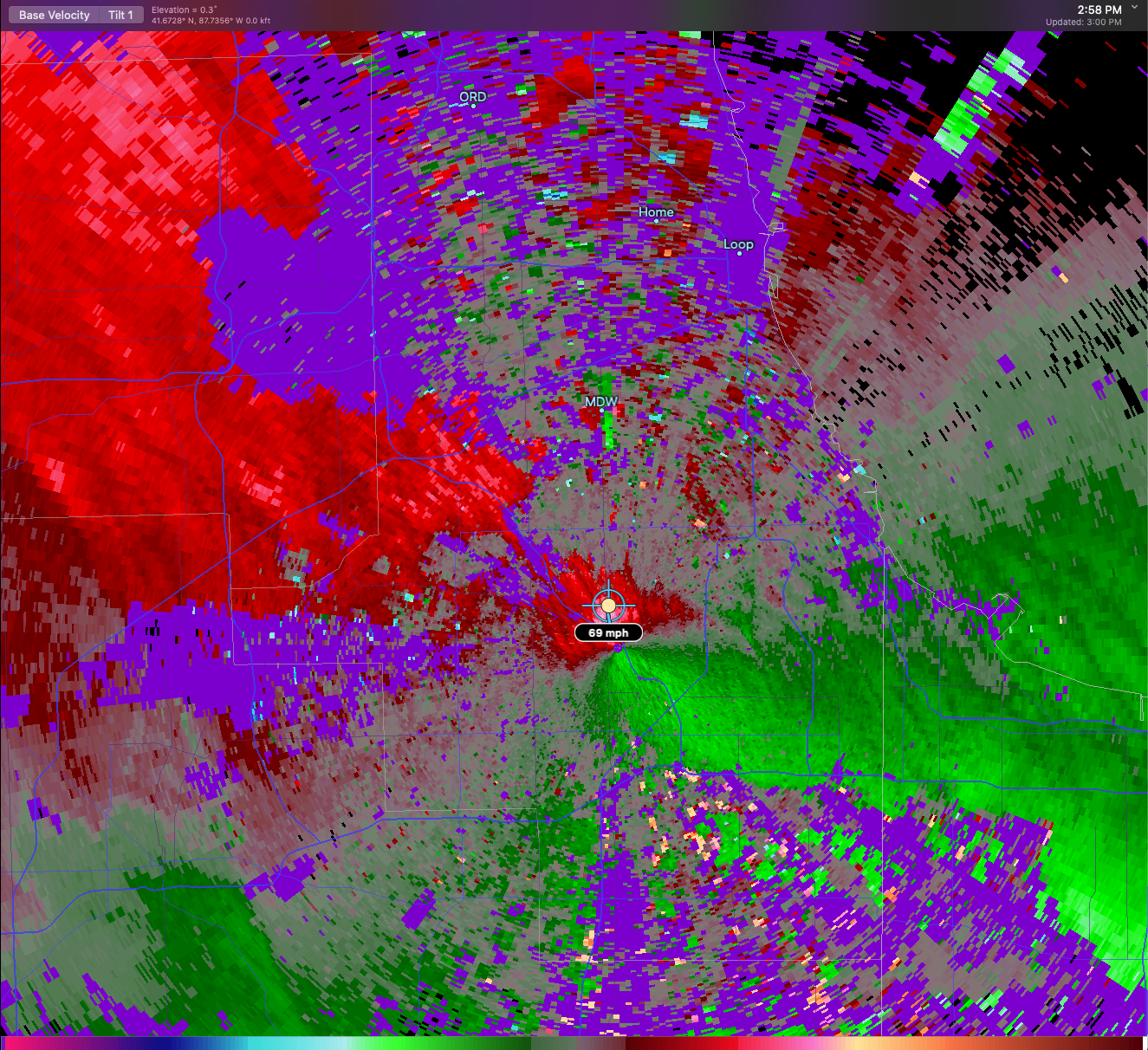
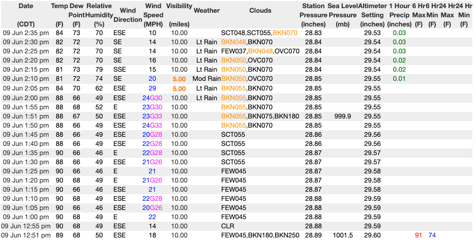
49MPH at MDW in this round. Also 78/77. wow.
-
60MPH at ORD KORD 092023Z 16030G52KT 3/4SM R10L/3000VP6000FT +RA BKN048 OVC060 28/22 A2952 RMK AO2 PK WND 18052/2023 RAB16 PRESRR P0000 T02830217
-
-
Local dopplers are estimating some small areas of 60-70MPH wind gusts embedded in this line.

-
Pretty cool to see how a passing shower at ORD cooled temps down and resulted in much lighter winds after. The steepest low level lapse rates of the day were out ahead of this precip banding, then they weaken as a shower passes. Breaks in the clouds S of this band are helping the stronger wind field aloft mix down in central IL, despite the poor lapse rates. Wind speeds/gusts are higher than a lot of the SE saw yesterday.
-
Probably a little too soon to be blaming protests. Wouldn't see anything from that until later this week or early next. Other states that opened early are also seeing spikes, though Georgia is somewhat perplexing.

-
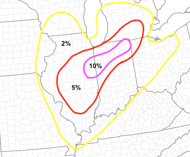
yep, this was that 10% area I had on my map from yesterday. Latest guidance has it a touch farther north now. Certainly worth keeping an eye on in the late evening. That lull you mention should be brought on by a brief 700mb dry slot: I think the biggest question in my mind is whether you'll have sfc based development overnight.
-
yep!
-
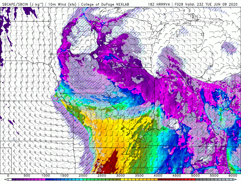
18Z 3k NAM has steep low-level lapse rates and 45KT at the top of the boundary layer as the PM convection rolls into Chicago, from central Cook Co below: As has been stated by others, the progged warmup to near 90 ahead of these bands will be critical in higher winds aloft being able to mix down in convection.

-
They may have to extend the FFW into later in the day Wednesday as the trailing synoptic systems rolls in. There should be another localized heavy rain threat on the NW side of that upper low where you'll have convection feeding into a deformation zone.
-
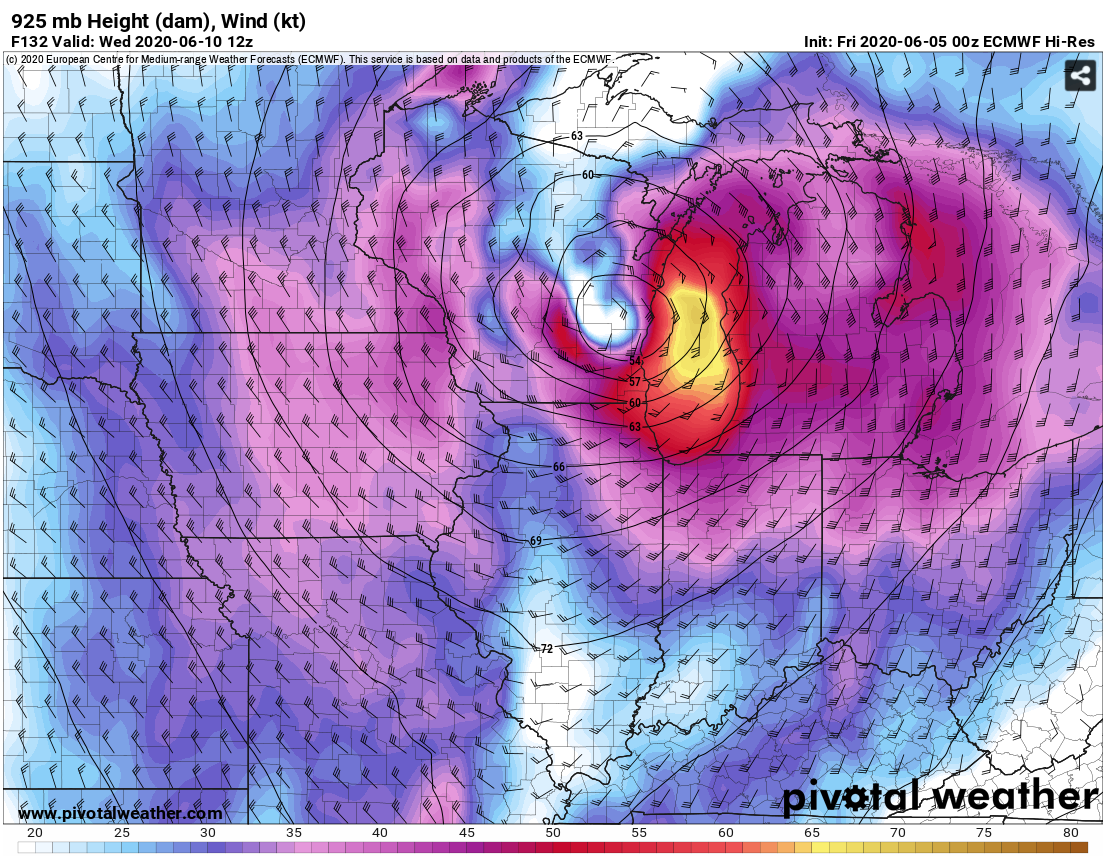
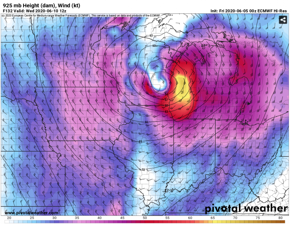
If you're referring to the sfc wind gust product, then perhaps this is true. I see very little difference in the 925-700mb winds on the 12Z run from the previous ones, 925mb below:
-
LOT/Ratzer has a nice, in-depth discussion of model preferences and what could change/differ given the continued spread: IND and ILX also discuss possible risk upgrades in subsequent SPC outlooks. I agree.
-
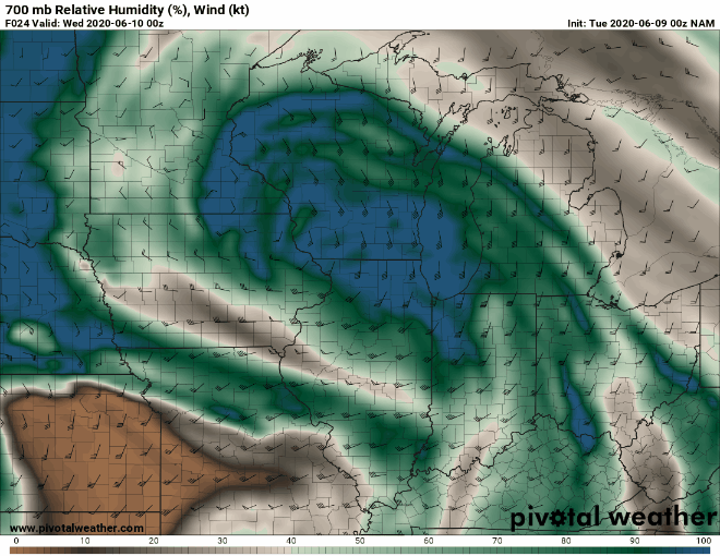
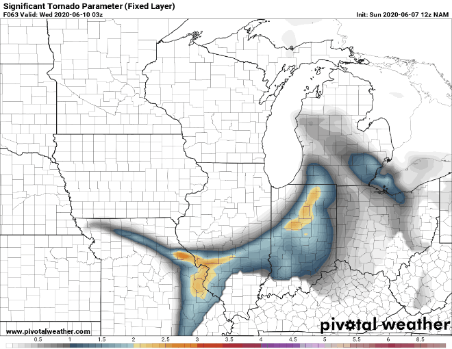
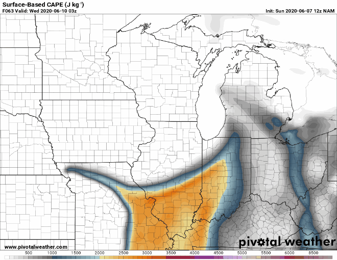
There's still quite a bit of difference in the 00Z guidance in how this evolves on Tuesday, both intensity- and forward motion-wise. Wind fields are still much stronger on the ECMWF/UKMET than other guidance, owing to a deeper low. The reality will probably end up some blend of current model progs. Based on everything I've seen so far, I think the tornado probabilities valid ~18Z Tuesday - 12Z Wednesday are something like below. The 10% area is where you have the best combo of instability and helicity (a 700 mb west-southwesterly wind max comes in atop a southerly 850 LLJ and SSE'rly 925 LLJ). Some guidance does suggest higher probs into northern IL but there will probably be some sort of shadow near Lake Michigan due to ageostrophic E to SE'rly sfc winds.
-
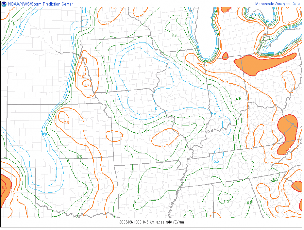
Agreed! Those 0-3 km lapse rates of 8.5C/km should enable some of the initial showers to produce strong wind gusts.
-
-
There is probably another severe weather threat later Tuesday evening into Wed ahead of the neg til upper trough. There looks to be a boundary left behind by Cristobal that forms a triple point near St Louis thru much of IL/IN/MI into the OH Valley Wed PM - watch that for possible spinups too. Lapse rates steepen and the wide open Gulf will have left mid-70s dews in the wake of Cristobal, so instability will actually build overnight.
-
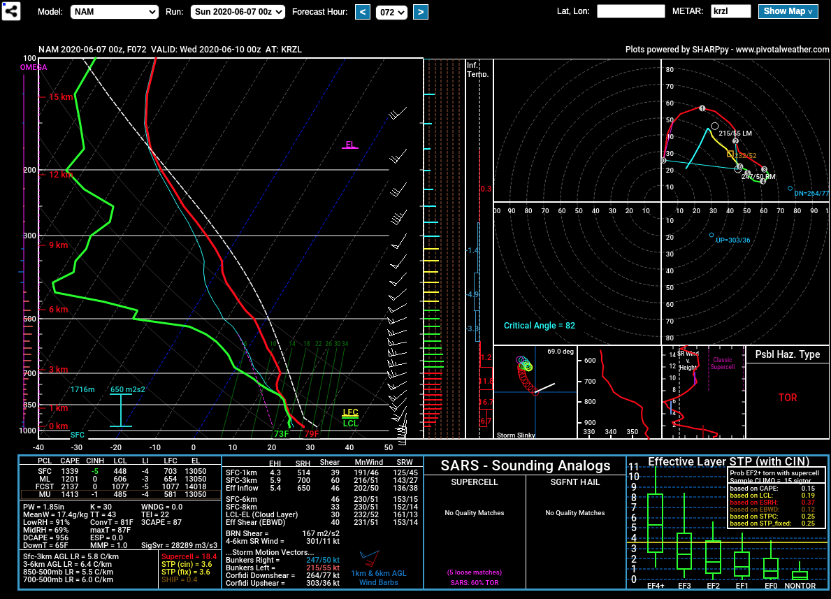
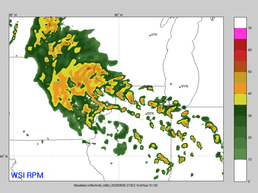
At the end of its range, but the RPM is highly cellular 18-21Z in IL/IN:
-
The acceleration of those winds from the sfc to 700 mb is astounding for summer in these parts, UKMET is equally impressive. Even with a more tropical instability profile (tall, skinny CAPE), that kind of increase in winds will lead to convection. A slight risk is probably warranted with the model disagreement, but that’s some mdt risk potential on the Euro. Getting into the hi-res range soon. Extended RPM is certainly convective a in IL, IN, MI, WI.
-
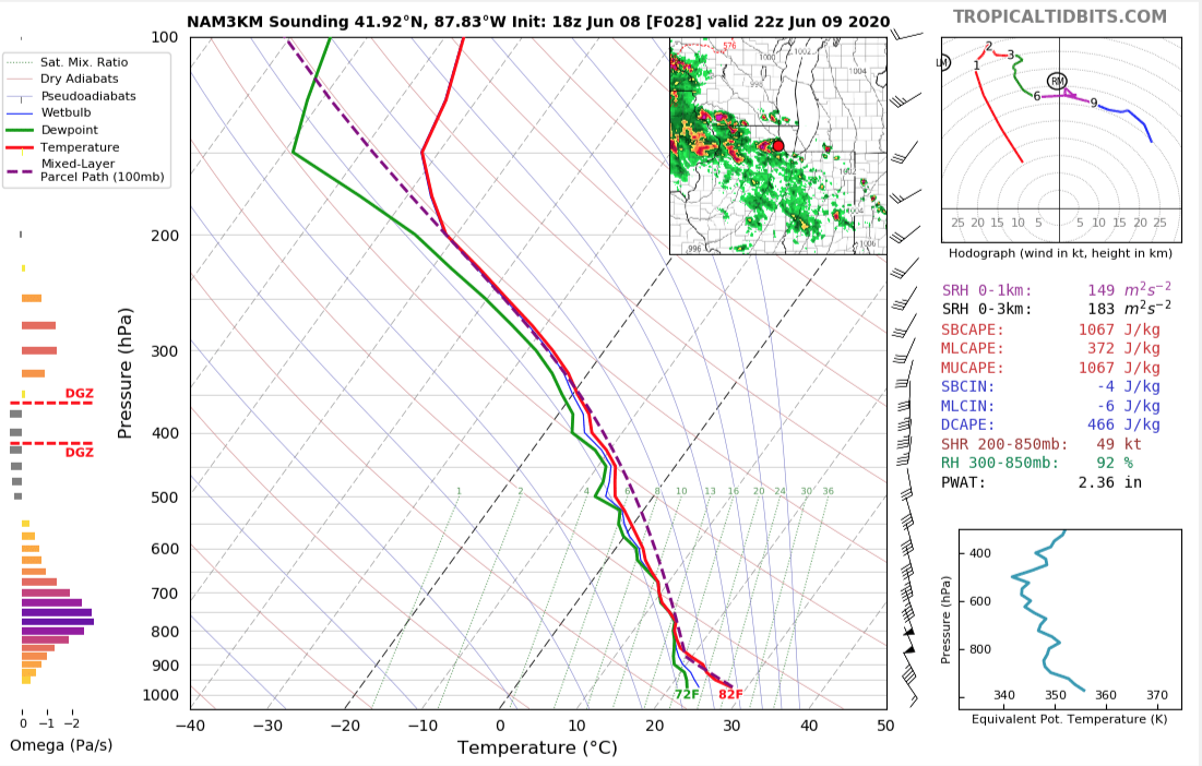
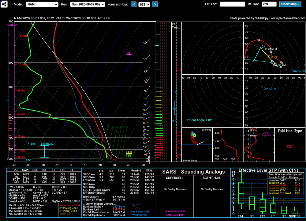
00Z NAM KRZL sounding valid 7PM Tues eve:
-
Seeing more QPF on the right side of the track is concerning, both for tornadic potential and the ability of convection (even if it’s just heavy showers) to drag that low level jet down to the surface. Many of the forecast soundings have low-level CAPE where the hodographs are long. Euro’s 1-2 punch for the Great Lakes would lead to widespread erosion on most shores, with the worst of it in MI and WI.
-
ugh, same. most curious about lower-level lapse rates/CAPE for any possible spinups.
-
That's an interesting feature, Euro isn't the only one bringing another round of winds Wednesday PM either.
-
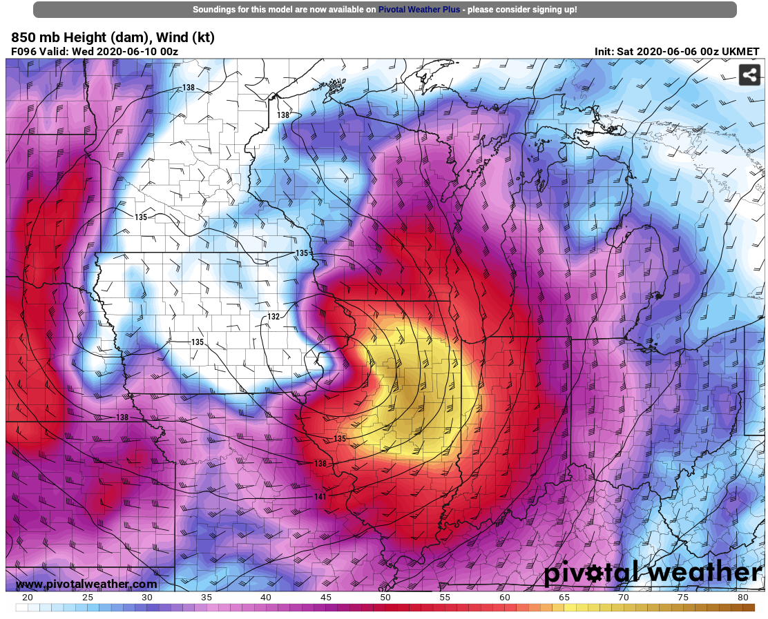
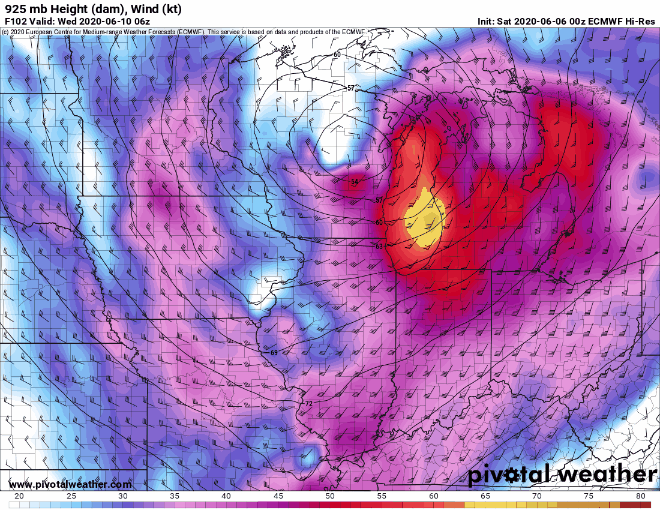
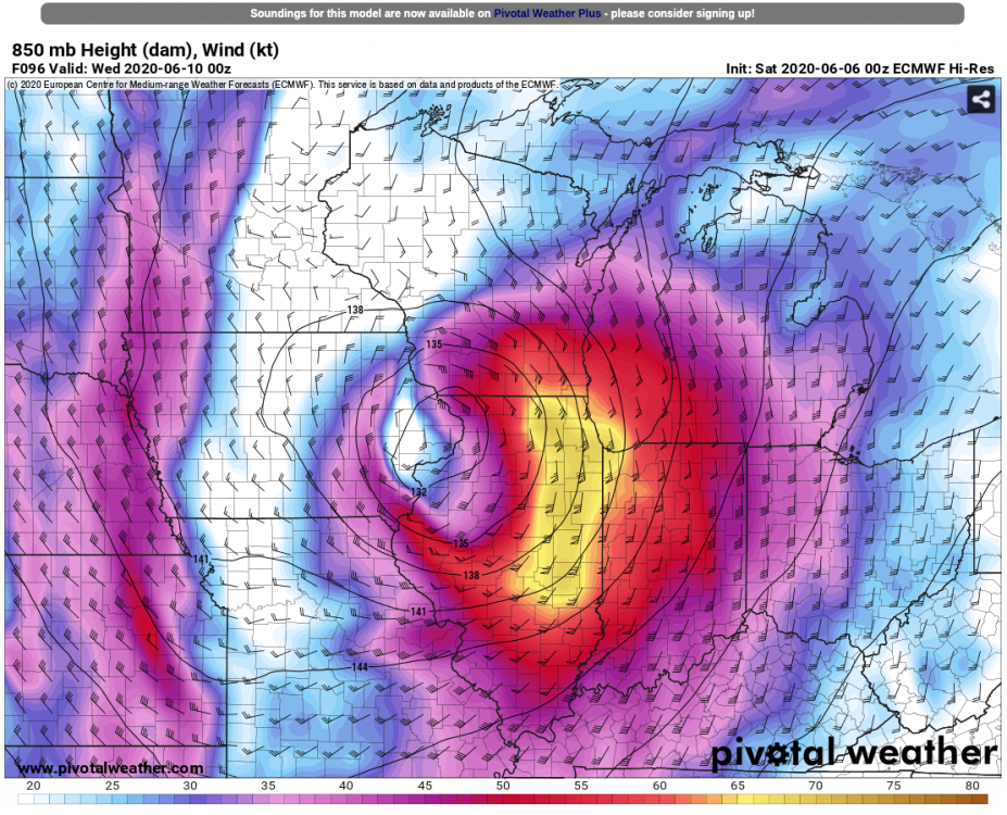
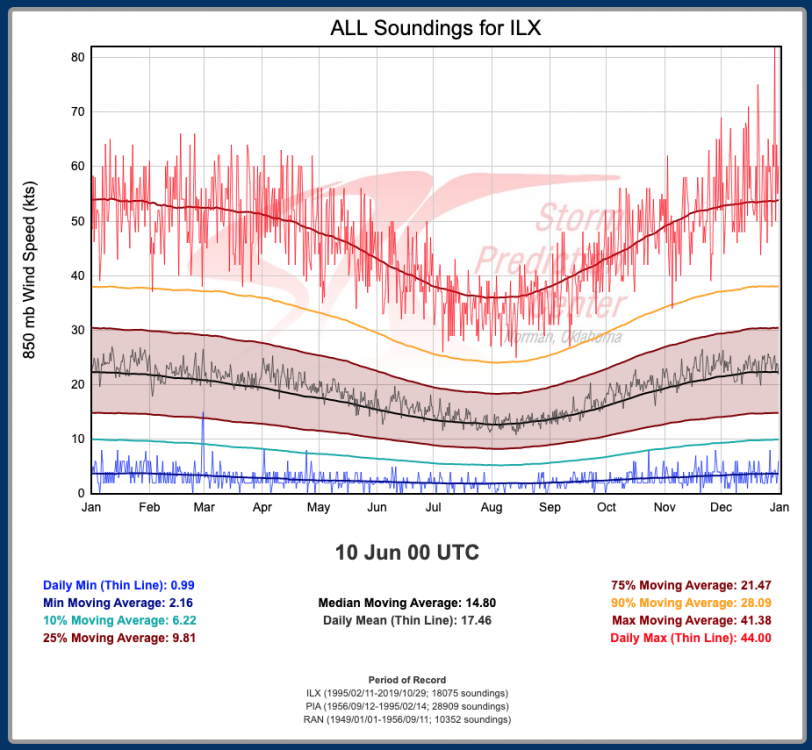
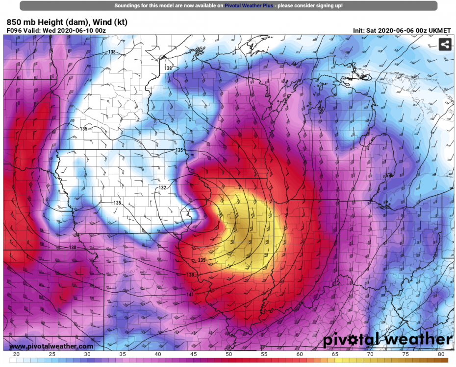
850mb wind speeds progged by some of the 00Z guidance are just incredible - something never seen before during the warm season:
-
70KT LLJ there over LM. Gets down to about 980 mb at the sfc.
-
Good news is that it's flying northwards by the time it gets here, but that wouldn't preclude some 5"+ amounts in a 6-12 hour period. I'm growing more concerned for lakeshore flooding, even surge/seiche, and the resulting erosion too. Most of the 00Z guidance is showing 50-60KT+ wind potential.