purduewx80
-
Posts
1,705 -
Joined
Content Type
Profiles
Blogs
Forums
American Weather
Media Demo
Store
Gallery
Everything posted by purduewx80
-
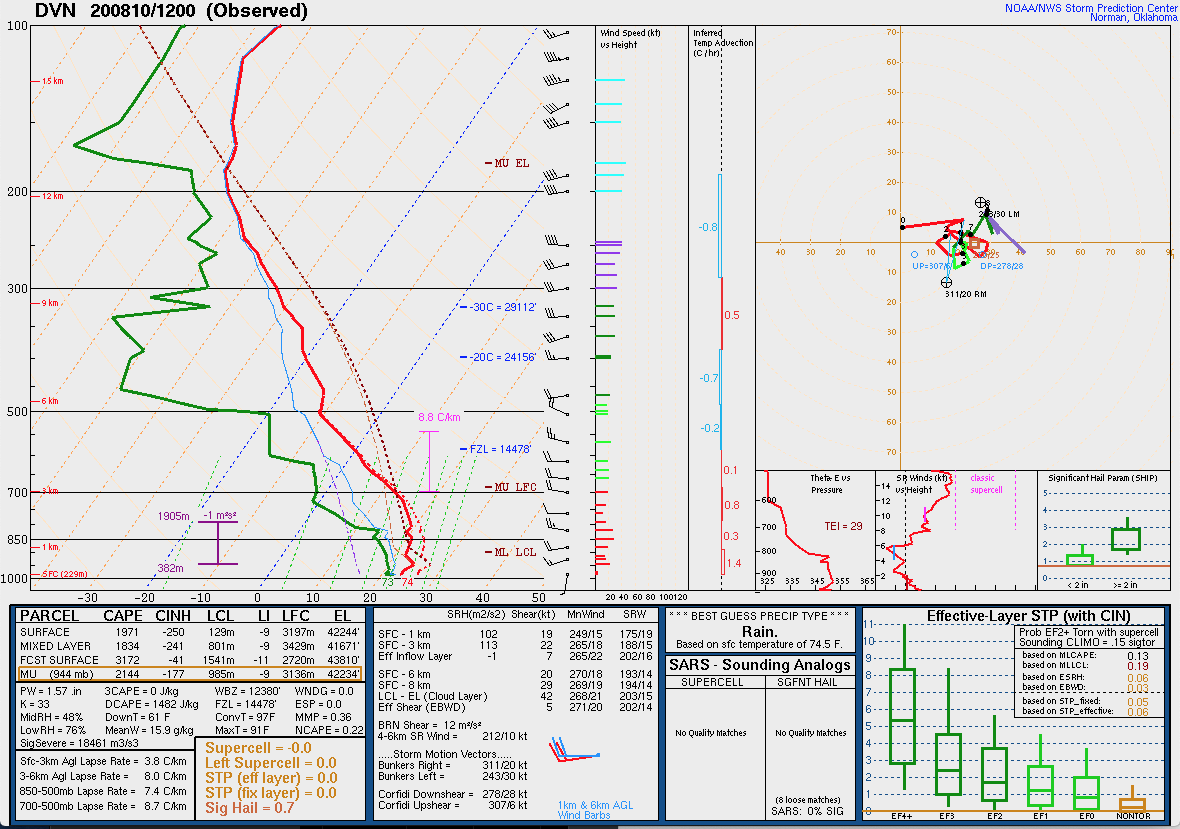
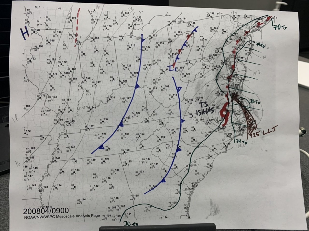
The 12Z DVN sounding has impressive mid-level lapse rates just under 9C/km. Very warm in the low levels, which means capping ahead of it should prevent any junky convection lowering the risk of a bust.

-
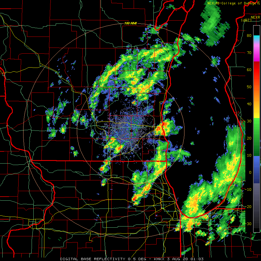
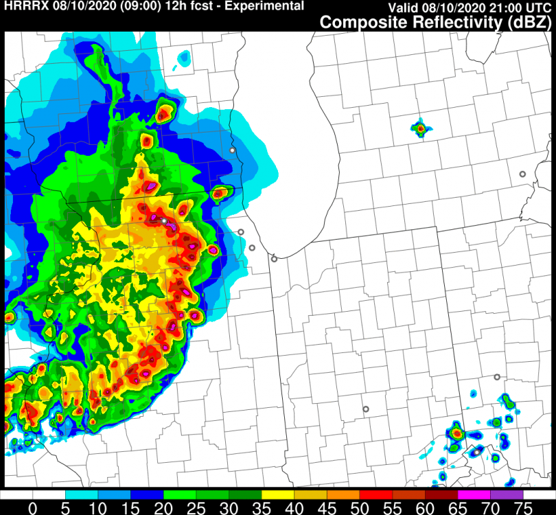
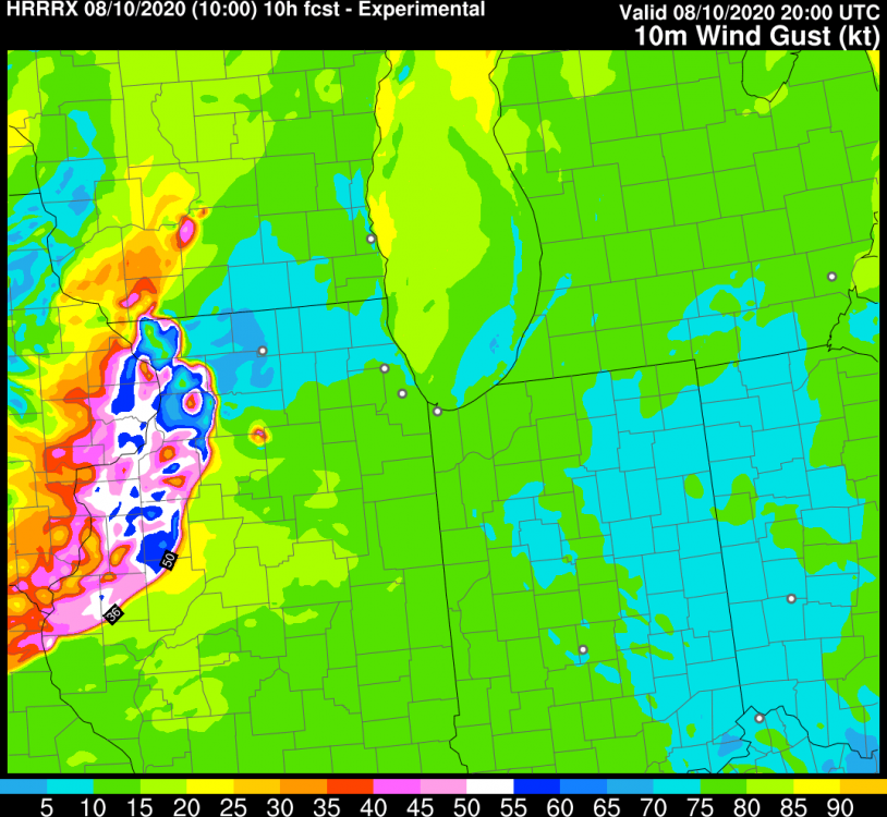
HRRRx keeps showing some small pockets of 75-85KT wind gusts, fairly widespread 55-65KT gusts. Probably some QLCS spinups in there too.
-
Pretty shocked the meh SPC outlook doesn't even mention any risk for upgrade given everything going on. Already a rear inflow jet on the SD/NE activity.
-
Jan/Feb ECM outlook fits into the standard La Nina:
-
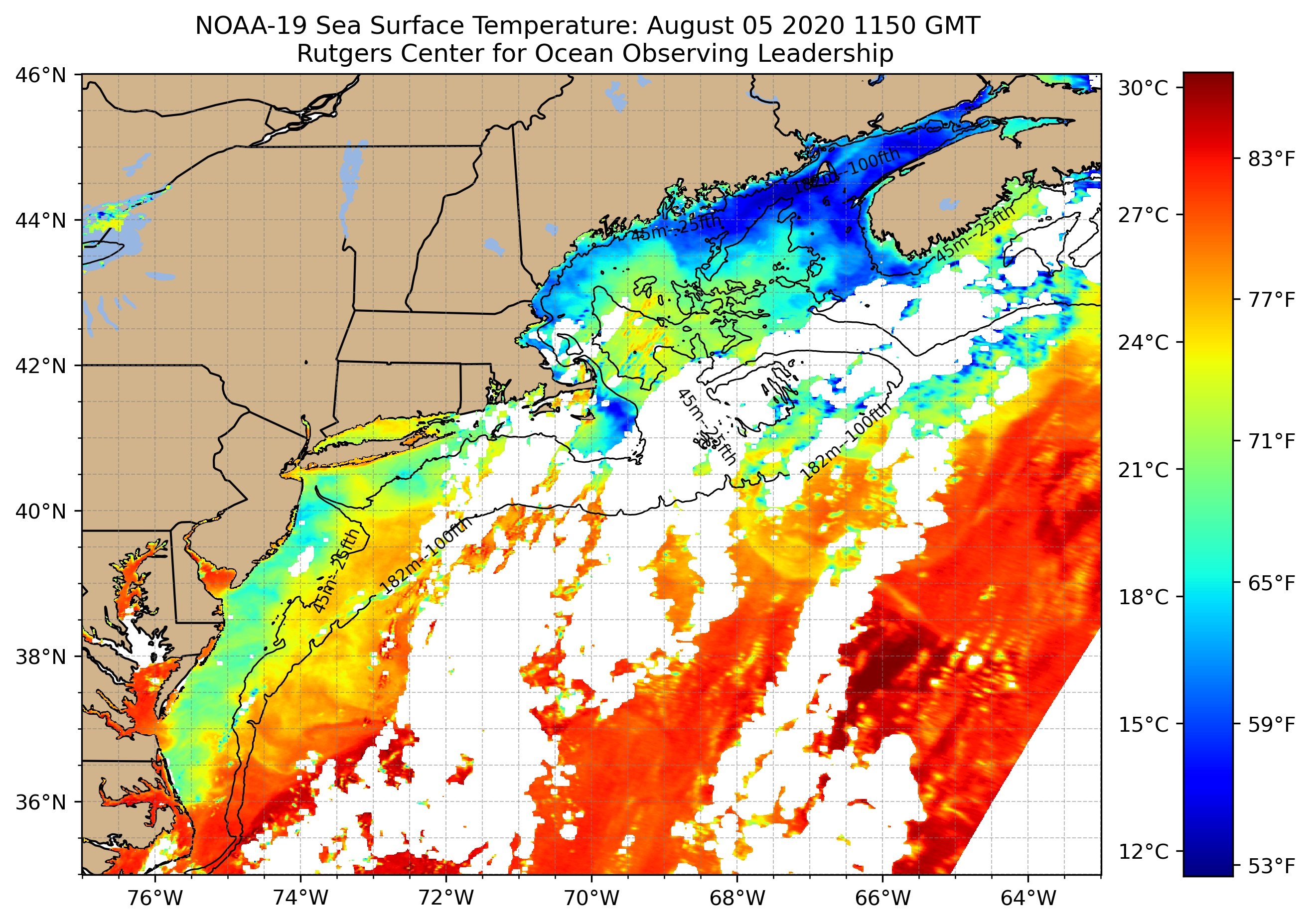
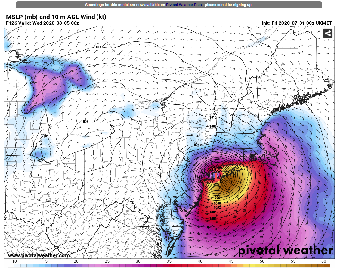
Isaias did a number on those previously-warm SSTs offshore: Will be interesting to see how/if those recover in the next few weeks.

-
Seems pretty straightforward to me. Test, trace, federal mask mandate w/ fines for non-compliance. If we’d had a total 6-week shutdown nationally in the spring, we wouldn’t have to deal with these conspiracies, mis-information and the trolls in this godawful thread.
-
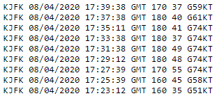
One of the tools they use at JFK Tower measured that today, as well.
- 1,530 replies
-
- 2
-

-
- heavy rain
- rip current
- (and 1 more)
-
Model wind products are at 10m because anemometers are at 10m. This is entirely due to aviation.
- 1,530 replies
-
- 4
-
-
- heavy rain
- rip current
- (and 1 more)
-
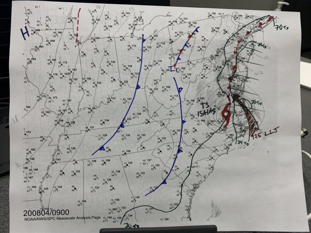
09Z surface analysis has a coastal front draped from the city down to those cells in the Delmarva. The LLJ will probably shove it back NW-W later this morning but it will likely act as a focus for any spinups.
- 1,530 replies
-
- 1
-
-
- heavy rain
- rip current
- (and 1 more)
-
because the NHC track shifted west. the heavy rain threat was always going to be west of the low's track.
- 1,530 replies
-
- 2
-
-
- heavy rain
- rip current
- (and 1 more)
-
agreed. not even seeing that in NC obs now.
-
This is where the recent heat wave and warm SSTs come into play. Allows for steeper low level lapse rates to tap into the low level jet.
- 1,530 replies
-
- 1
-
-
- heavy rain
- rip current
- (and 1 more)
-
At least three probable waterspouts out there now:
-
now up to 4.19" at MKE in the past 3 hours. radar is significantly underestimating totals there.
-
lake-effect getting going near Milwaukee now:

-
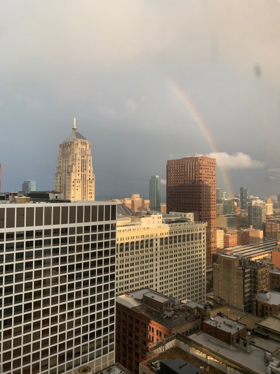
view from the office tonight
-
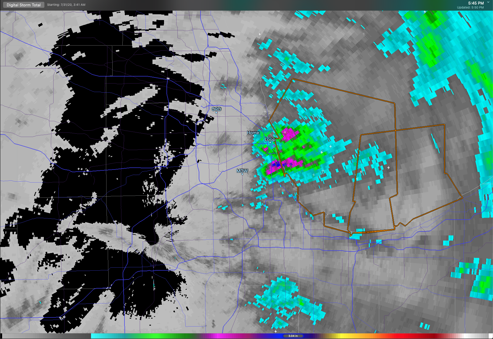
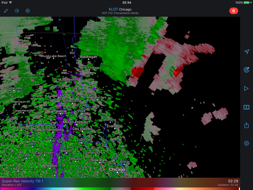
Already some rainfall totals of 1-3" across the urban core (highest south side). Given incoming storms and several rounds of lake-effect convection tonight and again tomorrow night, I'd expect some significant urban flooding will result.

-
la nina ftw
-
early monday could deliver. most 00z guidance has a meso-low over the southern end of the lake with lake-induced CAPE up to ~2000 j/kg.
-
You can always get tested so you know for sure. What you're describing definitely fits within the wide range of symptoms people experience, but it could just as easily be something else.
-
I'd add the "plandemic" video and widespread sharing of pseudo-science and misinformation on social media to that list. And maybe mental illness.
-
TN is the 4th fattest and 10th poorest state.
-
https://www.wrh.noaa.gov/mesowest/timeseries.php?sid=KORD&num=72&banner=NONE&hfmetars=1
-
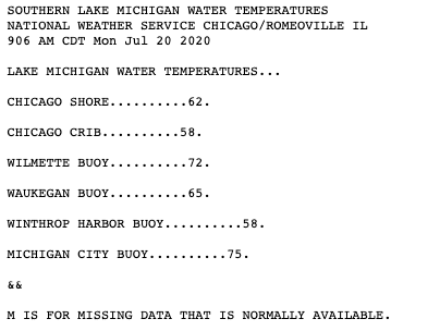
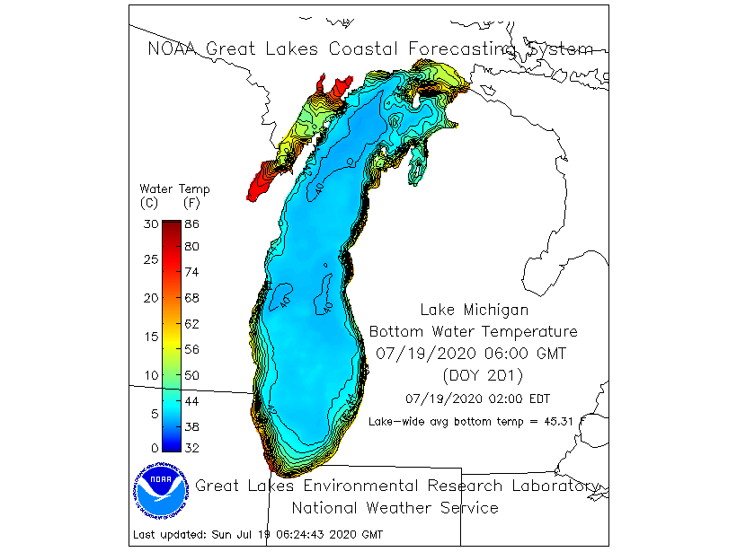
Current surface water temps on southern parts of LM: Goes to show you how easy it is to wipe out shallow warmth, especially when deeper parts of the lake have temps in the low 40s.