Sw NC weather
-
Posts
583 -
Joined
-
Last visited
Content Type
Profiles
Blogs
Forums
American Weather
Media Demo
Store
Gallery
Everything posted by Sw NC weather
-

2019/2020 Mountains and Foothills Fall/Winter Thread.
Sw NC weather replied to Tyler Penland's topic in Southeastern States
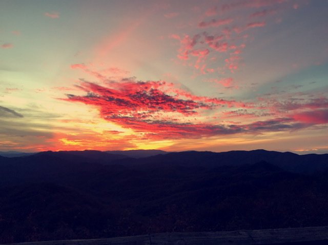
Here’s a little eye candy!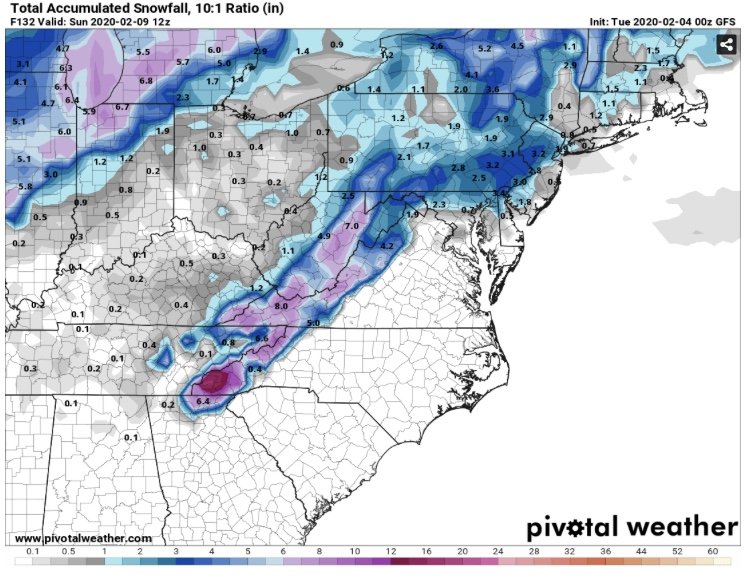
-
2019/2020 Mountains and Foothills Fall/Winter Thread.
Sw NC weather replied to Tyler Penland's topic in Southeastern States
Euro was a close miss, it has the storm just a little too warm. Northern mountains and the smokies actually fair well. -
2019/2020 Mountains and Foothills Fall/Winter Thread.
Sw NC weather replied to Tyler Penland's topic in Southeastern States
This is the best look we’ve had all winter within 5 days. A good warning event would go a long way on easing the pain of this winter. -
2019/2020 Mountains and Foothills Fall/Winter Thread.
Sw NC weather replied to Tyler Penland's topic in Southeastern States
I’m excited to see what the euro says this might be a legit threat. -
2019/2020 Mountains and Foothills Fall/Winter Thread.
Sw NC weather replied to Tyler Penland's topic in Southeastern States
It was so close to being a nice event for us when I rode into Franklin earlier there was a good mix and mostly snow when rates were present. -
2019/2020 Mountains and Foothills Fall/Winter Thread.
Sw NC weather replied to Tyler Penland's topic in Southeastern States
Well it was fun to see the snow flying but we lacked precipitation. Only received .06 of precip which amount to a light skiff of snow on elevated surfaces congrats to the southern mountains. -
2019/2020 Mountains and Foothills Fall/Winter Thread.
Sw NC weather replied to Tyler Penland's topic in Southeastern States
I wouldn’t complain with the 3-6 inches the Nam shows for me but man oh man if we could be just a degree or two colder it drops a inch of precipitation. -
2019/2020 Mountains and Foothills Fall/Winter Thread.
Sw NC weather replied to Tyler Penland's topic in Southeastern States
Wouldn’t a north west trend help get better rates here that would help with dynamic cooling. -
2019/2020 Mountains and Foothills Fall/Winter Thread.
Sw NC weather replied to Tyler Penland's topic in Southeastern States
Nam looks great for the Wednesday system solid 2-5 inches across wnc and it’s still snowing. -
2019/2020 Mountains and Foothills Fall/Winter Thread.
Sw NC weather replied to Tyler Penland's topic in Southeastern States
Wow was you right, I don’t have any access to maps but there’s some in the mid to long range forum. Hint hint it’s a blizzard. -
2019/2020 Mountains and Foothills Fall/Winter Thread.
Sw NC weather replied to Tyler Penland's topic in Southeastern States
I’m beginning to become intrigued by the Monday system. The models have been trending fairly good for us. I know it’s the 84hr Nam but it would probably be a 2-4 inch event for the southern and central mountains. It’ll be interesting to see what the models look like by tomorrow evening. -
2019/2020 Mountains and Foothills Fall/Winter Thread.
Sw NC weather replied to Tyler Penland's topic in Southeastern States
It’s been disappointing up here too this year. Yes, I have picked up 2.2 inches but a lot of the time I have that by the end of the first week of December. I’m hopeful we’re heading towards a pattern that a lot of us on here can at least score a decent event. -
2019/2020 Mountains and Foothills Fall/Winter Thread.
Sw NC weather replied to Tyler Penland's topic in Southeastern States
Thank God you guys are so much more sensible then they are. They live and die by every model run. But moving on I do feel as if will be tracking at least a mod event by the end of January. -
2019/2020 Mountains and Foothills Fall/Winter Thread.
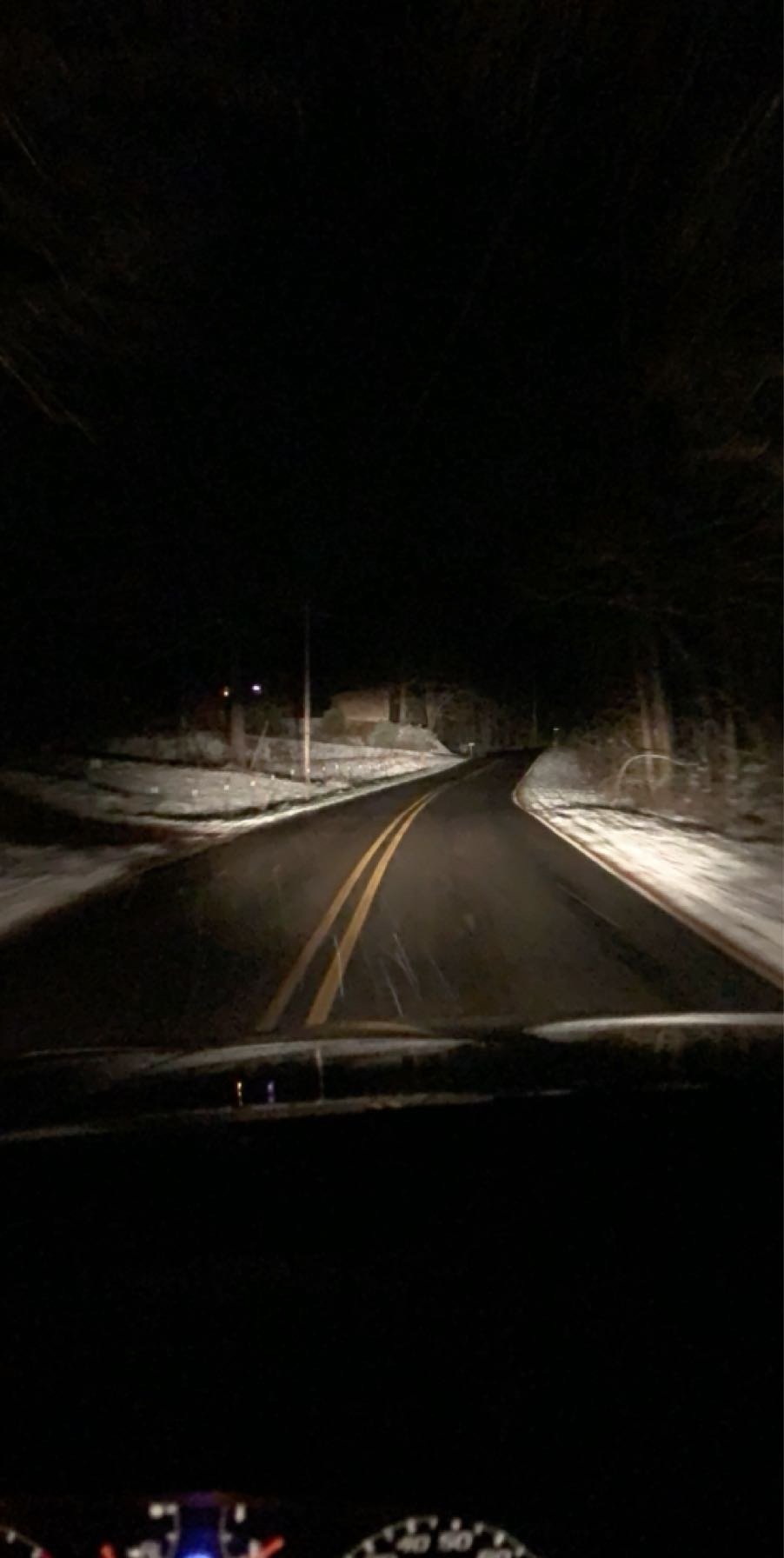
Sw NC weather replied to Tyler Penland's topic in Southeastern States
What a surprise I’ve got right at a inch on everything except the roads. With light flurries still.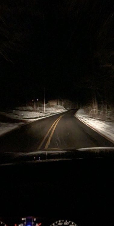
-
2019/2020 Mountains and Foothills Fall/Winter Thread.
Sw NC weather replied to Tyler Penland's topic in Southeastern States
This band means business absolutely ripping here elevated surfaces have a 1/2 inch -
2019/2020 Mountains and Foothills Fall/Winter Thread.
Sw NC weather replied to Tyler Penland's topic in Southeastern States
Hrrr has all of WNC getting accumulating snowfall by in the morning. -
2019/2020 Mountains and Foothills Fall/Winter Thread.
Sw NC weather replied to Tyler Penland's topic in Southeastern States
-
2019/2020 Mountains and Foothills Fall/Winter Thread.
Sw NC weather replied to Tyler Penland's topic in Southeastern States
Can’t believe there’s not more chatter on here, I think we might have a shot at some snow in the 8-10 day timeframe. Euro looks interesting. -
2019/2020 Mountains and Foothills Fall/Winter Thread.
Sw NC weather replied to Tyler Penland's topic in Southeastern States
We’re having one of the strongest storms we’ve had in a few months high winds, hail, and raining like crazy! -
2019/2020 Mountains and Foothills Fall/Winter Thread.
Sw NC weather replied to Tyler Penland's topic in Southeastern States
EPS mean is over an inch for Bryson City, so the trend continues -
2019/2020 Mountains and Foothills Fall/Winter Thread.
Sw NC weather replied to Tyler Penland's topic in Southeastern States
18z GFS holds serve for a modest event around the day 9 timeframe. Was real close to being special. Maybe the euro will come around. -
2019/2020 Mountains and Foothills Fall/Winter Thread.
Sw NC weather replied to Tyler Penland's topic in Southeastern States
I know it the nam at 84 hrs but it drops 2-4 inches of snow post front. -
2019/2020 Mountains and Foothills Fall/Winter Thread.
Sw NC weather replied to Tyler Penland's topic in Southeastern States
Yes, with the secondary low forming in the gulf, it definitely has potential. -
2019/2020 Mountains and Foothills Fall/Winter Thread.
Sw NC weather replied to Tyler Penland's topic in Southeastern States
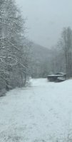
Light snow here at the moment with a 1/4 inch on elevated surface and ground starting to get some coverage. -
2019/2020 Mountains and Foothills Fall/Winter Thread.
Sw NC weather replied to Tyler Penland's topic in Southeastern States
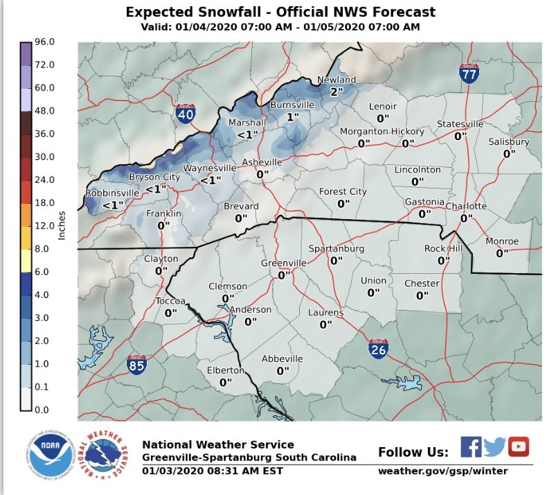
According to the 3 km NAM y’all higher elevation people are in for your first big snow of the year!