midatlanticweather
-
Posts
4,917 -
Joined
-
Last visited
Content Type
Profiles
Blogs
Forums
American Weather
Media Demo
Store
Gallery
Everything posted by midatlanticweather
-

2021 Mid-Atlantic Severe Weather - General Discussion
midatlanticweather replied to Kmlwx's topic in Mid Atlantic
@mappy was active on twitter about an hour ago. I think she was aware and keeping safe -
Things remain calm compared to earlier! Winds sustained 10 to 20mph and even lower at times. Not much happening.
-
Yikes
-
I am in Purcellville, and right now, we are the least windy we have been in a long while.. Will let all know if the second line brings it all back.
-
That line of showers brought some of the best severe winds of the Spring! WOW!
-
That line of showers brings the gusts down! Had about 5 minutes of sustained winds bouncing up to 45 to 50mph but I had no way to measure the gusts! WOW! Watch out when the showers come through!
-
2021 Mid-Atlantic Severe Weather - General Discussion
midatlanticweather replied to Kmlwx's topic in Mid Atlantic
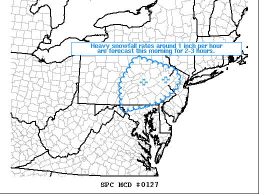
https://www.spc.noaa.gov/products/md/md0468.html -
27.5 for my low this morning. Brisk feel out there!
-
Graupel pretty heavy up here in Fredrick Maryland, where I happen to be today.
-
2021 Mid-Atlantic Severe Weather - General Discussion
midatlanticweather replied to Kmlwx's topic in Mid Atlantic
That next warning Polygon is yuuuge -
2021 Mid-Atlantic Severe Weather - General Discussion
midatlanticweather replied to Kmlwx's topic in Mid Atlantic
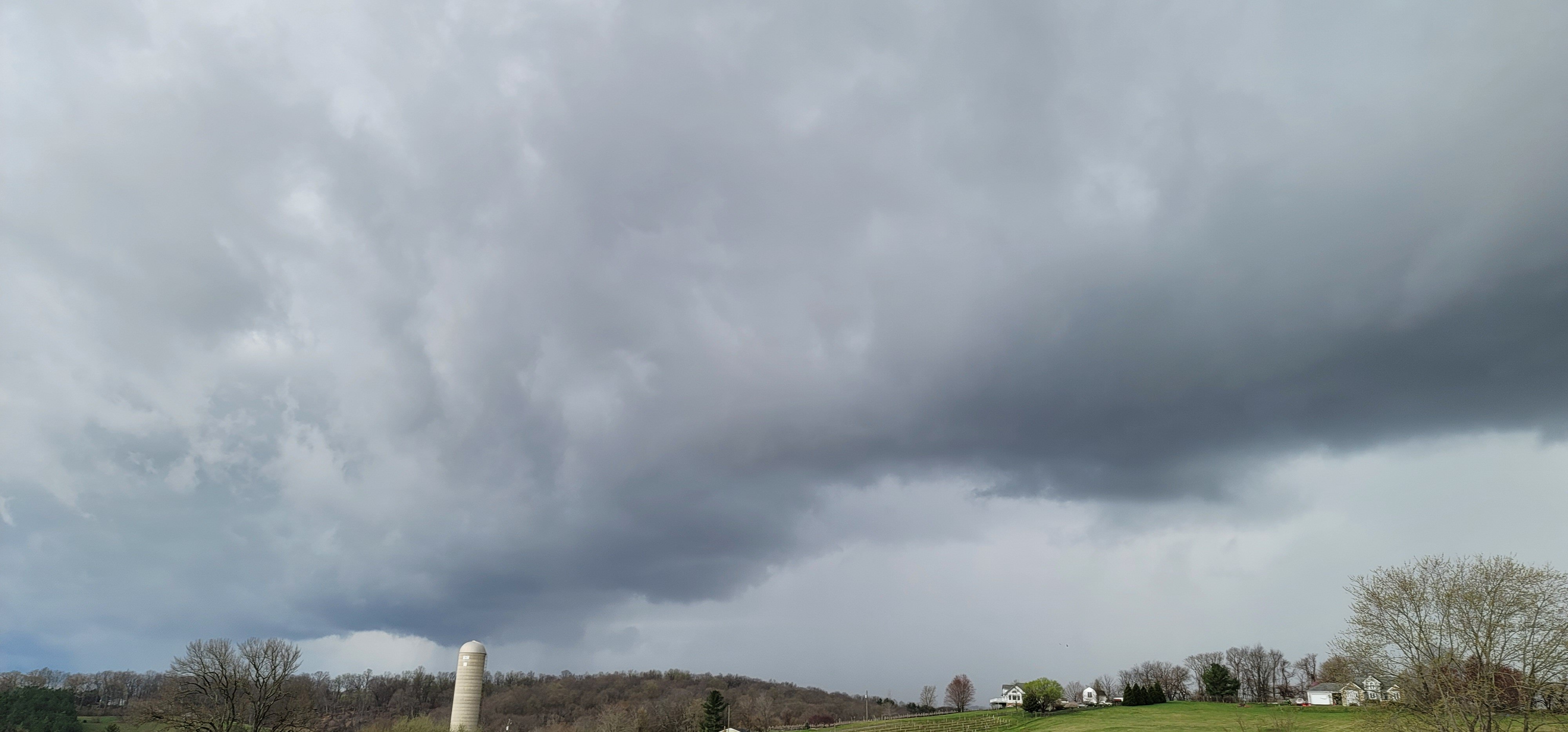
Before they hit Purcellville
-
2021 Mid-Atlantic Severe Weather - General Discussion
midatlanticweather replied to Kmlwx's topic in Mid Atlantic
Watch for areas that have not had the front yet. -
2021 Mid-Atlantic Severe Weather - General Discussion
midatlanticweather replied to Kmlwx's topic in Mid Atlantic
Those things are moving fast. Cold winds and heavy rain came through fast. -
2021 Mid-Atlantic Severe Weather - General Discussion
midatlanticweather replied to Kmlwx's topic in Mid Atlantic
Getting some minor rotation in one of the cells near Berryville -
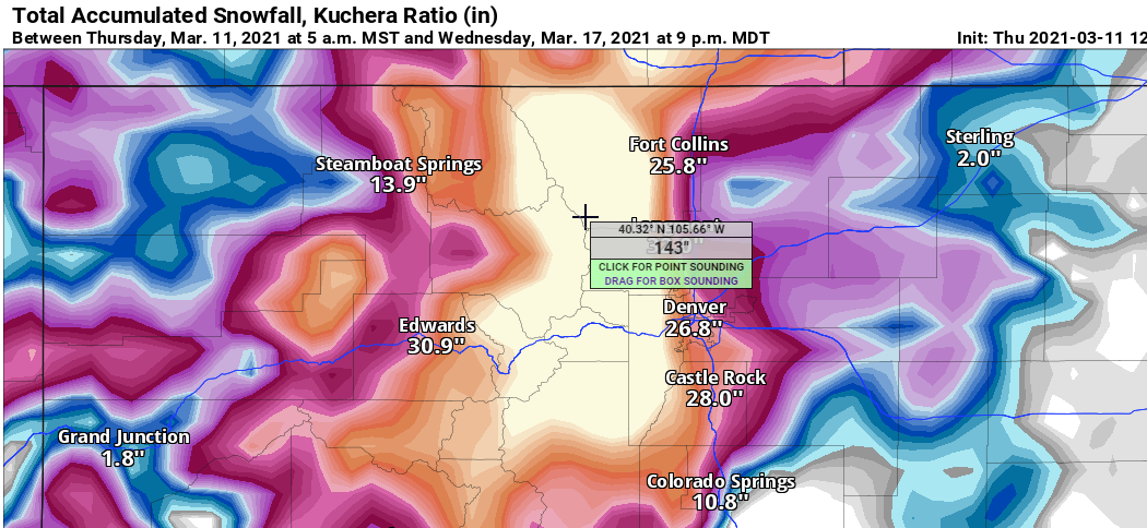
Hovering over areas west of Denver are now into the 100+ inches category between now and next Wednesday on the GFS! I saw up to 143 inches on Kuchera!
-
How about those amounts forecasted in Denver from the GFS! Insanity!
-
This would have been a nice end to winter... if only!
-
I see that it is official that Hurricane tracking by NHC will start May 15th. https://forecast.weather.gov/product.php?site=NWS&product=PNS&issuedby=NHC 000 NOUS41 KNHC 021258 PNSNHC Public Information Statement NWS National Hurricane Center Miami FL 800 AM EST Tue Mar 2 2021 To: NWS Partners, Users, and Employees From: Michael J. Brennan Branch Chief, Hurricane Specialist Unit National Hurricane Center Subject: Routine issuance of the Atlantic basin Tropical Weather Outlook beginning on May 15, 2021 In order to provide more frequent information on the potential for tropical cyclone formation as the official June 1 start of the Atlantic hurricane season approaches, the National Hurricane Center will begin routine issuance of the Atlantic Tropical Weather Outlook (TWO) and the Graphical TWO at 800 AM EDT (1200 UTC) May 15, 2021. Given recent increased tropical cyclone activity in the Atlantic basin in late May, routine issuance of the Atlantic TWO starting on May 15 offers a service improvement over unscheduled Special TWOs that are issued to discuss the possibility of tropical cyclone formation prior to the official start of hurricane season on June 1. The Atlantic TWO can be found under AWIPS header MIATWOAT and WMO header ABNT20 KNHC. The TWO and Graphical TWO can also be found online at hurricanes.gov. Any questions or comments on this change should be directed to: Michael J. Brennan Branch Chief, Hurricane Specialist Unit [email protected]
-
Nice rates, l grass, cars, and of course, decks covered.
-
Wet snow in Purcellville for the last half hour
-
39.120110 -77.743760
-
-
Flakes in Purcellville, but it is pretty light