midatlanticweather
-
Posts
4,576 -
Joined
-
Last visited
Content Type
Profiles
Blogs
Forums
American Weather
Media Demo
Store
Gallery
Everything posted by midatlanticweather
-

2021 Mid-Atlantic Severe Weather - General Discussion
midatlanticweather replied to Kmlwx's topic in Mid Atlantic
Looked a little bow-like on radar just west of Loudoun All Western Loudoun now in a Severe Warning now. EDIT: The bow-like look collapsed after this frame..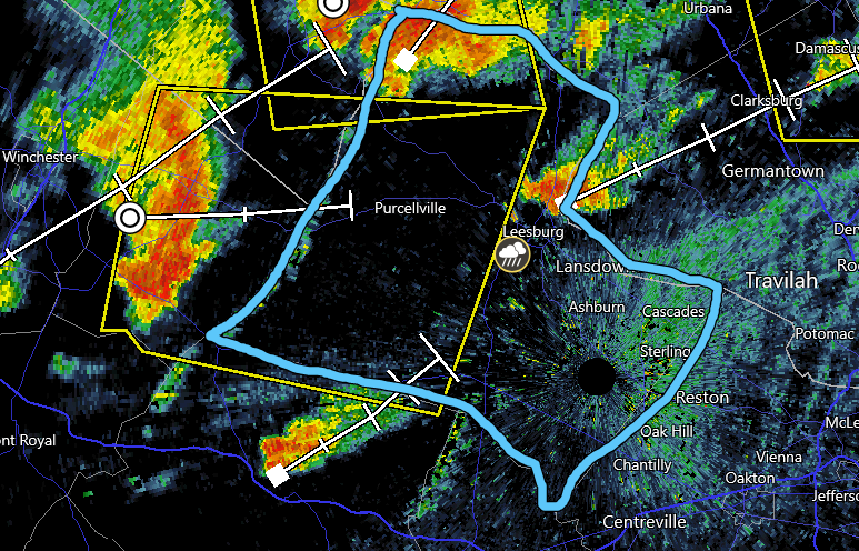
-
2021 Mid-Atlantic Severe Weather - General Discussion
midatlanticweather replied to Kmlwx's topic in Mid Atlantic
What is about to happen just north of Loudoun? Interesting look as these two storms collide.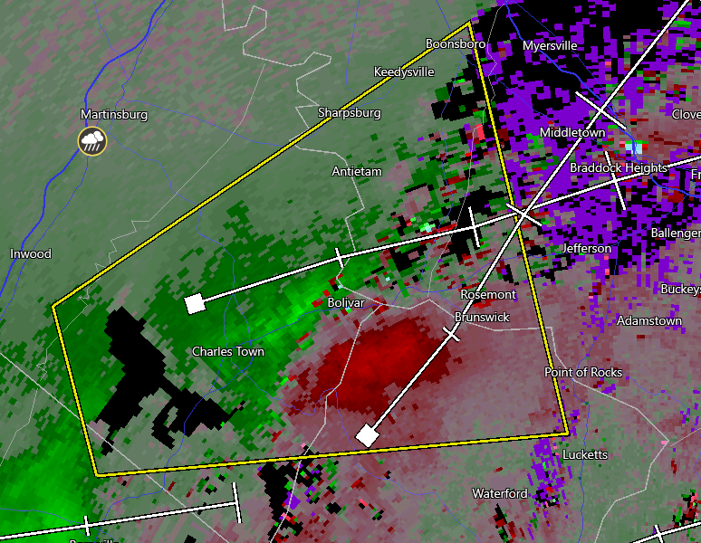
-
2021 Mid-Atlantic Severe Weather - General Discussion
midatlanticweather replied to Kmlwx's topic in Mid Atlantic
Radarscope picked up on there being a possible TVS out near Winchester.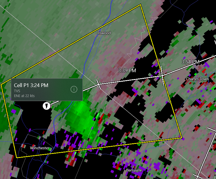
-
2021 Mid-Atlantic Severe Weather - General Discussion
midatlanticweather replied to Kmlwx's topic in Mid Atlantic
Thought it looked a bit interesting as well. -
2021 Mid-Atlantic Severe Weather - General Discussion
midatlanticweather replied to Kmlwx's topic in Mid Atlantic
SW Loudoun Storm looks like it may be rotating a little. Not tight.. but interesting. The other storm in Northern Loudoun into Maryland is now severe. ---------------------- BULLETIN - IMMEDIATE BROADCAST REQUESTED Severe Thunderstorm Warning National Weather Service Baltimore MD/Washington DC 314 PM EDT Thu Jun 3 2021 The National Weather Service in Sterling Virginia has issued a * Severe Thunderstorm Warning for... Northwestern Montgomery County in central Maryland... South central Frederick County in north central Maryland... Northeastern Loudoun County in northern Virginia... * Until 400 PM EDT. * At 314 PM EDT, a severe thunderstorm was located near Point Of Rocks, or near Poolesville, moving east at 25 mph. HAZARD...60 mph wind gusts and quarter size hail. SOURCE...Radar indicated. IMPACT...Damaging winds will cause some trees and large branches to fall. This could injure those outdoors, as well as damage homes and vehicles. Roadways may become blocked by downed trees. Localized power outages are possible. Unsecured light objects may become projectiles. * Locations impacted include... Germantown, Boyds, Clarksburg, Adamstown, Monrovia, Barnesville, Dickerson, Beallsville, Tuscarora, Lucketts and Park Mills. -
2021 Atlantic Hurricane Season Tracking Thread
midatlanticweather replied to WxWatcher007's topic in Mid Atlantic
Just working on compiling the Hurricane History around the Northern Virginia area. Anyone have some good resources that will help me in my endeavors? Thanks, and welcome to the season! -
0.37 from this event so far! Robbed!
-
Some of the temp forecasts are quite insane for highs on Saturday and Sunday! The pool may be where you could go to warm up! 40s showed up on the NAM (I know it is overdone) but WTH!
-
2021 Mid-Atlantic Severe Weather - General Discussion
midatlanticweather replied to Kmlwx's topic in Mid Atlantic
They heard you!
-
2021 Mid-Atlantic Severe Weather - General Discussion
midatlanticweather replied to Kmlwx's topic in Mid Atlantic
I see the trajectory gives me that feeling too! I see it happen a lot if times here in Purcellville in similar set ups... but a lot of heat and moisture east of the mountains today could keep them going or help them intensify.. so I have hope! -
2021 Mid-Atlantic Severe Weather - General Discussion
midatlanticweather replied to Kmlwx's topic in Mid Atlantic
Got our meso. Watch possible -
Great day of .60" of rain here in Purcellville! Happy to have every drop of it!
-
OK - 91.8 for the high and some humidity to boot! The winds makes it feel a bit more tolerable, but wow it is down right hot! How I hate the heat! And, wow we need rain! I mowed yesterday and have never sneezed so much in my life! The dust and pollen are ridiculous.
-
I was mistaken that they had not made it to Purcellville. They can be heard clearly in the woods making themselves known. I am on old farm land with only a few splotches of trees. They are not in my backyard but close by
-
Nothing much if anything in Purcellville. We were always riding the fence on whether they had really infested the area. I am going to say they have not. In Sterling the last go round it was insanity. If I see any it will likely be because they got caught up in the wind than actually invading the area.
-
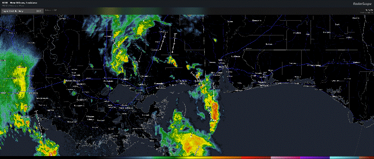
Louisiana system got a little eye
-
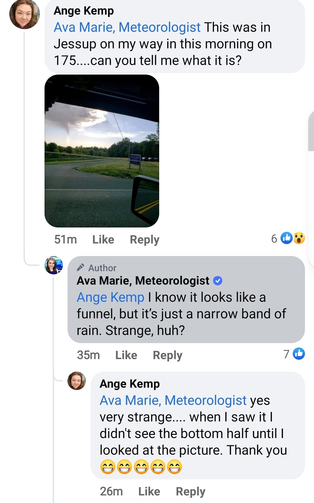
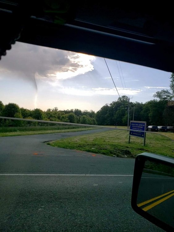
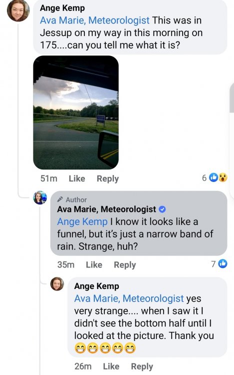
Saw this on an FB post response from Ava Marie.. It almost does look like a small funnel on there.
-
Looks like graupel falling pretty heavy briefly in Purcellville
-
Wow. 37 for a low is kind of impressive.
-
Those little heavier showers have some broad rotation in them even! LOL!
-
Just sprinkles out here in Purcellville today! So little that my rain gauge has not measured anything! I was in Leesburg earlier today and they seemed to have quite a bit more of rain, but this has not been a heavy rain producer in my area
-
41 degrees for a low! Chilly out there
-
How about that https://forecast.weather.gov/wwamap/wwatxtget.php?cwa=hfo&wwa=winter storm watch Hawaii winter storm watch
-
2021 Mid-Atlantic Severe Weather - General Discussion
midatlanticweather replied to Kmlwx's topic in Mid Atlantic
Seems that way when looking at it closer!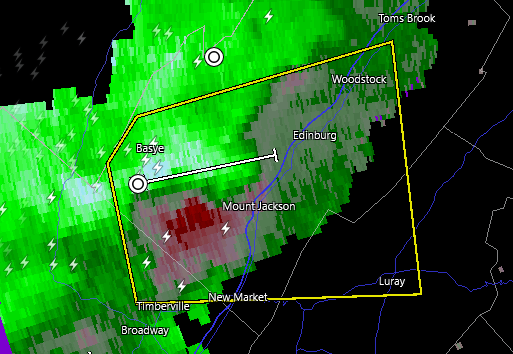
-
2021 Mid-Atlantic Severe Weather - General Discussion
midatlanticweather replied to Kmlwx's topic in Mid Atlantic
@mappy was active on twitter about an hour ago. I think she was aware and keeping safe