midatlanticweather
-
Posts
4,576 -
Joined
-
Last visited
Content Type
Profiles
Blogs
Forums
American Weather
Media Demo
Store
Gallery
Everything posted by midatlanticweather
-

Jan 15-16 Storm Thread 3: Obs and Disco
midatlanticweather replied to stormtracker's topic in Mid Atlantic
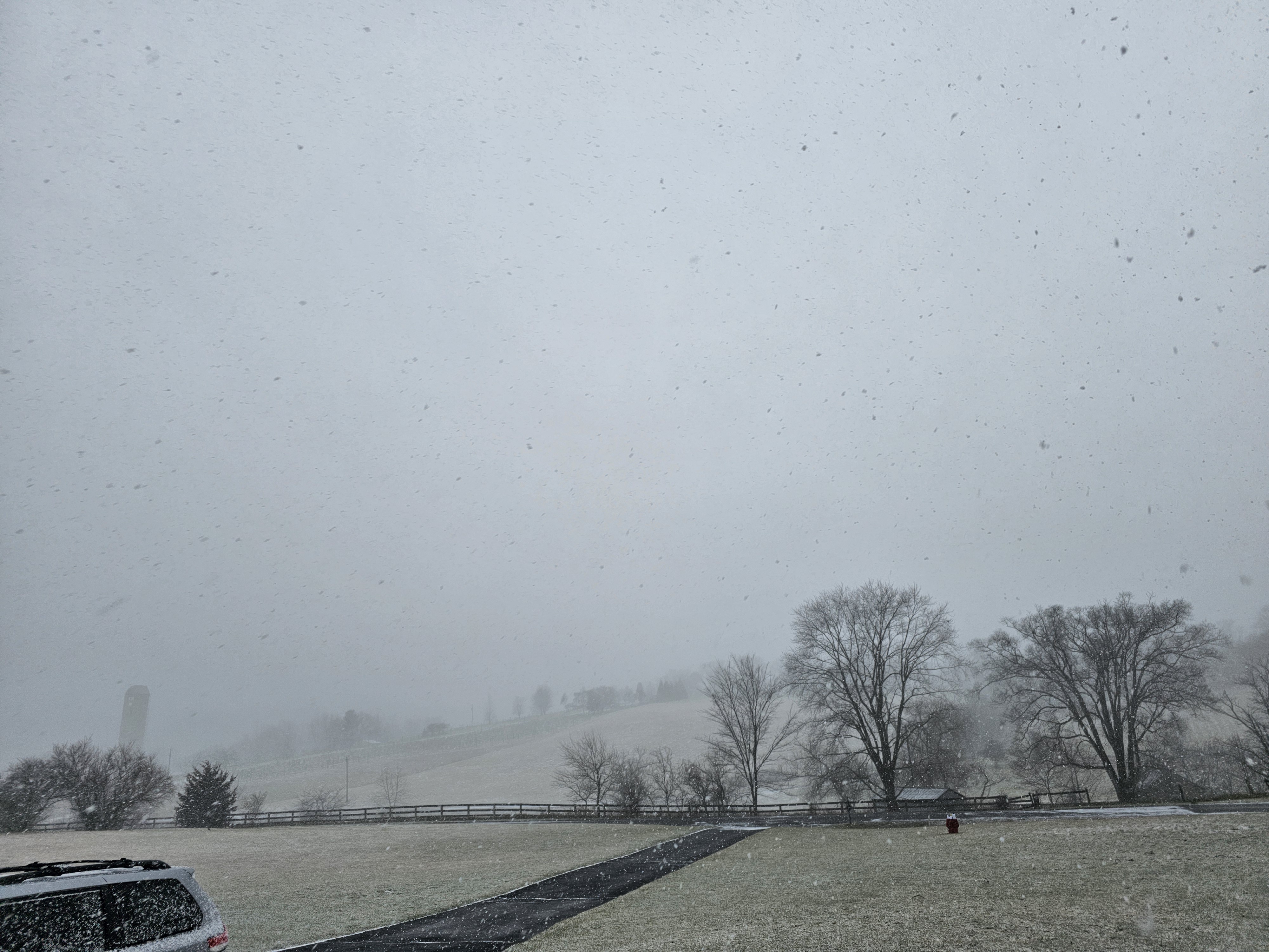
Finally seeing an uptick in snow. Been slow to get going. All surfaces are now white -
Jan 15-16 Storm Thread 3: Obs and Disco
midatlanticweather replied to stormtracker's topic in Mid Atlantic
Barely anything out this way. Maybe 0.2 on some surface. Been pixies and super light stuff most of the day. -
Jan 15-16 Storm Thread 3: Obs and Disco
midatlanticweather replied to stormtracker's topic in Mid Atlantic
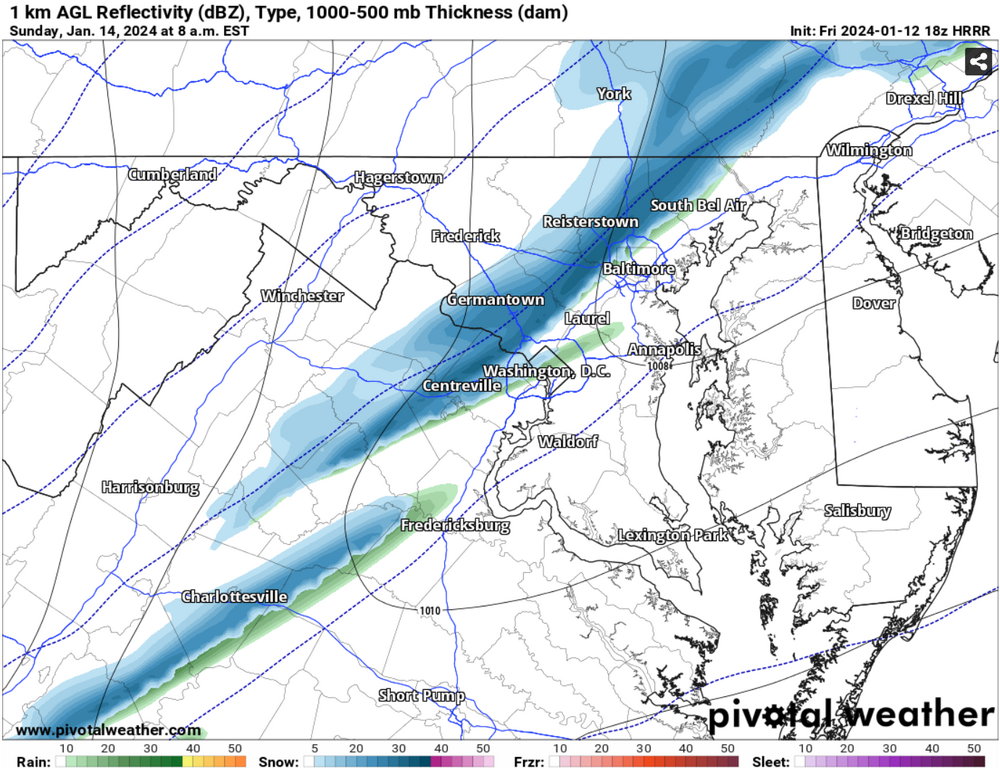
mPing shows a report down in Fredericksburg. I am at 25 with a dp of 3. Virga storm seems likely -
Jan 15-16 Storm Threat Thread: The Return of Hope??
midatlanticweather replied to stormtracker's topic in Mid Atlantic
Pepperidge Farms Remembers
-
Jan 15-16 Storm Threat Thread: The Return of Hope??
midatlanticweather replied to stormtracker's topic in Mid Atlantic
Their discussion said they would likely wait until late this evening. Has to be coming soon. -
Jan 15-16 Storm Threat Thread: The Return of Hope??
midatlanticweather replied to stormtracker's topic in Mid Atlantic
JI and I are fringed! Me more than him! LOL! I expected us all to get barely anything, so these are nice trends! KEEP them coming! -
Winds are whipping now like crazy! 32mph sustained.. gusts well in the 40s! 33 degrees!
-
If we could get several hours of this I would be happy

-
Jan Medium/Long Range Disco 2: Total Obliteration is Coming
midatlanticweather replied to Jebman's topic in Mid Atlantic
Well, Lucy has served up another one. As long as we get a notarized document by the Euro that she will not pull the ball then maybe we will get something! LOL! -
Jan 15-16 Storm Threat Thread: Do we finally win or get Saltburned?
midatlanticweather replied to H2O's topic in Mid Atlantic
You mean after it took away the storm it advertised... until it didn't.. Just a note! Euro was in on a storm early! NO ONE else was. Then the other models were and the Euro said - NOPE! -
Jan 15-16 Storm Threat Thread: Do we finally win or get Saltburned?
midatlanticweather replied to H2O's topic in Mid Atlantic
Every dang time recently!- 425 replies
-
- 5
-

-

-
- jinx
- kiss of death
- (and 3 more)
-
Jan 15-16 Storm Threat Thread: Do we finally win or get Saltburned?
midatlanticweather replied to H2O's topic in Mid Atlantic
Ya.. 18z looked terrible for both! -
Where to post this one? Maybe a quick snow squall Sunday with the Arctic front?
-
Jan 15-16 Storm Threat Thread: Do we finally win or get Saltburned?
midatlanticweather replied to H2O's topic in Mid Atlantic
^ Complications usually mean fail. I am the Deb.. but when we get things complicating possibilities, the safer bet is on failure. Seems we will have some snow flying around on Tuesday, but nothing super significant... I have some hope that the eastern part of the area gets some juice as things move towards the coast. I dunno.. It seems close to a whiff for us west and NW folks if the trending means anything. Yes, the Euro improved, but it is not like it came back to something too exciting. Later week now has more excitement. Cold week with some snow is not terrible.- 425 replies
-
- 3
-

-
-
-
- jinx
- kiss of death
- (and 3 more)
-
Jan 15-16 Storm Threat Thread: Do we finally win or get Saltburned?
midatlanticweather replied to H2O's topic in Mid Atlantic

- 425 replies
-
- 5
-

-
- jinx
- kiss of death
- (and 3 more)
-
Jan Medium/Long Range Disco 2: Total Obliteration is Coming
midatlanticweather replied to Jebman's topic in Mid Atlantic
Win means something different to many people on here! What you are speaking about is a nuisance event that should not require this much work to follow! LOL! Just sayin' - Most all of us are in for the big dogs. We will all take and love the 2 inch snow, but we all dream of the 10"+ or more storms (some even more than that!) I do get what you are saying though.. any snow is a win. But is it a big win or a little one! Most want to buy a Powerball ticket to win the big jackpots and not the scratch offs! -
Jan Medium/Long Range Disco 2: Total Obliteration is Coming
midatlanticweather replied to Jebman's topic in Mid Atlantic
Another note, the storm is again changing characteristics related to which wave will do what. When things like this happen we know we do not have the final picture. I hope the final becomes a better one than worse one. As of now, we do not know anything. It seems like, no matter what, an area of snow will be possible in the region. Who gets what is completely unknown. Now I am just being captain obvious -
Jan Medium/Long Range Disco 2: Total Obliteration is Coming
midatlanticweather replied to Jebman's topic in Mid Atlantic
This is exactly what I think, but I am always a Deb on complicated setups. I get that worried feeling that the wave snows south, blows up out at sea and curls back in for NE. Leaves us a hole. Maybe that curl back is a stretch but I had a moment thinking of December 2010, I think, with the big old hole over us. Painful -
Jan Medium/Long Range Disco 2: Total Obliteration is Coming
midatlanticweather replied to Jebman's topic in Mid Atlantic
Saw the same but I like the word "Tick" better! In many ways I thought it looked the same. I did see the TPV being a bit different and little modification in the energy. Need some better people than me to do proper analysis! Will look forwards to the ensembles -
Jan Medium/Long Range Disco 2: Total Obliteration is Coming
midatlanticweather replied to Jebman's topic in Mid Atlantic
Just need more precip and a wider precip shield! WHAT AM I TALKING ABOUT! This was awesome! Keep improving! Euro - get a clue and come back to the party please! -
Jan Medium/Long Range Disco 2: Total Obliteration is Coming
midatlanticweather replied to Jebman's topic in Mid Atlantic
Is there model validation on specific ensembles? Like certain ones are more reliable than others? Just curious -
Jan Medium/Long Range Disco 2: Total Obliteration is Coming
midatlanticweather replied to Jebman's topic in Mid Atlantic
5 day model losses storm rule? Weenie handbook item from long ago? But having it completely disappear is just so strange! Ensemble time! BUT this is disheartening to say the least -
Jan Medium/Long Range Disco 2: Total Obliteration is Coming
midatlanticweather replied to Jebman's topic in Mid Atlantic
I bet everything speeds up and it is not a 24-hour event! LOL! These things always end up being quick even when modeled for a long time. Maybe you were being sarcastic.. I cannot think of on event that took so long. -
Jan Medium/Long Range Disco 2: Total Obliteration is Coming
midatlanticweather replied to Jebman's topic in Mid Atlantic
The pattern did get better. We do not have ideal set ups ever now when we get close to an event. We do not need ideal.. We need cold and then a storm in the southern branch and something to lock the cold in place for the duration of the precipitation event. Keep it simple.. Look for the simple.. And the details will be cleared up when we approach. We do not do complicated well.. If it gets complicated bet in fail. As PSU has said, we always need luck. Sometimes the pattern makes it more likely we will get lucky. We want to see those features get better as we approach storm time.. If they step back on subsequent runs of models, you know your luck is likely to run out. Doesn't mean in the end you don't get lucky, but you better hedge your bets. I am being captain obvious here. Let's get the cold and the cutter off the table and see if some better stuff shows up. That is all we can do. The thing that seems certain for next week is colder air will be around -
Jan Medium/Long Range Disco 2: Total Obliteration is Coming
midatlanticweather replied to Jebman's topic in Mid Atlantic
I agree. Just not seeing the organization and important features until. It is too late