

Albedoman
-
Posts
1,118 -
Joined
-
Last visited
Content Type
Profiles
Blogs
Forums
American Weather
Media Demo
Store
Gallery
Everything posted by Albedoman
-
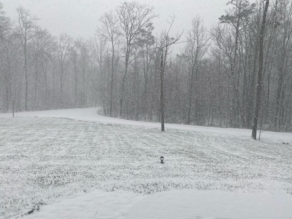
No snow whata whiff -strike two. Another sleet band coming through maybe. That will be strike three. The air coming over the Blue Mountains sucked the living hell out of available moisture to cool the profile too. Another flooding event coming with .10 rain over the next two days LOL These long range models really suck in this chaotic weather pattern. I have come to the conclusion that any significant snowfall will have to be thread the needle event until the gulf of mexico opens up for moisture availability. Its really sad that the lake effect snow region has zilcho in the snow dept. There are many ski resorts, snow mobile trial operations and snow plow contracting operations that are going to be in pretty bad shape unless this pattern breaks. https://www.weatherstreet.com/weather-forecast/Snow-Depth-US.htm
-
looks like the LV remains snowless. The dry air and drought continue on.
-
this out near Shippensburg PA. promising as our first measurable snowfall in the LV. The GFS keeps spitting out 8-12 on its runs after the New year- still not going to bite on that until Euro shows something plausible.
-
https://www.phrc.psu.edu/assets/docs/Publications/SoilFreezeDepthGuideforManufacturedHousing2ndED.pdf for a normal year
-
The May drought warning was on track until we received much above normal precip from the numerous tropical storms. No one could envision the amounts of rainfall from these numerous tropical storms. They were record breaking flood events in the LV and much of the heavy rainfall ran off after the ground water table was fully recharged, especially from Ida. The tropical storm season died in mid October and after that the spigot got shut off again. Why am I raising the alarm? Because many of you do not live in a Karst geological area. These areas are extremely sensitive to groundwater withdrawal and seasonal recharges. I have two USGS stream gauges in my backyard that I monitor and nearby Lehigh County Authority wellhead gauges. The base flows of the Little Lehigh Creek has fallen by inches and once the ground is frozen, that's it for groundwater recharge unless we get a good snowpack. Many of you expect that, I however, do not expect that unless this current weather pattern does a 180 in the next 30 days. With 1-2 ft deep frozen ground conditions, rainfall simply runs off. All I am doing is sounding the possibility of a drought if these these current conditions continue. None of you have even thought about it as you are too busy worrying about the next SECS event. By the way, the data supplied in the above maps by Hurricane Agnes is for a six month period . They are not applicable in the last 30 days as this is a critical recharge period for groundwater for the next season in our area. Again, if we do not get adequate snowfall and precip with ground water recharge in the next 30-45 days, these USGS maps will change in a hurry. Whats funny, I have an extensive hydrogeologist education and you still chose to ridicule me. Who is the snow weenie now?
-
To hell with predicting snow until around New years day. The models keep kicking that can down the street. My real concern however is not the snow but the record breaking drought conditions that are continuing in this crappy weather pattern. If we do get some significant precip in the next few weeks and by significant,--- I mean over well over an inch, drought watches and even warnings will be issued for our area in PA. This pattern of cold and dry fronts racing across our area every three days or so without precip is doing more damage to our ecosystem. Many areas rely on significant ground water recharge from Nov- Dec to keep their businesses going and supply well water and have received zilcho recharge since the second week of October. The fact that November was a little cooler than normal is the only saving grace. If this drought pattern continues, the lack of snow will not be only the only major topic to discuss in this forum. It was really unusual to see Mt Holly be concerned about wild fires in December the other day in their discussion. I would expect red flag warnings maybe issued by the end of the week if this dryness keeps up. Take a walk in any forest right now with the amount of extremely dry ground litter/leaf debris for its becoming a significant fire threat. How dry has it been ? October 31 through now-- little over 2 inches of precip at LVIA mostly in rainfall amounts of less than .25 which does nothing for groundwater recharge because of the lower humidity levels- evaporates on the surface and because of all of the daily warm record highs. Many areas have received much less rainfall too and much of the rainfall has been hit and miss. Normal rainfall at LVIA --- over 7 inches during the aforementioned same period Summation- we are in some serious trouble if January does not give us a significant/major precipitation event rain or snow. At this juncture, I would be happy with several back to back one inch rainfall events with temps between 35- 45 degrees before any moisture in the soil has a chance to freeze tight in January. Once the soils freeze without our vital recharge in place, let the drought watches begin. Landscaping firms and nurseries are cringing right now as vegetation becomes damaged from wind burn and the roots dry out before the daily temps stay below freezing. The race is on. Ski resorts which rely on surface ponds and groundwater wells to blow snow will become concerned too because under drought conditions, they will be limited on keeping their trails opened. For the other businesses like the regional water bottling companies in the LV area for the entire NE, they will be concerned too as their sources in Blue Mts start drying up. That bottlers for Deer Park, Niagara, Desani and even Nestle in Breinigsville for the entire Northeast are concerned ---believe me.
-
OH yea cannot wait when this shows up on the model for more than 3 runs. The snow weenies will come out hibernation. Talk about click bait and a tease. The GFS model cannot even predict a decent flurry right now. The only believable models is the Euro/NAM combo when the storm is in the 84 hour range. Otherwise time to put this dream storm storm to bed. The clown maps spit out over 2 ft of snow for us in the LV Currently , no where in the central and eastern US right now has even more than a foot of natural snow on the ground and they really expect me to believe this model is actually even used as "guidance" in this chaotic weather pattern? Give me a break. For the believers good luck and enjoy you dream storm. When the Euro shows it, then I may take the bait.
-
when the NAM spits out 4+, then I will jump. I love the NAM and everything is only a best guess
-
wow, two consecutive GFS runs now of 6"+ . I am thrilled. Maybe the tide is turning? LOL Lets see what the Euro spits out? Still no real good model consensus though in the long ranges. I will not budge off my 1-3" initial first thoughts for this storm until there at least two runs of the Euro in agreement to some type of 4+ snowfall. We have been burned too many times so far this season with even the light snow predictions in the LV. This is just how last season started off and this is a typical thread the needle type of storm. When the NAM sees it , I will jump on board. Basically these clown maps are click bait even at 5 days with the raging PAC jet and long range model chaos from run to run. I am sorry to say this but these long range models at least this year do not even provide proper guidance with their drastic changes every 8 hours. I am really wondering if many of the PAC ocean buoys are screwed up or do we need much more? How about launching balloons from drones to get more accurate atmospheric data to ingest into the models? Bet nobody thought of that?
-
 agree to all statements. The thing here is model consensus. I have never seen so much chaos in the models in the past two weeks both in long and short range with the raging Pac jet in the last 15 years. At least there appears to consensus at this point in the long range models that a light snow/ice accumulation event especially west of the Delaware River is now apparent. To have a 3+ inch plowable snow event though, threading of the needle has to be achieved for sure. Temps on Wednesday morning have to be several degrees below freezing at sunrise, otherwise a simple lawn covering snow/ice rain event is all that will happen. Anway, the snow will be gone by the end of the following weekend with the quick 60 degree warmup south of the NY/PA state line
 -
I was close one day off
-
My favorite: https://www.mcall.com/news/local/mc-lehigh-valley-thanksgiving-eve-snow-20141126-22-story.html
-
If the clipper hits, Nov 29. otherwise 12/2
-
I agree Walt. But IMHO, this typical model chaos for 5-10 day outlooks points out to a major pattern change in the workings which usually brings in an onslaught of Alberta Clippers/cold fronts to our area during the first week of December. December 5-7 time frame is very typical for the first accumulating snow for the tri-state area. Anything accumulating before this time frame is a bonus. These upper level lows are also notorious for setting up overrunning precip events a few days later after the frontal passage.
-
yellow jackets dead at my house but the snow chances live on. GEM says 4-6 on Tuesday Lets go. Article in Morning call, blowing snow at the ski resorts already. Maybe they know something?
-
Surprise surprise----. Clown maps indicate snow for us on 11/6. This would not be good if it came to fruition. Way too many green leaves on the trees. Most likely scenario - white rain for the LV 1-2 in for the Poconos if verified. Still we are skipping fall with this forecast. Think we will get still a good freeze though in this time period to finally end the growing season
-
I do not know about the others in this Philly region, but the LV stands a real good chance of having the latest frost ever recorded this year. I see no sub 36 degree temps so far through Nov 6. The latest frost date is Nov 13. Now that is record to beat. These overnight low temps with the high dewpoints and excessive cloud cover has led to the warmest avg overnight lows I could ever remember in 30 years I have been living here and especially in the last 4-6 months. Its like summer does not want to die. I had the ac on until last week. The same crap is now upon us for the fall season but slightly cooler daytime highs with overnight lows struggling to reach 40 degrees with again cloudy days and nights and high dewpoints. I want these dam bugs dead now with a 28 degree freeze. I may not see that until mid- November at the earliest.
-
the big issue for me is the overnight lows. Dewpoints in the mid to upper 60's--- I have had enough. The a/c has not shut off more than two days in the last few weeks when the overnight dewpoints in the 70's when i go to bed. I have never seen so many consecutive nights that have dewpoints in the 70's and in fact above 68 degrees. This situation is not great for cool season grasses for sure, weed growth is out of this world and mold production will be out of this world once the corn starts to wilt in the fields. Anyone with mold allergy problems better be prepared.
-
this will do it. Kills them within a few days. Best stuff to use. https://www.domyown.com/bifen-xts-p-1236.html
-
dream on. SOS T storms fire up in the Allegany Mts overnight wane and die out in the morning before getting to our area. We are left in the debris cloud layer from these storms all afternoon. The t storms may fire up again in the late afternoon near Harrisburg when the clouds clear out. The issue is with these storms that form near Harrisburg is that they have been quickly moving NE and are dinurally driven that miss many portions of the MT Holly region with hit and miss crap. I have seen the northern portions of the LV and southern Poconos being slammed the last several days with continuous heavy t-storms only to see anyone in eastern Berks, western Lehigh and Northern Montgomery literally bone dry. Driving around , the corn is already in full tassle in the northern areas of Lehigh County while in the southern areas, it has not even tasseled.
-
you are spot on. But in retrospect, I have had only an inch or so of rain and very little severe t- storms in western lehigh County during the entire time. Even those rains occurred overnight in dying diurnal t storms only to refire near Philly to the SE or northern NJ to the NE the next day. I swear this situation is just like winter snow storms. The severe t storms have been very localized too. What I have noticed is a persistent pattern of t storms firing up in the areas between Altoona and State College in the afternoon and racing up through NY in the last three days. Any that come east of Williamsport have either died out or missed SE PA. That 10 inch rain in Bucks county came from a dying and training t- storm yesterday. That was very telling of of the lack of steering winds in our area too from the stalled fronts.
-
No Jaindl was not scared off. The Army Corps of Engineers and PADEP refused to permit him to dredge the creek. The Little Lehigh Creek does not need dredging. There are numerous debris dams blocking the channel along with a few beaver dams as a result of the 2018 tornadoes/straight line wind tree/feled tree damage. There are hundreds of dead ash trees ready to fall soon as well.
-
Volume/rate control of stormwater plays an important part. The Little Lehigh Creek watershed was the first stream in PA to have these modern model stormwater ordinances (1982) and was used as a basis for all others municipalities/counties in the state to implement. I know because I was personally involved on the Little Lehigh and its tributaries stormwater boards. The flooding of this stream is far worse than the Neshaminy Creek in Bucks County but gets very little attention by Mt. Holly/media because there are very few physical structures actually entirely contained within the actual 100 year floodplain of the Little Lehigh Creek --33 miles worth of stream going into Berks County. I could probably count less than 50 structures in the actual 100 year floodplain and my house is one of them going all the way to the Lehigh River. Allentown residents/commercial structures are not in the actual 100 year floodplain as the Little Lehigh Creek is contained in a greenway park that was donated by General Trexler to be preserved forever, one of the largest in the entire country. The only structures in the actual floodplain are the water treatment plant near the main stem of the creek in the middle reach of the stream and the sewage treatment plant at the Lehigh River, the way it should be for any municipality when proper planning takes place. Those facilities are well protected by structural walls for flooding events too. But you are indeed correct, the Little Lehigh creek and its tributaries flood constantly on the slightest heavy rainfall event. The current flooding problem is however is not just from over development. The main problem is that the historical cement quarries/iron mines in Fogelsville area closed up in the late 80's and pumping of the Little Lehigh Creek groundwater for dewatering these quarries ceased. The natural spring flow came back to the Little Lehigh Creek and its tributaries after about 10-15 years (1996 with the great January snow melt event) and so did the natural flooding , way before any new more land development could take place. The new stormwater/ floodplain regulations are working, its just nature taking over what man screwed with over 100 years ago when they mined this area.
-
MIke, regional favoritism thats all it is. There are USGS digital gauges that Mt Holly has access too and were never used. Official Flood stages have not been set up at the newer remote stream gauges In the Trexlertown area but I set my own flooding electronic notification thresholds up myself because my property borders the streams and I visually know the exact depth in which the streams comes out of their banks. If I can do this, so can Mt Holly/USGS. I did this when we had the record flooding on the Little Lehigh last August when the Lower Macungie Township municipal building actually was severely flooded and closed for a several months as the result of this historic flooding event. That flooding event was worse than Agnes or Floyd and that is saying a lot. The FEMA floodplain lines were violated by this event as well for the mapped 100 year storm event. All I am saying is the LV deserves much more attention by the regional forecasters in the regional discussion as almost a million people live in this MSMA area and well over 300,000 people in the Little Lehigh Watershed alone. Physical structural flooding damage in our area is not as predominate as in others in the MT Holly region as the Little Lehigh Creek has strict floodplain regulations( strictest in the state) and stormwater regulations for structures(again the strictest in the state) and structural damage is usually limited to open areas and road closures. However, flooding occurs constantly. Mt. Holly cannot rely just on structural damage reports but also rely on stream gauges. and precip hourly events. That is why USGS set up digital/internet telemetry gauging stations in my backyard as this area floods way before the city of Allentown's Little Lehigh Creek gauges do since these new gauges are also located further upstream in the watershed and have digital rain gauges.
-
Another point, anything near an inch tonight will cause flooding again on the Little Lehigh Creek. Why is there no flash flood watch issued? A radar out of NJ is not the only tool in the tool chest for forecasting possible flooding. Look at the amount of precip recorded each hourover the last 24 hours on Thursday- Fridays storm at both airports. What about the USGS digital stream gauges? They do exist. A flood advisory should have been issued after 12 hours of continuous rains. Two + inch rains floods creeks. That is a no brainer. Spring Creek Rd was closed all day in Lower Macungie Township from flooding. I guess the Lehigh Valley is not in the Mt. Holly area. Forecasters are too worried about discussing potential riptides to mention the two- three inches of rain that fell across the Lehigh Valley/ Quakertown area on Thursday- Friday in their weather discussion. There is almost a million people that live in that particular forecast area. Priorities need to be reviewed.


