Albedoman
-
Posts
1,342 -
Joined
-
Last visited
Content Type
Profiles
Blogs
Forums
American Weather
Media Demo
Store
Gallery
Everything posted by Albedoman
-
one inch in Macungie better than nothing. Will be gone by Saturday afternoon. Driving will be bad in the morning on local roads as many municipalities have not salted.
-
a bunch of things can happen. 1. Since the LV has the most water bottling plants in the entire country- water withdrawal restrictions placed in a drought emergency will cause massive industrial layoffs. Water authorities can restrict however they want. 2. If the Little Lehigh goes dry again in my backyard, no trout stocking- end of fish season- pissed off fishermen. In fact stocking any trout would be ill advisable until we get sufficient rains right now. 3. Private wells going dry. Waiting weeks if not months for new wells to be drilled. Try taking showers, washing clothes and flushing toilets-- good luck. Thats doomsday for many people. 4. Restaurants start charging for water. Sinkholes keep opening up in limestone areas. No swimming due to high bacteria levels in lakes and streams. 5. No car washes open, no filling of pools and water restrictions for golf courses. see below state restrictions § 119.4. Prohibition of nonessential water uses. Whenever the Governor declares by proclamation or executive order a state of drought or water shortage emergency in an area of this Commonwealth, the following water uses shall be deemed nonessential and are prohibited within areas that have been declared to be in a state of drought or water shortage emergency, including within any public water supply agency’s service area for which a source of water is located within the designated drought emergency area. Nothing in paragraphs (1)—(4) allows a prohibited use of water as either a direct or indirect effect of the exceptions contained therein. (1) The use of any water for watering of grass, except: (i) Water may be applied to grass areas approved prior to or during the emergency as part of a sewage or storm water treatment system utilizing spray irrigation which system was approved in a permit issued by the Department prior to the drought emergency proclamation. (ii) Water may be used to establish and maintain newly seeded and sodded grass areas when applied between the hours of 5 p.m. and 9 a.m. by means of a bucket, can or hand held hose equipped with an automatic shut-off nozzle, or when applied between the hours of 7 p.m. and 11 p.m. by any other means designed and operated to ensure effective conservation. (iii) Water may be applied by a professional landscaper to establish and maintain newly seeded and sodded grass areas during working hours by any means designed and operated to ensure effective conservation. (iv) Water may be used by professional landscapers or irrigation contractors for the purpose of testing newly installed or repaired irrigation equipment for a period not to exceed 15 minutes per irrigation zone. (v) Water may be applied for the purpose of grub control one time during the effective period of the Governor’s proclamation of drought emergency. (vi) Water may be used, in a manner that ensures effective conservation, to implement revegetation following earthmoving, where revegetation is required under an erosion and sedimentation control plan adopted under state law or regulation. Revegetation use shall comply with applicable best conservation management practices for revegetation prescribed by the Department and county conservation districts. (2) The use of any water for watering athletic fields, except: (i) Water may be applied to athletic field grass areas approved prior to or during the emergency as part of a sewage or stormwater treatment system utilizing spray irrigation, which system was approved in a permit issued by the Department prior to the drought emergency proclamation. (ii) Water may be applied to maintain grass tennis courts, by means of a bucket, can or hand-held hose equipped with an automatic shutoff nozzle or by means of an irrigation system that is designed and operated to restrict the timing or total volume of water, when applied between the hours of 5 p.m. and 9 a.m. in a manner that ensures effective conservation. (iii) Water may be applied to athletic field grass areas, other than sand-based athletic field grass areas, by a means and in a manner that ensures effective conservation, between 5 p.m. and 9 a.m. during 1 night per calendar week, beginning 2 weeks prior to use of the athletic field for practice, regular season play or other organized use and continuing through the end of the same practice or regular season or other organized use, in accordance with a schedule that has been submitted, at least 7 days prior to implementation, to the Commonwealth Drought Coordinator, the local law enforcement agency and, if applicable, to the public water supply agency from which the water is obtained. (iv) Water may be applied to sand-based athletic field grass areas in accordance with a plan approved by the Commonwealth Drought Coordinator. Approval of the plan shall be in accordance with the following: (A) The quantities of water applied shall be measured by means of a volumetric meter, and reports of weekly total water use shall be submitted electronically to the Commonwealth Drought Coordinator on a monthly basis during the emergency, in a form acceptable to the Commonwealth Drought Coordinator. (B) Water may be applied at an average daily rate that does not exceed 54,300 gallons per acre per week. (C) Water shall be applied by a means and in a manner that ensures effective conservation. (D) All meters and meter records shall be made available by the athletic field operator for inspection by representatives of the local law enforcement agency or of the Commonwealth Drought Coordinator, at all times. (E) A copy of the approved plan shall be submitted to the local law enforcement agency and, if applicable, to the public water supply agency from which the water is obtained, prior to implementation. (F) Noncompliance by the water user with any term or condition of the approved plan shall cause the plan to be void, and any further use of water under this exception shall be prohibited. (v) Water may be applied to establish and maintain newly seeded or sodded grass areas by means and in a manner that ensures effective conservation. (vi) Water may be applied to athletic field nongrass areas to control dust during an athletic event, by means and in a manner that ensures effective conservation, if dust control is necessary to protect health or safety. (vii) Water may be used by professional landscapers or irrigation contractors for the purpose of testing newly installed or repaired irrigation equipment for a period not to exceed 15 minutes per irrigation zone. (3) The use of fresh water for irrigation and watering of outdoor gardens, landscaped areas, trees, shrubs and other outdoor plants except that fresh water may be: (i) Used for irrigation for the production of food and fiber, and the maintenance of livestock and poultry. (ii) Applied by means of a bucket, can, hand-held hose equipped with an automatic shut-off nozzle, or an irrigation system that is designed and operated to restrict the timing or total volume of water and to restrict the application to specific plantings and that ensures effective conservation, when applied between the hours of 5 p.m. and 9 a.m. Sources of water, other than fresh water, shall be used to the extent available. (iii) Used by nurseries to maintain stock, by a means that ensures effective conservation, only to the extent that sources of water other than fresh water adequate to supply needs are not available or feasible to use. (iv) Used by public gardens of National, State or regional significance, or arboretums to preserve specimens, by a means that ensures effective conservation, only to the extent that sources of water other than fresh water adequate to supply needs are not available or feasible to use. (v) Used by a professional landscaper or irrigation contractor during working hours, by a means that ensures effective conservation. (vi) Used, in a manner that ensures effective conservation, to implement revegetation following earthmoving, where revegetation is required under an approved erosion and sedimentation control plan adopted under state law or regulation, to the extent that sources of water, other than fresh water, adequate to supply needs are not available or feasible to use. Revegetation use shall comply with applicable best conservation management practices for revegetation prescribed by the Department and county conservation districts. (4) The use of any water for watering any portion of golf courses, except water may be applied to greens, tees and fairways in accordance with a plan submitted by the golf course operator and approved by the Commonwealth Drought Coordinator no earlier than 3 years prior to the month of use during an emergency. Approval of the plan shall be in accordance with the following: (i) The quantities of water applied shall be measured by means of a volumetric meter, and reports of daily total water use shall be submitted electronically to the Commonwealth Drought Coordinator on a monthly basis during the emergency, in a form acceptable to the Commonwealth Drought Coordinator. (ii) Water may be applied at an average daily rate that does not exceed 70% of the calendar month basis quantity. The basis quantity shall be determined for each calendar month, as follows: (A) Metered water use for the same calendar month, for each of the 5 years previous to submittal of the plan to the Commonwealth Drought Coordinator, shall be averaged, after deducting all water that was used for purposes other than irrigation of greens, tees and fairways. (B) To the extent that metered data is not available for any year prior to July 7, 2002, or the date of installation of the current irrigation system, whichever is later, an application rate of 41,000 gallons per week per acre of greens, tees and fairways currently irrigated may be used in lieu of metered data. (C) The basis quantity may not be less than 30,000 gallons per week per acre nor more than 54,000 gallons per week per acre. (iii) Except as provided in subparagraphs (vi) and (vii), water shall be applied between the hours of 5 p.m. and 10 a.m. (iv) Meters and meter records shall be made available by the golf course operator for inspection by representatives of the local law enforcement agency or of the Commonwealth Drought Coordinator, at all times. (v) A copy of the approved plan shall be submitted to the local law enforcement agency and, if applicable, to the public water supply agency from which the water is obtained, prior to implementation. (vi) Water may be applied between the hours of 10 a.m. and 5 p.m. with a hand-held hose equipped with an automatic shutoff nozzle, to syringe heat-sensitive grasses on tees, greens and fairways, in a manner that ensures effective conservation and so that water is applied to no grass area for a period exceeding 15 minutes in any 1 day. (vii) Water may be used by professional landscapers or irrigation contractors during regular work hours for the purpose of testing newly installed or repaired irrigation equipment for a period not to exceed 15 minutes per irrigation zone. (viii) Noncompliance by the water user with any term or condition of the approved plan shall cause the plan to be void, and any further use of water under this exception shall be prohibited. (5) The use of any water for washing paved surfaces, except water may be used: (i) For prewashing in preparation for recoating and sealing. (ii) At the minimum rate necessary for the maintenance of tennis courts composed of clay or similar materials, by means of a bucket, can or hand-held hose equipped with an automatic shutoff nozzle. (iii) At the minimum rate necessary for sanitation of the premises of raw or processed food, pharmaceutical or vaccine processing, storage or vending establishments, including restaurants and grocery stores. (iv) At the minimum rate necessary for the sanitation of the premises of waste handling, storage and disposal facilities. (v) At the minimum rate necessary to comply with permit conditions or other regulatory requirements. (6) The use of any water for ornamental purposes, including fountains, artificial waterfalls and reflecting pools, except: (i) Fountains or waterfalls may be operated to perform the primary and necessary aeration function for a pond that supports fish life. (ii) Water may be used to top off ornamental water gardens or fish ponds to the minimum extent necessary to maintain fish and aquatic life. (7) The use of any water for washing or cleaning of mobile equipment except that: (i) An individual may wash personally owned or leased vehicles by buckets and may use a hand-held hose equipped with an automatic shutoff nozzle to prerinse and rinse (total spray period not to exceed 2 minutes), in accordance with the following schedule: (A) Odd street addresses on first and third Saturdays of the month. (B) Even or no street addresses on the second and fourth Saturdays of the month. (ii) Water may be used by commercial car washes at the minimum rate necessary to ensure an effective wash. (iii) Water may be used for cleaning of construction, emergency, public transportation or government vehicles if necessary to preserve the proper functioning and safe operation of the vehicle. (iv) Water may be used for cleaning and sanitizing equipment used for hauling or vending raw or processed food, pharmaceuticals or vaccines for human or livestock use, or for handling waste products. (v) Water may be used for the cleaning of new and used cars which are part of a dealer’s sales inventory in accordance with the following restrictions: (A) A vehicle may be washed in preparation for sale at the time the vehicle is received from the manufacturer or prior owner. (B) A vehicle shall be washed no more than once every 7 days, to be determined as follows: (I) Odd street addresses on Tuesdays. (II) Even or no street addresses on Wednesdays. (C) A vehicle may be washed following sale immediately prior to delivery to the purchaser. (D) A vehicle may be washed only by a means designed and operated to assure effective conservation of water or in accordance with the procedures, excluding schedule, described in subparagraph (i). (vi) Water may be used by professional mobile wash businesses, at the minimum rate necessary, for the washing of vehicles as part of normal business practices. (vii) A nonprofit service organization or club may wash vehicles in conjunction with a fundraising activity in accordance with the procedures described in subparagraph (i), without restriction as to schedule. (8) The serving of water in restaurants, clubs or eating places, unless specifically requested by the individual. (9) The use of any water to fill and top off swimming pools, except that water may be used to fill and top off: (i) Public swimming pools and residential swimming pools serving 25 or more dwelling units, if the pools have filtration equipment allowing for continued use and recycling of water over the swimming season. (ii) Swimming pools operated by health care facilities used in relation to patient care and rehabilitation. (iii) Other pools only if approved by the public water supply agency from which the water is withdrawn. If water is obtained from other sources, permission from the owner of the source is required. (10) The use of water from a fire hydrant—including sprinkler caps—for any purpose, except for the following permissible uses: (i) Firefighting. (ii) Testing of fire fighting apparatus or conducting water flow tests for fire insurance classification or reclassification, if approved by the public water supply agency from which the water is obtained. (iii) Flushing sewers, water mains or hydrants when needed to protect public health and safety, if approved by the public water supply agency from which the water is obtained. (iv) The watering of urban gardens in the city of Philadelphia after obtaining a Water Department and Licenses and Inspection permit. (v) The filling of tank trucks at designated facilities with the approval of the public water supply agency from which the water is obtained, or if the city of Philadelphia, after obtaining a Water Department and Licenses and Inspection permit. (vi) Recreational use of sprinkler caps in the city of Philadelphia, under the recreational fire hydrant program at authorized locations and at times supervised by the city police, fire, recreation and park facilities. (11) The use of any water that is not for a beneficial use.
-
Looking at the LR- the drought is going get a lot worse in the upcoming 10-15 days. Basically less than .25 in of rain and dry as hell between a couple of rain events. Like Red Sky said, snowstorms appears to be over on the LR.
-
NO not purgatory, the hellish fires of a major drought. I hope you guys are praying for one hell of rainstorm in March because this fricking "REVOLUTION" type of progressive windy and dry weather pattern will not change. I have a perfect explanation of this revolution pattern in a video clip of how this pattern will not end. https://youtu.be/YvO5MXjAw5Q
-
Th 18z GFS run showing over a foot of snow is just simply a model that is FUBAR. I would like to know when the last time a 10 day GFS MECS run actually verified for our area? Right now, the odds are more than a thousand to one-- better odds being struck by lightning LOL
-
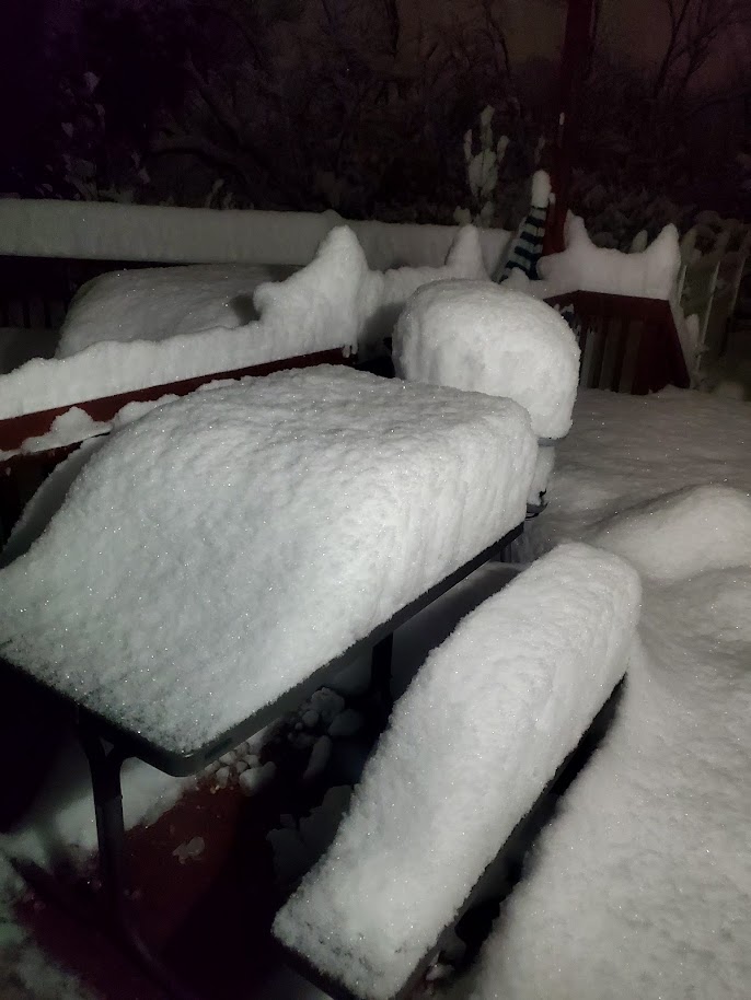
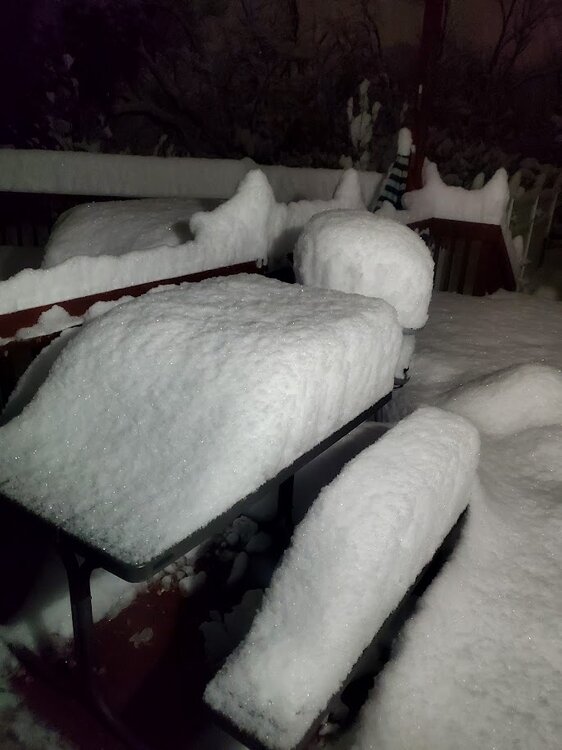
you are right- it was not a norlun- just a plain death band that gave Macungie the highest snow total in Eastern PA last year. here is a picture of my 14 in of snowfall on 2/16/2024
-
what a joke
-
El Nino, LA Nina really does not matter at this point for even next winter This is the worst weather pattern I have seen since the late 1980's for trying to produce a 6+ in snow event. I honestly do not know what will destroy this dry and windy progressive pattern. I keep saying a true miller A event. I am not giving up hope but March of 58 type of storm event is our last chance IMHO. The real bitch is even if we get 18 inches of snow, it will be gone in a week. After the thursday minor event of what I think will be generally a 3-5 inch advisory snow event, I am going to close the door halfway on this winter being over for anymore major snow events. I do not about many of the posters feelings right now but I am more anxious of seeing a raging constant thunderstorm with cloud to ground lightning every other minute than another nuisance snow event. This past summer with a few t-storms were a joke with the drought. The ground right now is really frozen hard and deep. I am ready to see some bulbs open up. My daffodils are up but it will take a week of 50 degree sunny weather to help. Today was the hardest I have seen it rain since New Years around 4 pm when the front was coming through. I received about .65 of liquid gold, including the 2 in of snow which is just about gone. Still not even close to a drought buster or even putting a dent in it as nothing got absorbed and basically ran off into the street as the soils were still frozen. We really need 50 degree weather for a week to thaw the soils to make a difference with the drought
-
But my drought lives on. LOL. where is the 1.5 to 2 in rains? I give up . I have not see 1 " rains since New years eve. Lets see if we can muster a decent t- storm for you guys in SE PA this afternoon - severe thunderstorm warning has a better chance to be issued than seeing a 12 + snow on Thursday. The winds will be crazy. lets talk about that. LOts of power outages coming
-
Don't you love it? LMAO These LR models cannot handle a very progressive flow with strong confluence and are unreliable now. This drought will be epic at this rate. The 1.5 to 2 in rains are now off the table unless a decent squall line forms tomorrow morning before the front comes through. Thunderstorm is in the cards thats for sure This crap on the ground now will be a memory by noon tomorrow. Then what ever moisture is still in the ground will refreeze for another week.Then comes those fricking 40+ mph winds for the 20th time in 6 months drying out the ground even more. I see power outages/tree damage as the news maker.
-
I want to give all you snow weenies out there a heads up. I am currently employed as a township consultant for planning. (Yeah retirement hogwash need the bucks LOL) Last night at the local township meeting, I was told by the public works director that they been told by salt suppliers that many (dozens) municipalities are OUT OF SALT. They the township maybe resorting to sand. The salt suppliers were told it will be 10-15 days before the municipalities y will be resupplied. Will not help after Sunday thats for sure. I expect a state disaster will be issued sometime after Sunday for any major storm over 6" so as the salt bins can filled in a hurry. The media has been kept out the picture on this entire situation but not for long because what municipality wants to broadcast to the media that they are out of salt or have a limited amount to their residents? Yes these numerous "nuisance" storm events have quickly escalated to a road disaster as many municipalities have already expended their salt budget twice over. Once the news gets out folks, hold on to hat. Thus far the media is too damn busy covering social BS and Trump doings. They better worry about their own dam backyard first as I always say.
-
OH MY our drought ----our fricking drought will be history. according to the Euro run Ah, but no worry the GFS will save our drought!!! This torm in the Euro is they type of storm that can break this drought and stubborn pattern too. The ideal storm we have been looking for. Nothing is believable until it is 48-72 hours out. Not enough accurate model data ingestion with this fluid progressive air above our heads. When I see the Euro match the 84 hour NAM in positive snow depth of 12+ in---- then BINGO- we have a winner winner chicken dinner. Until then horse puckey. I have been burned too many times with monster suppression/dry air or with a curve out to sea runs this year. Furthermore, The LP must be at the 70/30 bench mark and tucked within 75 miles of the coastline too to be believable. LOL
-
OMG OMG!!!! Our drought our drought----- will it be destroyed by another 93 type of superstorm? That storm was on the models for a week before too with a huge amount of model consistency---- Oh no, I am melting !!!!! I have posting in the past 2 months , it will take a storm like this to break this fricking dry air suppressing progressive pattern until I am blue in the face. Well lets see what happens as the NY metro forum is going batshit crazy right now. C'mon man, lets get this potential storm dwindle down to a 2-3 inch nuisance storm event like the past 20 days so our drought lives on baby. LMAO
-

-
Many of us have been burned with digesting the LR models now as gospel the last 30 days. Even the SR models have been questionable as the parade of overrunning events over extremely dry air masses and the the basic geography of the Blue Mts are destroying any chances of a nice snowstorm event in Eastern PA. To even see a 3-5 inch event for Saturday is IMHO questionable the air as the conditions must be absolutely perfect for this to happen in this crappy pattern. I still have doubt on a 1-2 inch rain this weekend. most likely .50 to 1 ".
-
Keep the dry air coming baby. Less than .25 in of any type of precip is great for assuring my drought emergency. LMAO MY new motto- Sublimation rules!!!! LOL. Pure ass sleet right now. Another waste of cold air for snow production. The dry air just will not retreat. The poor people who spread salt will have wasted their money in the morning as it turns to plain light rain/drizzle . Predicted high of 52 degrees with rain on Sunday- break out the shorts. Then Monday we go back into the freezer awaiting another batch of wasted arctic dry cold air with no storms. The LR modeling is so undependable right now in this progressive flow pattern. Just about every 10 day run in the last 20-30 days have shown 16 in + of snow for the LV and what do we have to show for all of these wonderful and trustworthy model runs about 3 in of snow and garbage. By Sunday all ice and snow on the ground it will be just a distant memory. Sunday, we actually might get more than .50 in of rain but I am not holding my breath that's for sure. Again no drought buster as the ground is still frozen and it the runoff even on Sunday will all runoff anyway.
-
 the drought lives on baby Every model run and radar is getting drier and drier. I will not be satisfied until a drought emergency is issued by PADEP LMAO. By the way, I warned you guys about the abundance of sinkholes in our general area for the past 3-4 months. I-80 fell into a massive on yesterday and it is getting bigger. This is the late 60's all over again. We need a a 93 superstorm badly. Maybe the first week in March will produce something major and pattern changing because the models tell me jack shite on even getting a WSW event for us for the next two weeks after continuously showing 30+ in of snow for the LV in the past three weeks . Just give at least 3 2" rain events now to hell with the snow. I did not even use the snow shovel for the sleet event, it sublimated away. LOL. https://abc7ny.com/post/north-jersey-traffic-80-wharton-faces-emergency-closure-sinkhole-appears-return/15888495/
 -
I have seen this type of scenario pan out before many times in the last 30 years. The second low essentially becomes a modified but weaker miller B type of storm event as it digs in later and goes rapidly to the northeast as the dying transfer low holds on little longer east of the Apps instead of completely dying in western PA. The key is how long does it take the secondary low to form with bringing a decent wave through central PA . A million dollar question in this progressive pattern. If the wave did happen this way then a winter storm warning upgrade could be needed later Wednesday in the middle of the snow event.
-
this a good map as the screaming progressive winds die off a little. Lets hope it holds
-
fwiw, I posted this earlier. Yes I am disgusted with the models the last few months. It will literally take a miracle of a storm event to get out of this very progressive pattern with no ties to GOA or Atlantic moisture to build upon for our area with storm events. The drought is the king folks for the foreseeable future. I will no longer rely on the models for precip prediction until the progressive pattern changes for weeks rather than for one event. Every model has been horribly operating with wild swings in precip amounts on EVERY SINGLE model run the past two weeks. This happens in a progressive pattern when a single storm event is able to tie into a moisture source like the GOA or the Atlantic. Another fine example of what I am talking about - where the f&*k is the sun today? It was supposed to be mostly sunny not 95% cloudy for 100th time this past six months. The SR models need to be calibrated PERIOD in these progressive patterns and I have been at this game for over 40 years. The air is to damn dry and flowing across the country at break necking speeds. Hard to forecast in these pattern conditions - not faulting MT Holly forecasters as they do a great job analyzing these models but relying on modeling tools appears to be not working even for cloud prediction thats for sure. The accuracy of the current modeling is going backwards not forwards for LR modeling too. Throwing different models out there is not helping either like the Icon Ukie JMA etc. NOAA needs to add additional data sources in the Pacific Ocean and sparse areas to increase the reliability of the data for LR modeling.
-
It will literally take a miracle of a storm event to get out of this very progressive pattern with no ties to GOA or Atlantic moisture to build upon for our area with storm events. The drought is the king folks for the foreseeable future. I will no longer rely on the models for precip prediction until the progressive pattern changes for weeks rather than for one event. Every model has been horribly operating with wild swings in precip amounts on EVERY SINGLE model run the past two weeks. This happens in a progressive pattern when a single storm event is able to tie into a moisture source like the GOA or the Atlantic. Another fine example of what I am talking about - where the f&*k is the sun today? It was supposed to be mostly sunny not 95% cloudy for 100th time this past six months. The SR models need to be calibrated PERIOD in these progressive patterns and I have been at this game for over 40 years. The air is to damn dry and flowing across the country at break necking speeds. Hard to forecast in these pattern conditions - not faulting MT Holly forecasters as they do a great job analyzing these models but relying on modeling tools appears to be not working even for cloud prediction thats for sure. The accuracy of the current modeling is going backwards not forwards for LR modeling too. Throwing different models out there is not helping either like the Icon Ukie JMA etc. NOAA needs to add additional data sources in the Pacific Ocean and sparse areas to increase the reliability of the data for LR modeling.
-
Mt Holly is leaning on the outcome of Tuesday's storm in this morning's discussion- it is no drought buster. No warning criteria for the LV thats for sure with only a couple of inches in the forecast. .A far cry from the 12 + inches in last weeks model runs. The hype by the media will be cured IMHO. It will literally take a miracle of a storm event to get out of this east west progressive pattern with no ties to GOA or Atlantic moisture to build upon for our area. I-95's enjoy your 4-6 inches because it will all be gone with Fridays rain event.
-
actually Ralph, I feel the same way. when the LR models show 40 in snows for 4 to 5 days in a row than nothing- its time for the forum to stop looking at them. GFS and the European could NOT sniff out a pile of dog shit right now at ten days. This progressive pattern with no SE troughs is killing us. Tonights storm was a disaster for the meso's. We need a March superstorm like 93 to break up this shitty drought pattern we are in. This drought is no longer a laughing matter as sinkholes are opening up everywhere in the LV the last two weeks There is absolutely ZERO spring groundwater recharge anywhere south of the Poconos with no snowpack on the ground. The base flows of the stream in the limestone geology are falling rapidly. I guess all we can do is hope the one of the storms dumps some snow on us. The Friday storm that Mt Holly is calling for rain- I bet it does not even rain .50 in. All of that will also run into streams as the ground will still remain frozen. The next winter storm warning will only be issued during the storm event because MT Holly cannot even trust getting 6 in totals in the models before the event LOL
-
How dry is it? The Little Lehigh is a spring fed limestone stream. When we had the -15 degrees temps a few weeks ago, ice formed on the banks of the 55 degree water. Since then, the banks of the stream have remain frozen but the baseflow has continued to drop. The ice hangs over the streams edge by up to a foot above where the original base flow was flowing. I have never seen the base flow of this stream this low in the winter in 30+ years. The sleet tonight will not help much, just make it worse as it freezes the surfaces of the ground and only causes an immediate runoff into the streams from any salted roads without recharging groundwater tables plus its the amount of moisture content is nothing. Its like raining ice cubes on frozen surfaces. The only real melting is from man made salt application or sublimation tomorrow morning when the sun peaks out. At this point, Like what Mike Gorse stated ,I will take 2-3 inch rainstorm over this crap anyday. The dry air preceding every storm since New Years day here has been as so abundant. Its like to get it to snow in Las Vegas for every winter storm event. The models literally cannot handle this scenario on the east coast and they are going wacko with timings of the storm event to total precip amounts. The amount of virga and the progressiveness of the precip is way too fast. The models just cannot see this scenario very well. Its back to old days of waiting for just the right time to get a heavy snow event. Its just not in the cards right now.
-
Wel another forecast down the crapper. Solid sleet. No snow here in macungie. Just like i said earler, the late start has destroyed the snow forecast. Get ready for a possible ice storm update and thundersleet