StantonParkHoya
-
Posts
1,953 -
Joined
-
Last visited
Content Type
Profiles
Blogs
Forums
American Weather
Media Demo
Store
Gallery
Everything posted by StantonParkHoya
-
Good article, and same point made by several NWS discussions and NHC, the eye location and landfall are really secondary focuses given the diffused nature of the wind. 50 miles doesn't make much difference from a wind perspective either way, more of a surge potential determining factor. Also of note -- NHC calls this a hybrid system, and a non-classical hurricane.
-
Charleston to Georgetown, SC. We won't know exact landfall until showtime.
-
Forgive me for querying "Wonder what Ian will be up to this weekend", logically finding "Tropical Headquarters --> Hurricane Ian" and hoping it might be the place
-
I already asked: can we please make 1) a thread for post-FL landfall discussion, etc... etc..; and 2) a current obs/model discussion thread? I'm still in this path, and have to sift through 40 posts about FL damage, climate ramblings, etc. to see any discussion on future Ian.
-
This thread is a dumpster fire
-
that would be a 170 mile miss by the Euro under 24 hours away.... bold call
-
Looks like Euro brings it in directly into Charleston harbor
-
Any way to bifurcate post-FL Ian landfall analysis and updates and real-time obs/model discussion?
-
Well, it hasn't hit SC as a Cat 1 yet. Never underestimate dry air and sheer once north of FL.
-
Yeah, where are the admins?
-
I'm sorry, are you from the future?
-
Looks like most models have consolidated around a Charleston hit.
-
That is a bright spot, we've been in a borderline drought this fall, so we can handle a good amount of rain.
-
Here in north-central NC, the wind is already whipping from the pressure gradient w/ the high to our north and Ian to the south. Akin to a nor'easter approaching. Can't recall a tropical storm with temps in the 50s before, but here we are.
-
DP of 46 here this morning. Be interesting to see when it goes post tropical
-
 Siesta Key, 125mph
 -
The temps are 85. The same they were in 1985. Please stay on topic.
-
Won’t be long before this takes on the ol’ Fibonacci spiral look. Sheer is apparent on northwest side.

-
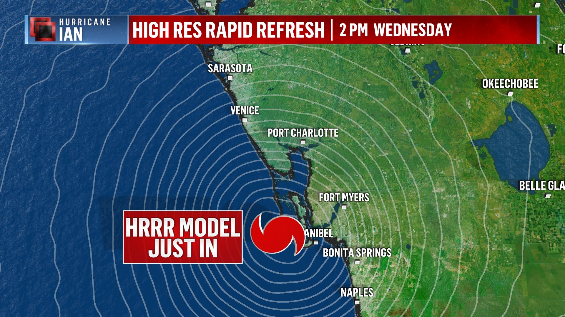
Good heavens. Current heading is 10 degrees. That is NOT Cape Coral.
-
No model to-date has gone north of Charleston that I’m aware
-
HWRF just took the storm from Columbus Ga to Columbia SC in one run… it’s… something
-
I would bet that’s a normalish number on a regular day out of a 13M home pop
-
It’s been forecast to go NNE. Some posters think they’re Sherlock Holmes discovering a clue.
-
2022 Atlantic Hurricane season
StantonParkHoya replied to StormchaserChuck!'s topic in Tropical Headquarters
Not an active season. Period. Stop it. -
I thought environment was supposed to degrade precipitously north of Tampa latitude, inland or over water? What’s the environment look like once this is over Orlando?