HeadInTheClouds
-
Posts
1,663 -
Joined
-
Last visited
Content Type
Profiles
Blogs
Forums
American Weather
Media Demo
Store
Gallery
Everything posted by HeadInTheClouds
-

12/15 - 12/16 Coastal/Winter Storm & Observations
HeadInTheClouds replied to Northof78's topic in New York City Metro
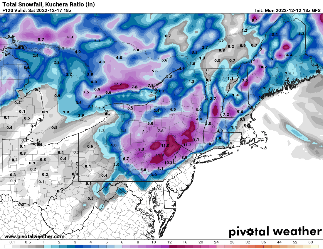
That same map using kuchera is considerably less which makes sense.
-
12/15 - 12/16 Coastal/Winter Storm & Observations
HeadInTheClouds replied to Northof78's topic in New York City Metro
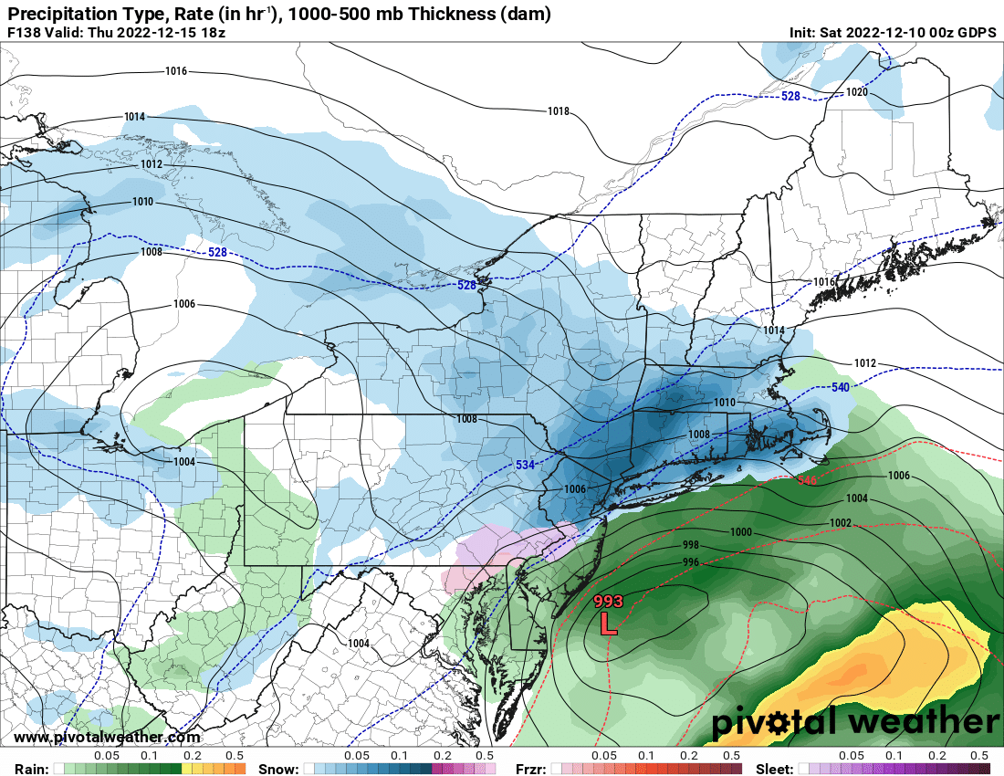
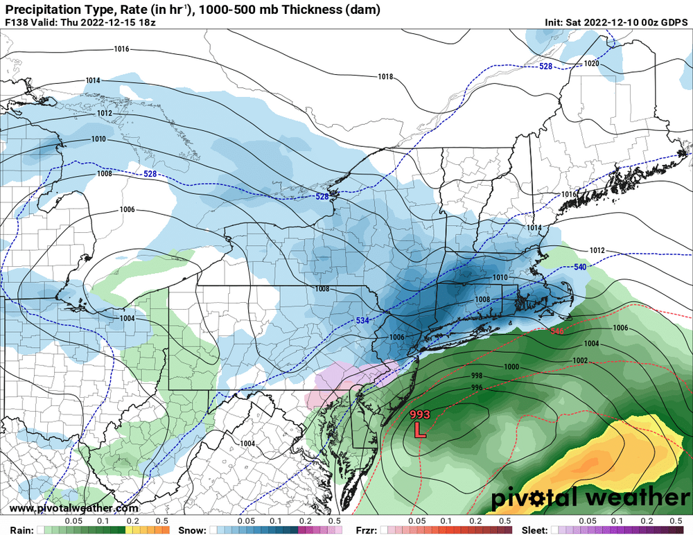
18z GFS - Oh how I wish..thumb.png.f79347bfdfe283b3dd39ffccacc630e3.png)
-
12/15 - 12/16 Coastal/Winter Storm & Observations
HeadInTheClouds replied to Northof78's topic in New York City Metro
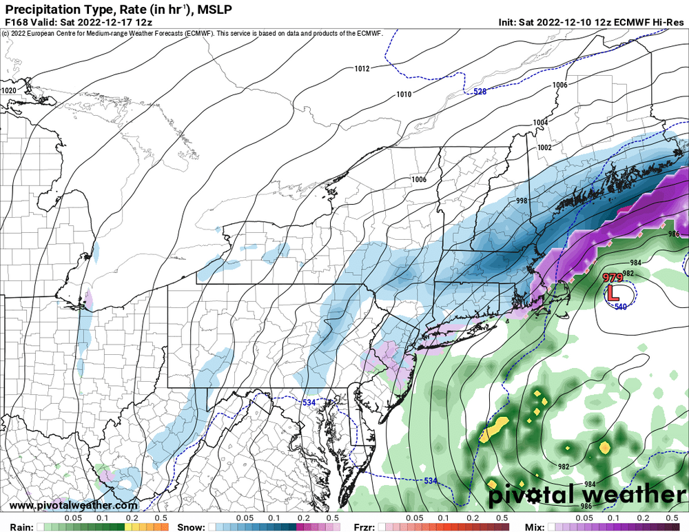
The Euro is warm but I still think parts of the interior see a front end dump of snow that most other models show. There is a definite CAD signature to support frozen at the onset. How long and how much is still in question. The coast is basically toast on this one but still hope for others. -
30 and still some light snow. 3.5 OTG.
-
30 with moderate snow, 2 inches OTG.
-
31 with light snow. Dusting on colder surfaces.
-
00z Nam 3k
.thumb.png.dd2be2730569642d409f55b8bc9812c8.png)
-
And north in Albany NWS zone:
.thumb.jpg.f327f252fb962cfed8e2136f0c4105fd.jpg)
-
Euro brings in colder air as low moves east and gets some snow to the coast eventually. Still long way to go with this.
-
Expected NYS totals tomorrow and tomorrow night.
.thumb.jpg.cccac1a50c0737fd67ff0ae4c0be3f37.jpg)
-
Yup. I'm looking at 2-4 in MHV. Poconos and Catskills could get 6 with this.
-
Yeah no kidding. Euro, CMC, and even ICON had a secondary developing and affecting the area with rain/snow days ago. GFS had a weak low headed to Bermuda.
-
Yes it is. Most models correct as we get closer in time to an event. The GooFuS is always late to the party and frequently on it's own little Island. All other major models were showing a coastal low days before the GFS. This model has major issues.
-
GFS decided to come back to planet earth at 12z. Horrible model. There is still plenty of time with this and hopefully we some eastern progression with the developing low instead of a rainstorm for most.
-
Both CMC and Euro bring a significant storm to the area with a mixed bag but also bring snow even to the coast while GFS sends a weak low to Bermuda.
-
Models basically held serve. GFS still lost.
-
It's having serious issues.
-
GFS shows nothing once again and is a sheared out mess. CMC still has the storm.
-
Don't look a gift horse in the mouth. He was a troll.
-
Did Snowman get banned? This is where he makes an appearance to tell us why the GFS is correct even though he hates the GFS.
-
Nothing can be ruled out from an inland runner to a miss but It's just so flat and the low so far south and weak IMO. I just think the Euro and CMC are much more plausible. I would be shocked if the GFS is correct.
-
Please just decommission the GFS.
-
This is why you can't jump off the ledge with each model run a week out with so much in play.
-
CMC was great but this is one ugly run.
-
It depends on what you mean by here because I could see both working out to some degree just N and W. Still too early to tell about the 16th.
.png.e50ed1ebcbb5a4d055fff327c64da4bd.png)

.png.7c19a492b69045803fb4f98194d9d5f0.png)
.jpg.95aeea8aab4f875dd5f6b741a88094dc.jpg)


.jpg.f0d31a71b6ae186274941290ae647cb9.jpg)