

OrdIowPitMsp
-
Posts
2,333 -
Joined
-
Last visited
Content Type
Profiles
Blogs
Forums
American Weather
Media Demo
Store
Gallery
Everything posted by OrdIowPitMsp
-

November 2020 General Discussion
OrdIowPitMsp replied to SchaumburgStormer's topic in Lakes/Ohio Valley
Yikes hopefully things cool off a bit more. Was worried we’d be on the eastern edge. Getting some sleet and snow mix right now. Actually becoming mostly snow as I type this. -
November 2020 General Discussion
OrdIowPitMsp replied to SchaumburgStormer's topic in Lakes/Ohio Valley
This is the kind of messaging I love waking up to. Should be a fun afternoon. “Winter Storm Warning URGENT - WINTER WEATHER MESSAGE National Weather Service Twin Cities/Chanhassen MN 452 AM CST Tue Nov 10 2020 ...ICE STORM WARNING FOR PORTIONS OF FAR SOUTH CENTRAL MINNESOTA TODAY... ...A BAND OF HEAVY SNOW WITH SOME FREEZING RAIN IS EXPECTED THROUGH TONIGHT FOR SOUTH CENTRAL MINNESOTA INTO WEST CENTRAL WISCONSIN... ...SOME SHIFTING OF THIS BAND EAST OR WEST IS STILL POSSIBLE... .A complex system is taking aim at the region, bringing a myriad of weather impacts through the late evening hours. Freezing rain is expected across extreme southern Minnesota where up to one quarter inch of ice may accumulate along with a slushy inch of snow. Further north, a narrow swath of heavy snow looks to set roughly along a line from Mankato to the Twin Cities to Luck WI. A Winter Storm Warning has been issued for this area where 4 to 7 inches of snow is expected. Timing of the heaviest snow will from the early afternoon through the evening commute. Isolated higher snow totals are possible, but it will be highly dependent on the track of the storm. Lesser amounts in the 2 to 5 inch range are expected on either side of this band, where a Winter Weather Advisory is in effect. Use caution if traveling and monitor further updates to the forecast, as even small shifts in the track could greatly alter the expected impacts.” -
November 2020 General Discussion
OrdIowPitMsp replied to SchaumburgStormer's topic in Lakes/Ohio Valley
Guess the frontal passage. -
November 2020 General Discussion
OrdIowPitMsp replied to SchaumburgStormer's topic in Lakes/Ohio Valley
Let’s see if this pans out. Inside 24hrs so it’s basically a nowcast. -
November 2020 General Discussion
OrdIowPitMsp replied to SchaumburgStormer's topic in Lakes/Ohio Valley
NWS service agrees. Winter Storm Watch for 4-7” of snow tomorrow afternoon. If this verifies Minneapolis will be having one heck of a hot streak this autumn. -
November 2020 General Discussion
OrdIowPitMsp replied to SchaumburgStormer's topic in Lakes/Ohio Valley
Cold front has blasted its way through. Temps have dropped ~15 degrees in the past hour and change. Hi-Res models are beginning to come into focus on tomorrow’s snow and the totals are becoming more robust. Might end up more like a 2-4” event around here or somewhere close by. -
November 2020 General Discussion
OrdIowPitMsp replied to SchaumburgStormer's topic in Lakes/Ohio Valley
Might luck out 1-2” of snow tomorrow. My gut says the narrow band will setup better to the southeast but we shall see. -
November 2020 General Discussion
OrdIowPitMsp replied to SchaumburgStormer's topic in Lakes/Ohio Valley
Just took the dog out and dews are in the mid 50s. It felt a little muggy outside. -
November 2020 General Discussion
OrdIowPitMsp replied to SchaumburgStormer's topic in Lakes/Ohio Valley
While Minneapolis didn’t break the November monthly record high, we did set a daily record high of 75 today. -
November 2020 General Discussion
OrdIowPitMsp replied to SchaumburgStormer's topic in Lakes/Ohio Valley
Also worth mentioning that the all time November record high temp in Minneapolis is 77. Very likely could see the monthly record fall today. -
November 2020 General Discussion
OrdIowPitMsp replied to SchaumburgStormer's topic in Lakes/Ohio Valley
Forecast high of 77 today. The record on this date is 73 set way back in the Stone Age of 2016. -
November 2020 General Discussion
OrdIowPitMsp replied to SchaumburgStormer's topic in Lakes/Ohio Valley
Yesterday’s high of 74 at MSP tied the record from 1975. 26 degrees above average -
November 2020 General Discussion
OrdIowPitMsp replied to SchaumburgStormer's topic in Lakes/Ohio Valley
High of 75 at MSP today breaks the record of 74 from 1978. Two weeks ago we saw 7.9” of snow. -
November 2020 General Discussion
OrdIowPitMsp replied to SchaumburgStormer's topic in Lakes/Ohio Valley
Dropped to 27 and now temps slowly rising this evening. Warm week on tap which will be great for someone like me who works outside. Return to winter next weekend perhaps? -
The last of the 10/20 snowstorm melted off my deck today. Just piles imby. Shaded north facing spots in the metro still have snowcover but melting quickly. Remarkable we went 10+ days of snowcover in spots in October.
-
I always felt growing up in Chicagoland we got shafted being on the eastern edge of a time zone because in the summer we’d have these early sunrises and “relatively” early sunsets. Works out better being further west in Iowa or Minnesota.
-
Some records from over the weekend
-
Backyard sensor is reading 14F this morning. By far the coldest air of the season
-
Mood flakes most of the day totaled 0.4” bringing our monthly total up to 9.1” High temp today of 29. Feels and looks like mid winter.
-
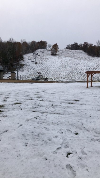
Will be skiing soon enough. Today is our 4th day in a row with snow otg which has to put us in the top spot or two for October. I’ve lived in Minneapolis for a little less then five years and have already experienced the snowiest February, April and now October on record.
-
Steady light snow this morning, even pockets of moderate showing up. Refreshing our October snowpack.
-
Central and northern Minnesota will see single digit lows. Might have to start looking at record ice-in dates on some of the lakes.
-
Nice wintry mix this morning. Big snows up north. Deep cold (for October standards) coming this weekend. Single digit lows outside the metro area
-
Seems like a south trend in the models is developing this year. Yesterday’s storm was only supposed to put down 0-2” changing over to rain in Rochester but they stayed all snow and ended with more then 3”. Tomorrow’s event has also been bumping south. No weakening however
-
If we can get a trough centered over the Great Plains then a big dog western lakes cutter should do the trick. Just gotta wait and see what Mother Nature throws at us. The northland is off to a very fast start with their 3rd significant storm bearing down tomorrow.


