

OrdIowPitMsp
-
Posts
2,299 -
Joined
-
Last visited
Content Type
Profiles
Blogs
Forums
American Weather
Media Demo
Store
Gallery
Everything posted by OrdIowPitMsp
-
Do the Michigan WFOs play a game of chicken to see who will issue a WWA first?
-
Pretty odd. Not sure I’ve ever seen us go from nothing to a winter storm warning before, but I’ll certainly take it. I’d feel a bit better being by you in the north metro. Anoka county should be in a prime spot. I haven’t had a ton of time to look at the high res models today but the city should be good for at least 4”+
-
We got dusted in south Minneapolis. Probably 0.1-0.2, wasn’t expecting it tbh.
-

Winter 2024-25 Medium/Long Range Discussion
OrdIowPitMsp replied to michsnowfreak's topic in Lakes/Ohio Valley
Lock it in. If you want snow, head north my friends.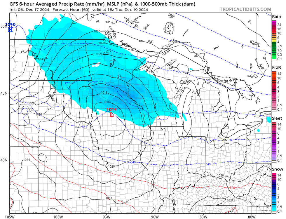
-
Tomorrow looks like a nice cosmic coating, but Thursday has my attention. I’m selfishly worried about the metro being a county or two south of the main action but we could easily score 3-6” out of that one. Since 2000, Minneapolis has 69% odds of a white Christmas. That drops to 60% the last 10 years. Thursdays system will probably determine it this year.
-
Manager only 0.05” of precipitation yesterday. Mostly sleet with some freezing rain. Freezing fog has everything extra slick this morning.
-
We’ve stayed mostly frozen hydrometers in the city. Just a touch of freezing rain to glaze things. Not even sure if we’ll see 0.10” of precipitation. This really fizzled out imby.
-
Drying trend on the hi-res models today, but at this point radar trends are all that matter. Maybe an inch of snow/sleet tomorrow. When it’s been cold and dry keep expecting the same I guess.
-
Temps held steady at 0 all night but we managed to sneak below zero for an official low of -1F. 3rd low below zero of the season. Tomorrow looks interesting. WWA for ice, but we could see the warm wedge aloft have a little less juice and end up with 2-3” of snow.
-
-8F this morning. Love it or leave it.
-
KMSP has fallen below zero for the first time in the 24/25 cold season as of 7pm this evening. -1F
-
0.6” at the airport today. 2.3” season to date. +1F
-
Sunset a few minutes ago and already down to 4F. Our coldest temp of the season.
-
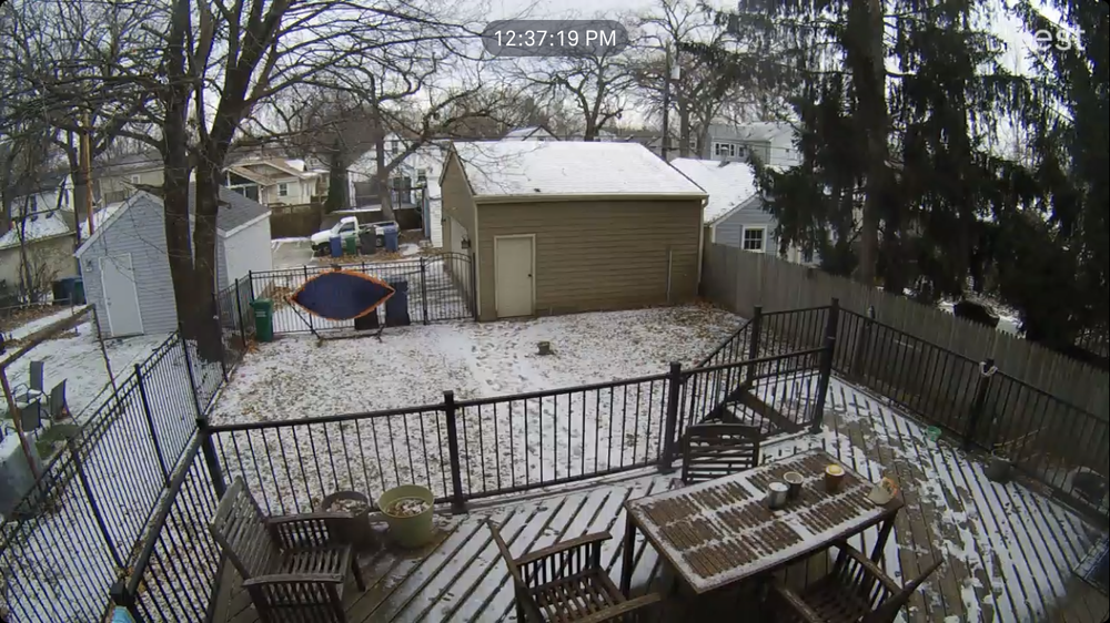
Half inch overnight with the arctic front. Snow squalls went through the metro half an hour ago and deposited a few tenths more. Temp at 10 and falling.
-
Arctic Front later today, first temps below zero of the season and potential system fri/sat. Nice to have a bit of an active stretch.
-
Fall/Winter '24 Banter and Complaints Go Here
OrdIowPitMsp replied to IWXwx's topic in Lakes/Ohio Valley
Bummer I’ll be in SoCal. Gotten lucky the last handful of years with AA temps so was due for a clunker in the desert. -
Winter 2024-25 Medium/Long Range Discussion
OrdIowPitMsp replied to michsnowfreak's topic in Lakes/Ohio Valley
Average highs are in the mid/upper 20s for my area come mid December, so a warm and wet pattern might turn out alright imby. -
Remaining patches of snow in the yard will get obliterated today and tomorrow. Back to BN temps next week. Lakes are starting to see the annual return of ice fishing shacks, my ski hill has been making tons of snow during this cold stretch. Should be a great day on the slopes today.
-
Already down to 12F at MSP. If winds weren’t sustained at 30+ and gusting near 50mph we’d drop below zero tonight.
-
Missed mby by about 5 miles or so, but the ground has been white since Sunday night. Wind might take my hammock away today.
-
Popped above freezing this morning from compressional warning ahead of the arctic front. 34F. Temps should start dropping in the next couple hours and the winds are going to really get going this afternoon. If we had more then a 1/2” of snow otg there would be a ground blizzard here today.
-
While this pattern is cold and dry we’ve still managed to sneak flurries/light snow out of any minuscule stratus deck. Eeked out another 0.2” of daytime mood flakes yesterday. 1.7” season to date
-
0.4” overnight. Nickels and Dimes this winter so far. We’ve now been below freezing for 7 days. Lakes are completely frozen over.
-
Morning low of 6F to kick off December. The urban lakes are beginning to freeze over.
-
November 2024 General Discussion
OrdIowPitMsp replied to SchaumburgStormer's topic in Lakes/Ohio Valley
Low of 6F in Minneapolis.


