

OrdIowPitMsp
-
Posts
2,333 -
Joined
-
Last visited
Content Type
Profiles
Blogs
Forums
American Weather
Media Demo
Store
Gallery
Everything posted by OrdIowPitMsp
-
Overnight low of -6 before the clouds and light snow moved in. Another morning with 0.1-0.2” of accumulation.
-
Sat at 0 for 4 hours this afternoon with a couple 5min obs of 1, have since fallen back to -1 at 5pm.
-
Low of -11 this morning. Sunny skies today will probably bring us up to 0 or 2 above
-
Wound up with .2-.3” of new snow on just a trace of precip. NWS only mentioned a slight chance of flurries in the aviation discussion. Impressive what moisture can be squeezed out of this airmass.
-
NWS adjusted this mornings low to -17 and this afternoons high made it to -2.
-
-4 and snowing. I’ve only seen it snow this cold a few other times.
-
The only saving grace (for now) is that snowpack is below average across northern Wisconsin and central/northern Minnesota. Headwaters for the Wisconsin and Mississippi rivers.
-

Winter 2020-21 Medium/Long Range Discussion
OrdIowPitMsp replied to Hoosier's topic in Lakes/Ohio Valley
GFS pitching a 16 day shutout for MSP. Zzzzzzzz indeed. -
Warming up nicely in Minneapolis under mostly sunny skies, -8 at 11:45am.
-
-16 is our low in the city. Suburbs dropped to -20. Red Wing MN which is 40 miles southeast of town got down to -24, and International Falls is sitting at -29.
-
Been stubbornly sitting at -15 for the past few hours.
-
Already down to -9F here.
-
Not a good weekend for a Lutsen trip!
-
Sure! However 9 days below zero is something I only want to experience once
-
-3F at 7am. Only the 3rd below zero low of the season at MSP. (We average 11 in January alone) P&C has lowered my high to a balmy -1F for today. To make the top 10 longest below zero streak only 4 more days to go. 130 consecutive hours below zero is the tenth spot. https://www.dnr.state.mn.us/climate/journal/zero_and_below_streaks.html
-
A bit chilly in the extended.
-
Low of 6F overnight. Nothing forecasted to get that warm until next weekend.
-
Feb 3rd - 5th Potential strong stm threat
OrdIowPitMsp replied to Brian D's topic in Lakes/Ohio Valley
Fresh drifting snow on frozen Lake Nokomis, Dog, and a beautiful sunset. Doesn’t get better then this.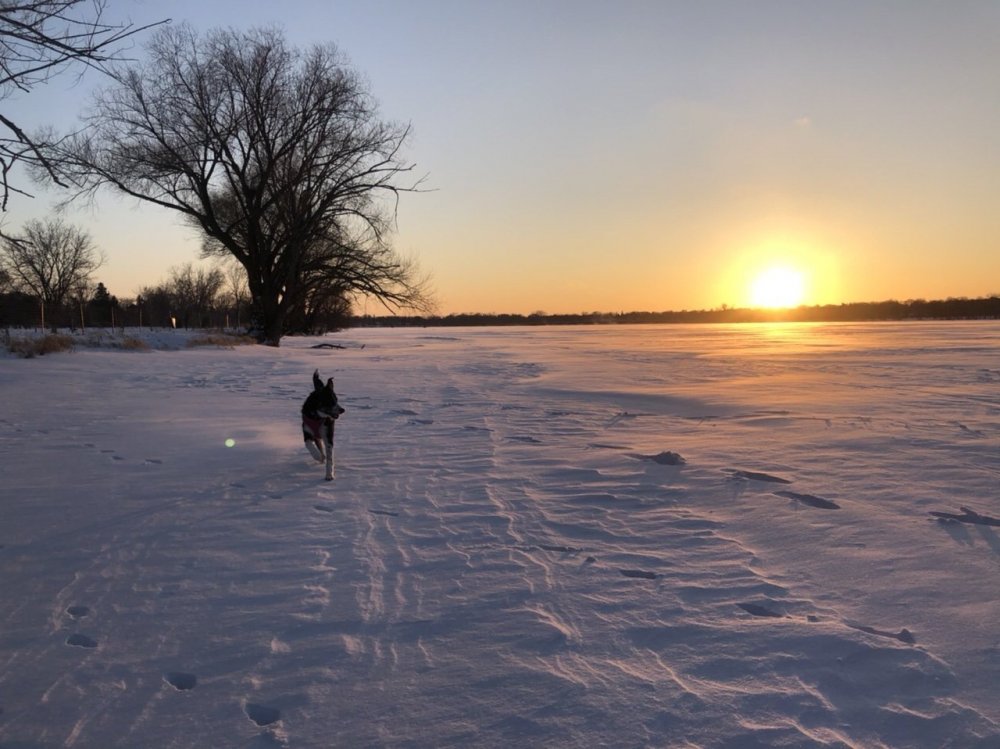
-
Oof. Tomorrow looks like our last high temperature above 10 for the foreseeable future. Lake Superior will be manufacturing ice this month.
-
Feb 3rd - 5th Potential strong stm threat
OrdIowPitMsp replied to Brian D's topic in Lakes/Ohio Valley
Storm total of 2.1” at the airport. Looks like my eyes are good. Over 40” on the season now -
Feb 3rd - 5th Potential strong stm threat
OrdIowPitMsp replied to Brian D's topic in Lakes/Ohio Valley
Snow just winding down here as the wind picks up and temps plummet. Looks like we got around 2” eyeballing -
Feb 3rd - 5th Potential strong stm threat
OrdIowPitMsp replied to Brian D's topic in Lakes/Ohio Valley
We had a period of FRDZ overnight as there was a glaze under the fresh snow on the sidewalk. -
Feb 3rd - 5th Potential strong stm threat
OrdIowPitMsp replied to Brian D's topic in Lakes/Ohio Valley
Been ripping pretty good this morning. Inch down so far. Good luck to those further east -
Feb 3rd - 5th Potential strong stm threat
OrdIowPitMsp replied to Brian D's topic in Lakes/Ohio Valley
What’s falling imby and radar trends definitely more impressive then what the HRRR and NAM have been showing. Still thinking 2” here but we’ll see if it’s rip city when I wake up. -
Feb 3rd - 5th Potential strong stm threat
OrdIowPitMsp replied to Brian D's topic in Lakes/Ohio Valley
Getting some light freezing rain and ice pellets at the moment. Wasn’t expecting any precip this early.


