OrdIowPitMsp
-
Posts
2,333 -
Joined
-
Last visited
Content Type
Profiles
Blogs
Forums
American Weather
Media Demo
Store
Gallery
Everything posted by OrdIowPitMsp
-
At 10:40 we are still sitting at 90 degrees.
-
Appears we will be 99’d in MSP today. 5min obs been stuck there since 120pm
-
Record high of 97 in MSP today. Could make a run at 100 tomorrow. Crispy out there.
-
0.21” of rain yesterday with backend flurries this morning. Tomorrow we should bag our first 70 of the year.
-
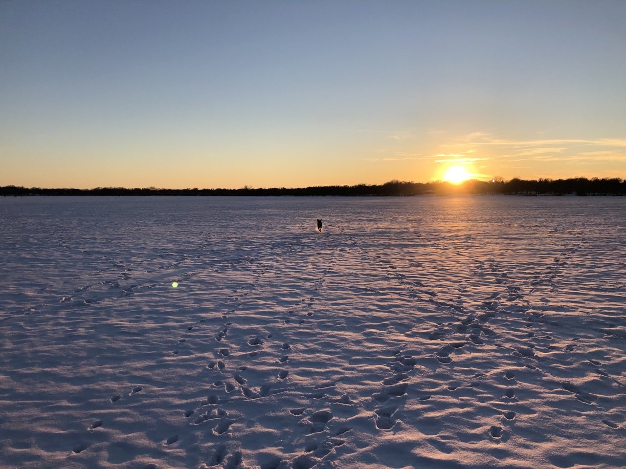
Lake Nokomis a few blocks from my house is now officially ice free. The median date of ice out is April 4th, so a couple weeks early this year.
-
Urban lakes are still holding their ice but with 1” of rain coming tomorrow through Wednesday I imagine ice-out will be occurring very soon here.
-
0.3” of wet slush this morning. 7am snow depth of 3” should be all but gone by the end of the week.
-

Beware the Ides of March (and into the 16th)
OrdIowPitMsp replied to Hoosier's topic in Lakes/Ohio Valley

-
Beware the Ides of March (and into the 16th)
OrdIowPitMsp replied to Hoosier's topic in Lakes/Ohio Valley
Just measured 3.5" here with snow about finishing up. Storm ended up a bit further NE then modeled putting down 2-5" across the metro, with double digit amounts across southern Minnesota based on reports. Classic spring wet slop, although the top inch is much drier. -
Beware the Ides of March (and into the 16th)
OrdIowPitMsp replied to Hoosier's topic in Lakes/Ohio Valley
Straight dumping heavy snow here right now. Solid 1.5” down on the far west side of Bloomington. Going to be an impressive spread of totals across the metro area. -
Beware the Ides of March (and into the 16th)
OrdIowPitMsp replied to Hoosier's topic in Lakes/Ohio Valley
2-3” in the forecast for mby. With the snow falling during the day I have a hard time believing rates will be strong enough to efficiently accumulate. -
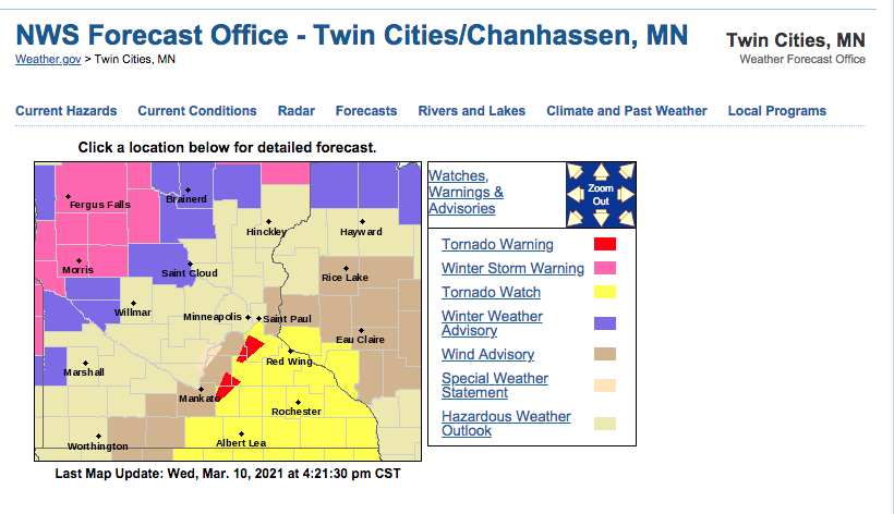
Springtime brings out all sorts of different weather warnings.
-
First Tor warning of the year for this area.
-
So close yet so far....
-
43 at noon, steady light rain with a few heavier bursts this morning. Hate to see the snow vanish but nice to wash all of the crude off the roads.
-
First lightning flash of the year here. Meanwhile @Brian D and the arrowhead region of Minnesota are in line for 4-8” of snow. Must be spring.
-
High of 63 today breaks the record of 61 from all the way back in 1879.
-
58 and full sun today. Official snowdepth at the airport is T, but out in the suburbs the snow is hanging on at the in-laws backyard.
-
Its still too soon for me to give this winter season a formal grade, since we still have 6+ weeks of measurable snow opportunities. Presently I'd say B-/B mostly hinging on the snowpack being able to stick around for going on 71 consecutive days now. The record breaking October 20th storm of 7.9" was something else. Never did I expect to receive so much, so early, and at a 10-1 ratio to boot! An additional 0.8" two days later helped preserve snow cover for an unprecedented 8 days, while high temperatures never climbed out of the mid 30s and a few days staying below freezing entirely. October 2020 is the snowiest October on record in the Twin Cities. I skied twice in October this year within an hour of the Twin Cities. November started very warm with numerous days in the low 70s until an 8.3" thumping over 3 days from the 10th-12th brought winter back. Unfortunately a few days in the 50s zapped the snow and while the rest of the month was seasonal temperature wise we saw no precipitation and ended the month with less total snowfall then October, and 8 days of total snow cover. December was a dry dud until the 23rd which brought verified Blizzard Warnings and 8.7" of snow on 0.48" of water for an 18-1 ratio. The 2nd blizzard in the metro in the past 3 years. Classic midwest winter storm, nothing super memorable although outside the metro I'm sure the winds were something. January was very warm by Minneapolis standards at 6.5 degrees above average, but still managed 7.8" of snow in multiple events, and the minimum snow depth for the month was 6" which was aided by well timed out small snowfalls. Not much to say about February that hasn't already been shared. A historically long cold snap which brought us 10 straight days in the single digits or colder and 4 days with below zero high temperatures. Even with a few days in the 40s at the end of the month we still finished 9.1 degrees below average, on 5.9" of snow. I can see this winter being bumped up to a B/B+ if we can get 1-2 more solid events coupled with a colder stretch to keep ice on the lakes and some snow cover. Presently we are at 44.9" of snowfall on the season which is only 2" above average to date, and with the current forecast we will probably fall behind average to date before our next event. Still some ice houses out on the lake but I imagine they will be gone soon too.
-
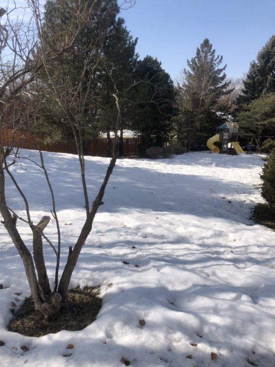
Tagged 50 briefly yesterday. Touch cooler today but the mid 40s and full sun still doing work on the snowpack. Down to 3" depth officially but lots of bare spots starting to show up.
-
46 and full sun today. Worked in a t-shirt during peak heating outdoors. Starting to see a big difference in mostly bare south facing sun drenched lawns vs. deep snow cover on north facing shaded lawns.
-
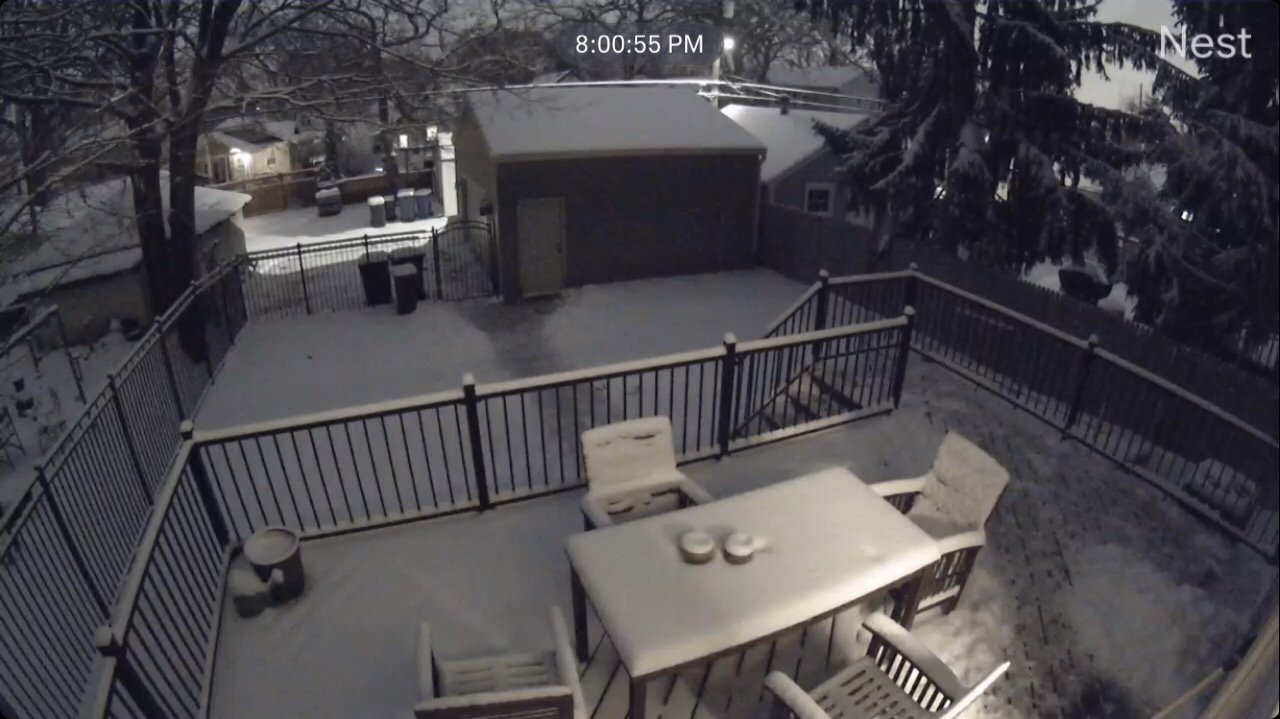
Fresh snow and a high temp in the low 20s today. Probably the last hurrah of “deep winter” around here. The pup is sure going to miss playing out on the frozen lake. With temps in the 40s this week the ice will be getting unsafe rather soon.

-
0.7” overnight to kick off the month. 5” snowdepth will probably dwindle to just a trace by the weeks end.
-
1.5” of slop to briefly freshen up the melting pack this morning. Sunny and 30 degrees to close out February. This month has now seen 5.9” of snow on an average of 7.5”
-
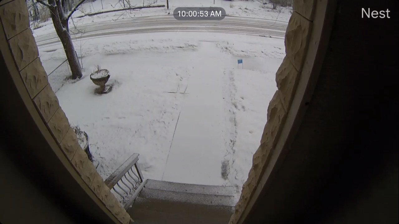
Local roads getting dicey from the slush we received overnight.