OrdIowPitMsp
-
Posts
2,333 -
Joined
-
Last visited
Content Type
Profiles
Blogs
Forums
American Weather
Media Demo
Store
Gallery
Everything posted by OrdIowPitMsp
-

December 15th-16th Warmth, Wind, and Severe Threat
OrdIowPitMsp replied to Geoboy645's topic in Lakes/Ohio Valley
Peak overnight wind gust at MSP of 60mph. 24F with snow showers currently. -
December 15th-16th Warmth, Wind, and Severe Threat
OrdIowPitMsp replied to Geoboy645's topic in Lakes/Ohio Valley
Temperature peaked at 58 just ahead of the (rather unimpressive) storms. Peak gust of 37mph so far. Things are eerily calm at the moment. -
December 15th-16th Warmth, Wind, and Severe Threat
OrdIowPitMsp replied to Geoboy645's topic in Lakes/Ohio Valley
Temperatures starting to jump up here as dews pool ahead of the line of storms. 54/52. Old record 51 -
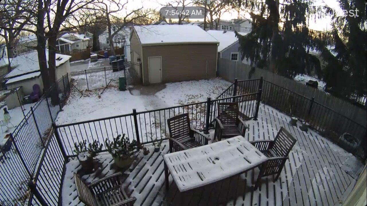
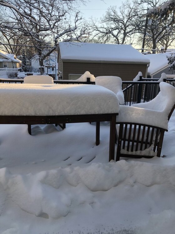
Grass is showing up. We’ve melted nearly 8” of snow in 18 hours. Will be left with patches and piles by morning.
-
December 15th-16th Warmth, Wind, and Severe Threat
OrdIowPitMsp replied to Geoboy645's topic in Lakes/Ohio Valley
There has a never been a recorded tornado in Minnesota in December. Let’s see how today changes that. -
We’ve still got 8” otg here. Will be very interesting see how much survives tomorrow. I recall a tornado in either Kenosha or Racine County WI in January back around 2005-2008 that occurred with snow on the ground.
-
That sounds like absolute hell. Troll post?
-
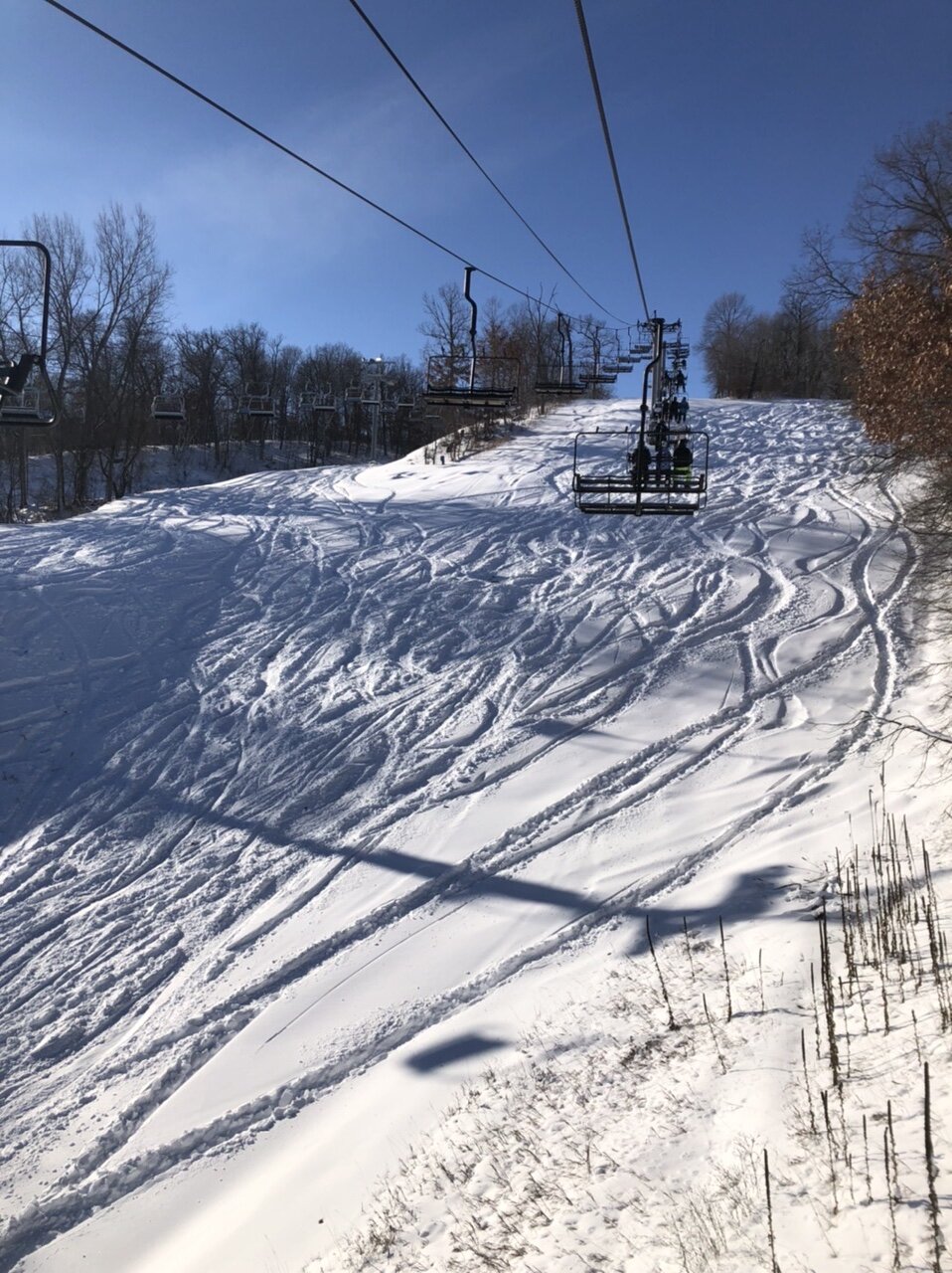
What a storm. 11.8” officially imby and the airport. Crazy this will likely be our biggest storm of the year with the rest of the sub in winter-less hell and record warmth on the way. Southern suburbs (5-10 south of me) received 15-18” under that stalled heavy band while northern suburbs where my in-laws live received 3-8” for a big spread south to north across the metro. Ratios ended up around 16-1 so a very light easy to shovel snow. I bought a new 2021 Toyota 4Runner TRD off-road this summer and decided Friday evening was the perfect time to test the 4WD system and drive 40 miles SE for some powder skiing. Well worth it. Things are very wintry around here with deep snowcover, at least for another couple days…..

-
The southern suburbs finished with 15-20” totals. The airport and mby finished with 11.8”
-
Looks like a 20” report just came in from Woodbury. (Eastern suburb)
-
What an evening it has been, especially here on the southern half of the metro. Sitting at around 9.5” imby so we should break double digits. Much more impressive there are many reports of 15”+ in the southern suburbs where the heaviest banding from earlier this evening stalled.
-
Stacking flake quickly in Minneapolis. Visibility under a mile in moderate snow. Airport cancellations ramping up.
-
Aren’t you in Mankato? I thought they did well with one of the February 2019 storms. Either way it’s looking good for both our areas.
-
First winter storm warning of the season imby. Going to be sweating the gradient tomorrow, would like to be 30-40 miles south but given the pattern we are in I’ll take it!
-
Hi-res models coming into focus and slowing inching north. First winter storm watch of the season posted. Looks like Minneapolis might win the thread the needle pattern award.
-
3” of snow otg, clear skies and 5 degrees. Finally feels like winter.
-
I think MSP will be on the far northern fringe of things so I’m trying not to get to excited. My local ski hill is 40 miles southeast so I’m getting pretty optimistic about powder skiing this weekend.
-
Todays wave came with more of a punch then expected. Very fluffy high ratio snow. 2-4” reports across the southern portion of the metro. The airport reported 1” as of noon. My guess is ~1/2” or so is added to the final total.
-
Low of 3 overnight. Temp has risen to 8 with light snow. Should see a coating maybe a quarter inch of new snow this morning while areas further south push towards 0.5-1”
-
Temps have held steady at 9 degrees all day with a stiff wind leading to wind chills around -10. We actually bottomed out at 7F this morning for the low.
-
9 degrees this morning. Coldest temp of the season. Airport is reporting 2” snow depth at 6am. I think that is a bit generous but there is definitely solid snow cover for the first time this winter.

-
1.1” officially at the airport. Might tack on another tenth or two this morning. Too bad it’ll be gone this afternoon before the cold blast comes through.
-
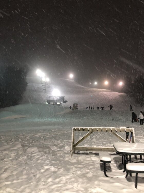
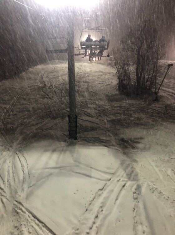
28 degrees and the Lt. Snow is readily accumulating. 2nd accumulating event of the season.
-
We’ve been under the F-Gen band for awhile this evening but snow finally beat the dry air and started reaching the ground. Hi-res models have been developing this band further and further south before it pushes north.