OrdIowPitMsp
-
Posts
2,299 -
Joined
-
Last visited
Content Type
Profiles
Blogs
Forums
American Weather
Media Demo
Store
Gallery
Everything posted by OrdIowPitMsp
-

March 2024 General Discussion
OrdIowPitMsp replied to HillsdaleMIWeather's topic in Lakes/Ohio Valley
Light snow underway a few hours ahead of schedule and readily accumulating. The last couple days have been below freezing and really cooled the ground off. -
March 2024 General Discussion
OrdIowPitMsp replied to HillsdaleMIWeather's topic in Lakes/Ohio Valley
My guess is they are waiting until after tonight’s snowfall to avoid confusing the public. Doesn’t make sense to me. My grid forecast for tonight says 3-7” so 4.1” fits nicely in that range. -
March 2024 General Discussion
OrdIowPitMsp replied to HillsdaleMIWeather's topic in Lakes/Ohio Valley
Bill Borghoff did the afternoon forecast discussion. He mentioned watches coming soon. -
March 2024 General Discussion
OrdIowPitMsp replied to HillsdaleMIWeather's topic in Lakes/Ohio Valley
P&C was bumped up to 4.1” imby for tonight’s event. NWS must think the heavier band will setup over the twin cities. We shall see. P&C is at 17” for the Sunday/Monday storm. Shocked it’s that high tbh. Models have been trending more frozen precip today but given the complexity of the setup I think it’ll be a nowcast type of storm. -
March 2024 General Discussion
OrdIowPitMsp replied to HillsdaleMIWeather's topic in Lakes/Ohio Valley
Getting a few flurries here in Maplewood (St. Paul suburb) -
March 2024 General Discussion
OrdIowPitMsp replied to HillsdaleMIWeather's topic in Lakes/Ohio Valley
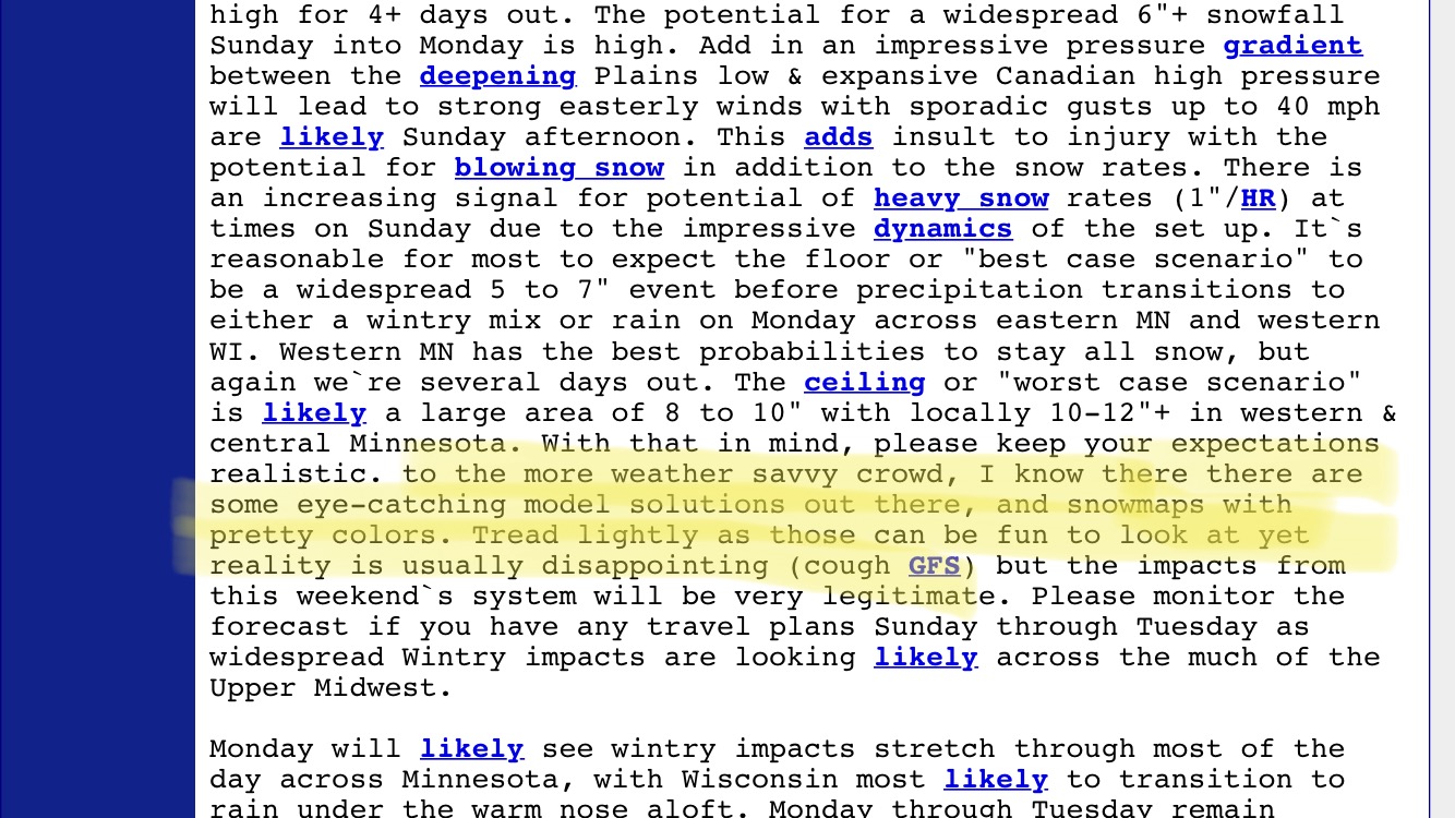
Every Twitter and Facebook metrologist needs to take the highlighted segment to heart.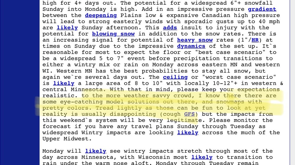
-
March 2024 General Discussion
OrdIowPitMsp replied to HillsdaleMIWeather's topic in Lakes/Ohio Valley
Wagons north is the trend today. Should still provide hefty precip totals here even if in more liquid form. -
March 2024 General Discussion
OrdIowPitMsp replied to HillsdaleMIWeather's topic in Lakes/Ohio Valley
19 outside as I leave for work. Chilly morning. -
March 2024 General Discussion
OrdIowPitMsp replied to HillsdaleMIWeather's topic in Lakes/Ohio Valley
NWS tweeted out the data. We’ve moved to #2 just in time for the streak to end!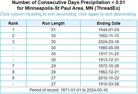
-
March 2024 General Discussion
OrdIowPitMsp replied to HillsdaleMIWeather's topic in Lakes/Ohio Valley
Quite a bullish afternoon forecast discussion by MPX. This tidbit at the end caught my attention. Things are about to change. “However, after the benign winter and how dry it`s been (MSP is now experiencing their second longest stretch ever with less than 0.01"), this system could bring major impacts to the region for a prolonged period.” -
March 2024 General Discussion
OrdIowPitMsp replied to HillsdaleMIWeather's topic in Lakes/Ohio Valley
I wonder how many times on record March 16-31 delivered more snow then December 1-March 15. -
March 2024 General Discussion
OrdIowPitMsp replied to HillsdaleMIWeather's topic in Lakes/Ohio Valley
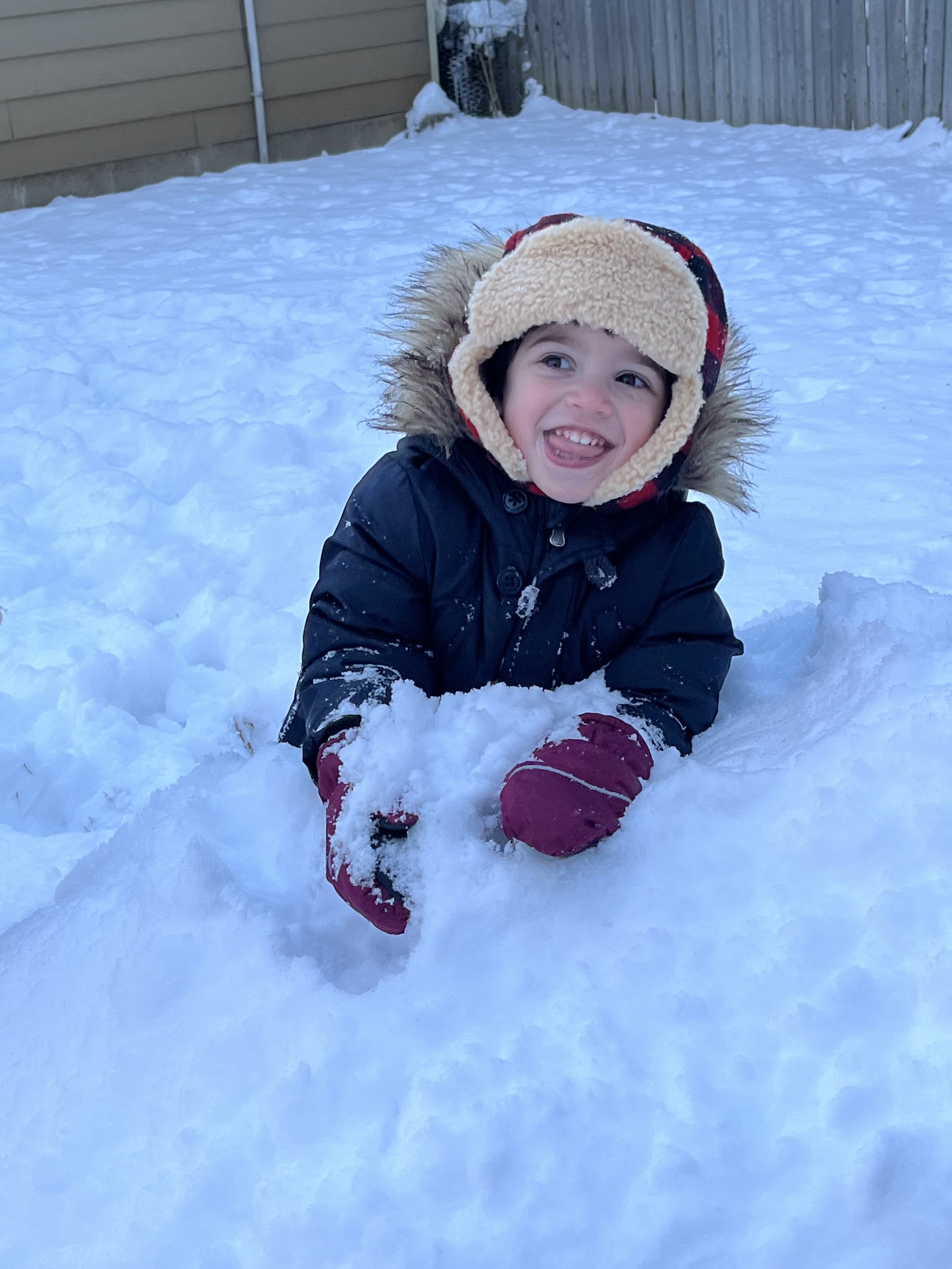
Hard not to get excited about this upcoming stretch for us in Minnesota. -
Winter '23-'24 Piss and Moan/Banter Thread
OrdIowPitMsp replied to IWXwx's topic in Lakes/Ohio Valley
Local ski hill (Welch Village) closed for the season yesterday. I only made it out 16 times this winter. I’d blame the weather for not getting at least 30 days on the snow but in reality parenting got in the way. Pretty damn proud of how the season went given the multitude of challenges running a ski hill must have been in the Midwest this winter.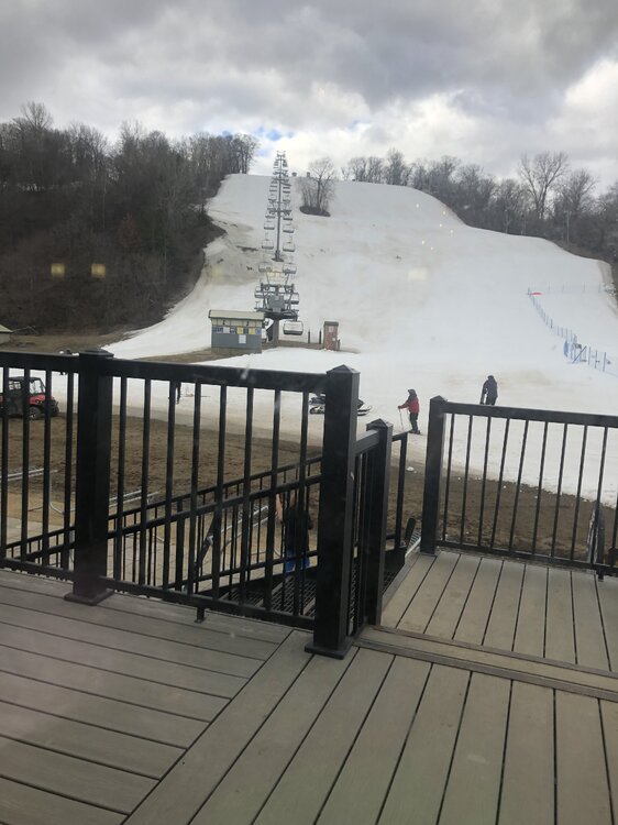
-
March 2024 General Discussion
OrdIowPitMsp replied to HillsdaleMIWeather's topic in Lakes/Ohio Valley
We still have another month until our annual April Blizzard. -
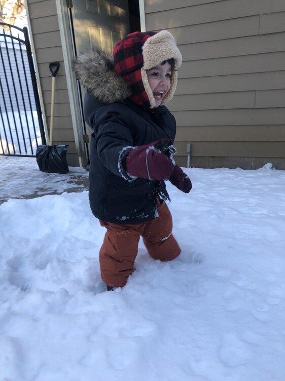
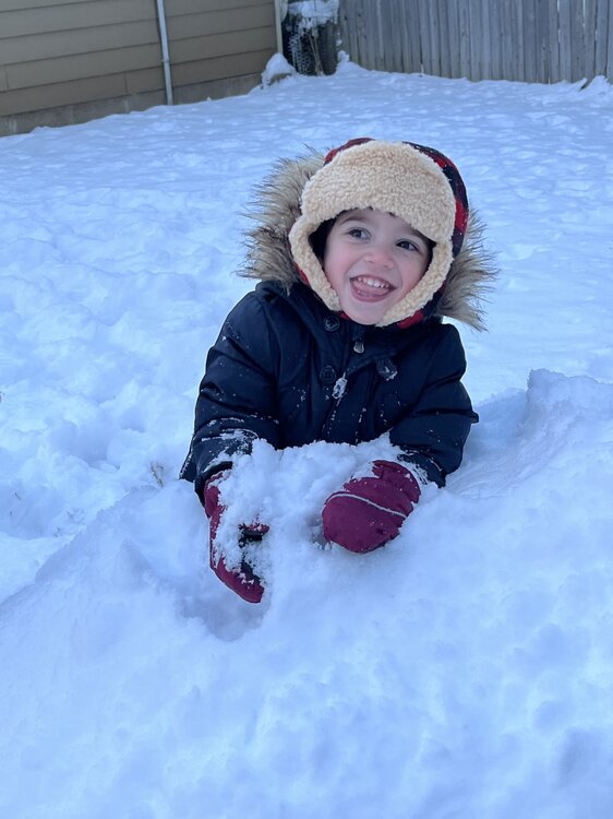
Any disappointment I had from missing out on futility was replaced by watching the joy on my kids face. If it ends up being rain or snow, I don’t care at this point. I’m just glad there’s something of interest to track again and hopefully knock back the drought concerns.
-
March 2024 General Discussion
OrdIowPitMsp replied to HillsdaleMIWeather's topic in Lakes/Ohio Valley
Few flurries this morning. Low 20s and breezy, but otherwise the benign weather continues. -
The full run GFS gives Minneapolis nearly 30” of snow, starting with a system next Thursday. That would get us within striking distance of normal snowfall for the season. Won’t happen but hopefully this is a signal for some unsettled weather to assist our parched soils.
-
March 2024 General Discussion
OrdIowPitMsp replied to HillsdaleMIWeather's topic in Lakes/Ohio Valley
High clouds. Not a drop of moisture. Just a trace of precipitation through the first half of March. -
March 2024 General Discussion
OrdIowPitMsp replied to HillsdaleMIWeather's topic in Lakes/Ohio Valley
Seeing some Hastas and Tulips starting to emerge here. Euro beats out the American guidance. Precip chances have been squashed. -
March 2024 General Discussion
OrdIowPitMsp replied to HillsdaleMIWeather's topic in Lakes/Ohio Valley
The theme of models drying things out as an event gets closer continues for Minnesota. What was looking like a decent 0.5-1.0” event for the southern half of Minnesota now is trending to be a thin band of 0.5” somewhere south of the metro. Just hope we can score a few tenths imby. Good luck with the convection for those to my south east. -
March 2024 General Discussion
OrdIowPitMsp replied to HillsdaleMIWeather's topic in Lakes/Ohio Valley
Did some skiing today at Welch Village. Started out very firm with temps in the low 20s but the March sun did it’s job and things became soft goodness and bottomless slush. My second favorite snow type to powder. Harvested lots of spring corn today. -
March 2024 General Discussion
OrdIowPitMsp replied to HillsdaleMIWeather's topic in Lakes/Ohio Valley
Jelly. Nothing but sun soaked here. -
Thanks for the info @Geoboy645 not going to get much precipitation with polar air in control.
-
Long range makes me think it’s the return of the Dust Bowl. I wonder what the record is for latest into the new year before Minneapolis surpasses 1” of precipitation for the year.
-
March 2024 General Discussion
OrdIowPitMsp replied to HillsdaleMIWeather's topic in Lakes/Ohio Valley
Another miss SE for much needed precipitation. 0.78” since January 1st in Minneapolis. That has to be among the lowest total in the region. I noticed some trees are budding down in the Minnesota River valley.