kvegas-wx
-
Posts
2,388 -
Joined
-
Last visited
Content Type
Profiles
Blogs
Forums
American Weather
Media Demo
Store
Gallery
Everything posted by kvegas-wx
-
The Monday wintry event potential (12/8/25)
kvegas-wx replied to GaWx's topic in Southeastern States
Just need some moisture here in the Triad. Already 2° colder than modeled at 33°. We could sneak down to freezing soon with no cloud cover. Don't you Virginia boys wreck a forum party! -
The Monday wintry event potential (12/8/25)
kvegas-wx replied to GaWx's topic in Southeastern States
School closings gotta be coming soon for the Triad and northern counties, right? If they closed for Friday, this is modeled as a higher impact event during school hours. Really curious to see what WSFCS does here. -
The Monday wintry event potential (12/8/25)
kvegas-wx replied to GaWx's topic in Southeastern States
Didn't wake up to the advisories, but there they are! Should be an interesting morning. Nowcasting will be required! -
We're going to wake up to some advisories tomorrow? This is looking more legit than Friday's whiff and we cancelled school from VA to FL for that nonsense! Models definitely not backing down inside of 48 hours.
-
Everything you said here is the equivilent of me just watching Stranger Things. As a matter of fact, what do you want to bet they are having a Miller A in the Upside Down! It's the only thing that makes sense!
-
Maybe there will be some sleigh tracks across the south for Christmas this year. As long as the cold keeps dumping, we have a chance!
-
Ground is 80% covered at the farm in Stuart at 1400'. Nothing here in the triad. Back to the models.....
-
Raining and 44° here in the triad. This is a non-starter. Next!
-
Absolutely nothing gets past you.
-
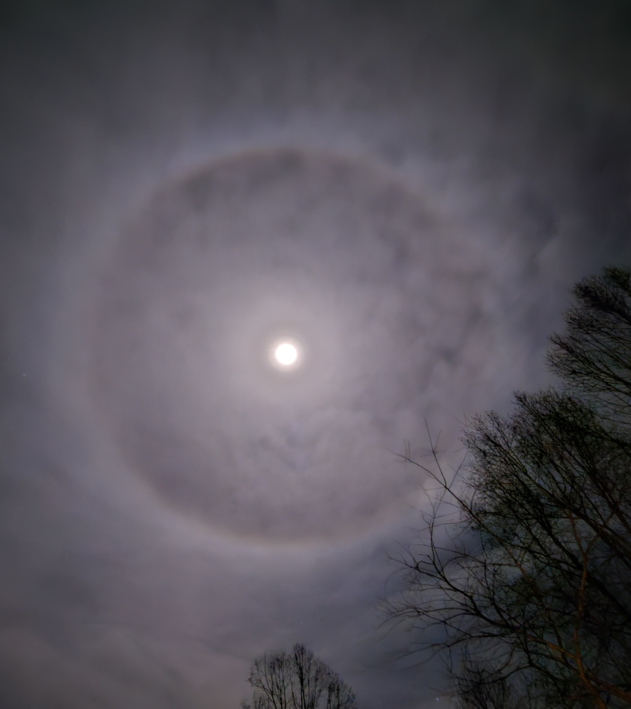
Here is the ring. Anyone want to take a stab at why this formed? Ice crystals?

-
Anybody in the triad go outside and check out the moon ring. Thats nuts!! When I figure out how to post a photo I will.
-
Who is going to mention ground temps?!? They're cold for once! Nearly every rain drop will stick. I'm a skeptic until the mulch is white.
-
This is a very different answer for your area of VA vs most of the NC foothills. Showing a bit more snow for you. Model runs later tonight should be interesting to see if the trends hold.
-
Not trolling, just a novice observation and welcome any explanations. But I am so tired of seeing the comment about "snowpack being laid down will help us" every single year. Anyone want to elaborate on why snowpack across the mountains and 500 miles northwest will help our battle against a nearly decade long SER problem? Sure it may help with cold-er air chasing our moisture from the southern stream. But I honestly cannot recall a single event where snowpack was featured as the reason our temps were favorable enough to enable a winter storm. What's the thinking here? (And any case studies?)
-
"It only takes one storm....." in 3, 2, 1.......
-
My obs....COLD AF....and it took one day of the heat coming on to make me sick. Happens every year! I need a humidifier asap. What a completely unreasonable event yesterday!
-
Snowing in Mooresville!
-
Daughter sent me a video of snow in Mooresville. Lake Norman area is seeing a good shower!
-
Major Hurricane Melissa - 892mb - 185mph Jamaica landfall
kvegas-wx replied to GaWx's topic in Tropical Headquarters
All I can think about regarding the recovery is mold. Everywhere. Helene was terrible here in the NC mountains with mold remediation needs. But in Jamaica with no power for months and the high heat and humidity, its going to be awful. Lot of folks starting over there. And they should seriously be looking at concrete printed homes. Never a better case study than now. -
Thats a photo of my Jan 2026 winter storm right over Forsyth County. Snowing at 60" per hour right under those clouds.
-
I want to see this in 4 weeks when I know it is here to stay and will only get colder. End of August is waaay too early to get excited. October 90s are a thing you know!
-
Ocracoke Island now has mandatory evacs effective immediately. (If this should be in OBS please move. Not an active discussion other than here)
-
Mandatory Evacs beginning now thru Tuesday morning for Dare County. Will be expanded soon to include additional Islands / Counties I would imagine.
-
Correct. Not worried about their immediate safety, but the ferrys may stop running for 2-3 days and that alone causes some big issues out there.
-
Tell me about it. Half my family is on Ocracoke this week for vacation. Ferries are filling up quick.