Hotair
-
Posts
539 -
Joined
-
Last visited
Content Type
Profiles
Blogs
Forums
American Weather
Media Demo
Store
Gallery
Everything posted by Hotair
-
Euro imagines a direct hit to New England from a high end category 2/ cat 3 Lee next Sunday question is what is Euro seeing now that wasn’t evident 12 hours ago and that other models are dismissing ?
-
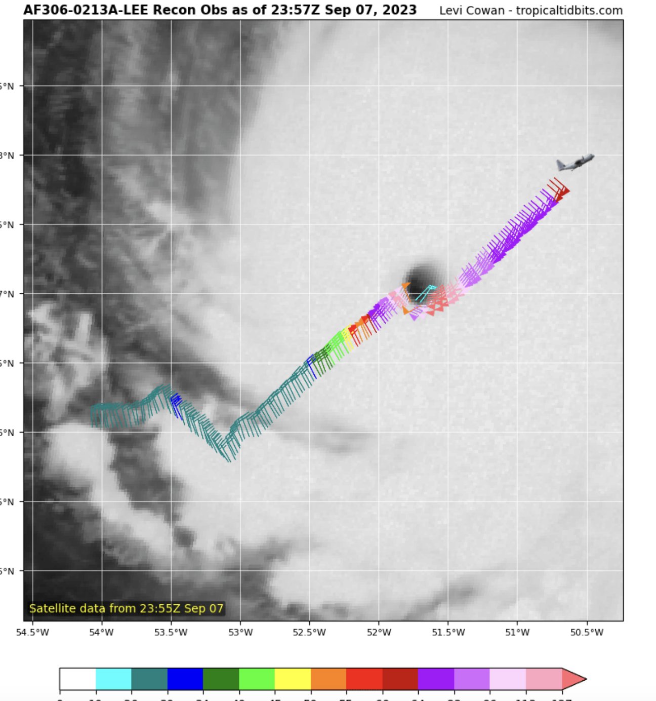
IR presentation almost suggests a WSW heading now, but it’s difficult to say for sure since the inner core has completely disintegrated (dry air and sheer forces) yesterday we saw RI and now it’s like we’re witnessing Rapid Weakening
-
Ok it was not clear from previous response that it would actually break the model if they used real values. It just seemed like a capricious choice
-
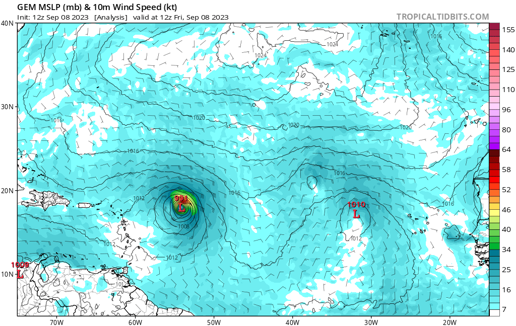
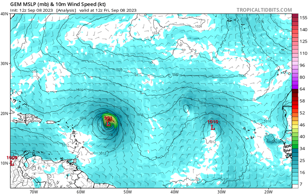
Initialized Lee at 991 mb Where do they get these #s ?
-
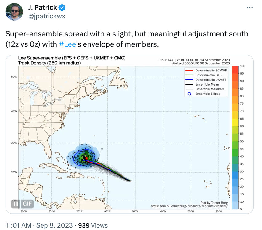
https://twitter.com/jpatrickwx/status/1700162335355097241?s=20
-
Anyone else notice a WSW wobble in the satellite presentation ? If the grid overlays are accurate Lee is trending toward the South side of the official track cone at this hour. Not of great significance yet but the models should reflect this on the next runs
-
Can someone here care to explain the rationale for the models initializing using much higher pressures than what recon measured ? Mike's Weather Page @tropicalupdate · 1h Recent models initializing way higher than actual. EURO 983mb, GFS 966mb, CMC 996mb, ICON 999mb. HAFS/HMON seem accurate. Odd?
-
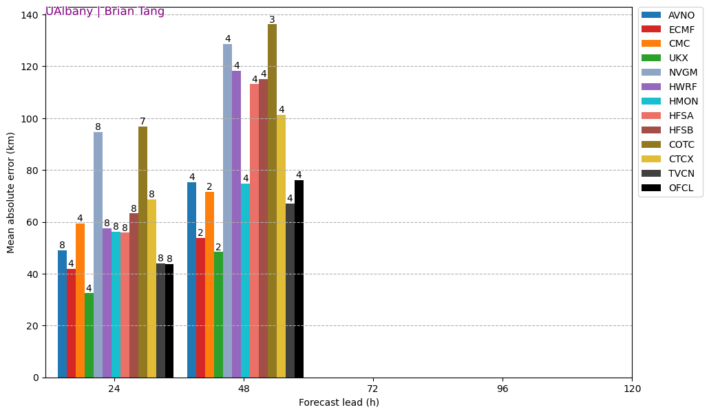
Model track accuracy for Lee

-
Or ERC?
-
Cat 5 winds in NE as well

-
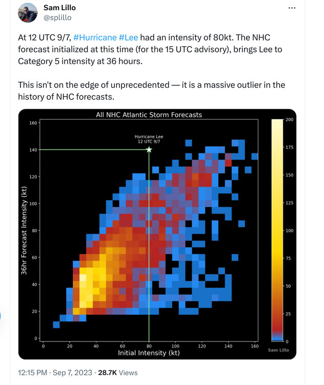
Worth mentioning that none of the models had Lee as a Cat 5 at this hour. also, even if NHC waits until the 11 pm advisory to call it a Cat 5 it will still be a record for rapidLee intensifying to a 5 in the Atlantic
-
First pass. Correct. This is CAT 5 material We should know more in about 10 minutes as it punches into the NE quadrant
-
That temperature is nuts

-

-
Some of the top AI machine learning models are looking for New England impacts from Lee.

-
-
New England has never seen even a Cat 4 storm come onshore. Most powerful one was a Cat 3 in 1938 (New England hurricane ) which caused significant damage throughout Long Island. Needless to say, all the stick built homes and above ground utilities would be utterly destroyed if a powerful cane like Lee were to come onshore as a Cat 4 anywhere along the New England coast.
-
HAFS Model projects sustained 190-200MPH winds with gusting well over 210 MPH by Friday. This will be pushing record territory for Atlantic Canes and will certainly have the attention of every actuary working in the insurance industry.
-
SAR shows 95 knot sustained winds in NE quadrant. Safe to say we have a Cat2 for now
-
The approach and transit through 70W will certainly provide high quality suspense to cane fans everywhere
-
That was 12 hours ago?
-
Anyone have any opinion on how well Gainesville should fare? Have a kid at UF
-
Plenty of time left over hot water to get to CAT 3. May even sneak up close to 4 as it approaches the Coast. If it doesn’t, it certainly won’t be because of a lack of an energy source given the record high GoM water temps.
-