ams30721us
-
Posts
670 -
Joined
-
Last visited
Content Type
Profiles
Blogs
Forums
American Weather
Media Demo
Store
Gallery
Everything posted by ams30721us
-
Nothing to bang the drums about, but as a few others have mentioned, watching a few opportunities for some wintry mischief next week. The first period to keep an eye on is a quick moving disturbance Tuesday, that could at the very least spark off a few snow showers. The vort is really not that far off from something a bit bigger, but would need to drift a little more west as it digs Monday night. The second, more fun disturbance to watch could be the one towards the end of the week into the weekend. Again, nothing to shout from the rooftops yet, but hey it's a few things we have to watch in the coming days imo!
-
Timing is going to be big as usual with this type of setup. The past few days, most models were delaying the onset of precipitation till during the day Friday, and into Saturday. Just noting the early 12z data today, has shifted back to an earlier onset, Thursday evening, leading to a colder/drier airmass, and allowing for a slightly better signal for some icy concerns by Friday morning. Also, the GFS seems to become quite amped up with an inland tracking surface low up closer to the Apps, while the other guidance is indicating a low tracking further east along the coast. In the end, this may not matter much as the high slides out during the day, Friday leading to a narrow window of opportunity. Just a few thoughts to monitor in the future trends.
-
Here comes winter -- October 28-November 1 Snowstorm Potential
ams30721us replied to Hoosier's topic in Lakes/Ohio Valley
Yep, we had several large trees come down with the heavy, wet 1"-2" in Davenport this morning. -
Here comes winter -- October 28-November 1 Snowstorm Potential
ams30721us replied to Hoosier's topic in Lakes/Ohio Valley
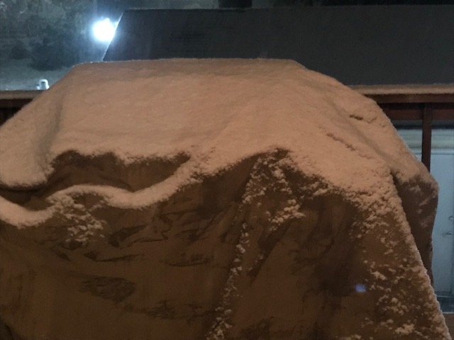
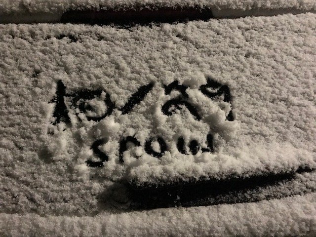
Just a few quick shots from earlier in the event around DVN.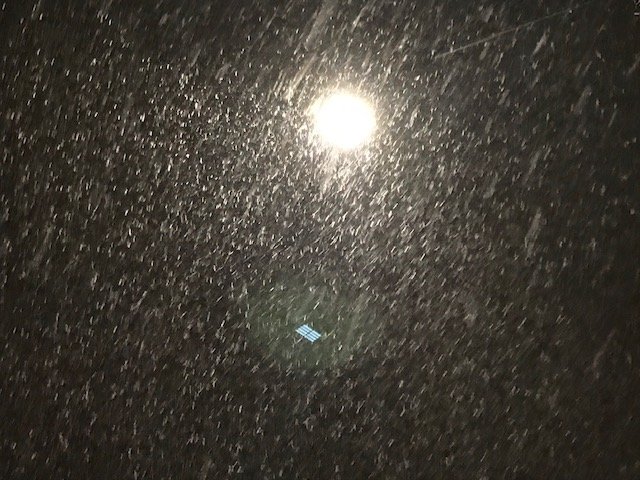
-
Here comes winter -- October 28-November 1 Snowstorm Potential
ams30721us replied to Hoosier's topic in Lakes/Ohio Valley
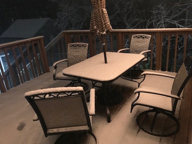
Man...it is literally pouring snow currently in Davenport. Very low visibility, main roads starting to become snow covered, and at least 1/2 to 1 on the grass, and decks/patios now. Nice early treat for sure! -
12Z Euro says, hold on it's gonna be CLOSE next weekend. At least something to watch. Arctic air, and precip! The last front did just plow thru the SE ridge giving the SE a storm.


-
It's almost here! Moving into Kaufman & Van Zandt county now! Fingers crossed! LOL
-
I'm going to need you to post the Texas tech model for us please! Lol
-
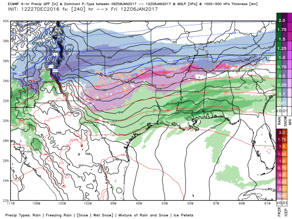
We actually have pretty good agreement now (barring an 00z Euro change) of this threat of a few waves overrunning the arctic cold front late next week. The GFS has come around to the Euro timing and strength of the initial trough and cold push. That allows the arctic air to be established a good 24 hours, before a few waves move across the area from west to east starting Wednesday night- Thursday and then again possibly on Friday. Minus some major blocking scheme change, I think this may be a pretty strong threat!
-
Oh...and let's be fair and include the CMC too at least in some respect.
-
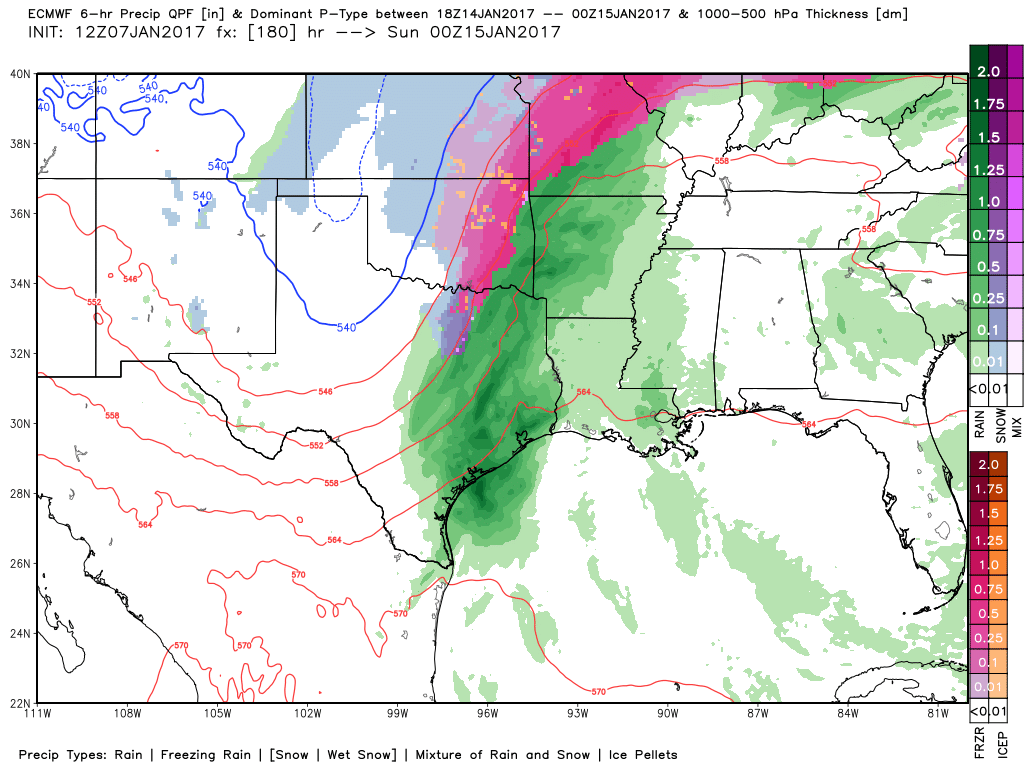
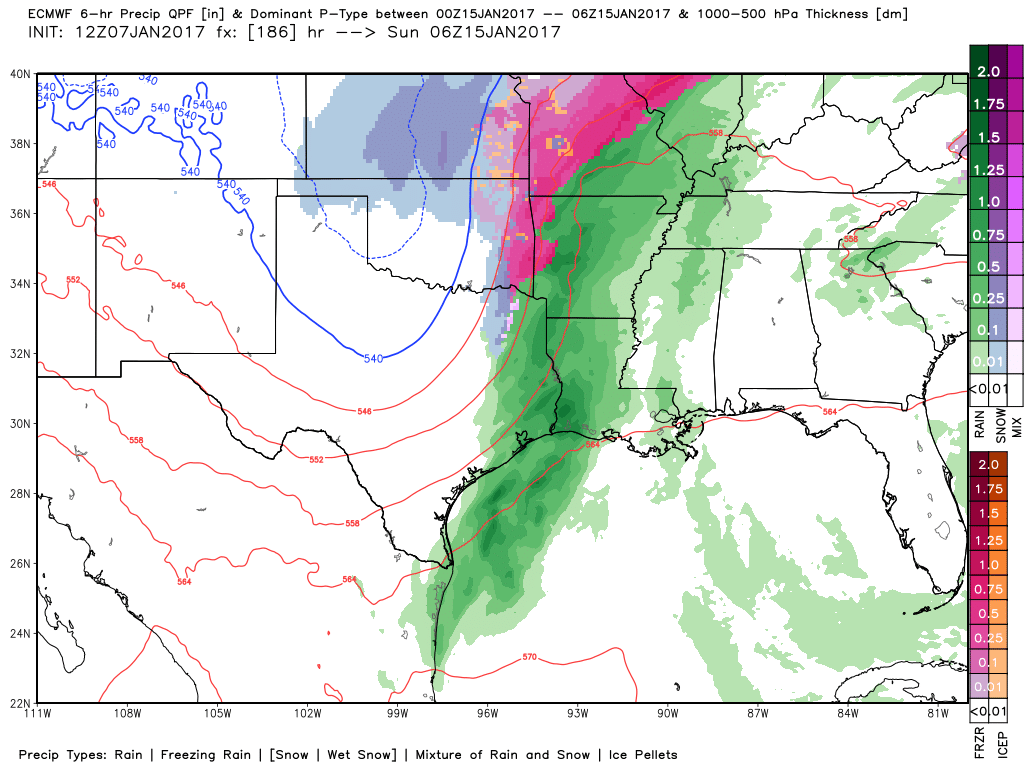
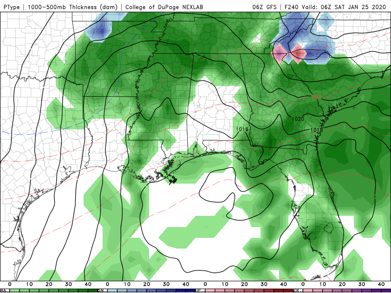
Looks like both the 12z GFS & 12Z Euro Suite are on board for getting some wintry weather down to at least the I-20 corridor in Texas by the end of next week behind the next arctic front.
-
Wow! I can't even imagine! I still have some swings to get used to! Thats just gotta be unreal to the body!
-
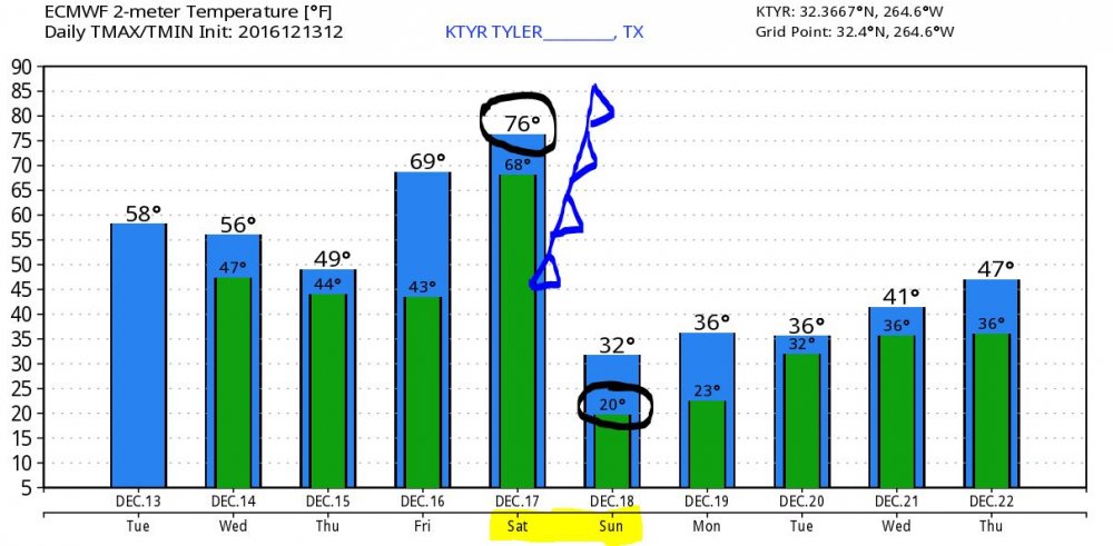
Wow! This reminds me a TON of March 2014 here. The night of the big Ice storm behind the arctic front. Not saying we will see that again, but that day we had temps in the 70's before the front rolled thru and we dropped into the low 20s here by morning. This front may even be stronger than that one since back then we actually had 3 inches of sleet and freezing rain everywhere. What a wild drop! 76-20 in 12 hrs! Oh and temp Tuesday are def. not balmy with that next system hovering around or just above freezing on Tuesday.
-
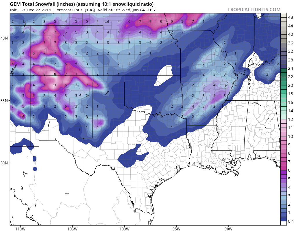
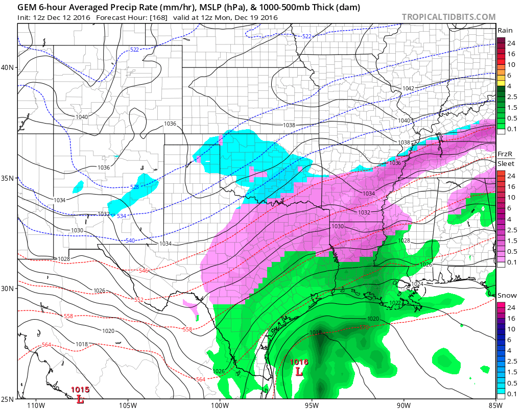
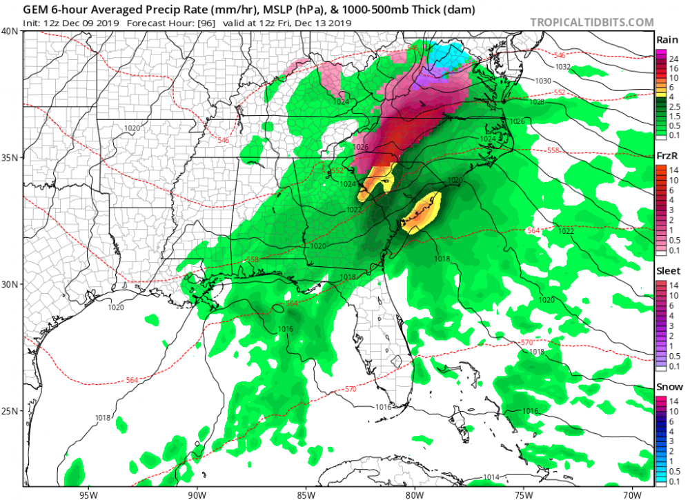
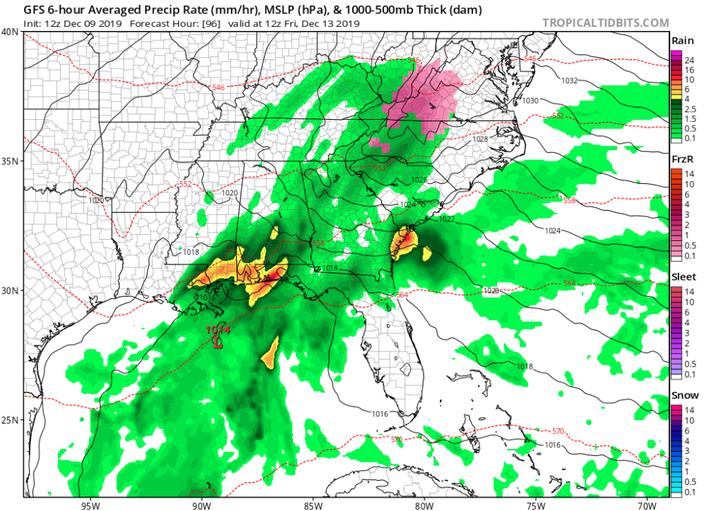
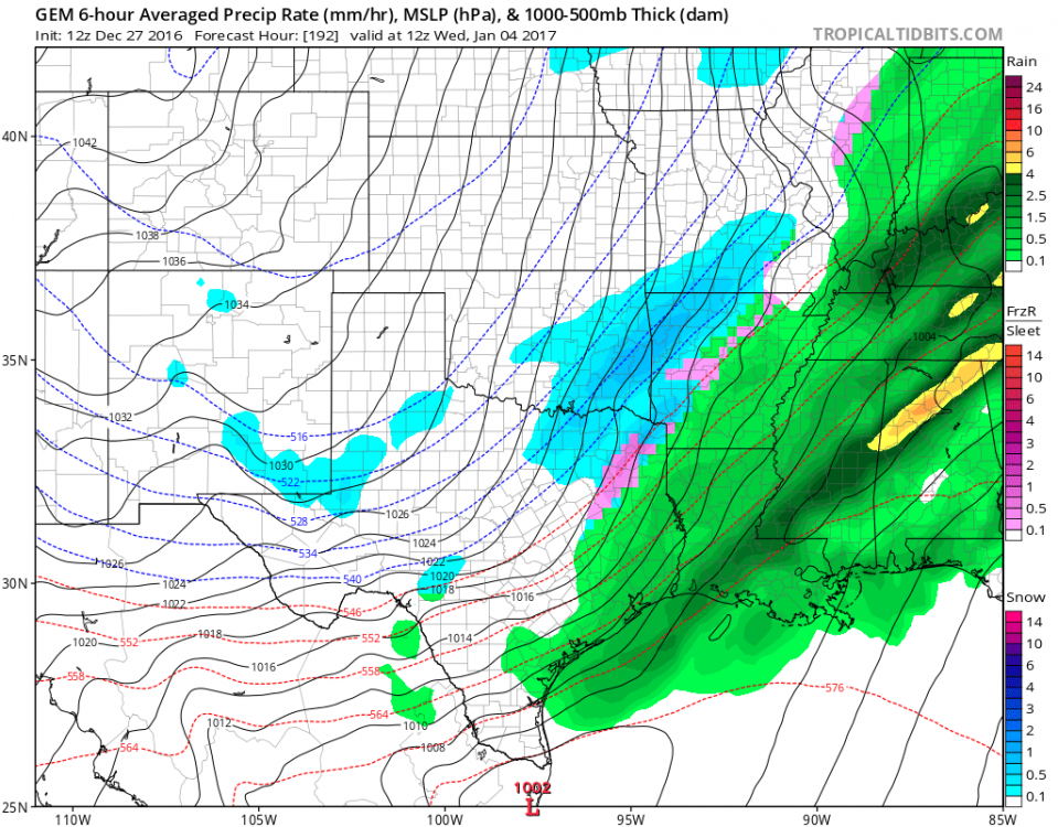
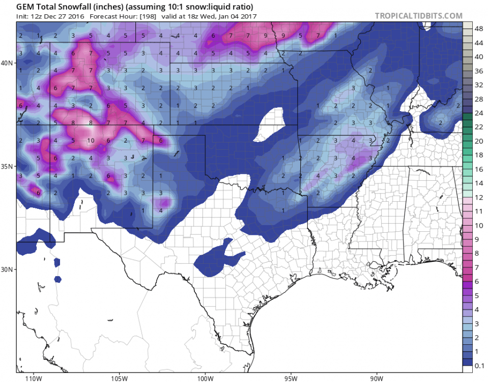
Starting to get interested in this potential energy rolling thru on Sun ngt into Monday. Cold air will be in place, so if the energy rolls out for Monday, It could get a bit messy for sure. Here's the 12z GEM picture. GFS also has the system, although on the 12z it was a bit displaced further east.

-
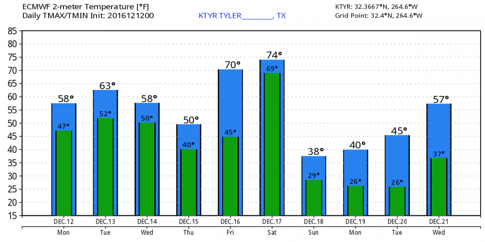
The 00Z Euro sure does paint a fun temperature swing for ETX heading into the weekend! Ha Spring Break to January in 24 hours Saturday into Sunday
-
From SHV: Watching Sat night/Sun and next Monday for interest...
-
Wow! The 12z Arctic Plunge may make this week feel like Spring!
-
I don't know if the ASOS is reporting this correctly, but if so it matches up with that moderate band of echoes south of DFW