forecasterjack
-
Posts
108 -
Joined
-
Last visited
About forecasterjack

-
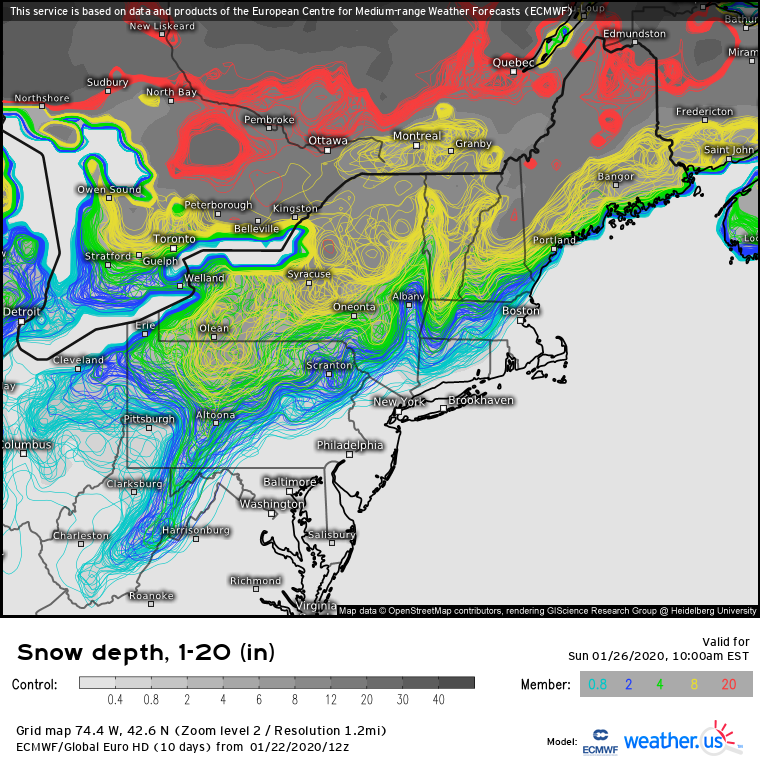
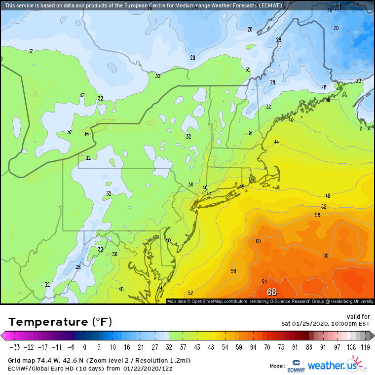
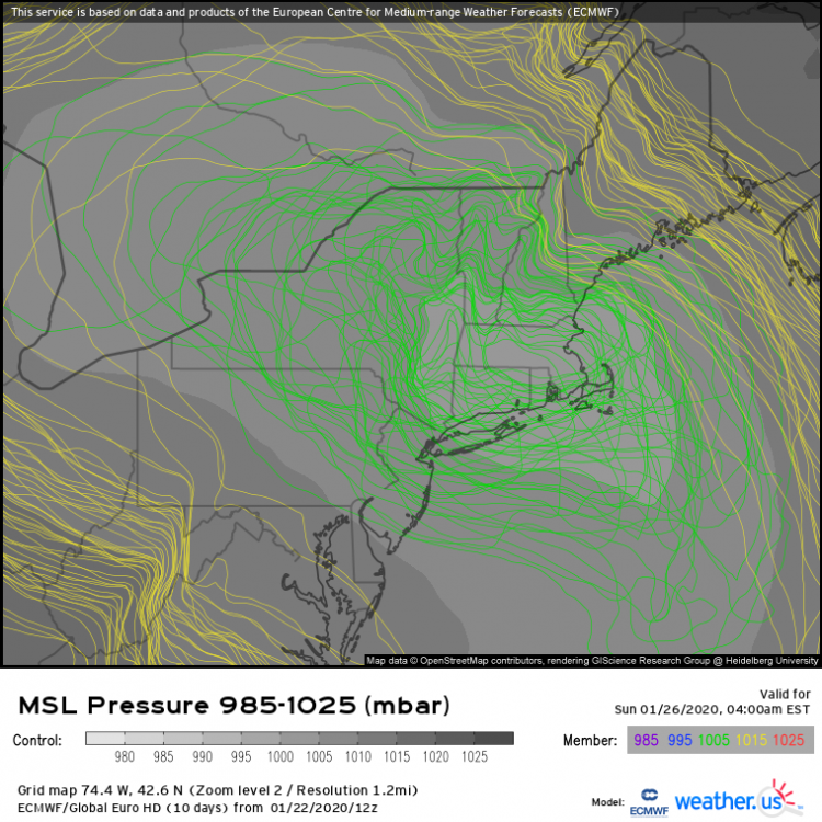
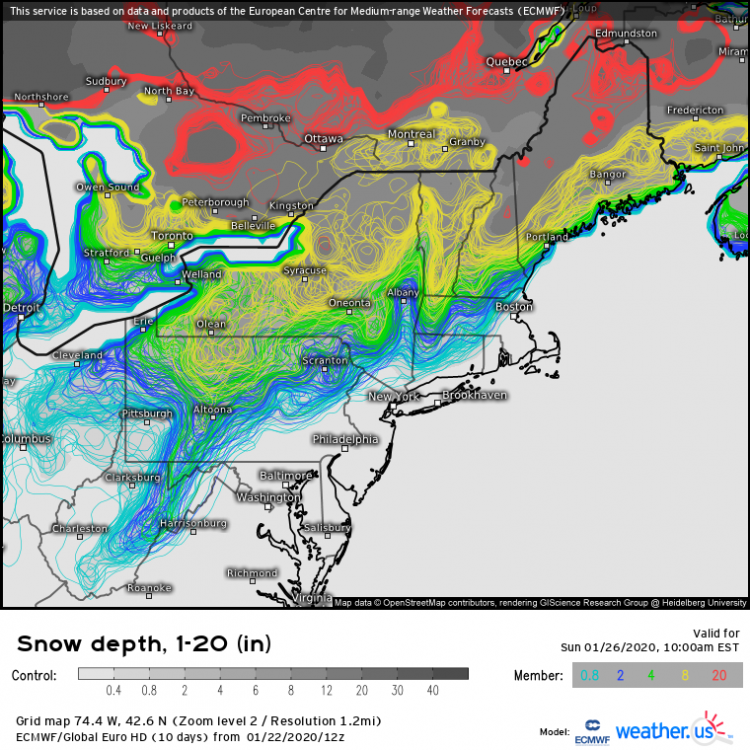
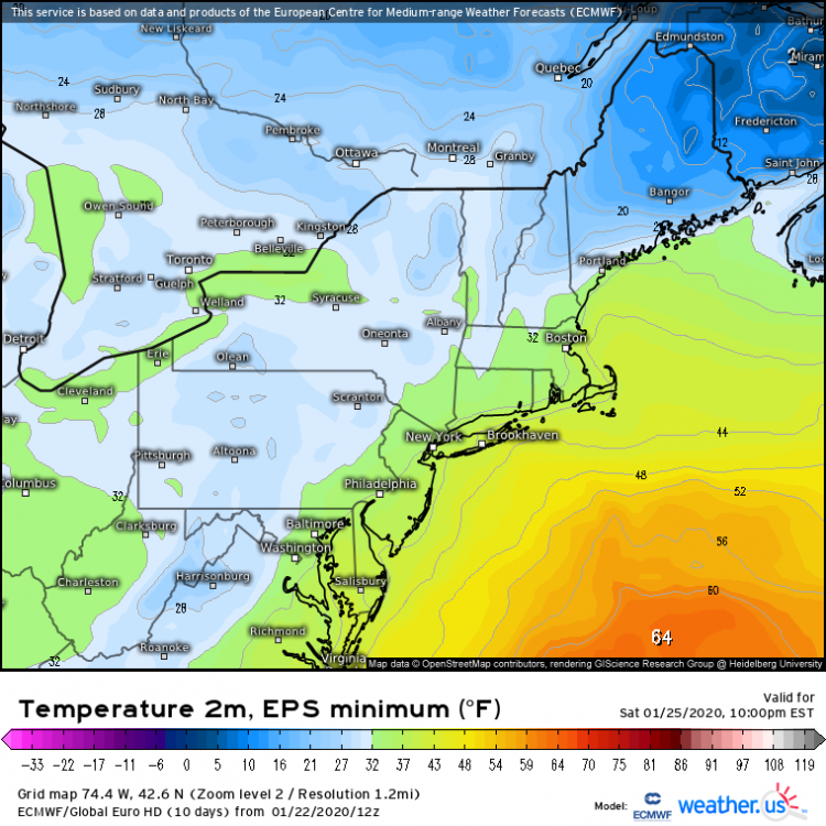
hi! Let's take a look at the EPS... All members have honed in on a low track somewhere between the Mass Pike and Long Island. There's still a bit of variability within those bounds though, and that will make all the difference for N MA/S VT/S NH/S ME. Taking a look at EPS snow depth forecasts for after the event, it's pretty clear that even in the more southern solutions, the I-95 corridor is all rain. You'll note a lot more spread as you move into the Catskills/Albany/Berkshires/Southern NH/Worcester Hills area. That's where future adjustments in track/intensity will make all the difference IMO. Another way to look at this is by seeing what the coldest 2m temp forecast among all the EPS members is. For 10 PM Saturday when the heavier precip would be around, even the coldest ECMWF members have the I-95 >32F. So there's still some room for a southeastward correction, but it's probably too small to matter much for the I-95. Interior areas though definitely should keep watching
-
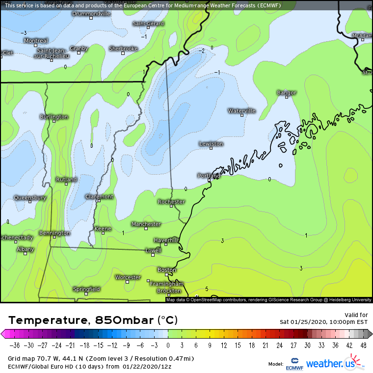
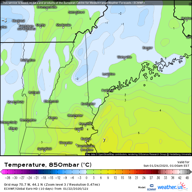
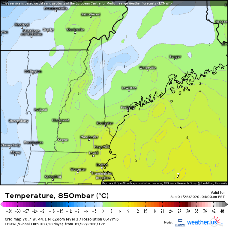
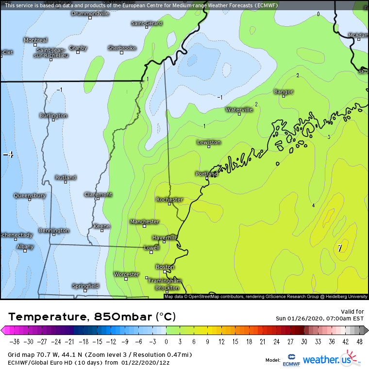
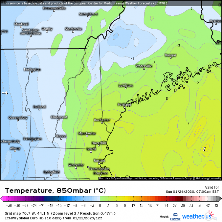
yep the high res makes a big difference, as does being able to zoom in. ME/NH stay <0C at 850mb for the duration of the event https://weather.us/model-charts/euro/707-w-441-n/temperature-850hpa/20200126-0300z.html


-
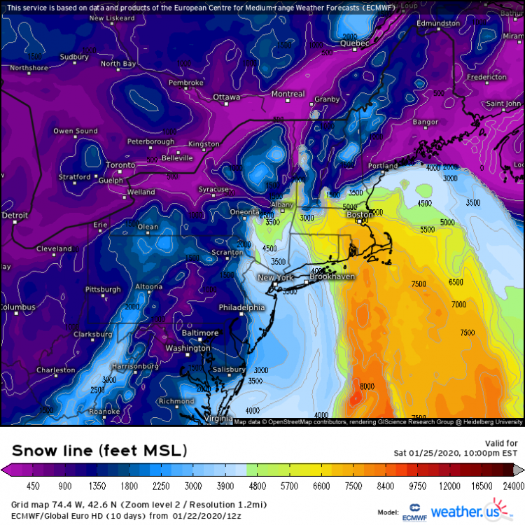
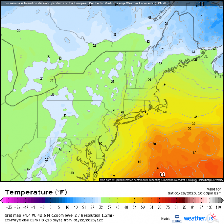
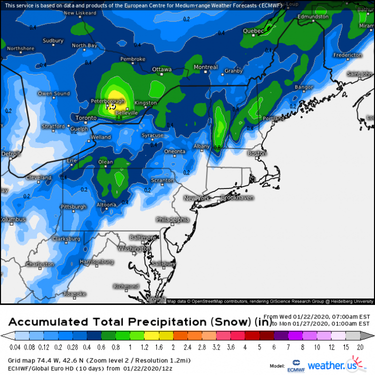
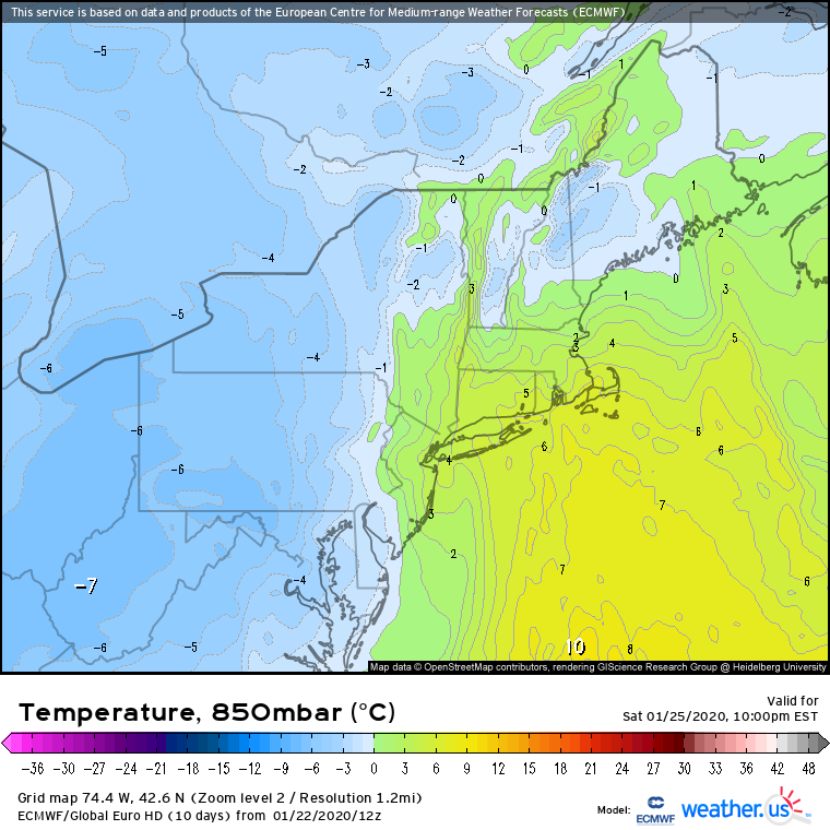
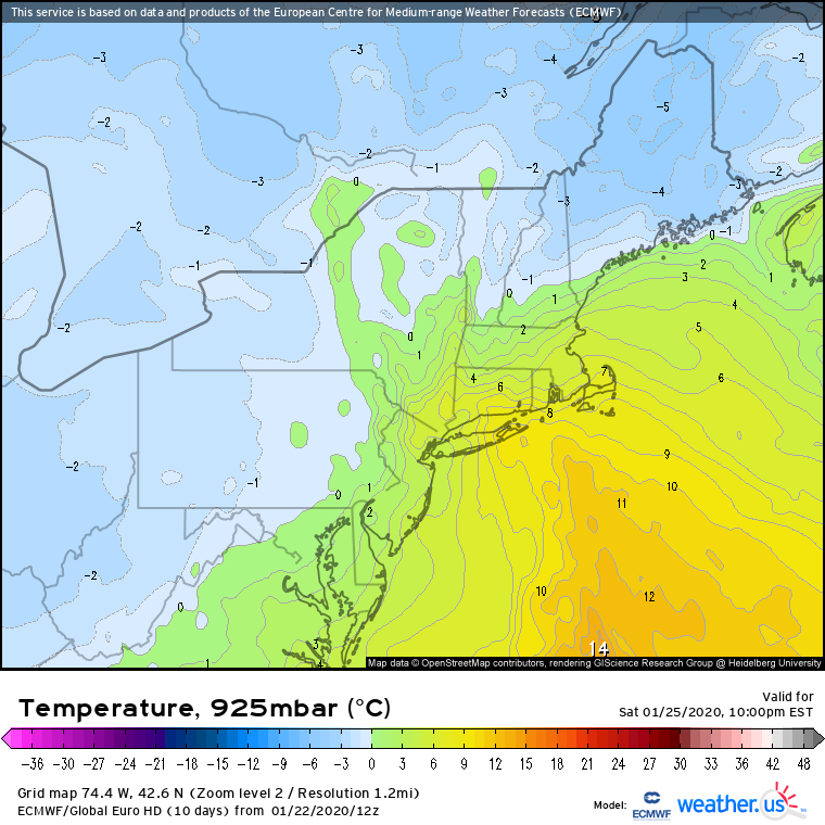
FWIW, here's the ECMWF's forecast for the snow line on Saturday night. It reads out the topography where snow is falling, which is why the whites/greens/dacks show up even though it's cold enough for snow there. The bottom of the warm layer is still pretty darn high (3000-7000ft) over SNE. Even over the Catskills, it's >4000ft (higher than the terrain there). Checking lower level temps (sfc-850mb), we see that the warm layer is pretty warm and pretty deep until you hit NH/VT/ME or the NY Thruway Gonna be hard to punch through that, even if you get intense lifting. The ECMWF's QPF-falling-as-snow forecast I think does a pretty good job with the spatial extent of who is snow and who is rain. Multiply by a ratio of your choice at your own risk haha, even in the Greens/Whites, warm temps into the 700mb layer should do a number on our ability to grow dendrites efficiently