

StormChazer
-
Posts
1,193 -
Joined
-
Last visited
Content Type
Profiles
Blogs
Forums
American Weather
Media Demo
Store
Gallery
Everything posted by StormChazer
-

MO/KS/AR/OK 2024-2025 Winter Discussion
StormChazer replied to JoMo's topic in Central/Western States
Edited to get rid of confusion! Now they are the same. -
MO/KS/AR/OK 2024-2025 Winter Discussion
StormChazer replied to JoMo's topic in Central/Western States
High res NAM This is midnight. I would say this is probably the best case scenario at this point that we could reasonably expect. This is midnight's totals with precip still falling. -
MO/KS/AR/OK 2024-2025 Winter Discussion
StormChazer replied to JoMo's topic in Central/Western States
The NAM says, "Sorry about that afternoon run, Idk what got into me". -
MO/KS/AR/OK 2024-2025 Winter Discussion
StormChazer replied to JoMo's topic in Central/Western States
So far, the 500mb vorticity on the NAM is looking more like the 06Z run than the 12Z run, which is good. But just getting into Wed night atm. -
MO/KS/AR/OK 2024-2025 Winter Discussion
StormChazer replied to JoMo's topic in Central/Western States
I want to say there's an interesting statistic that when the Canadian and ICON agree with one another, it has a very good track record. But otherwise, it's always too cold or overdoes it. It is the optomist's model, lol. -
MO/KS/AR/OK 2024-2025 Winter Discussion
StormChazer replied to JoMo's topic in Central/Western States
The 12Z High Res Canadian isn't going with the NAM at all. Canadian NAM -
MO/KS/AR/OK 2024-2025 Winter Discussion
StormChazer replied to JoMo's topic in Central/Western States
And just like that, the 12Z NAM has ALL the meteorologists biting their nails. The storm just doesn’t manifest. The precip train stays to the south of DFW and the cold air doesn’t catch it. Dry and where there is precip it’s rain. And we don’t even sniff flurries up here on that run. So here’s to hoping the NAM is out to lunch and not onto something… -
MO/KS/AR/OK 2024-2025 Winter Discussion
StormChazer replied to JoMo's topic in Central/Western States
Latest NAM with more with probably another 3 more hours of snowfall. -
MO/KS/AR/OK 2024-2025 Winter Discussion
StormChazer replied to JoMo's topic in Central/Western States
Many Mets will tell you to throw out the 06Z and 18Z Euro runs because they don’t have proper data to reflect a successful projection. I’m hoping that’s true because the 18Z euro trended south with the totals giving most of us just 1-2 inches. Crossing fingers for good news in the evening runs tonight! -
MO/KS/AR/OK 2024-2025 Winter Discussion
StormChazer replied to JoMo's topic in Central/Western States
One thing looks to be apparent, it’ll be a sharp gradient between the have and have-nots. I just want at least 4 in Tulsa. I don’t need 8-12(although I’d love that), just at least 4. Very doable with this setup, but I’d we can shift north a little more over the next 36 hours that’ll make me feel better. -
MO/KS/AR/OK 2024-2025 Winter Discussion
StormChazer replied to JoMo's topic in Central/Western States
GFS more snow, Canadian MUCH more snow. -
MO/KS/AR/OK 2024-2025 Winter Discussion
StormChazer replied to JoMo's topic in Central/Western States
Last nights runs did 2 things. 1) All the major models now agree on the idea of a major winter storm impacting Texas/Oklahoma in a broad but relatively same area. Beforehand, there was still some discrepancy on whether it would happen or not in the runs. 2) There was a northward shift in the precip amounts, mostly due to a broad area of snow that is expected to develop and push through most of us. These new runs put most of us in the 2-6 inch range. My rule of thumb is it usually takes at least 4 inches to be a truly memorable, nice blanket of snow on everything worth playing in etc. I’m hoping last night’s runs aren’t the needle swinging in the opposite direction only for it to move back south a little more, and instead it is a trend that the afternoon models will reinforce. I’ll continue to post precip maps etc from my weather bell account. If anyone has any requests, let me know and I’ll post it. -
MO/KS/AR/OK 2024-2025 Winter Discussion
StormChazer replied to JoMo's topic in Central/Western States
I'm OK with this 5 days out. I obviously want a shift north, but the fact that the EURO is hanging onto a snowstorm in and around our area is a good place to be at this stage. Now we just cross our fingers for a 50 mile shift north and we are COOKING. -
MO/KS/AR/OK 2024-2025 Winter Discussion
StormChazer replied to JoMo's topic in Central/Western States
The Euro is beginning to bite on next week's storm now. -
MO/KS/AR/OK 2024-2025 Winter Discussion
StormChazer replied to JoMo's topic in Central/Western States
Latest High Res NAM brings us about .5 to 1 for a good amount of us. If we can land some mood flakes with a dusting for Sunday afternoon, I'll take it. -
MO/KS/AR/OK 2024-2025 Winter Discussion
StormChazer replied to JoMo's topic in Central/Western States
Getting flashbacks of the 1/11/19-1/13/19 snowstorm that we all missed out on by a hair. I remember how depressed I was on this day, knowing if I just hopped in the car and drove 2 hours away I would be in a winter wonderland, and instead it was 33 degrees with a cold rain. This is practically the same situation. Great pattern ahead of us though for more chances!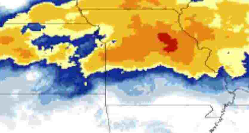
-
MO/KS/AR/OK 2024-2025 Winter Discussion
StormChazer replied to JoMo's topic in Central/Western States
Just waiting for a storm to truly overperform in a big way. I feel like it’s been around 10-15 years here in the Tulsa area now since we’ve truly had a major winter storm impact the area in a way that is talked about for a while. Don’t get me wrong, we’ve had a couple 4-6 inchers the last 10 ish years, and some ice that lasted a couple days(and of course the deep freeze of 21’). But I’m talking about something to truly remember. I just feel like we are due at this point. This storm likely isn’t going to be one for Tulsa to even mention(unless the models do a 100 mile jog to the south over the next 48 hours). But I’m holding out hope that this year we get something special. -
MO/KS/AR/OK 2024-2025 Winter Discussion
StormChazer replied to JoMo's topic in Central/Western States
I can always count on the Canadian to get my hopes up! -
MO/KS/AR/OK 2024-2025 Winter Discussion
StormChazer replied to JoMo's topic in Central/Western States
Wake me up when winter actually arrives. Been in this above normal pattern since basically September. Summer never wanted to leave and Winter has been timid to show its face. Hoping that the new year brings a very active Jan/Feb. Merry Christmas everyone! -
That's an EF3 maybe even a 4 by the looks of it, can almost make out what looks like horizontal vertices.
-
Just keeps looking better and better on IR.
-
Little wobble to the SE at the moment. But could also be an optical illusion as the eye reforms.
-
The eye has gotten unbelievably small. If this is the start of an EWRC, I just hope recon gets there first so we can give this thing the records it deserves.
-
Looks like the recon flight turned around?
-
Towers going up in the SE Quadrant, might see some more symmetry here and begin to see a pressure drop.


