StormChazer
-
Posts
1,193 -
Joined
-
Last visited
Content Type
Profiles
Blogs
Forums
American Weather
Media Demo
Store
Gallery
Everything posted by StormChazer
-

MO/KS/AR/OK 2019-2020 Winter Wonderland Discussion
StormChazer replied to JoMo's topic in Central/Western States
I should also note that this run of the NAM does NOT include the new upper air data sampled from this morning. So food for thought. -
MO/KS/AR/OK 2019-2020 Winter Wonderland Discussion
StormChazer replied to JoMo's topic in Central/Western States
This isn't all the way out yet, so don't fret MO peeps. But it does pick up on that deformation zone and puts it pretty much over NE OK. I'm more interested in that trend east than anything else. That area used to be 70 miles west.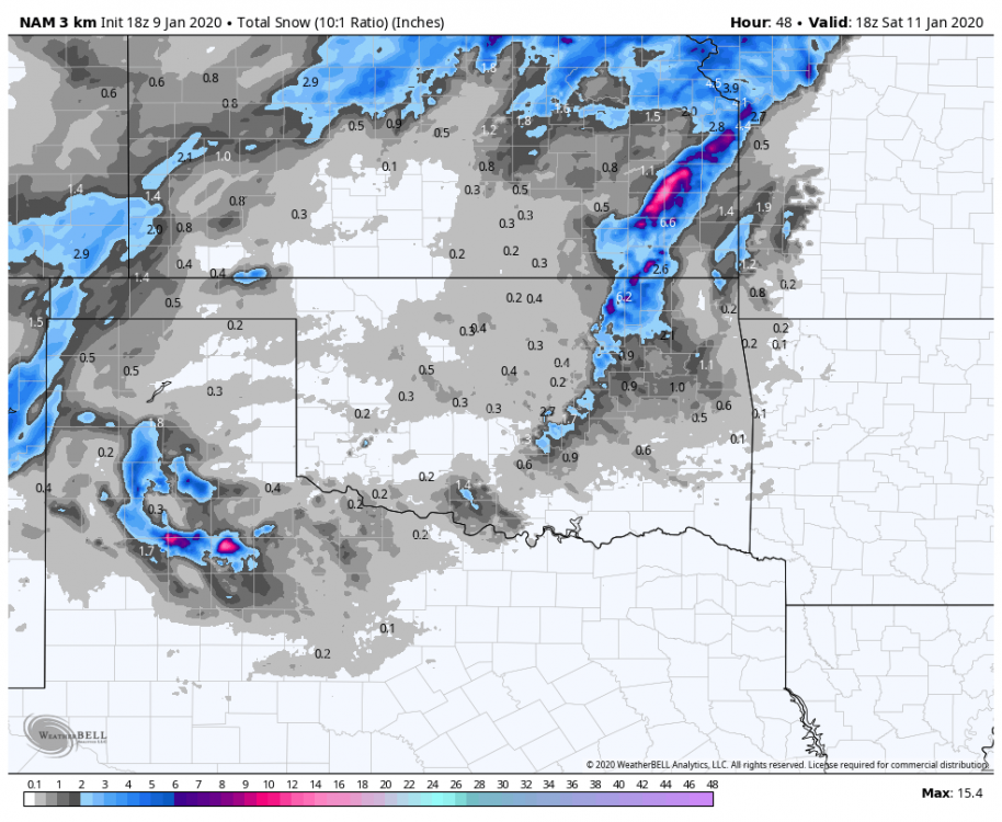
-
MO/KS/AR/OK 2019-2020 Winter Wonderland Discussion
StormChazer replied to JoMo's topic in Central/Western States
Now we wait to see who follows suit. Will Tulsa have the gumption to issue a winter storm watch or leave it all as advisories? -
MO/KS/AR/OK 2019-2020 Winter Wonderland Discussion
StormChazer replied to JoMo's topic in Central/Western States
Ask and you shall receive.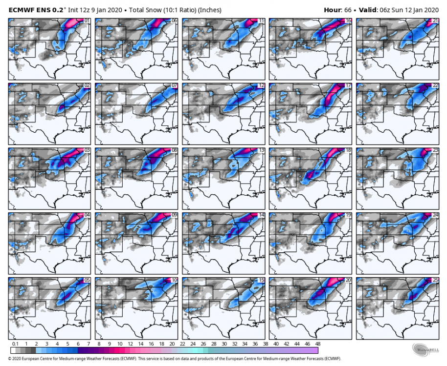
-
MO/KS/AR/OK 2019-2020 Winter Wonderland Discussion
StormChazer replied to JoMo's topic in Central/Western States
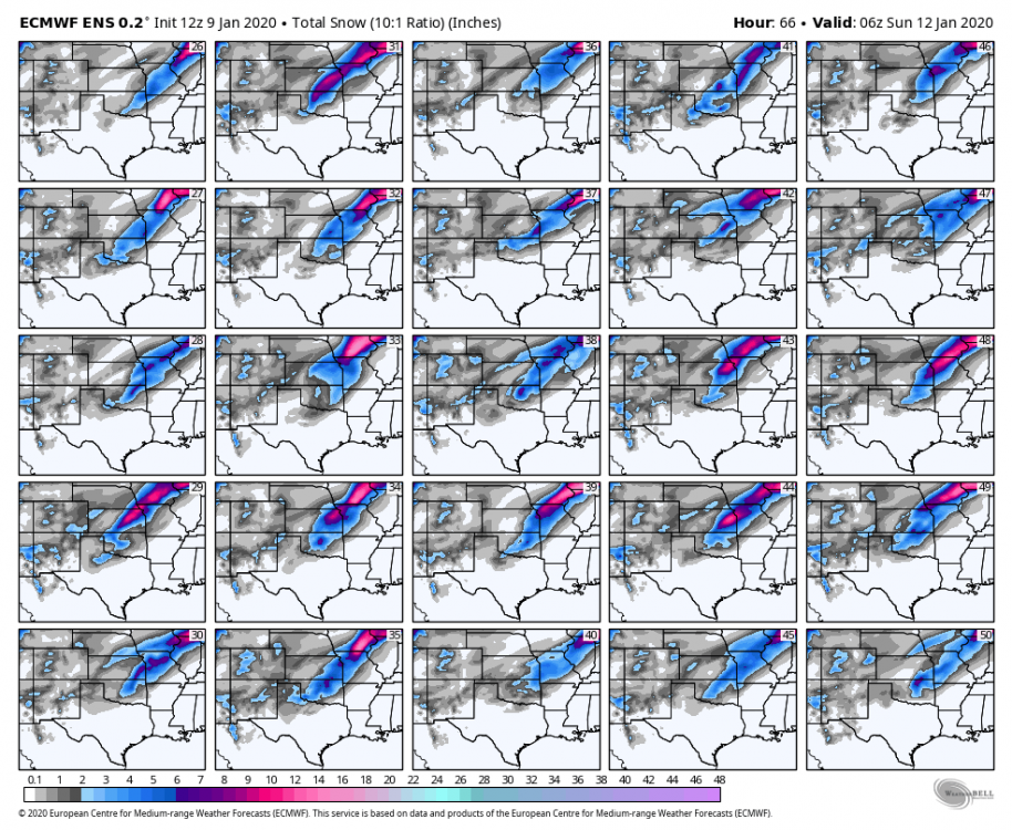
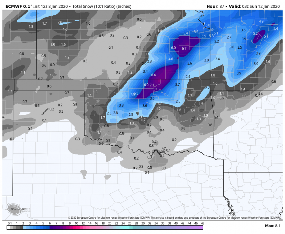
Btw, the Euro members supported the OP run highly, if not a little more east. -
MO/KS/AR/OK 2019-2020 Winter Wonderland Discussion
StormChazer replied to JoMo's topic in Central/Western States
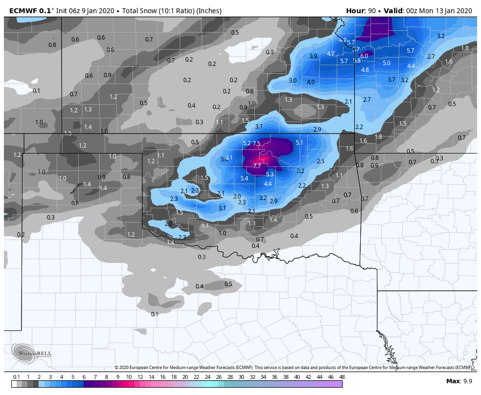
As a Tulsan...I'm very invested in this recent Euro run, as it drops an additional heavy swath of snow over us, separate from the main one to the NW. -
MO/KS/AR/OK 2019-2020 Winter Wonderland Discussion
StormChazer replied to JoMo's topic in Central/Western States
Beat me to it! lol -
MO/KS/AR/OK 2019-2020 Winter Wonderland Discussion
StormChazer replied to JoMo's topic in Central/Western States
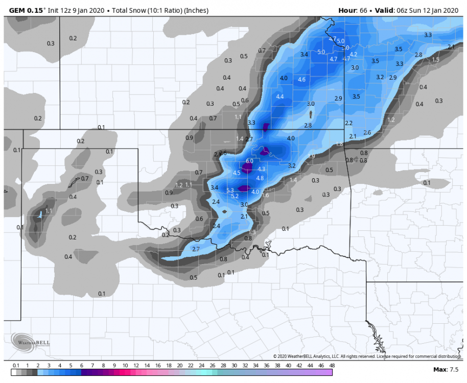
-
MO/KS/AR/OK 2019-2020 Winter Wonderland Discussion
StormChazer replied to JoMo's topic in Central/Western States
-
MO/KS/AR/OK 2019-2020 Winter Wonderland Discussion
StormChazer replied to JoMo's topic in Central/Western States
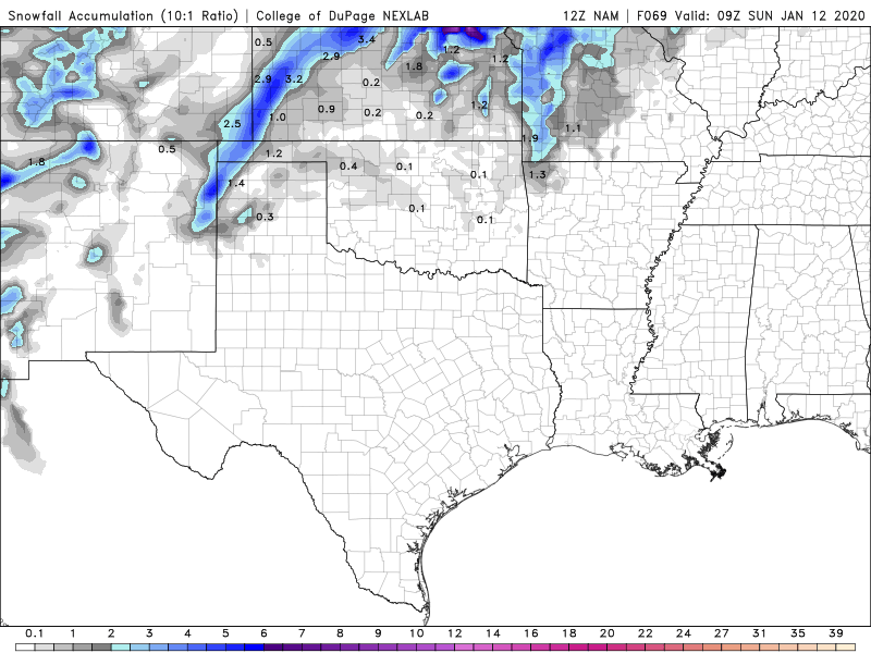
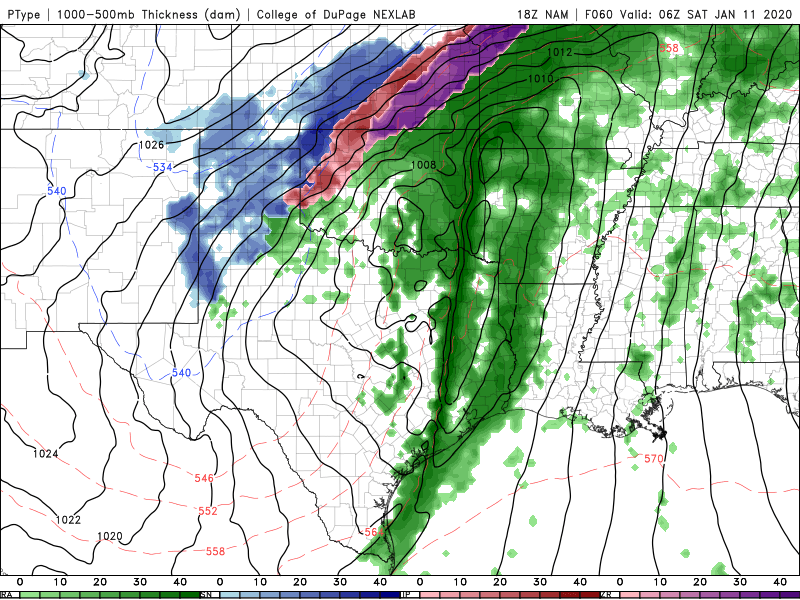
You aren't kidding...... Do we know if this NAM run includes sampling from the now, on-shore trough? -
MO/KS/AR/OK 2019-2020 Winter Wonderland Discussion
StormChazer replied to JoMo's topic in Central/Western States
12Z Nam is looking funny so far....very devoid. Edit: Up to hour 54 and looking like it may be a heavy Missouri hit? -
MO/KS/AR/OK 2019-2020 Winter Wonderland Discussion
StormChazer replied to JoMo's topic in Central/Western States
06Z Euro trends south a little.
-
MO/KS/AR/OK 2019-2020 Winter Wonderland Discussion
StormChazer replied to JoMo's topic in Central/Western States
Canadian with a considerable shift South and East. That, combined with the latest gfs has me feeling good about the trend. Now we wait for the almighty Euro.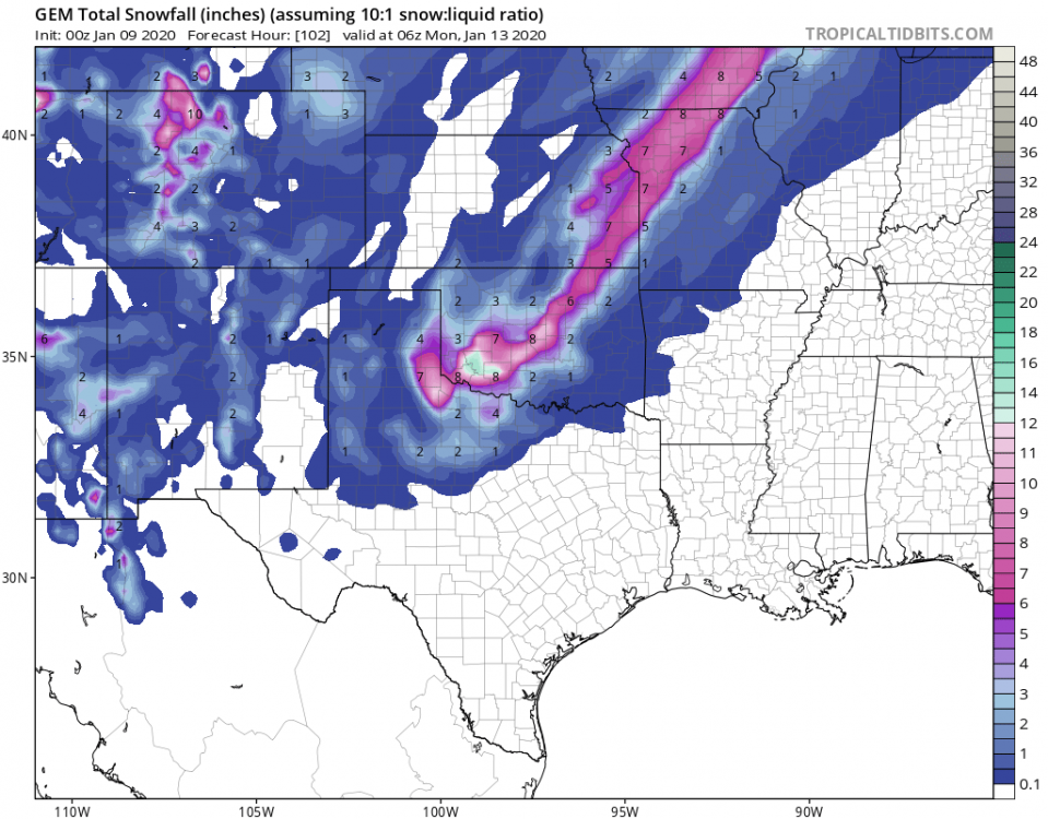
-
MO/KS/AR/OK 2019-2020 Winter Wonderland Discussion
StormChazer replied to JoMo's topic in Central/Western States
00Z GFS stays with the 18Z run’s thinking. There’s still hope. -
MO/KS/AR/OK 2019-2020 Winter Wonderland Discussion
StormChazer replied to JoMo's topic in Central/Western States
I’m going to go ahead and post the 18Z Euro by the 12Z for those interested. It’s the 18Z so don’t get too caught up in the tiny details, still holding onto its thinking.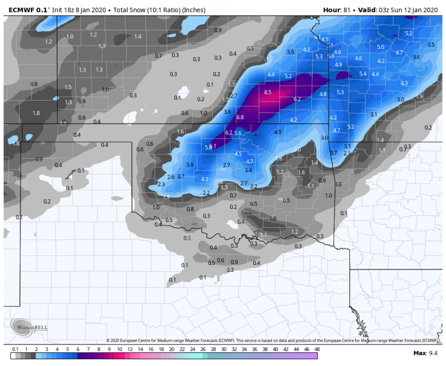
-
MO/KS/AR/OK 2019-2020 Winter Wonderland Discussion
StormChazer replied to JoMo's topic in Central/Western States
Meanwhile, 9 days out the GFS keeps hinting at a horrible ice storm. -
MO/KS/AR/OK 2019-2020 Winter Wonderland Discussion
StormChazer replied to JoMo's topic in Central/Western States
TSA "The wintry precipitation will develop after midnight Friday through Saturday morning. The global models have been consistently showing the deeper cold air will plunge south across central/western Oklahoma before arriving into our area. This will favor a freezing rain/sleet set up at least initially, with all rain south of the freezing line overnight Saturday. By Saturday morning, most areas will be cold enough for snow, with some freezing rain possibly lingering for portions of northwest Arkansas. Potential for a heavy snow band exists within the deformation zone which will move across the area on Saturday. The ECM/Canadian have indicated a slower solution, which would allow snow to persist longer across eastern Oklahoma than the NAM/GFS. The heaviest snows will likely be north and west of Tulsa, with several inches of snow possible. Negative EPV values and strong frontogenetical forcing suggest the possibility of banding and heavy snow rates, mainly on Saturday morning. For those who have travel plans this weekend, please check the latest forecasts, as there will be travel impacts for portions of the area." -
MO/KS/AR/OK 2019-2020 Winter Wonderland Discussion
StormChazer replied to JoMo's topic in Central/Western States
Doesn't mean it should be thrown out altogether imo. It's old upper air data combined with new surface data. I still think there's a trend to follow. -
MO/KS/AR/OK 2019-2020 Winter Wonderland Discussion
StormChazer replied to JoMo's topic in Central/Western States
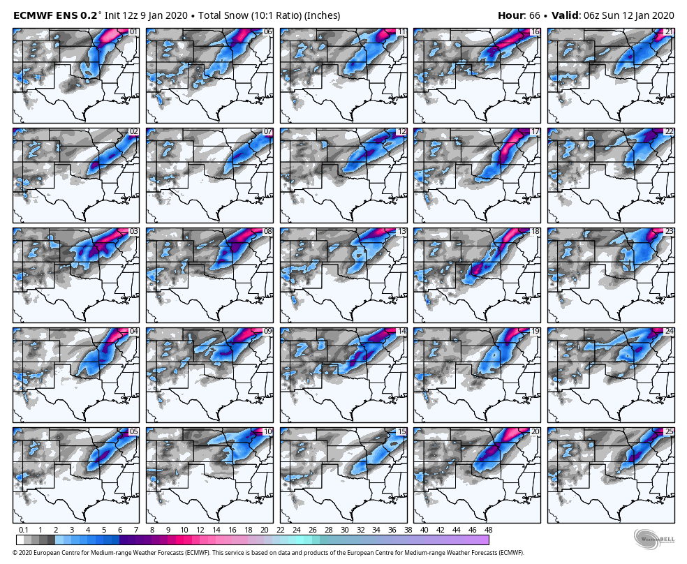
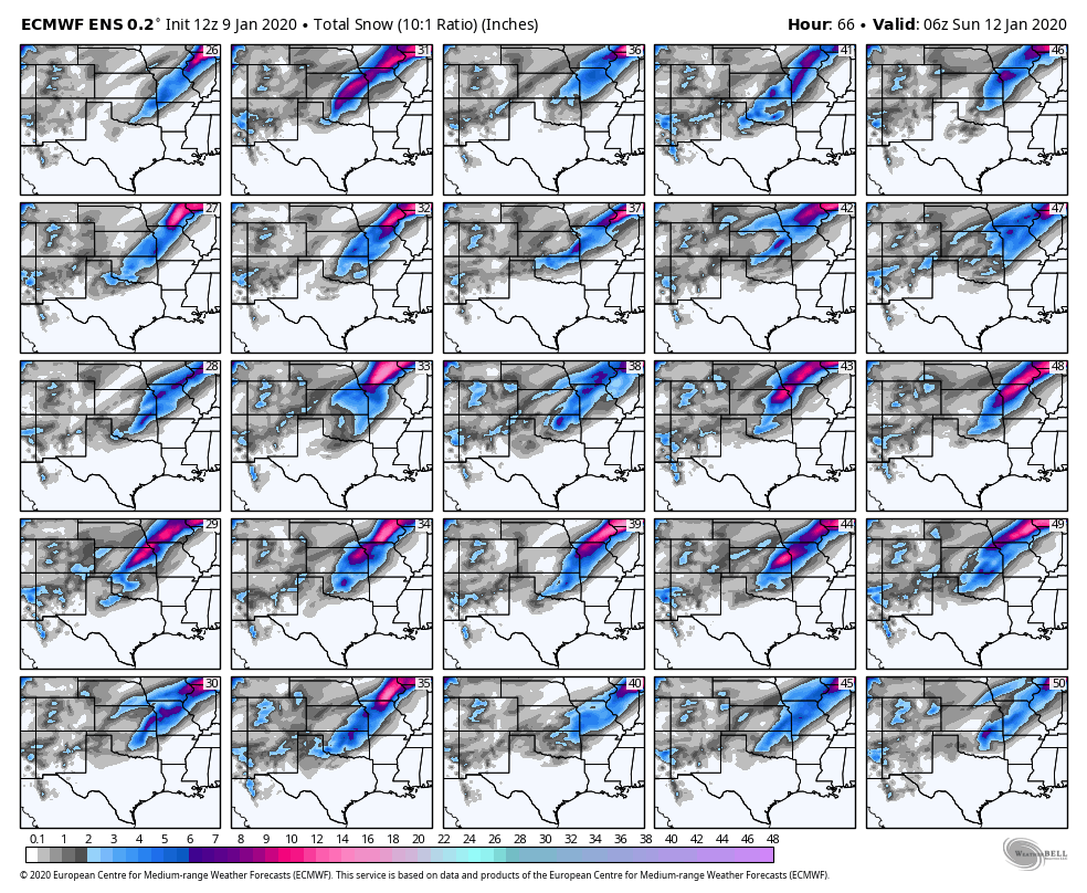
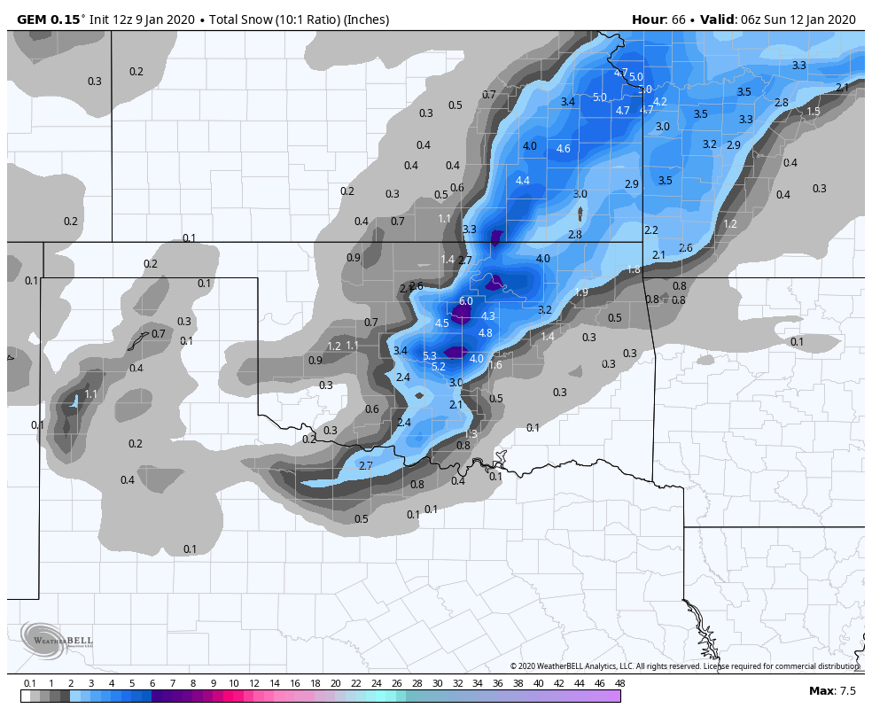
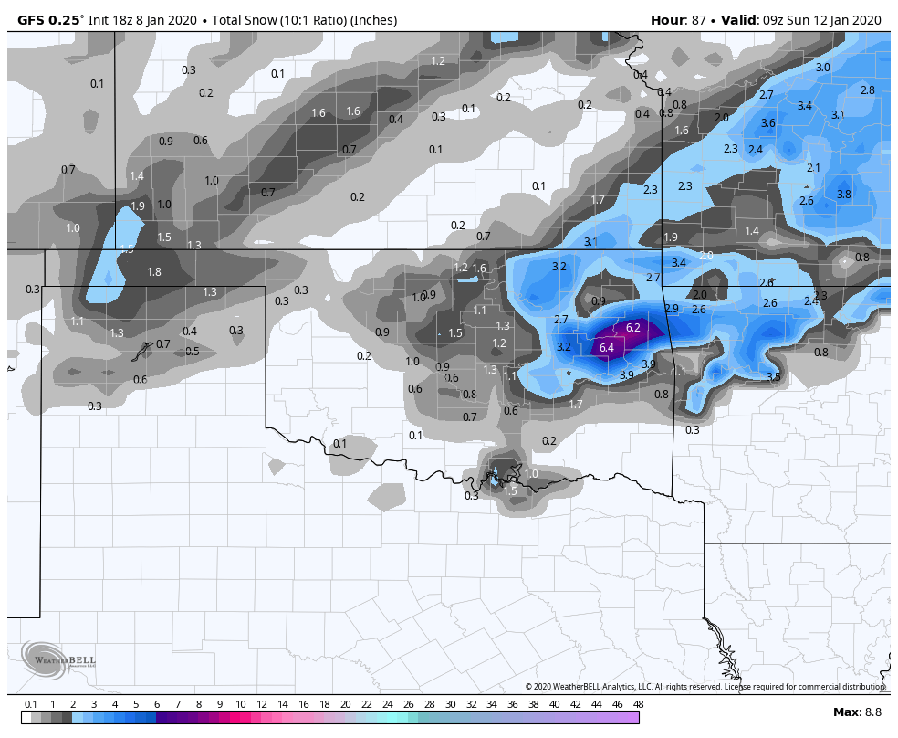
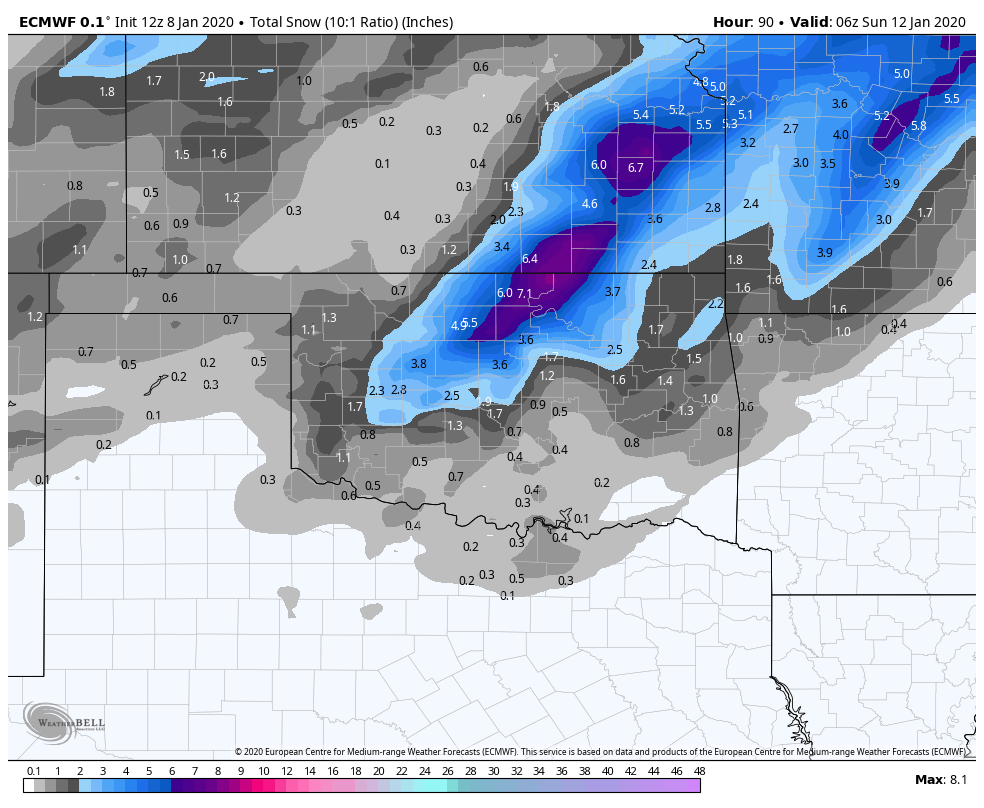
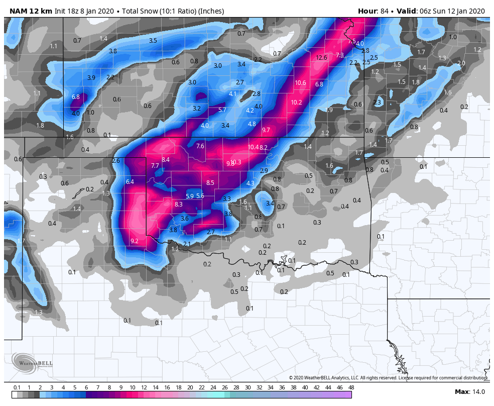
So drastically different than the 12Z run. So we've got the NAM, which blasts Western and Central OK The Euro which hits central OK And the GFS which hits Eastern OK and NW AR.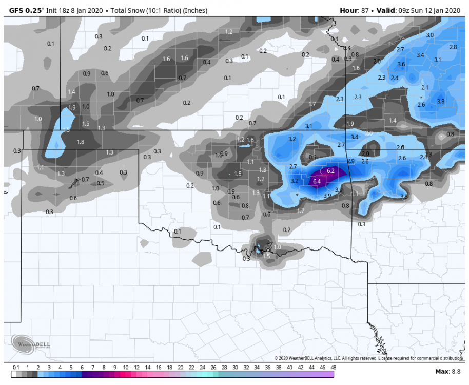


-
MO/KS/AR/OK 2019-2020 Winter Wonderland Discussion
StormChazer replied to JoMo's topic in Central/Western States
GFS to the rescue. -
MO/KS/AR/OK 2019-2020 Winter Wonderland Discussion
StormChazer replied to JoMo's topic in Central/Western States
Closes off quickly and then grazes by...I'm glad this run is 72 hours out and not 36... just need it to scoot a little east....
-
MO/KS/AR/OK 2019-2020 Winter Wonderland Discussion
StormChazer replied to JoMo's topic in Central/Western States
Stark difference. Agreed on the 06Z euro comment..png.f698324faf998135e1a18cf867fde0a8.png)
-
MO/KS/AR/OK 2019-2020 Winter Wonderland Discussion
StormChazer replied to JoMo's topic in Central/Western States
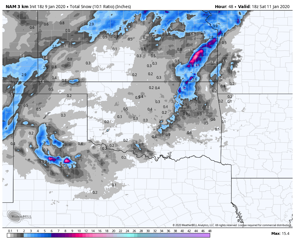
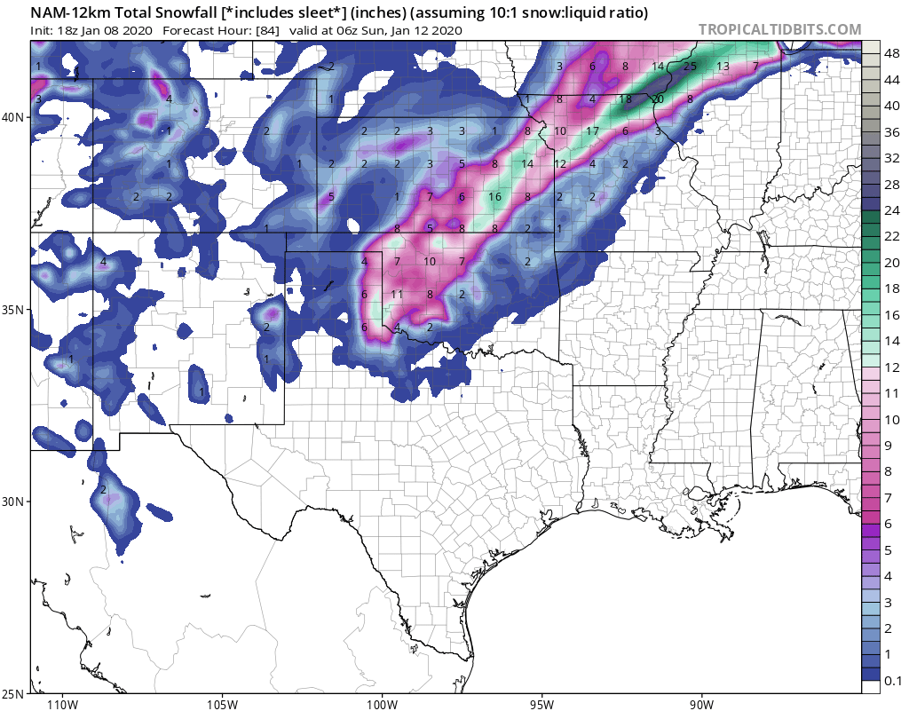
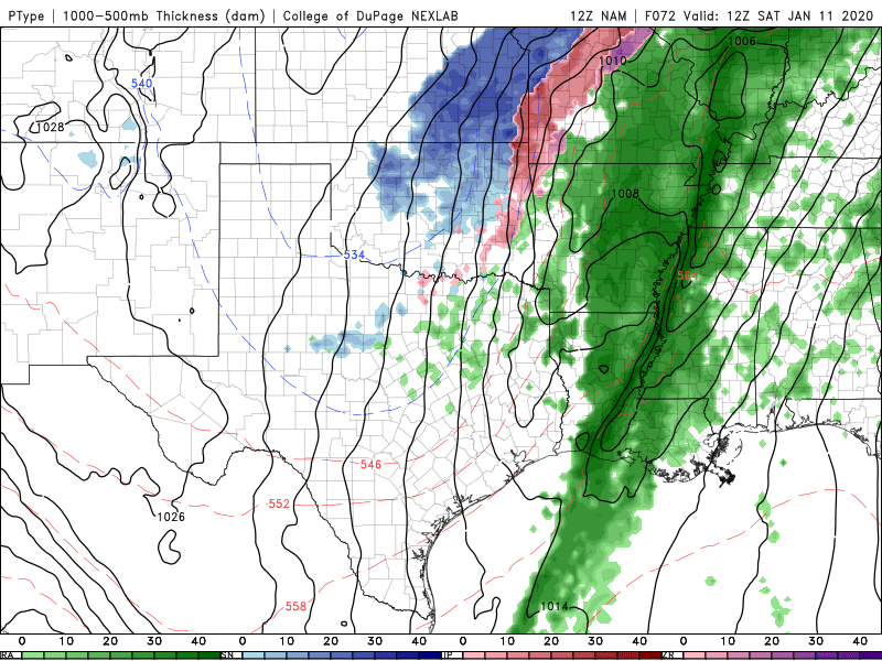
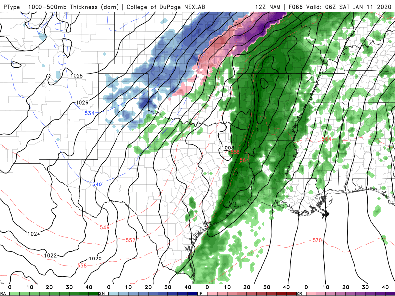
BUCKLE UP FOR THIS NAM. -
MO/KS/AR/OK 2019-2020 Winter Wonderland Discussion
StormChazer replied to JoMo's topic in Central/Western States
-
MO/KS/AR/OK 2019-2020 Winter Wonderland Discussion
StormChazer replied to JoMo's topic in Central/Western States
NAM is looking different than past runs so far.