NEG NAO
-
Posts
7,490 -
Joined
-
Last visited
Content Type
Profiles
Blogs
Forums
American Weather
Media Demo
Store
Gallery
Everything posted by NEG NAO
-
 I find it odd on the 0Z Euro that the center of LP goes from the FLA panhandle to the Virginia capes in a 6 hour timespan between hours 156 -162 . too fast or a quick transfer of energy ??? The HP to the north seems to be holding its own in strength at 1033 and not moving out east northeast . We just need continuity in the model runs - once the EURO locks into a solution run after run confidence grows. Another thing to still consider is water temps - still on the warm side upper 40's - low 50's
 -
December 2020 General Discussions & Observations Thread
NEG NAO replied to bluewave's topic in New York City Metro
Red Sky in morning - Sailor's take warning ! -
need the wind direction to not come off the water - (a east, south or southeast direction) water temps are still in the low to mid 50s.
-
changed it to 0Z as I stated there is no run to run continuity developing yet so each run has been different .....can't take it seriously yet
-
0Z Euro looks similar to the 12Z GEM strong enough anchored high to the north and off coast track and its only about a week away - just need run to run continuity to develop I also like that High near Idaho /Montana border
-
Central Park (CP): First Trace or measurable snow Wednesday 12/9/20?
NEG NAO replied to wdrag's topic in New York City Metro
Moderate Snow here on border of Middlesex Union County NJ sticking to everything but roads - more then a Trace now -
Central Park (CP): First Trace or measurable snow Wednesday 12/9/20?
NEG NAO replied to wdrag's topic in New York City Metro
Any reports of snow in NYC ? seems it is having a hard time making it across the Hudson on radar -
Central Park (CP): First Trace or measurable snow Wednesday 12/9/20?
NEG NAO replied to wdrag's topic in New York City Metro
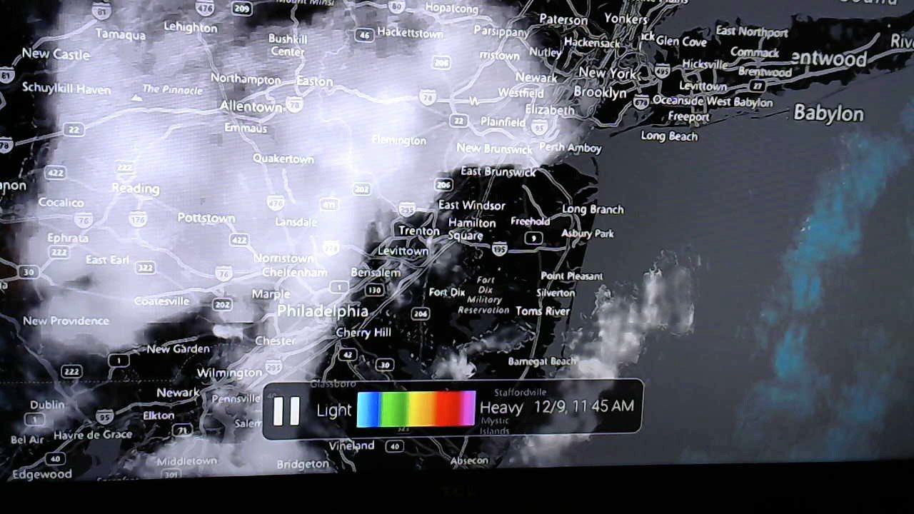
Latest update from My Radar app on Fire TV at 11:45 this app can zoom in to street level and I find it very accurate especially during thunderstorms - still mode here it also goes in accurate motion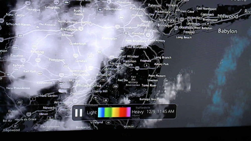
-
Central Park (CP): First Trace or measurable snow Wednesday 12/9/20?
NEG NAO replied to wdrag's topic in New York City Metro
Light Snow here on Woodbridge Township /Clark border -
Central Park (CP): First Trace or measurable snow Wednesday 12/9/20?
NEG NAO replied to wdrag's topic in New York City Metro
-
Central Park (CP): First Trace or measurable snow Wednesday 12/9/20?
NEG NAO replied to wdrag's topic in New York City Metro
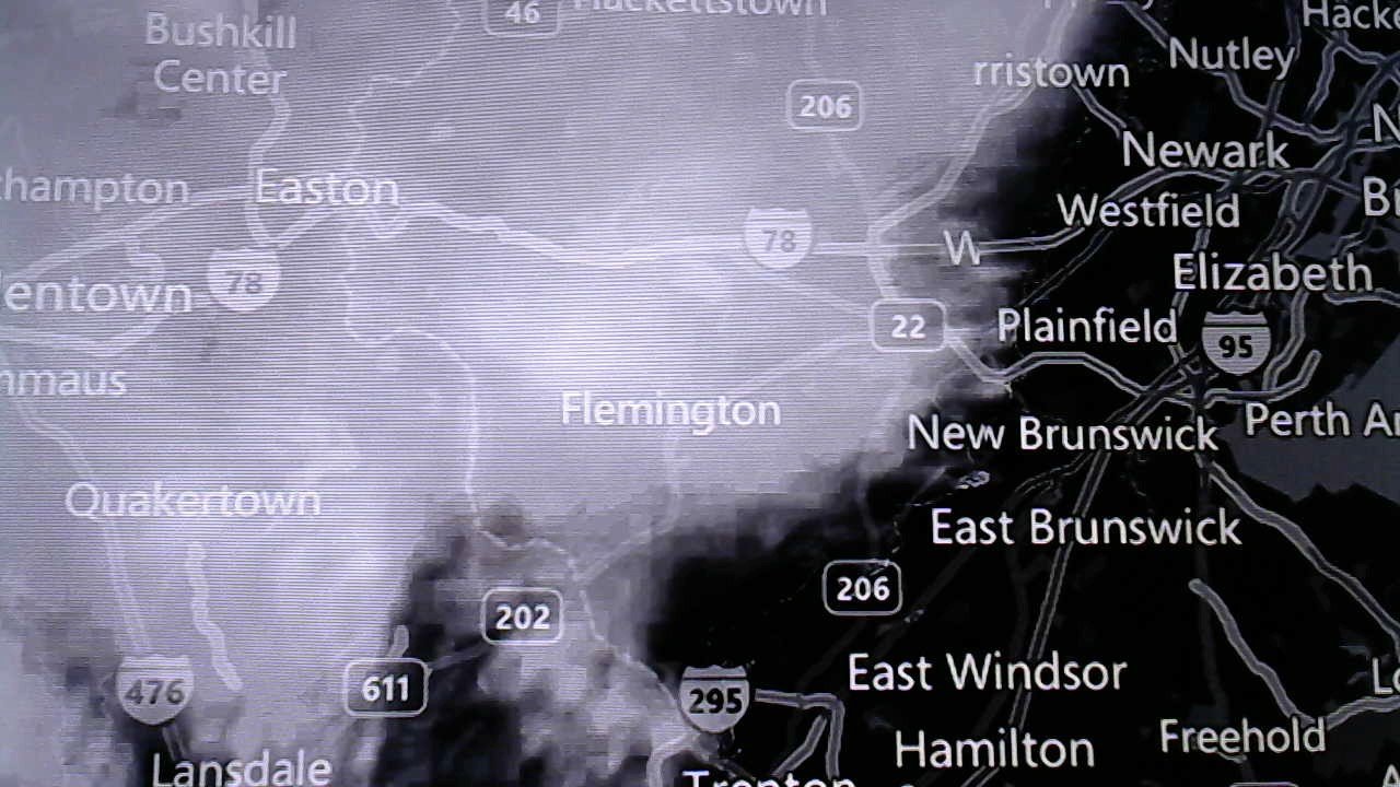
This is hiding the clutter on the above radar image - I have bright skies here with partial sunshine here just east of precip field serious doubts about this having much impact in NYC Metro -
Central Park (CP): First Trace or measurable snow Wednesday 12/9/20?
NEG NAO replied to wdrag's topic in New York City Metro
-
Central Park (CP): First Trace or measurable snow Wednesday 12/9/20?
NEG NAO replied to wdrag's topic in New York City Metro
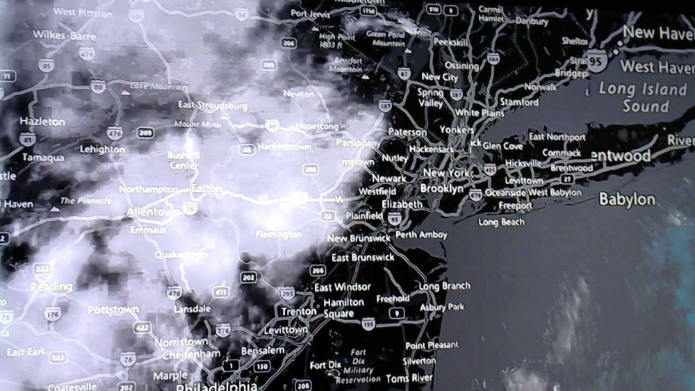
Seems as you go from partly cloudy skies to snowy conditions in a short period of time the only question now is how much of the snow dissipates before reaching the immediate NYC metro which some models were suggesting...... -
Central Park (CP): First Trace or measurable snow Wednesday 12/9/20?
NEG NAO replied to wdrag's topic in New York City Metro
Here is a picture of my sky condition at 10:10 am on the border of Union/Middlesex County Woodbridge Township/Clark in NJ
-
Central Park (CP): First Trace or measurable snow Wednesday 12/9/20?
NEG NAO replied to wdrag's topic in New York City Metro
Walt when I checked the preliminary NYC climate report late yesterday evening on New Jersey Weather Page (cod.edu) for NYC snowfall it said T but the final report at 1:20 am said 0 but I have no way of proving it unless they have a copy somewhere - oh well we still have 0 snow in Central Park - maybe today they will finally get the Trace amount -
Central Park (CP): First Trace or measurable snow Wednesday 12/9/20?
NEG NAO replied to wdrag's topic in New York City Metro
They recorded the flurries as a Trace of snow in the park -
Central Park (CP): First Trace or measurable snow Wednesday 12/9/20?
NEG NAO replied to wdrag's topic in New York City Metro
18Z Nam was more bullish at 18Z -
Central Park (CP): First Trace or measurable snow Wednesday 12/9/20?
NEG NAO replied to wdrag's topic in New York City Metro
HRRR has most precip dissipating before it reaches NYC -
December 2020 General Discussions & Observations Thread
NEG NAO replied to bluewave's topic in New York City Metro
` Corrected -
December 2020 General Discussions & Observations Thread
NEG NAO replied to bluewave's topic in New York City Metro
Modoki La Nina years and snow totals at Central Park: 73-74 23.5 75-76 17.3 83-84 25.4 88-89 8.1 98-99 12.7 00- 01 35.0 08 -09 27.6 10 -11 61.9 16 -17 30.2 -
December 2020 General Discussions & Observations Thread
NEG NAO replied to bluewave's topic in New York City Metro
up and down the east coast ski resorts are doing well check out cams from Sugar Mountain North Carolina Sugar Mountain Resort Web Cams - Sugar Mountain Resort (skisugar.com) -
December 2020 General Discussions & Observations Thread
NEG NAO replied to bluewave's topic in New York City Metro
Rain Rain and more rain - pattern does not support a frozen solution for most of NYC metro................. -
December 2020 General Discussions & Observations Thread
NEG NAO replied to bluewave's topic in New York City Metro
1995 -96 is one of the top analogs for this upcoming winter.............75 inches of snow at Central Park............according to LC There are suspicions of a pattern change across North America as we head into late December. But I can assure you that any alteration in the 500MB longwave configuration will be slow, and be dependent on two factors. One is the active southern branch jet stream, which all of the numerical models are having trouble handling. The other is the potential for a sudden stratospheric warming event, which could have a "cascade/domino" effect on lower layers of teh atmosphere as we head into January. The subtropical jet stream has been a force in apparent weather in the U.S., with a surface temperature response quite unlike the "typical La Nina" calls that have dominated traditional and online media since November. Quite simply, we have seen a warm Canada and northern U.S. response, with colder than average readings common along and below 40 N Latitude. The various guidance formats use climatology in the equations, and the numerical model expectation of a very warm pattern continues to be at odds with readings that often fall lower than what can be expected for the season. This is why when you look at the monthly outlooks, they appear to be almost ablaze with record warmth across most, if not the entire, continent. Check the analog predictions as a balance. We are now down to ten usable comparison seasons, with 1995-96 and 2007-08 being the most similar. This set-up gives credence to teh idea that a shift to a colder outcome will occur in January, and keep going through February and March. The 10MB temperature and height forecasts are interesting because the reveal a sudden stratospheric warming over Siberia, with a re-alignment of the circumpolar vortex in a linear manner from eastern North America through much of Europe and western Russia. Keep in mind that the predictions and boundary layer response for this level fall often into uncertainty. And, that the eventual outcome from 500MB on down usually happens after about a two week delay. But if the December 21 panel verifies, then we will see a shift to a -AO/+PNA configuration by the second or third week of January. That would mean a more traditional, colder winter across the eastern two-thirds of North America. If the energy from the southern branch can interact with more profound digging troughs from Canada, it might make us forget some of those longer term predictions by the world agencies. There is hope, at least!