KoalaBeer
-
Posts
636 -
Joined
-
Last visited
Content Type
Profiles
Blogs
Forums
American Weather
Media Demo
Store
Gallery
Everything posted by KoalaBeer
-
Just watched this video. Never seen anything like it outside of Japan. Power lines are getting buried at this point.
-
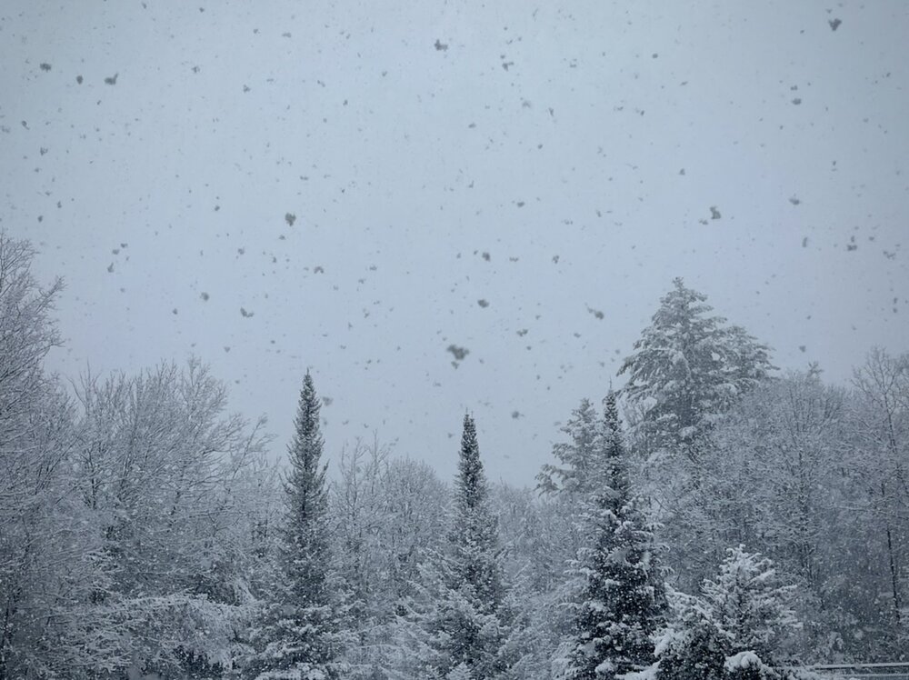
Yup, heavy snow here in Conway. Huge flakes. Next week on the slopes will be great. Can’t wait to get a few days off to get out.
-

March 2nd Moderate Risk ArkLaTex
KoalaBeer replied to Ed, snow and hurricane fan's topic in Central/Western States
CC drop west of Hackelburg as well.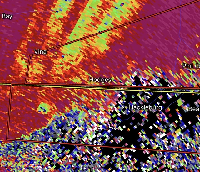
-
The event of the season - 2 days of hell!
KoalaBeer replied to Go Kart Mozart's topic in New England
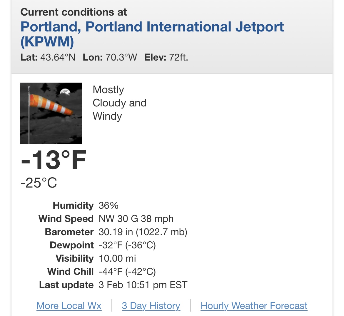
Haven’t posted in a while, hope everyone is staying safe. Up in North Conway for a week of snowboarding, currently -16 with winds still cranking. Looks like Portland just broke there all time wind chill record for what it’s worth. From the GYX discussion earlier.. After sifting through our old paper book records, a -43 degree wind chill from 1971 appears to be the record to beat in Portland, at least since 1948.
-
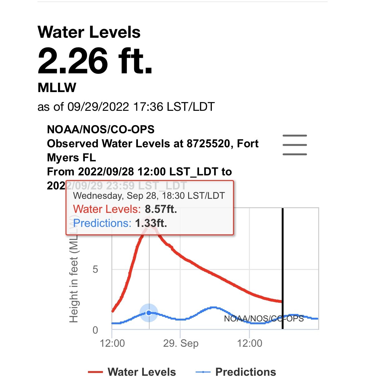
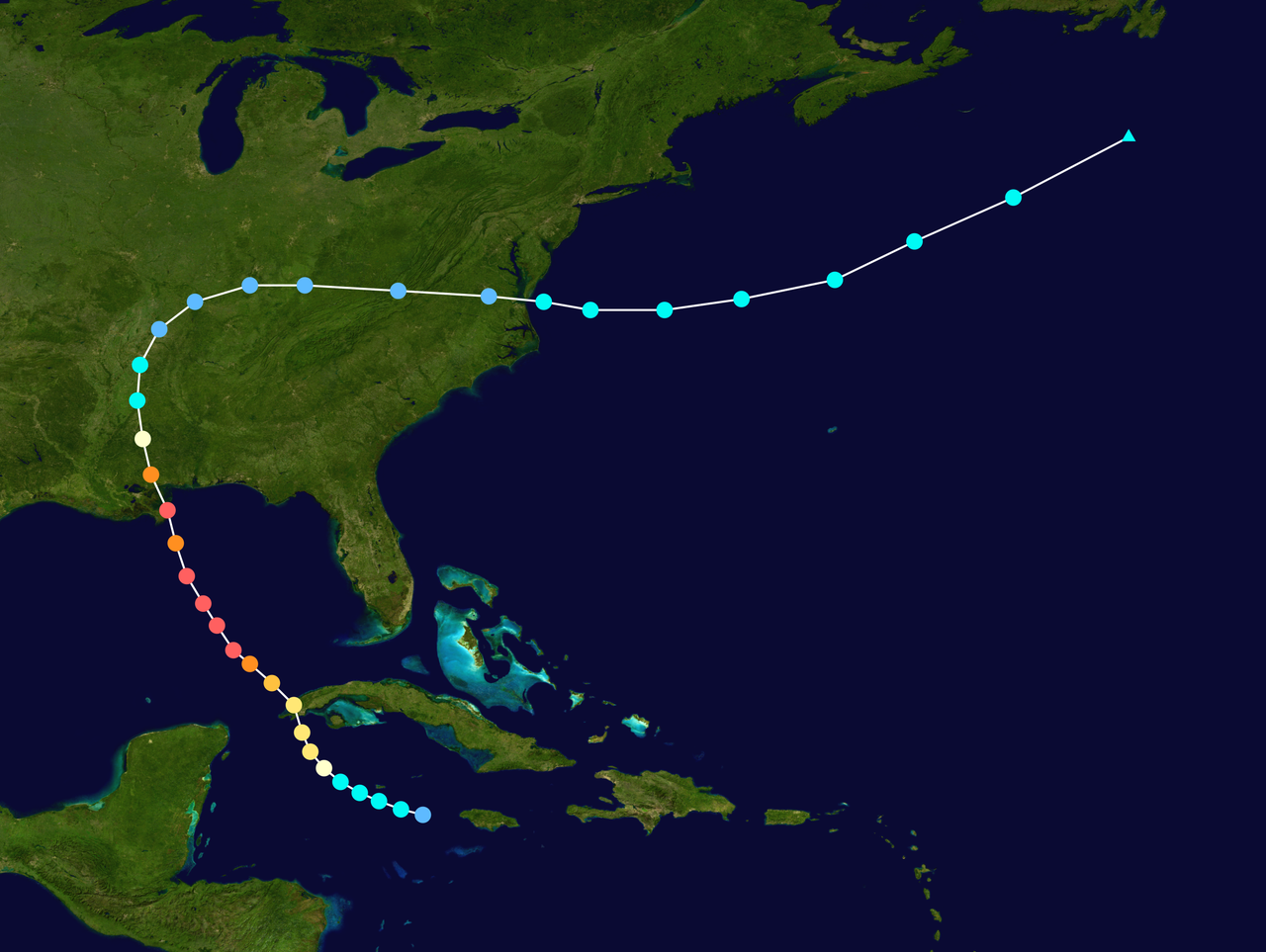
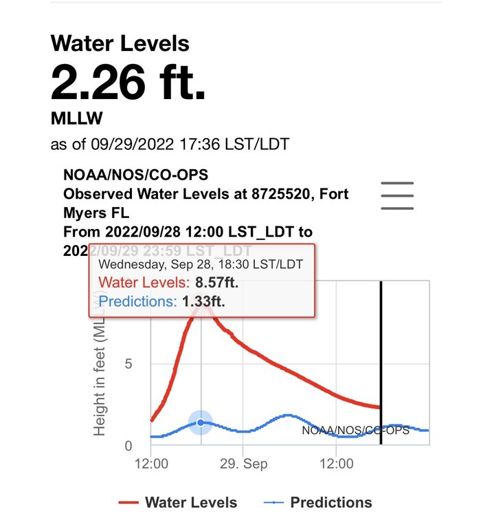
Ya Ian more then doubled it. Think I saw it get to 7.84 at one point. That gauge is up the river some ways as well. Wouldn’t be surprised if the surge was quite a bit higher right on Fort Meyers beach looking at the damage. Its early but dare I say this might become the third costliest hurricane in US history behind Katrina and Harvey once all is said and done? Such a sad situation. I love experiencing some extreme weather but man is it nice living in New England where we are pretty immune to catastrophic events… edit: looks like 8.57 was the unofficial peak
-
Haven’t seen much from there. Looking at obs winds were out of the N or NE all day so surge shouldn’t of been an issue. They got some hurricane force gusts however. https://w1.weather.gov/data/obhistory/KSRQ.html
-
Im so confused by this post. Storm surge is exactly what Fort Myers is experiencing. Punta Gorda got blasted by those backside eyewall winds but looks like they avoided significant surge. Also that video you posted has “City of Naples” written on the side of the door of the fire truck. People need to stop trusting these twitter posts from random accounts without verification.
-
Huh? At least Camille went over western Cuba but the track similarities end there. Not many good analogs to go off of here in modern record keeping.


-
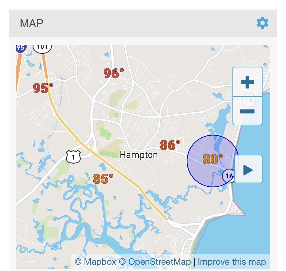
Scorching hot at my parents place in Hampton right by I-95 when I picked up the dog after work. A beautiful 80-85 right on the coast at my apartment a few miles away. Pretty crazy temperature gradient.

-
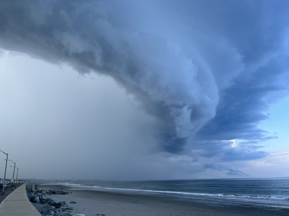
NH seacoast delivers again
-
Tuesday, July 12, 2022 Stupid Severe Potential
KoalaBeer replied to weatherwiz's topic in New England
-
Tuesday, July 12, 2022 Stupid Severe Potential
KoalaBeer replied to weatherwiz's topic in New England
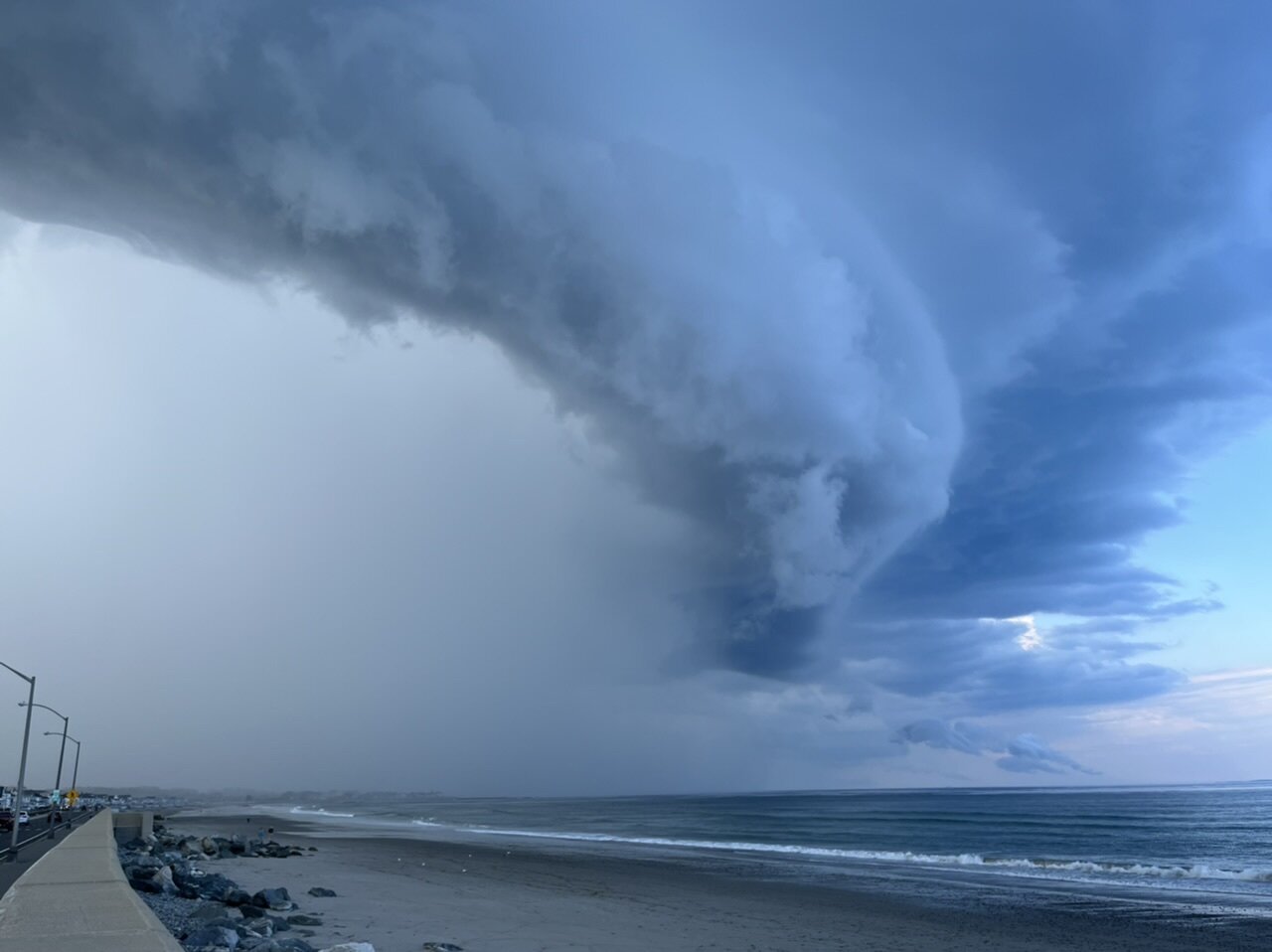
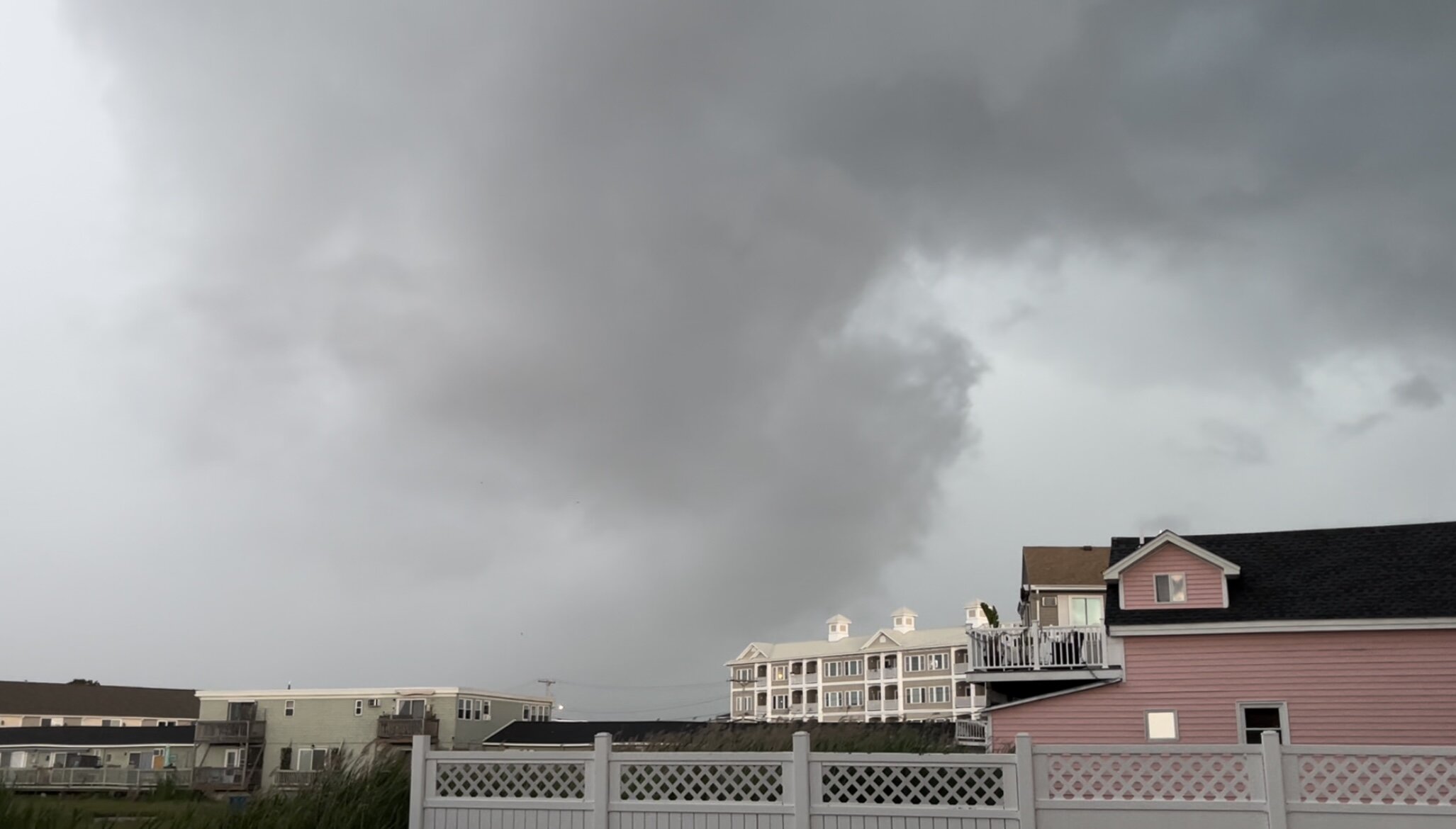
Getting hit pretty good here. Possible micro burst just north of me. That lowering was really surging as it passed by me.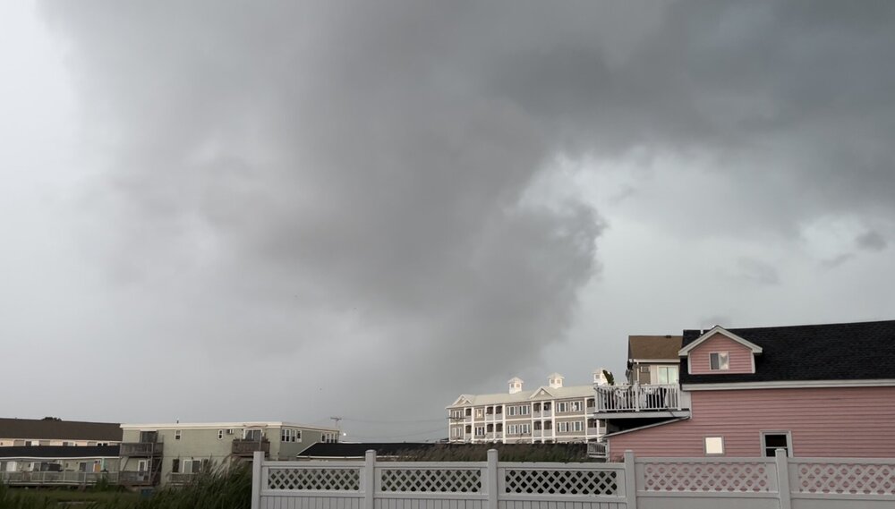
-
Pretty much the main reason I do all my snowboarding in ME and NH. VT mountains are a bitch to get to from the seacoast. Beautiful day here in Hampton with some nice 3ft waves. Might have to take the surfboard out for the first time this year now that the waters slightly warmer.
-
-
Waterville is a good mountain. I should be there as well for the demo. Maybe we’ll have to meet up for a beer and a lap.
-
Wait George isn’t on board? Is hell freezing over? Im happy as long as this stays snow for the ski areas. Conditions are good up there right now.
-
OBS/DISCO - The Historic James Blizzard of 2022
KoalaBeer replied to TalcottWx's topic in New England
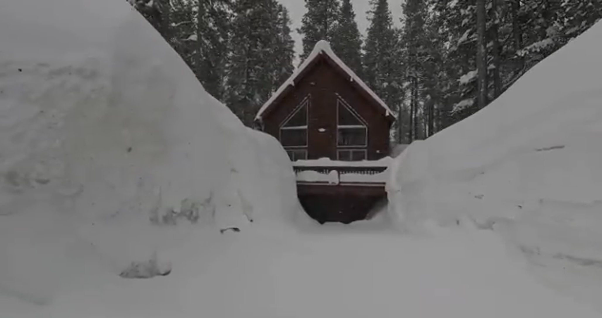
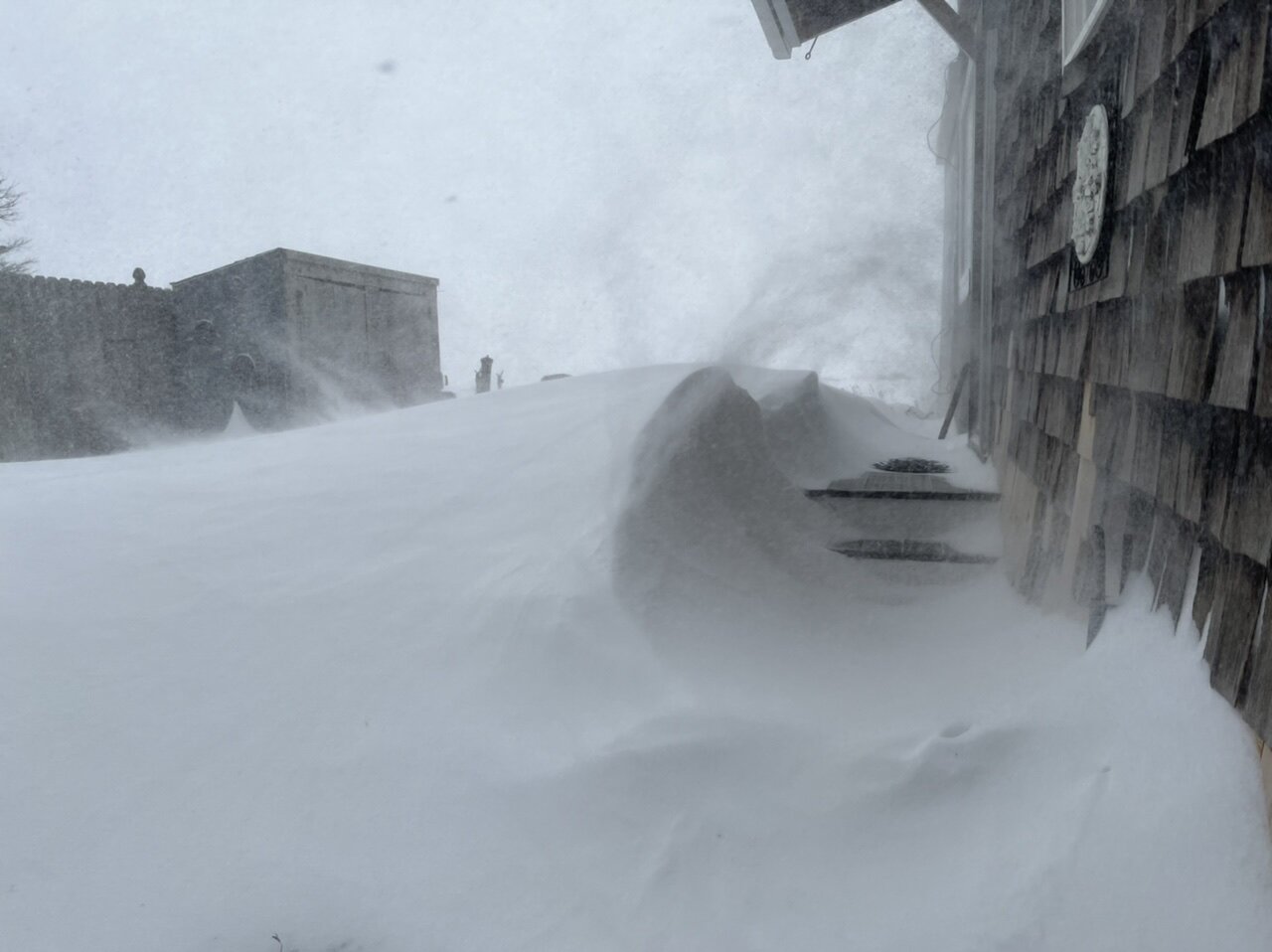
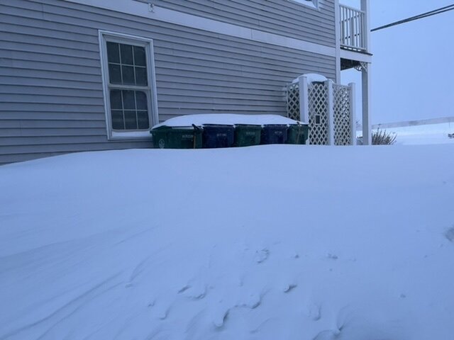
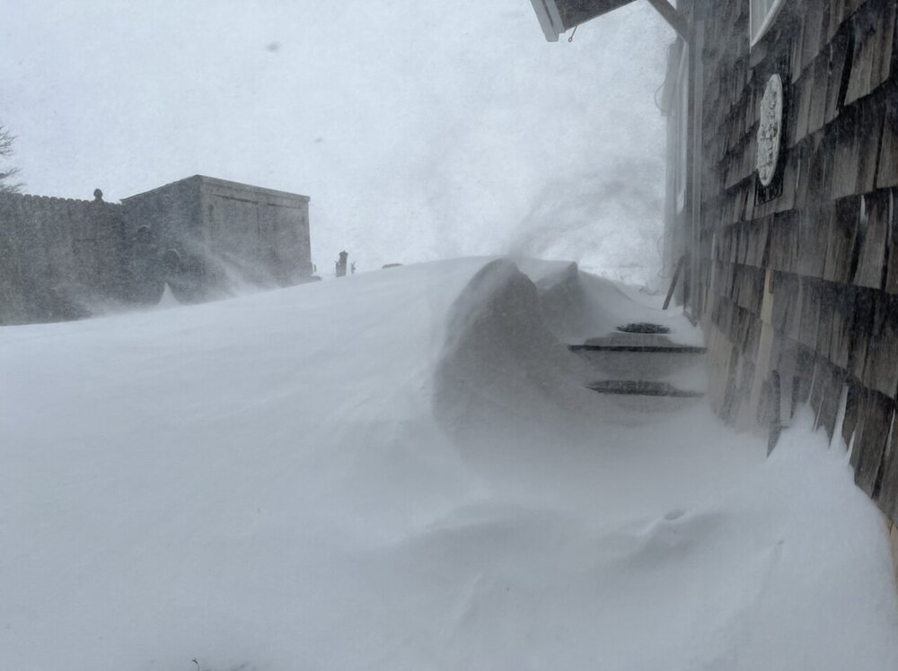
My driveway is either bare ground or a 4 foot drift.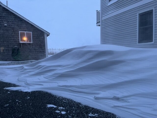
-
OBS/DISCO - The Historic James Blizzard of 2022
KoalaBeer replied to TalcottWx's topic in New England
5+ hours of blizzard conditions now, .06mi visibility I couldn’t tell you if I got 15 inches of snow or 25 with the wind and drifting.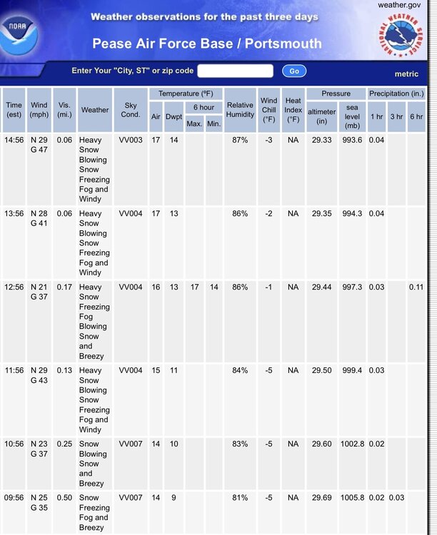
-
OBS/DISCO - The Historic James Blizzard of 2022
KoalaBeer replied to TalcottWx's topic in New England
-
OBS/DISCO - The Historic James Blizzard of 2022
KoalaBeer replied to TalcottWx's topic in New England
Another one from Hampton. Got to be pushing 2-3” / hr now. -
OBS/DISCO - The Historic James Blizzard of 2022
KoalaBeer replied to TalcottWx's topic in New England
Quick video from my place in Hampton NH -
OBS/DISCO - The Historic James Blizzard of 2022
KoalaBeer replied to TalcottWx's topic in New England
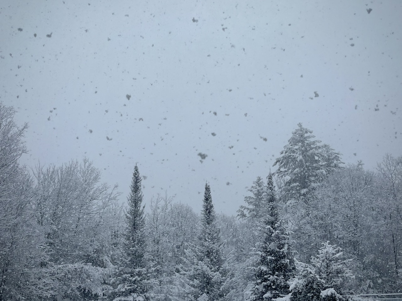
Same at KPSM. Complete whiteout here on the coast of NH, not even going to bother and try a measure with the wind. Grass exposed in some areas and 3 foot drifts in others…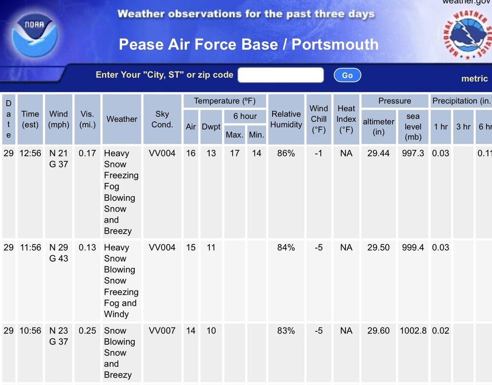
-
No snow here, but some serious coastal flooding in Hampton. Worst I’ve seen it in two years.
-
Yikes.
-
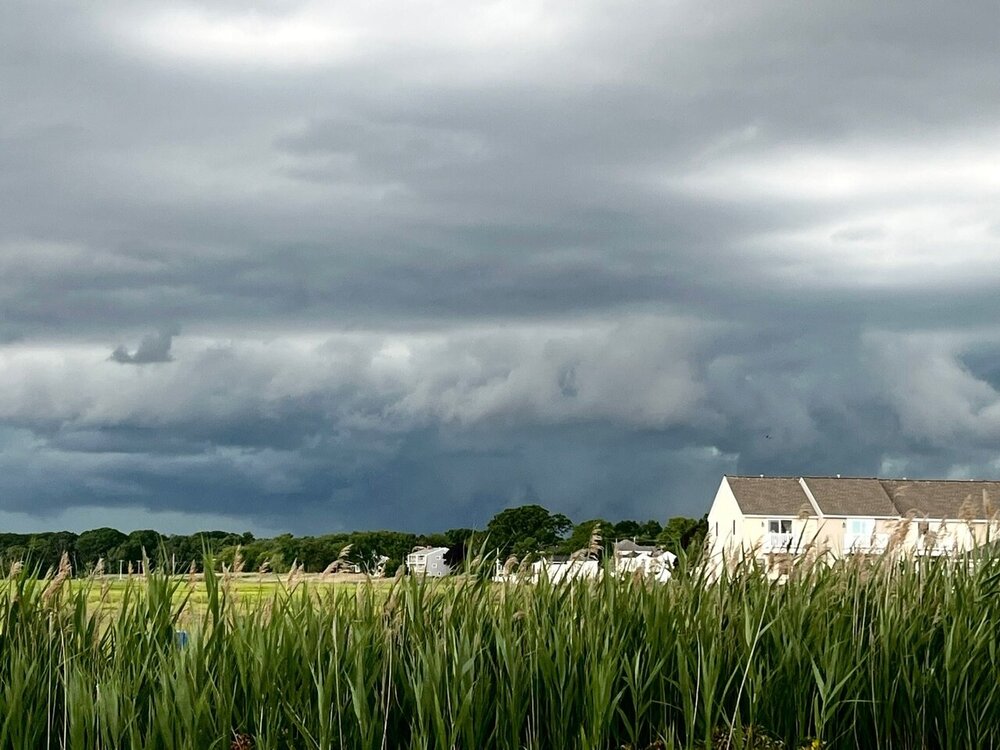
TOR warning in Maine. Looks pretty impressive on radar. Wouldn’t be surprised at all if it’s on the ground. Looks to have lofted some debris in the air on CC.