KoalaBeer
-
Posts
623 -
Joined
-
Last visited
Content Type
Profiles
Blogs
Forums
American Weather
Media Demo
Store
Gallery
Everything posted by KoalaBeer
-
Pretty speechless that we have this many discreet TOR producing cells still. Robards KY area has two possible tornadoes following just about the same path right behind each other.
-
Put this one in the tornado hall of fame.
-
Well Reed could of got killed in a car accident. Sherman and Wynne damage looks bad.
-
Looks like TOG by Sherman IL north of Springfield. Cell in Wayne IL needs to be closely watched in a very populated area, no TOR warning on that yet.
-
Looks like Charlotte Iowa just took a direct hit. Significant CC drop on that one. STL bound storms thankfully petered out some. The recently TOR warned storms in Arkansas are concerning for the Memphis metro downstream. That storm that went through Covington might be the one of the outbreak…maybe the most significant outbreak I’ve tracked since 2011.
-
Charles Peek had homes slabbed in Wynne. Same cell is about to impact Covington, TOR emergency issued. Dire situation there.
-
Yeah that TOR warned cell by Bourbon MO is aligned to head right towards the STL metro….dangerous situation shaping up for them.
-
Longer video. That thing went from relatively mellow to violent extremely quick. I don’t know anything about the chasers so I’ll refrain on talking about that but they put themselves in quite the precarious spot there.
-
The ugh downstream implications of that are not good if it holds.
-
Other cell moving through Little Rock is paying a visit to those south of the last one. Very surprised it isn’t TOR warned yet. edit: there’s the warning
-
Pretty absurd day already shaping up. NWS Little Rock might have just taken a direct hit. Cell approaching Peoria is insane looking.
-
Direct hit on NWS?
-
KLZK radar going to be very close to a direct hit. Going to be hard to track on radar as it gets closer. Looks like a significant tornado OTG on THV11 stream. Tornado emergency issued. Tornado coverage with Tom Brannon & Nathan Scott | thv11.com
-
Not my subforum but I'll be following along. Be safe today.
-
Going to be a busy day, upgrade to tornado driven high risk incoming. Mesoscale Discussion 0390 NWS Storm Prediction Center Norman OK 1037 AM CDT Fri Mar 31 2023 Areas affected...portions of southeastern Iowa...northwestern Illinois...and far northeastern Missouri Concerning...Outlook upgrade Valid 311537Z - 311630Z SUMMARY...Portions of the Moderate Risk over southeastern IA, northwestern IL, and far northeastern MO will be upgraded to a categorical High Risk in the 1630 UTC Convective outlook. DISCUSSION...An upgrade to a tornado-driven High Risk (30% probability) is expected for the 1630 UTC outlook. Environmental conditions are quickly becoming favorable to support the potential for numerous strong to potentially violent and long-track tornadoes across portions of southeastern IA, northwestern IL, and far northeastern MO. Please see the forthcoming Day 1 outlook update for more information. ..Lyons/Smith.. 03/31/2023
-

Severe Weather 3-23-23 through 3-26-23
KoalaBeer replied to cheese007's topic in Central/Western States
Thought I heard on the scanner the Exxon gas station is completely gone. That would line up well with the CC drop. Plenty of homes around there unfortunately. The scanner is heartbreaking. -
Severe Weather 3-23-23 through 3-26-23
KoalaBeer replied to cheese007's topic in Central/Western States
Amory Fire scanner link. https://m.broadcastify.com/listen/feed/37840 -
Absolutely terrible situation unfolding in MS tonight. Smithville about to get clobbered, they got hit by an EF-5 in the 2011 outbreak.
-
Severe Weather 3-23-23 through 3-26-23
KoalaBeer replied to cheese007's topic in Central/Western States
Man hopefully it avoids Smithville, don’t need to relive that horror. Terrible situation unfolding, maybe it just barely went north of Amory? Looking at google maps it looks less developed on the north side of town. -
Severe Weather 3-23-23 through 3-26-23
KoalaBeer replied to cheese007's topic in Central/Western States
Holy crap that wrapped up again really quick just now. -
Severe Weather 3-23-23 through 3-26-23
KoalaBeer replied to cheese007's topic in Central/Western States
Reed has it. -
Everyone shitting on the Euro but I’ve yet to see any data to back up it’s so called donkey ballz performance. Not saying that I have it…I’ve looked but model verification is hard to come by. Seems like there might be a little selective memory/recency bias when evaluating the models. Humans are inherently bad at correctly noting stuff like this IMO and it’s tough to trust what people ‘feel’ like they are seeing with the models without data to confirm it. To stay on topic somewhat more, glad we have a little something to track over the next week and tomorrow’s severe wx could be pretty nasty in the southeast. New MD graphics from SPC are clean.
-
Thanks for this post. It definitely irks me when people trash a model without data to back it up. Admittedly I wish that data was easier to find…I’ve had this bookmarked for a while, and I think CSU used to have a good page… https://www.wpc.ncep.noaa.gov/html/modeldiag.html#verification Seems like it didn’t matter how many times with this event pro mets told everyone to toss the clown maps in the trash, people were still treating them like the gospel.
-
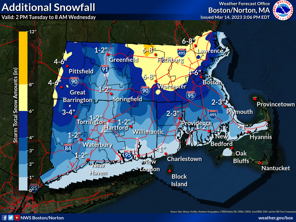
Bold call by BOX but I can see it happening.
-
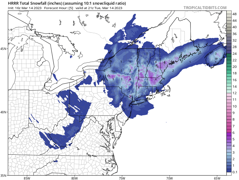
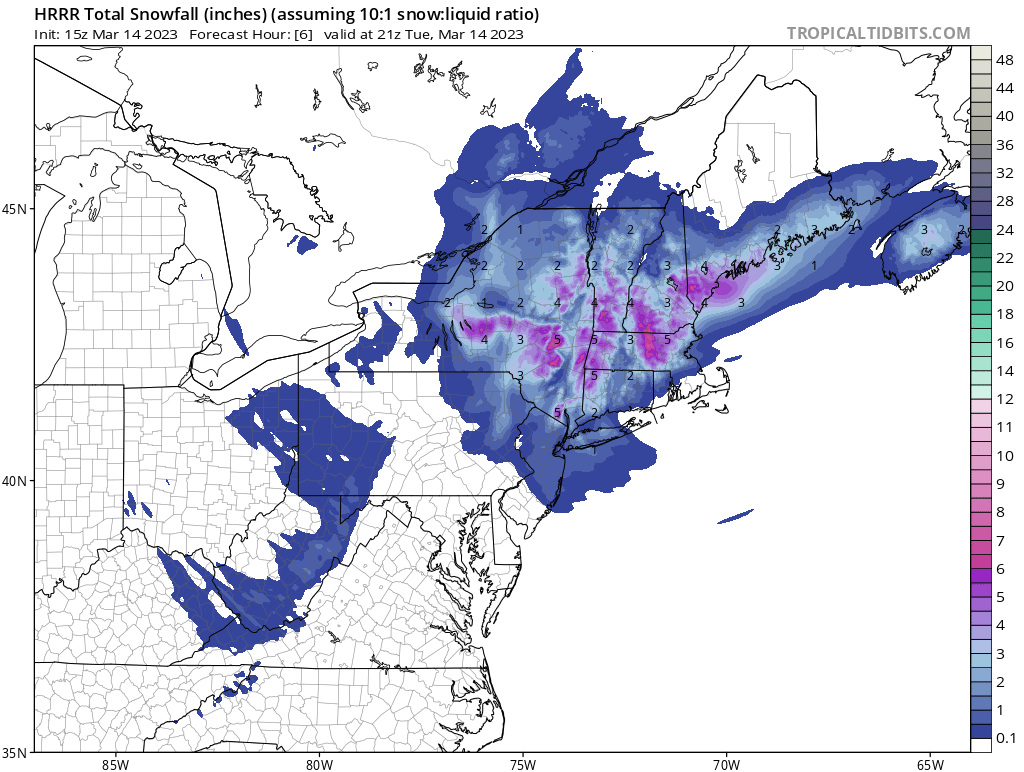
15z and 16z images below for 21z show 2-3” max - again with 10:1 ratios and temps around 34/35, it was obvious to toss the clown map. Sucks you guys are getting screwed down there but listen to the pros. BOX put out 4-6 this morning and I expect that to verify most likely on the low end.