
cardinalland
-
Posts
481 -
Joined
-
Last visited
Content Type
Profiles
Blogs
Forums
American Weather
Media Demo
Store
Gallery
Everything posted by cardinalland
-
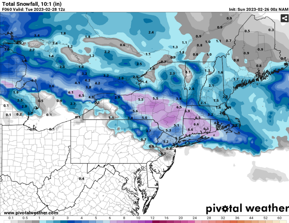
NAM at 63 hrs (rain-snow line has moved to Putnam county by this time). Totals will be lower due to mixing/low ratios near the coast
-
NAM starts with snow north of 195 in NJ (except for right on the shore), and sleet in philly
-
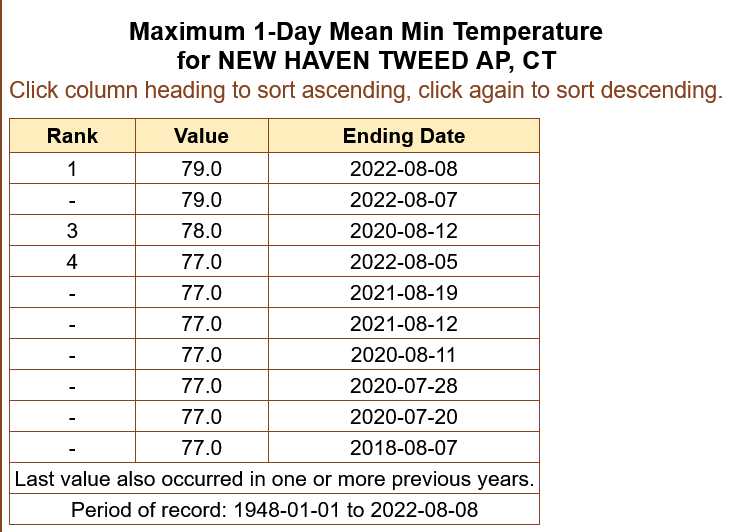
warmest February day on record in Bridgeport and New Haven (68F, breaking previous records of 67F at both locations)
-
Rain snow mix in New Haven
-
lightning and thunder in new haven
-

12/15 - 12/16 Coastal/Winter Storm & Observations
cardinalland replied to Northof78's topic in New York City Metro
looks like a lot is dependent on whether a coastal can form... if it never forms the storm will be a front end dump for those N&W while if it forms there should be more substantial snowfall N&W. Starting air mass is too warm for those near 95 though -
Yeah, I hope I am wrong though and we get crushed, but it's what I'm thinking right now
-
2.2” snow accumulation in New Haven, light flurries now
-
Light snow from about 12-2 in New Haven… it stopped for a bit but it’s picked up in the last 45 minutes, starting to stick now
-
NYC: 14" EWR: 16" MMU: 20" ISP: 14" SWF: 28"
-
If the dew point goes above 75 again I’m moving to Greenland
-
New Haven had record high nighttime lows twice in a row… currently 88/78 HI102. The dew point hasn’t dropped below 74 for over 3 days.
-
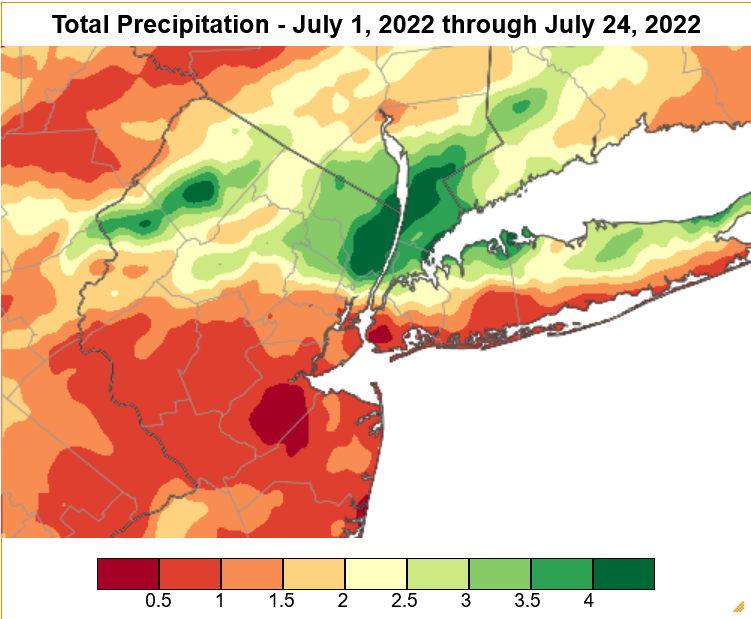
You can generate these on http://scacis.rcc-acis.org/ under Gridded Data Products/Gridded Data Maps!
-
It's a crazy precipitation gradient across NYC this month
-
Dusting already in Chelsea Manhattan on some sidewalks
-
Flakes falling in Chelsea Manhattan
-
Power went out and the basement is flooding in new haven
-
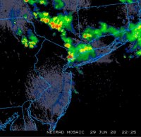
I was on route 4 1-2 hours ago and there was lots of lightning and intense rain
-
Few Tstms with hail-gust 40-45KT 1P-6P especially NJ/se NYS/w LI
cardinalland replied to wdrag's topic in New York City Metro
Heard from friends that it’s hailing in lower Manhattan -
OBS and nowcast Thursday morning 2/18 - 11PM Friday 2/19/21
cardinalland replied to wdrag's topic in New York City Metro
7PM Official Snow Reports KNYC: 4.4" KLGA: 4.1" KJFK: 5.0" KEWR: 5.3" KISP: 5.0" -
OBs and nowcast later Tuesday morning - Noon Wednesday 1/26-27
cardinalland replied to wdrag's topic in New York City Metro
Moderate snow in Upper Manhattan there's a dusting on grassy surfaces, cars, some sidewalks, and some less used streets. -
OBs and nowcast later Tuesday morning - Noon Wednesday 1/26-27
cardinalland replied to wdrag's topic in New York City Metro
Flurries on the upper west side -
Obs and nowcast Sun 9A Jan 3 - 6A Mon Jan 4 2021
cardinalland replied to wdrag's topic in New York City Metro
Snowing in upper Manhattan massive flakes -
December 16-17, 2020 Storm Observations and Nowcast
cardinalland replied to wdrag's topic in New York City Metro
Yeah I agree. 10" snow is what I was expecting so I'm happy to be getting near there


