Henry's Weather
-
Posts
1,572 -
Joined
-
Last visited
Content Type
Profiles
Blogs
Forums
American Weather
Media Demo
Store
Gallery
Everything posted by Henry's Weather
-
 About the same, solid warning event. Nice
 -
Ooooh GFS is better. I’m forsaking my 6 am wakeup for this, better be good. Gotta get that eight hours
-
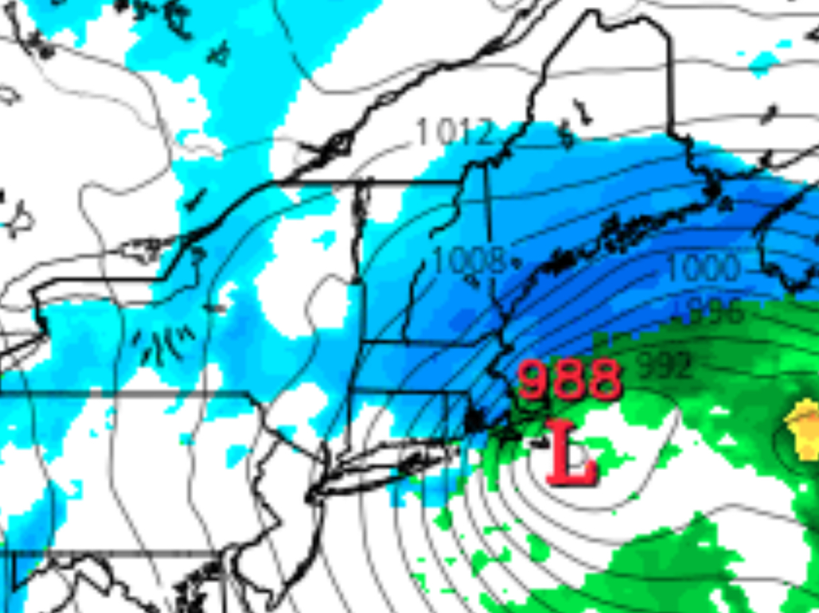
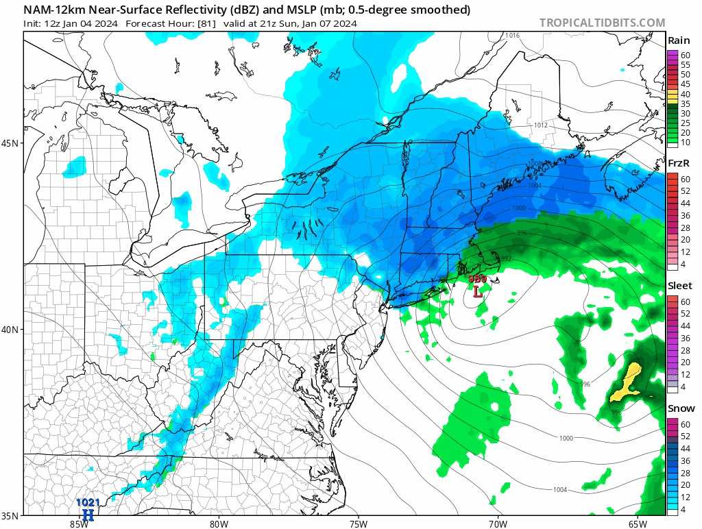
Preface: not a met, subject to error. WAA= warm air advection. This mode of precipitation is caused by warm front mechanics, generally. Warm air moving northward. Pre-mature cyclone. CCB: cold conveyor belt. This type of snow is a result of cyclonic curvature funneling moist air into the dendrite-forming column in the atmosphere on the cold side of a system. It occurs during the strengthening of a cyclone to near peak strength and continues once it reaches maturity. subject to correction
-
50 miles more of latitude would’ve done it.
-
NAM is a whiff for WAA, not for CCB
-
Definitely exchanging WAA for CCB these past few runs
-
Woah, that’s amped
-
Had some flurries come through recently, sets the tone for this weekend
-
It’s pretty draining dopaminurgically.
-
General tilt seems more positive, slightly more separation between S/Ws. Should be less amped, good news for coastal crowd, bad news for dryslot and dendrite
-
BOX should release their first suite of watches at 4 today, probably going to go for 6-12+ interior, 4-8 along coast excluding cape and islands
-
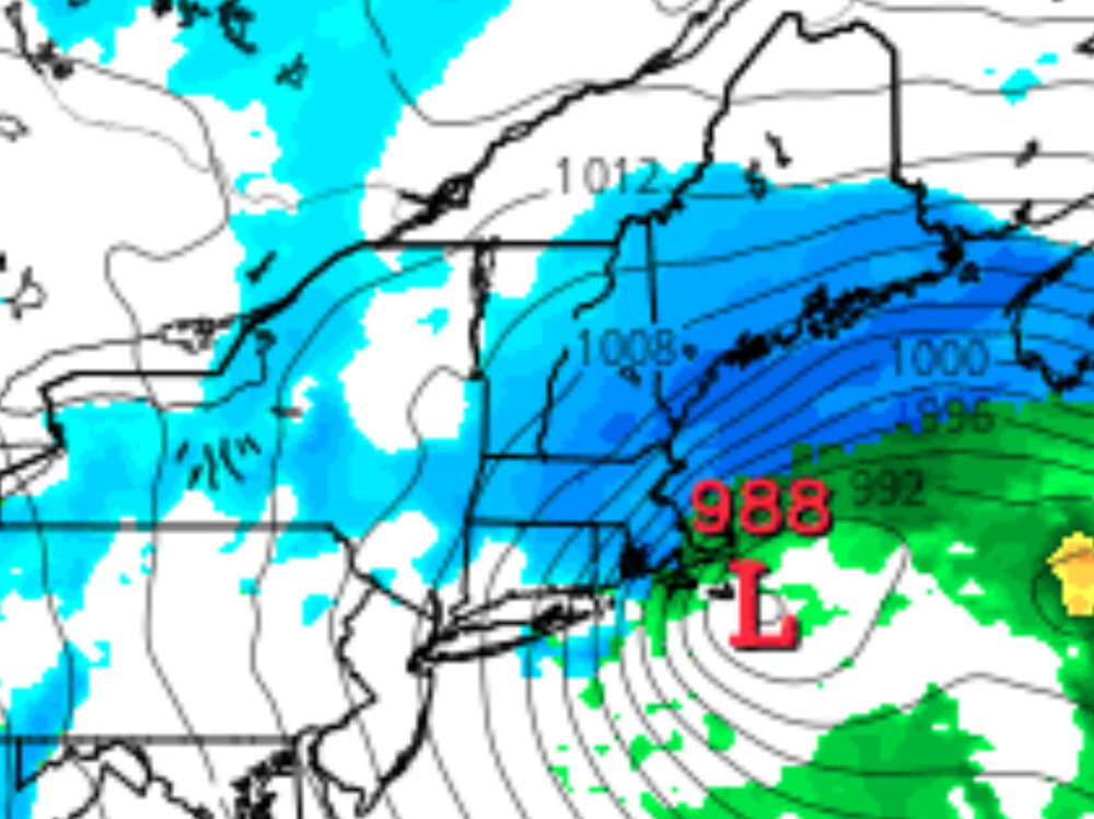
Folks who imagine that more than a swath of 6-12+ could materialize do not understand the fundamental synoptics of the event. This has never had the firepower to be a long-duration, multi-stream merger blizzard. The question is SECS or low-end MECS (meaning a zone of 12-15), which is entirely dependent at this stage on whether the trailing energy can interact with the initial WAA-causing pulse and close off H5 south of the coast to prolong CCB for a couple more hours. I’ve seen a couple insinuations of 1-2 feet from some here, who are woefully demonstrating their lack of comprehension of or experience with these type of systems.
-
Im on team CCB over WAA, welcome trend to me
-
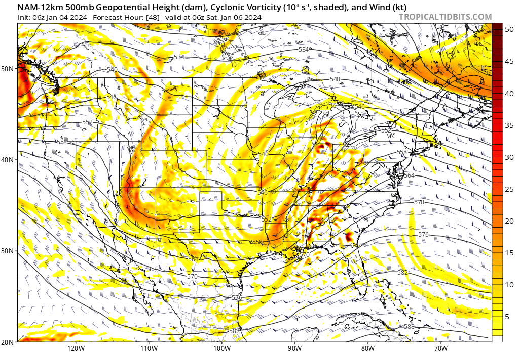
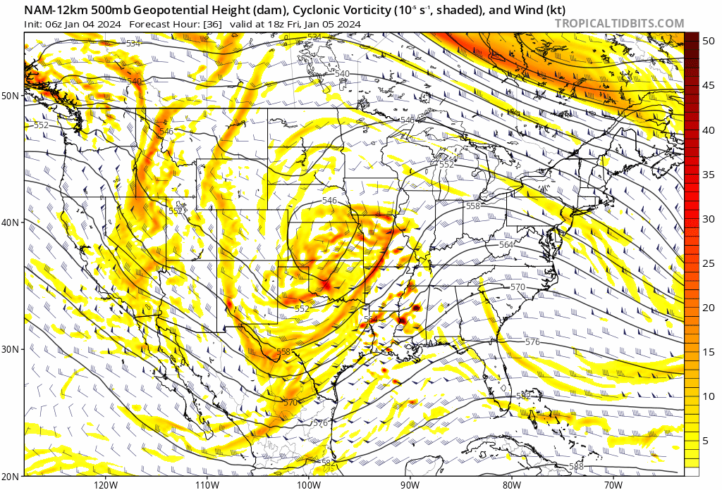
That second wave interaction really gets it going

-
Dont know what you’re referencing, but yeah
-
Glad to see we agree!
-
Oh I’m locked in now. We back
-
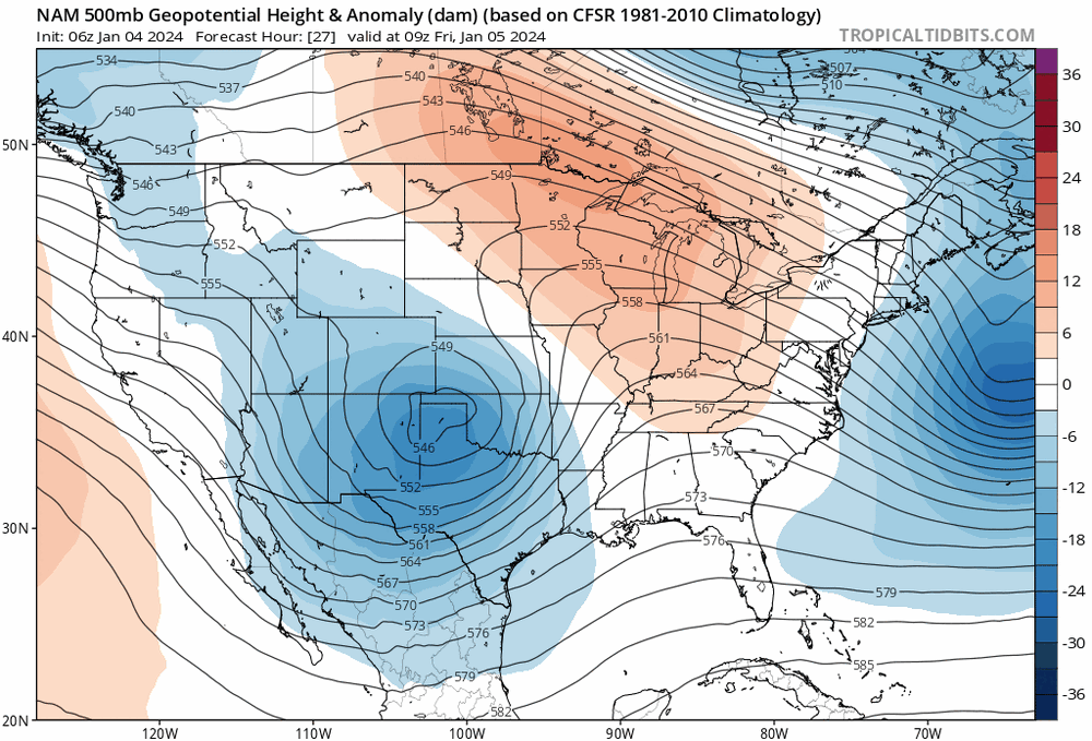
Notice the increased amplitude of upstream western ridging
-
Encouraging trend with regard to greater s/w activation

-
Noticeable positive trend in western ridge magnitude trailing the shortwaves, supporting greater s/w interaction
-
Heights out ahead are slightly depressed, should be slightly less tucked
-
Shortwaves are more distinct

-
Notice that the trailing piece of energy is less far behind. May mean that the lull we saw in past guidance will be less represented here due to earlier interaction?
-
12z NAM may be slightly less amped. S/W slightly weaker and downstream ridge slightly weaker. May turn out to be a good thing for sensible weather south of Concord, NH