SRRTA22
-
Posts
1,879 -
Joined
-
Last visited
Content Type
Profiles
Blogs
Forums
American Weather
Media Demo
Store
Gallery
Everything posted by SRRTA22
-

SVR/FF potential late today-Friday June 29-July 2, 2021
SRRTA22 replied to wdrag's topic in New York City Metro
2.84" in Jersey City 0.19 at 6pm to give you an idea how heavy the rain was. Rain ended about 9pm. Flooding everywhere in the low lying areas. Manholes turned into geysers in some areas. One area actually sent chunks of asphalt flying into the air. I was a little bit upset with that storm sitting west of me, until it decided to pay me a visit and park right overhead. Pure craziness. -
SVR/FF potential late today-Friday June 29-July 2, 2021
SRRTA22 replied to wdrag's topic in New York City Metro
We're in deep doodoo in Jersey City -
SVR/FF potential late today-Friday June 29-July 2, 2021
SRRTA22 replied to wdrag's topic in New York City Metro
Whoa. Can't deny it. That looks like you've gotten a TOR. Winds do a complete shift from the first video to the second. Crazy. -
Gm Sacrus, thats yesterdays sat image
-
SVR/FF potential late today-Friday June 29-July 2, 2021
SRRTA22 replied to wdrag's topic in New York City Metro
Showers/storms appear likely between 3-9pm , I'd say after 10 you should be okay. -
I think Forkies MCS happens today
-
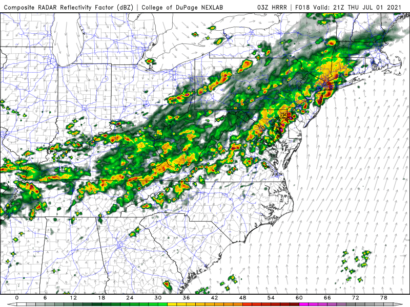
Oh man what I would do for the 03/04z HRRR to verify. Holy shmokes
-
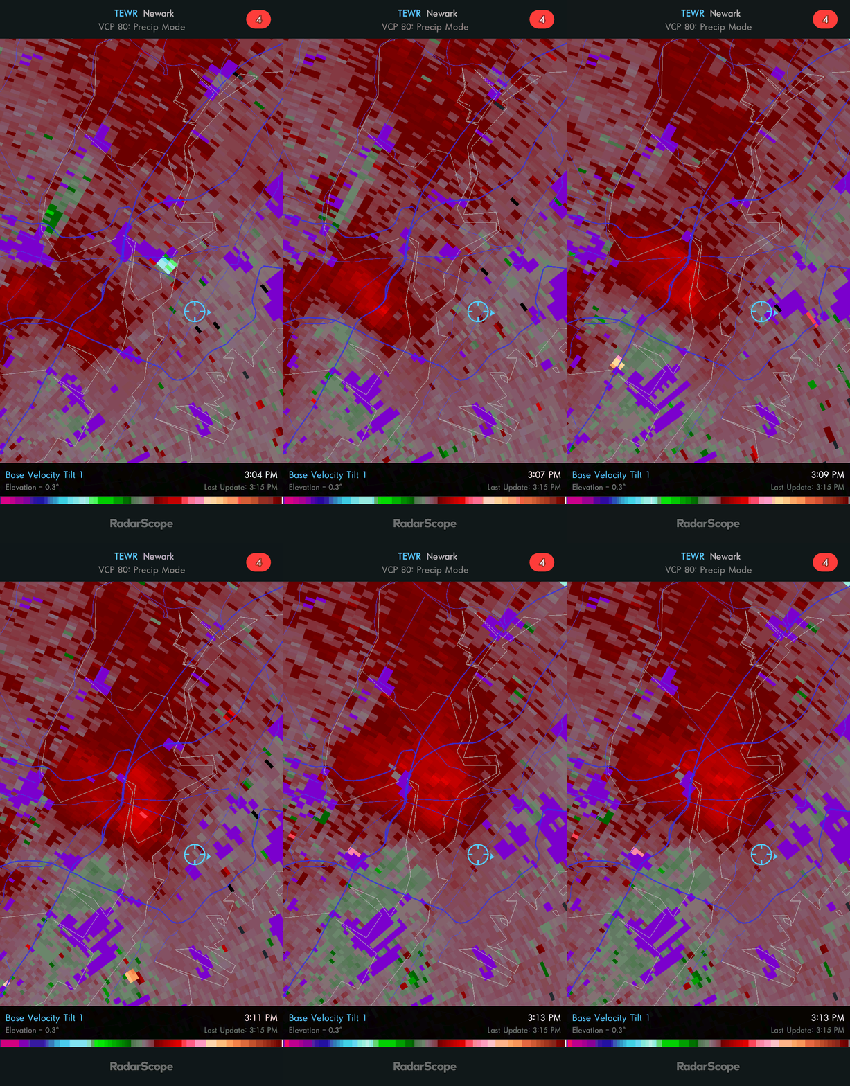
Severe thunderstorm warning here. Pretty good looking gust front on TEWR
-
What I'd do to be where you are man
-
High of 95 here in Jersey City, highest dewpoint topped out at 74 Currently 93/72/102 The usual spots are definitely not dropping below 80 tonight
-
Id rather break dewpoint records at this point, even though I absolutely hate it..but I love convection...ying/yang
-
I will call that bluff every single time. Theres no way anyone actually enjoys that type of heat besides Forky
-
Its still a littttle bit chilly here in Jersey City with that wind. Im savoring every moment of it too
-
Always love seeing rclabs posts...full of wit and dry humor but knowledge as well
-
I look at PoP like i do svr wx risks.. Ie "15% of seeing dmg winds within a 25 mi radius" Ill never forget the tornado that happened in Nj on a day that was generally mostly sunny with iso tstorms (no svr risk outlined by spc) Weather will do what it wants
-
SVR (iso FF) potential 4P-mid Sat and Mon, then during the day Tue
SRRTA22 replied to wdrag's topic in New York City Metro
Good storms are going to make it to the hudson river alright... Just not in Jersey lol -
I cant count how many times ive seen the GFS do a hook into the coast with an offshore low. Every. Year. They dont call it the happy hour gfs for no reason haha
-
18z GFS said get the ark ready
-
Welp that failed
-
latest HRRR and NAM have more widely scattered convection developing across the metro in the next 1-3 hours from the convection to the north. See what happens. Also have an outflow boundary in the area from the storms to our south so I definitely agree that the metro will see some action in the next few hours (Nyc west)
-
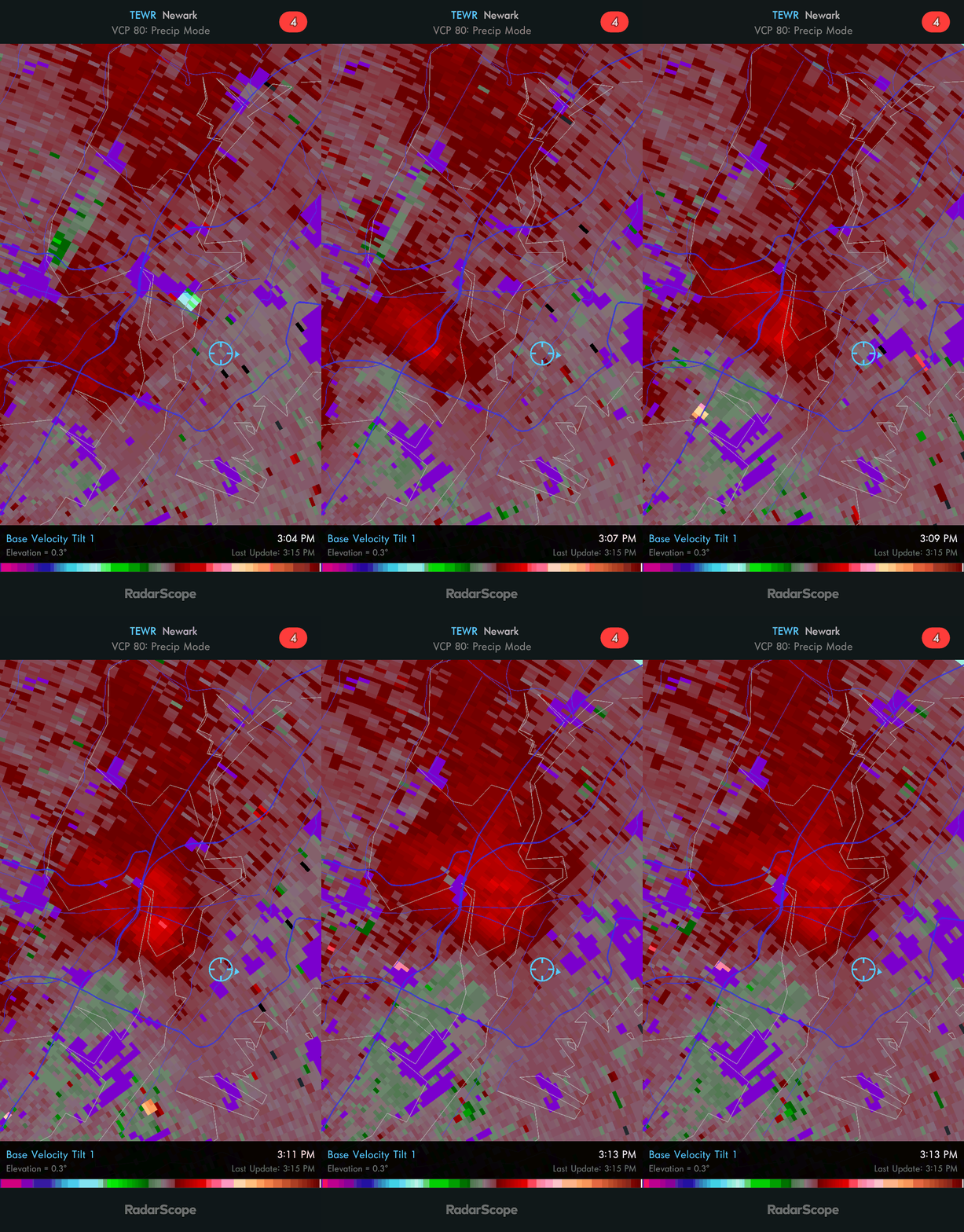
Looks like a weak? microburst has occurred with the storm just west of NYC near Harrison,NJ per TEWR radar
-
SPC has issued a Slight risk for our area
-
Our best events always seem to happen on marginal svr days
-
That line has embedded rotations and a new warning has been issued for NE NJ which has a TOR possible attached to it SPC has also issued a severe thunderstorm watch for NYC metro The NWS Storm Prediction Center has issued a * Severe Thunderstorm Watch for portions of Connecticut Delaware New Jersey Southern New York Far Eastern Pennsylvania Coastal Waters * Effective this Friday afternoon and evening from 305 PM until 800 PM EDT. * Primary threats include... Scattered damaging wind gusts to 65 mph possible Isolated large hail events to 1 inch in diameter possible SUMMARY...Clusters of storms will move east-southeastward toward New Jersey and southern New York including the New York City vicinity, with the strongest storms capable of wind damage and marginally severe hail.
-
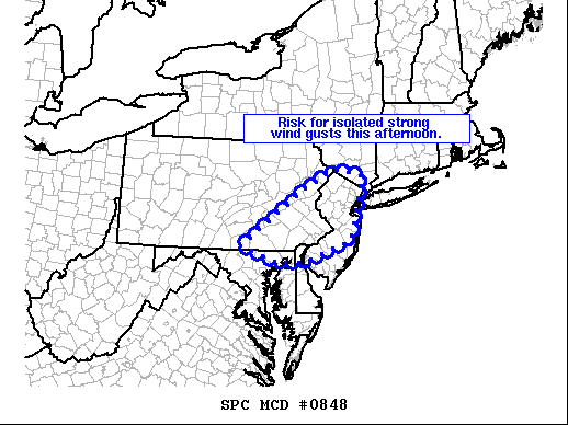
SUMMARY...A few stronger storms will continue shifting eastward across the Delaware Valley and southeastern Pennsylvania into New Jerse and the New York City area this afternoon. Locally strong/gusty winds are expected. A WW may be considered. DISCUSSION...Latest radar Loop shows a area of thunderstorms moving slowly eastward across eastern Pennsylvania and into northwestern New Jersey at this time. A few stronger storms have evolved -- aided by 1000 to 1500 J/kg mixed-layer CAPE as boundary-layer heating occurs beneath cool air aloft/steep lapse rates in conjunction with the vort max/short-wave trough crossing the central Appalachians. While lower tropospheric flow remains rather weak, moderate westerly mid-level flow is sufficient to support multicell-type organization, and thus potential for gusty winds capable of minor damage -- primarily limited to tree damage. As storms continue shifting eastward, they will begin affecting western fringes of the New York City metro area in the next 1 to 2 hours.